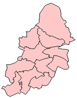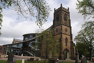
Erdington is a suburb and ward of Birmingham in the West Midlands County, England. Historically part of Warwickshire and located 5 miles (8 km) northeast of central Birmingham, bordering Sutton Coldfield. It was also a council constituency, managed by its own district committee. The former council district consisted of the ward of Erdington as well as Tyburn, Stockland Green and Kingstanding, although all of Kingstanding and most of both Tyburn and Stockland Green wards lie outside the historical boundaries of Erdington. Stockland Green was formerly part of Aston, Kingstanding part of Perry Barr and Tyburn partially split between Aston and Hodge Hill. Erdington (ward) was part of the Sutton Coldfield constituency before 1974.

Wylde Green is a residential area within the town of Sutton Coldfield in Birmingham, England in the West Midlands. It was in the county of Warwickshire. The area is in the Sutton Vesey ward.

Castle Vale is a housing estate located between Erdington, Minworth and Castle Bromwich. Currently Castle Vale makes up the Castle Vale Ward of Birmingham City Council which is part of Erdington constituency, 6 miles (9 km) northeast of Birmingham city centre in England. The area has an approximate population of 10,000 people and has a distinctly modern residential character stemming from its history as a postwar overspill estate.

Shard End is an area of Birmingham, England. It is also a ward within the formal district of Hodge Hill. Shard End borders Castle Bromwich to the north and Kingshurst to the east which are situated in the northern part of the neighbouring Metropolitan Borough of Solihull.
Stockland Green is an area of Birmingham, England.
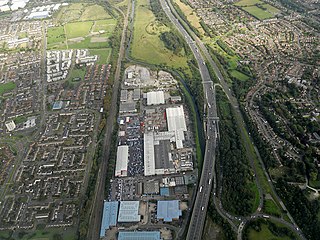
Castle Bromwich is a large suburban village and civil parish in the Metropolitan Borough of Solihull in the West Midlands, England. It borders the rest of the borough to the south east, Sutton Coldfield to the east and north east, Shard End to the south west, Castle Vale, Erdington and Minworth to the north and Hodge Hill to the west.

Walmley is a suburban village situated in the civil parish of Sutton Coldfield, West Midlands. It lies within the City of Birmingham on its northeastern outer fringe, where it forms part of the Sutton Walmley and Minworth electoral ward. It is in southern Sutton Coldfield, close to Minworth, Wylde Green, Pype Hayes and south of Thimble End. It is approximately 7 miles (11.3 km) northeast of Birmingham City Centre. It is the main focus of the Sutton New Hall Birmingham City Council ward.

Birmingham Erdington is a parliamentary constituency in Birmingham, England, represented in the House of Commons of the Parliament of the United Kingdom since 2022 by Paulette Hamilton of the Labour Party.

Sentinel is a 16-metre-high (52 ft) sculpture by Tim Tolkien, installed upon Spitfire Island, a roundabout at the intersection of the Chester Road and the A47 Fort Parkway at the entrance to the Castle Vale estate in Birmingham, England.

The A452 is a road in England, which runs from Royal Leamington Spa, Warwickshire to Brownhills in the West Midlands. It is the major link to the M6 motorway for both Leamington and Warwick in addition to serving as Leamington's link to the M40 motorway and to Coventry.
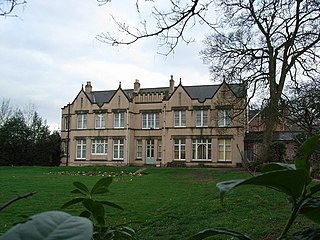
Pype Hayes Hall is a former mansion house in the Pype Hayes area of Erdington, Birmingham, England. The hall's grounds now form Pype Hayes Park. It was formerly in the historic county of Warwickshire before being transferred into the new county of the West Midlands, along with the rest of the city, in 1974. It has grade II listed status.

Kingstanding is an area in north Birmingham, England. It gives its name to a ward in the Erdington council constituency. Kingstanding ward includes the areas; Perry Common, Witton Lakes. The other part of Kingstanding falls under the Oscott ward.
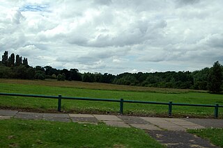
Pype Hayes is a modern housing estate area and council ward in the east of the Erdington district of Birmingham. It was within the Tyburn ward until 2018. Covering the postcodes of B24 and B76.

Bromford, referred to locally as "the Bromford", is an industrial and residential area of Birmingham, situated between Ward End, Alum Rock, Hodge Hill, Washwood Heath, Shard End, Stechford, Castle Bromwich and Tyburn. The industrial area is predominantly situated on the north side of the M6 motorway, including The Bromford Gate industrial park, Fort Shopping Park, and Fort Dunlop, with one industrial site sitting east of the M6 called Bromford Central. The residential area sits adjacent to the East of the M6 comprising two neighbourhoods, Bromford built along Bromford Drive, and The Firs built along Chipperfield Road. The industrial and residential areas have increasingly become two separate distinguishable places, and not recognised locally as joined or one. This is signified by the M6 & River Tame dividing the two areas, poor public transport links between the two areas, and the areas sitting within three different local authority wards, and two parliamentary constituencies (industrial area situated within Birmingham Erdington and residential area situated within Birmingham Hodge Hill.
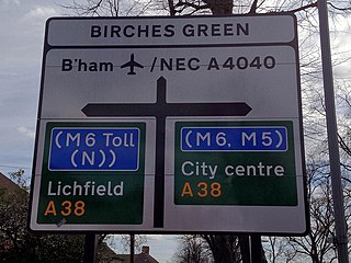
Birches Green is a small area of Tyburn in Birmingham, England, within the parliamentary constitiuency of Erdington. It is located between Gravelly Hill, Erdington and the M6 motorway.
Pype Hayes Park is a park in Birmingham, England. The park is part of the Westminster constituency of Birmingham Erdington and straddles the boundary between the Birmingham City Council wards of Pype Hayes and Erdington. It borders the Pitts Farm estate as well as the Paget and Pype Hayes estates.


