Springfield Township, Oakland County, Michigan

Last updated
Springfield Township, Michigan
Springfield Charter Township
Motto: 
"Come Home to Springfield Township"
Springfield Charter Township (Oakland), MI location.png
Location within Oakland County
USA Michigan location map.svg
Red pog.svg
Springfield Township
Location within the state of Michigan
Coordinates: 42°45′06″N83°30′00″W / 42.75167°N 83.50000°W / 42.75167; -83.50000
Country United States
State Michigan
County Oakland
Established1836
Government
  SupervisorLaura Moreau
  ClerkSean R. Miller
  TreasurerJamie L. Dubre
Area
   Charter township 36.7 sq mi (95.2 km2)
  Land35.6 sq mi (92.2 km2)
  Water1.2 sq mi (3.0 km2)
Elevation
1,017 ft (310 m)
Population
 (2020)
   Charter township 14,703
  Density400/sq mi (150/km2)
   Metro
4,296,250 (Metro Detroit)
Time zone UTC-5 (Eastern (EST))
  Summer (DST) UTC-4 (EDT)
ZIP code(s)
48346, 48348, 48350, 48442
Area code(s) 248
FIPS code 26-75760 [1]
GNIS feature ID1627110 [2]
Website springfield-twp.us

Springfield Charter Township is a charter township of Oakland County in the U.S. state of Michigan. As of the 2020 census, the township population was 14,703. [3] The township was named for the numerous springs in the area.

Contents

Communities

The Township has no incorporated villages and five unincorporated communities within:

History

Springfield Township was established by the Michigan Legislature on March 2, 1836. Civil government was first organized April 3, 1837. Springfield, one of the first settlements in the area, began with a hotel along the Detroit and Saginaw Turnpike, now known as Dixie Highway. Andersonville, located at the intersection of Andersonville Road and Big Lake Road, was settled shortly thereafter in 1833, followed three years later by the hamlet of Davisburg. Springfield Township transitioned from a General Law Township to a Charter Township under Michigan's Charter Township Act on April 1, 1986.

The Detroit and Milwaukee Railway (now part of the Canadian National Railway) was built in 1856, and two stations were in the township, in Andersonville and Davisburg. The railroad provided a major impetus to growth. Agriculture was the mainstay of the local economy and trains allowed the farmers to ship produce and live stock to market and to receive supplies and equipment. By 1860 Springfield Township's population was 1,425.

In 1924, Dixie Highway was paved from Pontiac to Flint. With the decline of agriculture as a major economic activity in the township, residents began commuting to Pontiac and Flint for employment in the developing automotive factories, marking the beginning of the township's decline. By 1930, Springfield Township's population had fallen to 923. The township's decline would unexpectedly be reversed in the 1960s with the construction of Interstate 75. The accessibility provided by two interchanges accelerated residential growth in the late 1960s and 1970s. Population improved, going from 1,825 in 1950 to 2,664 in 1960, 4,388 in 1970, 6,502 in 1976, and 8,295 in 1980.

Springfield Township has had a long-standing commitment to zoning and planning dating back to the early 1950s. The Township Board adopted an interim zoning ordinance in early 1952, which contained five zoning districts. In 1965 an ordinance which contained 13 different zoning districts was adopted. Planning and zoning functions were coordinated with the adoption of the township's first Master Plan in 1972 and subsequently the adoption of an entirely new zoning ordinance the following year. The 1973 ordinance serves as a basis for the current zoning ordinance.

Out of concern for the residential growth during the 1970s and its effects on the entire township, the Planning Commission embarked on a comprehensive review of the Master Plan and the Zoning Map in the early 1980s. As a result, the revised Master Plan and Zoning Ordinance incorporated natural resource protection information and standards. This slowed the growth of Springfield Township during the decade, growing to 9,927 in 1990. Additional comprehensive reviews and updates were done in the early 1990s and again in 2002. The primary basis for the township's planning, zoning, and land use decisions for at least the last 20 years has been the protection and preservation of their abundant and very special natural resources.

Today, Springfield Township is home to many parks, including Springfield Oaks County Park, site of the annual Oakland County Fair, and Indian Springs Metropark. The township is also home to several churches, a few schools including Springfield Christian Academy (the township's only high school) and a handful of shopping areas. The township's population, which increased by a third in the 1990s, continued to grow through the first decade of the 21st century.

Springfield Township also houses a former Superfund site, The Springfield Township Dump.

Springfield Township is a member of the Clarkston Area Chamber of Commerce and Holly Chamber of Commerce.

Geography

According to the United States Census Bureau, the township has a total area of 36.8 square miles (95 km2), of which 35.6 square miles (92 km2) is land and 1.2 square miles (3.1 km2), or 3.16%, is water.

The Shiawassee River, [12] Huron River, [13] along with the main branch of the Clinton River, [14] rise within the township. The Shiawassee flows in a northwesterly direction toward Saginaw where it joins with the Tittabawassee River to form the Saginaw River, which drains into the Saginaw Bay of Lake Huron. The Huron flows in a southeasterly direction and empties into Lake Erie. The Lower Huron River demarks the boundary between Wayne County and Monroe County. The Clinton flows in an easterly direction and empties into Lake St. Clair in Macomb County's Harrison Township.

Demographics

As of the census [1] of 2000, there were 13,338 people, 4,619 households, and 3,658 families residing in the township. The population density was 374.8 inhabitants per square mile (144.7/km2). There were 4,794 housing units at an average density of 134.7 per square mile (52.0/km2). The racial makeup of the township was 96.69% White, 1.09% African American, 0.46% Native American, 0.55% Asian, 0.01% Pacific Islander, 0.26% from other races, and 0.93% from two or more races. Hispanic or Latino of any race were 1.98% of the population.

There were 4,619 households, out of which 41.2% had children under the age of 18 living with them, 68.5% were married couples living together, 7.2% had a female householder with no husband present, and 20.8% were non-families. 15.6% of all households were made up of individuals, and 3.2% had someone living alone who was 65 years of age or older. The average household size was 2.87 and the average family size was 3.22.

In the township 28.8% of the population was under the age of 18, 7.1% was from 18 to 24, 32.9% from 25 to 44, 25.4% from 45 to 64, and 5.8% was 65 years of age or older. The median age was 36 years. For every 100 females, there were 101.4 males. For every 100 females age 18 and over, there were 99.8 males.

The median income for a household in the township was $71,977, and the median income for a family was $76,816. Males had a median income of $57,500 versus $34,615 for females. The per capita income for the township was $28,247. About 3.8% of families and 5.9% of the population were below the poverty line, including 8.8% of those under age 18 and 9.6% of those age 65 and over.

Related Research Articles

<span class="mw-page-title-main">Shiawassee County, Michigan</span> County in Michigan, United States

Shiawassee County is a county located in the U.S. state of Michigan. As of the 2020 United States Census, the population was 68,094. The county seat is Corunna, and the largest city in the county is Owosso. In 2010, the center of population of Michigan was located in Shiawassee County, in Bennington Township.

<span class="mw-page-title-main">Oakland County, Michigan</span> County in Michigan, United States

Oakland County is a county in the U.S. state of Michigan. It is a principal county of the Detroit metropolitan area, containing the bulk of Detroit's northern suburbs. Due to the county's government complex spanning two municipalities, its seat of government is shared between Pontiac and Waterford. Its largest city is Troy. As of the 2020 Census, its population was 1,274,395, making it the second-most populous county in Michigan, and the largest county in the United States without a city of 100,000 residents.

<span class="mw-page-title-main">Fairhaven Township, Michigan</span> Civil township in Michigan, United States

Fairhaven Township is a civil township of Huron County in the U.S. state of Michigan. The population was 1,081 at the 2020 census.

Au Sable Township is a charter township of Iosco County in the U.S. state of Michigan. The population was 2,206 at the 2020 census.

<span class="mw-page-title-main">Genoa Township, Michigan</span> Charter township in Michigan, United States

Genoa Charter Township is a charter township of Livingston County in the U.S. state of Michigan. As of the 2020 census, the township population was 20,692.

<span class="mw-page-title-main">Hartland Township, Michigan</span> Civil township in Michigan, United States

Hartland Township is a civil township of Livingston County in the U.S. state of Michigan. The population was 15,256 at the 2020 census, up from 14,663 at the 2010 census.

<span class="mw-page-title-main">Marion Township, Livingston County, Michigan</span> Civil township in Michigan, United States

Marion Township is a civil township of Livingston County in the U.S. state of Michigan. The population was 11,245 at the 2020 census, up from 9,996 at the 2010 census.

<span class="mw-page-title-main">Berlin Charter Township, Michigan</span> Charter township in Michigan, United States

Berlin Charter Township is a charter township of Monroe County in the U.S. state of Michigan. At the 2020 census, the township population was 9,890.

<span class="mw-page-title-main">Commerce Township, Michigan</span> Charter township in Michigan, United States

Commerce Township, officially the Charter Township of Commerce, is a charter township of Oakland County in the U.S. state of Michigan. The population was 43,058 at the 2020 census.

<span class="mw-page-title-main">Highland Township, Oakland County, Michigan</span> Charter township in Michigan, United States

Highland Township, officially the Charter Township of Highland, is a charter township of west Oakland County, Michigan. The population was 19,172 at the time of the 2020 census.

<span class="mw-page-title-main">Holly Township, Michigan</span> Civil township in Michigan, United States

Holly Township is a civil township of Oakland County in the U.S. state of Michigan. The population was 12,006 at the 2020 census.

<span class="mw-page-title-main">Oakland Charter Township, Michigan</span> Charter township in Michigan, United States

The Charter Township of Oakland is a charter township on the north Oakland County outskirts of Metro Detroit, in the U.S. state of Michigan. It is colloquially referred to as "Oakland Township". The population was 20,067 at the 2020 census.

<span class="mw-page-title-main">Waterford Township, Michigan</span> Charter township in Michigan, United States

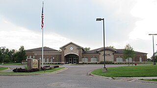
Waterford Township is a charter township in the geographic center of Oakland County, Michigan, United States.

<span class="mw-page-title-main">White Lake Township, Michigan</span> Charter township in Michigan, United States

White Lake Charter Township is a charter township of Oakland County in the U.S. state of Michigan. Together with its two unincorporated communities, the township makes up part of the Detroit metropolitan area outskirts. As of the 2020 census, the township population was 30,950.

<span class="mw-page-title-main">Antrim Township, Michigan</span> Civil township in Michigan, United States

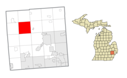
Antrim Township is a civil township of Shiawassee County in the U.S. state of Michigan. As of the 2020 census, the township population was 2,116. The township is believed to be named after either Antrim, Northern Ireland or Antrim, New Hampshire.

<span class="mw-page-title-main">Ann Arbor Charter Township, Michigan</span> Charter township in Michigan, United States

Ann Arbor Charter Township is a charter township of Washtenaw County in the U.S. state of Michigan. The population was 4,673 at the 2020 census. The township borders the city of Ann Arbor and contains numerous exclaves, but the two are administered autonomously.

<span class="mw-page-title-main">Van Buren Township, Michigan</span> American township in Michigan

Van Buren Township is a charter township in Wayne County in the U.S. state of Michigan. A western suburb of Detroit, Van Buren Township is located roughly 28 miles (45.1 km) southwest of downtown Detroit, and 17 miles (27.4 km) southeast of Ann Arbor. As of the 2020 census, the township had a population of 30,375. It surrounds, but is independent of, the city of Belleville.

<span class="mw-page-title-main">Cass River (Michigan)</span> River

The Cass River is a 61.5-mile-long (99.0 km) river in the Thumb region of the U.S. state of Michigan. It drains large portions of Sanilac and Tuscola counties and smaller portions of Genesee, Huron, Lapeer, and Saginaw counties.

<span class="mw-page-title-main">Shiawassee River</span> River in Michigan, United States

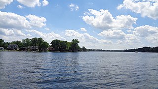
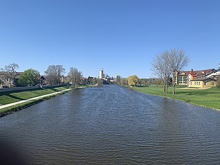
The Shiawassee River in the U.S. state of Michigan drains an area of 1,201 square miles (3,110 km2) within Oakland, Genesee, Livingston, Shiawassee, Midland and Saginaw counties. It flows in a generally northerly direction for approximately 110 miles (180 km) from its source to its confluence with the Tittabawassee River creating the Saginaw River, which drains into Saginaw Bay of Lake Huron.

<span class="mw-page-title-main">Misteguay Creek</span> River in Michigan, United States

Misteguay Creek is a tributary of the Flint River, 38.4 miles (61.8 km) long, on the central Lower Peninsula of Michigan in the United States. The stream drains an area of 174.4 square miles (452 km2) in predominantly agricultural areas of the Flint/Tri-Cities region. Via the Flint and Shiawassee rivers, it is part of the watershed of the Saginaw River, which flows to Saginaw Bay of Lake Huron. Via Lake Huron and the Great Lakes system, it is part of the larger watershed of the St. Lawrence River.

References

  1. 1 2 "U.S. Census website". United States Census Bureau . Retrieved 2008-01-31.
  2. U.S. Geological Survey Geographic Names Information System: Springfield Township, Oakland County, Michigan
  3. "Explore Census Data". data.census.gov. Retrieved 2024-04-20.
  4. U.S. Geological Survey Geographic Names Information System: Andersonville, Michigan
  5. 1 2 3 Romig, Walter (1986) [1973]. Michigan Place Names. Detroit, Michigan: Wayne State University Press. ISBN   0-8143-1838-X.
  6. 1 2 http://www.michiganrailroads.com/RRHX/Maps/Counties/63-OaklandCoMap.htm [ bare URL ]
  7. U.S. Geological Survey Geographic Names Information System: Davisburg, Michigan
  8. "Community". www.springfield-twp.us. Archived from the original on 2007-08-18.
  9. "Station: Davisburg, MI". www.michiganrailroads.com. Archived from the original on 2004-04-23.
  10. U.S. Geological Survey Geographic Names Information System: Jossman Acres, Michigan & GNIS in Google
  11. U.S. Geological Survey Geographic Names Information System: Springfield, Michigan
  12. "Shiawassee River". Geographic Names Information System . United States Geological Survey, United States Department of the Interior.
  13. "Huron River". Geographic Names Information System . United States Geological Survey, United States Department of the Interior.
  14. "Clinton River". Geographic Names Information System . United States Geological Survey, United States Department of the Interior.