Roads and freeways in metropolitan Detroit

Last updated

Roads and freeways in Metro Detroit

I-75.svg

US 24.svg

M-10.svg

Highway markers for I‑75, US 24 and M‑10
Metro Detroit Freeways.svg
Map of Metro Detroit freeways
System information
Formed1805 [1]
Highway names
Interstates Interstate nn (I‑nn)
US Highways US Highway nn (US nn)
State M‑nn
System links

The Detroit metropolitan area in southeast Michigan is served by a comprehensive network of roads and highways. Three primary Interstate Highways pass through the region, along with three auxiliary Interstates, and multiple state and U.S. Highways. [2] These are supplemented by the Mile Road System, a series of local roads spaced one mile apart on a perpendicular grid.

Contents

Many of the grid's east-west roads are known by numbers, such as 8 Mile Road, the system's baseline and Detroit's northern border. Intersecting this grid are five diagonal spokes, major arterial roads which travel from downtown to the suburbs. Most major roads in the city and suburbs follow this grid, though streets in some areas (particularly within Detroit, and near Lake St. Clair and other lakes) deviate.

History

Augustus Woodward's plan following the 1805 fire for Detroit's baroque styled radial avenues and Grand Circus Park. Old map 1807 plan.jpg
Augustus Woodward's plan following the 1805 fire for Detroit's baroque styled radial avenues and Grand Circus Park.

Following a historic fire in 1805, Judge Augustus B. Woodward devised a plan similar to Pierre Charles L'Enfant's design for Washington, D.C. Detroit's monumental avenues and traffic circles fan out in a baroque-styled radial fashion from Grand Circus Park in the heart of the city's theater district, which facilitates traffic patterns along the city's tree-lined boulevards and parks. [3] The Woodward plan proposed a system of hexagonal street blocks, with the Grand Circus at its center. Wide avenues, alternatively 200 feet (61 m) and 120 feet (37 m), would emanate from large circular plazas like spokes from the hub of a wheel. As the city grew these would spread in all directions from the banks of the Detroit River. When Woodward presented his proposal, Detroit had fewer than 1,000 residents. Elements of the plan were implemented.

The Mile Road System extended easterly into Detroit, but is interrupted, because much of Detroit's early settlements and farms were based on early French land grants that were aligned northwest-to-southeast with frontage along the Detroit River and on later development along roads running into downtown Detroit in a star pattern, such as Woodward, Jefferson, Grand River, Gratiot, and Michigan Avenues, developed by Augustus Woodward in imitation of Washington, D.C.'s system.

The Mile Road grid came about largely as a result of the Land Ordinance of 1785, which established the basis for the Public Land Survey System in which land throughout the Northwest Territory was surveyed and divided into survey townships by reference to a baseline (east-west line) and meridian (north-south line). In Southeast Michigan, many roads would be developed parallel to the base line and the meridian, and many of the east-west roads would be incorporated into the Mile Road System.

The baseline used in the survey of Michigan lands runs along 8 Mile Road, which is approximately eight miles (13 km) directly north of the junction of Woodward Avenue and Michigan Avenue in downtown Detroit. As a result, the direct east-west portion of Michigan Avenue, and M‑153 (Ford Road) west of Wyoming Avenue, forms the zero mile baseline for this mile road system. While the roads are almost precisely aligned with cardinal directions, there are slight discrepancies—for example, the eastern terminus of 8 Mile Road in St. Clair Shores is at 42.45°N, whereas its western terminus (45 miles [72 km] away in Whitmore Lake) is 1+12 miles (2.4 km) south, at 42.42°N.

The point of origin in Campus Martius Park Detroit December 2021 62 (Detroit Point of Origin).jpg
The point of origin in Campus Martius Park

The precise point of origin is located in Campus Martius Park, marked by a medallion [4] embedded in the stone walkway. It is situated in the western point of the diamond surrounding Woodward Fountain, [5] just in front of the Fountain Bistro.

Freeways

Satellite image of the I-96/I-275/I-696/M-5 interchange spanning Farmington Hills and Novi Spaghetti Bowl Interchange (Novi, Michigan).png
Satellite image of the I-96/I-275/I-696/M-5 interchange spanning Farmington Hills and Novi

Diagonal spoke arterial roads

Listed clockwise from southwest to northeast.

East-west mile roads

Detroit and western suburbs

Listed from south to north. Mile roads south of 5 Mile are referred to exclusively by their names, not by mile numbers.

Northern suburbs

Listed from south to north. Mile roads are referred to only by numbers in Macomb County (with few exceptions); in Oakland County, however, mile roads north of 14 Mile are referred to primarily by names, not numbers.

South of Ford

The grid continues south of Ford Road, with roads generally spaced one mile (1.6 km) apart up to, and past, the border with the state of Ohio. None of these roads connect to Detroit, and they are almost never referred to by mile numbers, officially or colloquially. Further south and west, along the Lake Erie shoreline, and through Downriver, the roads tend to fall off the grids more often, for several reasons, including remnants of the French ribbon farms and natural features preventing straight road building.

Eastern Detroit and Grosse Pointe

On Detroit's far east side, which is aligned according to the French colonial long lot system rather than the Northwest Ordinance survey grid, Cadieux, Moross, and Vernier Roads are not extensions of 6 Mile Road, 7 Mile Road and 8 Mile Road, respectively. East McNichols (6 Mile) ends at Gratiot Avenue, with traffic continuing to Cadieux two miles (3.2 km) away via Seymour Street and Morang Drive. East 7 Mile Road ends as a short four-lane one-way side street at Kelly Road, two blocks east of where Moross veers off from 7 Mile, taking most traffic with it. Most traffic on 8 Mile Road continuing east of Kelly Road veers onto Vernier Road; 8 Mile continues as a side street eastward for a short distance past Harper Avenue. This is a common misconception by residents of Detroit, Harper Woods and Grosse Pointe, as Cadieux, Moross and Vernier appear to be extensions of their mile-road neighbors, but are in fact roads in their own right.

Northern exurbs

Oakland County

  • 26+12 Mile Road—Judah Road
  • 27 Mile Road—Silverbell Road, Maybee Road, Gregory Road
  • 27+12 Mile Road—Snell Road, Maybee Road
  • 28 Mile Road—Waldon Road, Gunn Road
  • 28+12 Mile Road—Gunn Road
  • 29 Mile Road—Buell Road
  • 30 Mile Road—Stoney Creek Road, Clarkston Road
  • 31 Mile Road—Predmore Road, Whipple Lake Road
  • 32 Mile Road—Romeo Road, Indian Lake Road, Oak Hill Road
  • 33 Mile Road—Brewer Road, Drahner Road, Seymour Lake Road
  • 34 Mile Road—Mack Road, Lakeville Road
  • 35 Mile Road—Frick Road, Ray Road, Granger Road
  • 36 Mile Road—Noble Road, Hummer Lake Road
  • 37 Mile Road—Oakwood Road
  • 38 Mile Road—Davison Lake Road, Sawmill Lake Road (northern border of Oakland County)

Macomb County

  • 27 Mile Road—Clark Street (within New Haven)
  • 28 Mile Road
  • 29 Mile Road
  • 30 Mile Road
  • 31 Mile Road
  • 32 Mile Road—St. Clair Road (within Romeo), Division Road (within Richmond)
  • 33 Mile Road
  • 34 Mile Road
  • 35 Mile Road—Armada Center Road (Brown Road to Omo Road), School Section Road (Berman Road to Russ Road)
  • 36 Mile Road—Irwin Road (Romeo Plank to east of North Avenue, then Omo Road to Regent Road)
  • 37 Mile Road—McPhall Road (Coon Creek Road to Omo Road), Prinz Road (Omo Road to Cryderman Road)
  • 38 Mile Road—Bordman Road (northern border of Macomb County)

St. Clair County

Through St. Clair County, none of these mile number names are carried over, as a result, all of the Mile Roads are known by their road names.

  • 25 Mile Road—Arnold Road
  • 26 Mile Road—Marine City Highway
  • 27 Mile Road—Springborn Road
  • 28 Mile Road—Meisner Road
  • 29 Mile Road—Lindsey Road
  • 30 Mile Road—Puttygut Road
  • 31 Mile Road—St. Clair Highway
  • 32 Mile Road—Division Road (Richmond to Palms Road), Fred W. Moore Highway (Palms Road eastward)
  • 33 Mile Road—Clay Road
  • 34 Mile Road—Woodbeck Road, Big Hand Road
  • 35 Mile Road—Crawford Road
  • 36 Mile Road—Meskill Road
  • 37 Mile Road—Frith Road

Lapeer County

The system continues uninterrupted in sequence up to 38 Mile Road, on the Macomb–Lapeer county line near Almont and Van Dyke Road (M‑53). However, although not signed as mile roads, major roads still lie at one-mile (1.6 km) intervals in Lapeer County and in fact a few major roads that start in and around the city of Flint continue east into Lapeer County.

  • 38 Mile Road—Bordman Road/Davison Lake Road
  • 39 Mile Road—Hough Road
  • 40 Mile Road—Almont Road, St. Clair Street, General Squier Road
  • 41 Mile Road—Tubspring Road
  • 42 Mile Road—Dryden Road
  • 43 Mile Road—Hollow Corners Road
  • 44 Mile Road—Webster Road, Ross Road, Sutton Road
  • 45 Mile Road—Hunters Creek Road
  • 46 Mile Road—Newark Road
  • 47 Mile Road—Belle River Road
  • 48 Mile Road—Attica Road
  • 49 Mile Road—Davison Road (west of Lapeer, eastern continuation of a major section-line road that starts in Flint); Imlay City Road (between Lapeer and Van Dyke); Weyer Road (east of Van Dyke)
  • 50 Mile Road—Oregon Road (west of Lapeer); Bowers Road (east of Lapeer)
  • 51 Mile Road—McDowell Road, Davis Lake Road, Haines Road, Utley Road, Muck Road, Norman Road
  • 52 Mile Road—Daley Road, Armstrong Road, Turner Road
  • 53 Mile Road—Coldwater Road (eastern continuation of a major section-line road in the Flint area), portions of Marathon and Flint River Roads, Mountview Road, King Road, Lyons Road, Speaker Road
  • 54 Mile Road—Stanley Road (eastern continuation of a major section-line road in the Flint area), Coulter Road, Reside Road
  • 55 Mile Road—Mount Morris Road (eastern continuation of a major section-line road in the Flint area), Sawdust Corners Road, Curtis Road, Martin Road, Abbott Road
  • 56 Mile Road—Pyles Road, Norway Lake Road, Clear Lake Road
  • 57 Mile Road—Columbiaville Road (turns southeast as Pine Street from the east and southwest as 2nd Street from the west within Columbiaville), Mott Road, Willis Road
  • 58 Mile Road—Piersonville Road, Miller Lake Road (briefly), Hasslick Road, Deanville Road
  • 59 Mile Road—Sister Lake Road, Barnes Lake Road, Johnson Mill Road, Martus Road, Wilcox Road
  • 60 Mile Road—Howell Road, Burnside Road (part of M-90 east of Van Dyke)
  • 61 Mile Road—Otter Lake Road, Tozer Road, Elm Creek Road, Brooks Road
  • 62 Mile Road—Castle Road, Stiles Road
  • 63 Mile Road—Elmwood Road, Dwyer Road, Peck Road
  • 64 Mile Road—Barnes Road
  • 65 Mile Road—Millington Road, Montgomery Road
  • 66 Mile Road—Murphy Lake Road
  • 67 Mile Road—Swaffer Road, Markle Road, Soper Road
  • 68 Mile Road—Brown Road, Marlette Road (northern border of Lapeer County)

North-south grid roads

The area's north-south roads, often colloquially called grid roads, are similarly spaced one mile (1.6 km) apart, perpendicular to the east-west mile roads. Like the east-west grid, north-south roads lose cohesion to the grid in much of Detroit, the Grosse Pointes, eastern Downriver, and in the lake-filled areas of Oakland County.

Listed from east to west:

Address numbering scheme

Addresses are generally numbered outwards from Woodward Avenue (south of McNichols Road) and John R Street (north of McNichols) for numbers on east-west roads and from the Detroit River (east of the Ambassador Bridge), a Norfolk Southern Railway/CSX Transportation railroad line between the Ambassador Bridge and the Rouge River, the Rouge River itself north to just past Evergreen Road in Dearborn, an invisible line from there to the eastern end of Cherry Hill Road and Cherry Hill Road for numbers on north-south streets, with the numbers increasing the further one is from these baselines.

Addresses in the Detroit area tend to be much higher than in many other major cities, with numbers in the 20000s common within the city limits and in the inner-ring suburbs. The highest addresses used in the Detroit system are the range 79000 to 80999, for north-south roads beyond 37 Mile Road in northern Macomb County, and from 81000 to the high 81900s in the portion of the city of Memphis that bulges about 0.5 miles (0.80 km) into St. Clair County. For many years, the Guinness Book of World Records incorrectly listed 81951 Main Street (M‑19) in Memphis as the highest street address number anywhere, but higher numbers are in use elsewhere in the United States. The Detroit system also extends as far west as Lyon Charter Township, whose supervisor's offices are located at 58000 Grand River Avenue, [9] and as far south as the southernmost border of Wayne County.

With a few exceptions, one can determine which mile roads an address is between on major north-south roads north of Five Mile/Fenkell by using the formula:

[(first two numbers of the address)-5] / 2
Example: 34879 Gratiot Avenue [(34-5)/2]= 14.5 which indicates the address is between 14 Mile and 15 Mile roads.

In the early days of Detroit-area house numbering, surveyors calculated position on the grid of mile roads to define addresses. The resulting system, adopted in 1921 and sometimes referred to as the Detroit Edison system, generally assigns 2000 addresses to each mile. (There are often gaps in the numbering; for instance, east addresses 9000 to 10999 and north addresses 2300 to 5599 [at Ford Road] are skipped). Typically, addresses of single family homes on adjacent lots on the grid system, both within Detroit and in the suburbs, are incremented by 8, 10, 12 or more rather than by 2 as is the case in most other large cities in the United States.

Pontiac grid

Pontiac and a number of surrounding communities have a separate grid, on which numbers ascend traveling away from the corner of Saginaw and Pike streets in downtown Pontiac. This system is used in Pontiac, Auburn Hills, Bloomfield Township, Bloomfield Hills, Waterford, Sylvan Lake, Keego Harbor, Orchard Lake Village, West Bloomfield, and portions of White Lake. Addresses on Woodward in these communities use the Detroit scheme.

Other independent numbering schemes

Though many suburbs also use the Detroit system, there are several that border those using the Detroit system that instead use their own numbering systems.

See also

Notes

    Related Research Articles

    <span class="mw-page-title-main">Wayne County, Michigan</span> County in Michigan, United States

    Wayne County is the most populous county in the U.S. state of Michigan. As of 2020, the United States Census placed its population at 1,793,561, making it the 19th-most populous county in the United States. The county seat is Detroit. The county was founded in 1796 and organized in 1815. Wayne County is included in the Detroit-Warren-Dearborn, MI Metropolitan Statistical Area. It is one of several U.S. counties named after Revolutionary War-era general Anthony Wayne.

    <span class="mw-page-title-main">Oakland County, Michigan</span> County in Michigan, United States

    Oakland County is a county in the U.S. state of Michigan. It is a principal county of the Detroit metropolitan area, containing the bulk of Detroit's northern suburbs. Its county seat is Pontiac, and its largest city is Troy. As of the 2020 Census, its population was 1,274,395, making it the second-most populous county in Michigan, and the largest county in the United States without a city of 100,000 residents.

    <span class="mw-page-title-main">U.S. Route 12</span> Numbered Highway in the United States

    U.S. Route 12 or U.S. Highway 12 (US 12) is an east–west United States Numbered Highway, running from Aberdeen, Washington, to Detroit, Michigan, for almost 2,500 miles (4,000 km). The highway has mostly been superseded by Interstate 90 (I-90) and I-94, but, unlike most U.S. Highways that have been superseded by an Interstate, US 12 remains intact as an important link for local and regional destinations. The highway's western terminus in Aberdeen is at an intersection with US 101, while the highway's eastern terminus in Downtown Detroit is at the corner of Michigan and Cass avenues, near Campus Martius Park.

    <span class="mw-page-title-main">M-1 (Michigan highway)</span> State highway in Michigan, United States

    M-1, also known as Woodward Avenue, is a north–south state trunkline highway in the Metro Detroit area of the US state of Michigan. The highway, called "Detroit's Main Street", runs from Detroit north-northwesterly to Pontiac. It is one of the five principal avenues of Detroit, along with Michigan, Grand River, Gratiot, and Jefferson avenues. These streets were platted in 1805 by Judge Augustus B. Woodward, namesake to Woodward Avenue. The Federal Highway Administration (FHWA) has listed the highway as the Automotive Heritage Trail, an All-American Road in the National Scenic Byways Program. It has also been designated a Pure Michigan Byway by the Michigan Department of Transportation (MDOT), and was also included in the MotorCities National Heritage Area designated by the US Congress in 1998.

    <span class="mw-page-title-main">M-3 (Michigan highway)</span> State highway in Michigan, United States

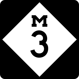
    M-3, known for most of its length as Gratiot Avenue, is a north–south state trunkline highway in the Detroit metropolitan area of the US state of Michigan. The trunkline starts in Downtown Detroit and runs through the city in a northeasterly direction along one of Detroit's five major avenues. The highway passes several historic landmarks and through a historic district. It also connects residential neighborhoods on the city's east side with suburbs in Macomb County and downtown.

    <span class="mw-page-title-main">M-5 (Michigan highway)</span> State highway in Michigan, United States

    M-5, commonly referred to as Grand River Avenue and the northern section as the Haggerty Connector, is a 27.9-mile-long (44.9 km) state trunkline highway in the Metro Detroit area of the US state of Michigan. The highway runs through suburbs in Oakland and Wayne counties in addition to part of Detroit itself. It starts in Commerce Township as a north–south divided highway and freeway called the Haggerty Connector and connects with Interstate 96 (I-96) in Novi. The freeway then turns southeasterly to bypass the suburb of Farmington as an east–west highway. The freeway ends on the southeast side of Farmington, and M-5 follows Grand River Avenue as boulevard into Detroit. The eastern terminus is at the five-way intersection between Grand River Avenue, Cass Avenue, and Middle Street in Downtown Detroit, where it had been extended to in May 2016 from an interchange with I-96 on the northwest side of the city. The trunkline passes between suburban residential subdivisions and along urban commercial areas while serving 17,200–68,800 vehicles on average each day.

    <span class="mw-page-title-main">U.S. Route 16 in Michigan</span> Former U.S. Highway in Michigan

    US Highway 16 (US 16), also called Grand River Avenue for much of its length in the state, was one of the principal roads prior to the post-World War II construction of freeways in the state of Michigan. Before the creation of the United States Numbered Highway System in 1926, the highway had been designated as a state highway numbered M-16. The modern route of Grand River Avenue cuts across the Lower Peninsula in a northwest–southeast fashion from near Grand Rapids to Detroit. Before the late 1950s and early 1960s, US 16 followed other roads between Muskegon and Grand Rapids, and then Grand River Avenue through Lansing to Detroit. In the years immediately preceding the creation of the Interstate Highway System, US 16 was shifted from older roads to newer freeways. Later, it was co-designated as an Interstate. When the gap in the freeway was filled in around Lansing, the US 16 designation was decommissioned in the state. The freeway was solely designated Interstate 96 (I-96) east of Grand Rapids and I-196 west of that city.

    <span class="mw-page-title-main">M-10 (Michigan highway)</span> State highway in Wayne and Oakland counties in Michigan, United States

    M-10 is a state trunkline highway in the Metro Detroit area of Michigan in the United States. Nominally labeled north-south, the route follows a northwest-southeast alignment. The southernmost portion follows Jefferson Avenue in downtown Detroit, and the southern terminus is at the intersection of Jefferson and M-3 next to the entrance to the Detroit–Windsor Tunnel. The northern terminus is in West Bloomfield Township at the intersection with Orchard Lake Road. The highway has several names as it runs through residential and commercial areas of the west side of Detroit and into the suburb of Southfield. It is called the John C. Lodge Freeway, James Couzens Highway, and Northwestern Highway. One segment has also been named the Aretha Franklin Memorial Highway.

    <span class="mw-page-title-main">M-102 (Michigan highway)</span> State highway in Michigan, United States

    M-102 is an east–west state trunkline highway in the US state of Michigan that runs along the northern boundary of Detroit following 8 Mile Road. The highway follows the Michigan Baseline, a part of the land survey of the state, and the roadway is also called Base Line Road in places. As a county road or city street, 8 Mile Road extends both east and west of the M-102 designation, which leaves 8 Mile on the eastern end to follow Vernier Road. The western terminus of M-102 is at the junction of 8 Mile Road and M-5 and the opposite end is at Vernier Road and Interstate 94 (I-94). The 8 Mile Road name extends west to Pontiac Trail near South Lyon with a discontinuous segment located west of US Highway 23 (US 23). The eastern end of 8 Mile Road is in Grosse Pointe Woods, near I-94, with a short, discontinuous segment east of Mack Avenue.

    Jefferson Avenue is a 63.71-mile-long (102.53 km) scenic road along the eastern part of the Detroit metropolitan area in the southeastern part of the U.S. state of Michigan. It travels alongside Lake Erie, the Detroit River, and Lake St. Clair. This road also provides access to many recreational facilities in the area. West Jefferson Avenue is primarily commercial, while East Jefferson Avenue contains a historic residential district.

    <span class="mw-page-title-main">M-59 (Michigan highway)</span> State highway in Michigan, United States

    M-59 is an east–west state trunkline highway that crosses the northern part of Metropolitan Detroit in the US state of Michigan. It runs between Howell at Interstate 96 (I-96) and I-94 on the Chesterfield–Harrison township line near the Selfridge Air National Guard Base. While primarily a multi-lane surface highway, it is a full freeway from just east of downtown Pontiac near Opdyke Road to just east of the Mound Road/Merrill Road exit in Utica. The various surface highway segments are named either Highland Road, Huron Street or Hall Road, with the latter known as an area for shopping and dining. The rural sections west of Pontiac pass through Oakland County lake country, passing through two state recreational areas.

    <span class="mw-page-title-main">M-17 (Michigan highway)</span> State highway in Washtenaw County, Michigan, United States

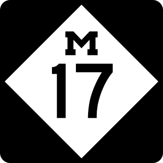
    M-17 is a 6.390-mile-long (10.284 km) state trunkline highway in the U.S. state of Michigan, connecting the cities of Ypsilanti and Ann Arbor in Washtenaw County. It was once part of a highway that spanned the southern Lower Peninsula of Michigan before the creation of the U.S. Highway System in 1926. The designation once extended into downtown Detroit, but the eastern terminus was progressively scaled back in the late 1960s to the current location in Ypsilanti. The changes made to the highways in Washtenaw County spawned Business M-17, a business loop for 11 years between 1945 and 1956.

    <span class="mw-page-title-main">M-58 (Michigan highway)</span> State highway in Saginaw County, Michigan, United States

    M-58 is a 5.108-mile-long (8.221 km) east–west state trunkline highway in the US state of Michigan that runs from M-47 in Saginaw Township east to exit 3 of Interstate 675 (I-675) near the north part of downtown Saginaw. The trunkline follows State Street through the Saginaw area, and east of Lathrop Avenue, M-58 is split along two streets, using Davenport Avenue as well. This is the third time that the number has been used on a highway in Michigan; the first two were used in the Berrien County and Pontiac areas. The Saginaw version was designated in 1971, and it is listed on the National Highway System.

    <span class="mw-page-title-main">U.S. Route 24 in Michigan</span> U.S. Highway in Michigan

    US Highway 24 is a United States Numbered Highway that runs from Minturn, Colorado, to Independence Township, Michigan. In Michigan, it is also known as Telegraph Road and runs for 79.828 miles (128.471 km) as a major north–south state trunkline highway from Bedford Township at the Ohio state line through Metro Detroit. The highway runs through three counties in southeastern Michigan, Monroe, Wayne and Oakland, as it parallels the Lake Erie shoreline and bypasses Metro Detroit on the west. Telegraph Road connects several suburbs together and passes through the western edge of Detroit before it terminates northwest of Clarkston at an interchange with Interstate 75 (I-75).

    <span class="mw-page-title-main">Business routes of U.S. Route 10 in Michigan</span> Routes of a highway in Michigan

    There are three business routes of US Highway 10 (US 10) in the state of Michigan. They serve as connections from the main highway into Reed City, Clare, and Midland. Additionally, there were another two business routes that connected US 10 to the downtowns of Flint and Pontiac. All these business routes are, or were, former sections of US 10 that were marked Business US Highway 10 after the main highway was realigned to bypass the downtowns of the cities.

    <span class="mw-page-title-main">Business routes of Interstate 94 in Michigan</span> List of business route highways in Michigan

    There are currently eight business routes of Interstate 94 (I-94) in the US state of Michigan. These business routes connect I-94 to the downtown business districts of neighboring cities. Seven of the eight routes are business loops which bear the Business Loop I-94 designation while one is a business spur that bears the Business Spur I-94. These loops are former routings of I-94's two predecessors in Michigan: US Highway 12 (US 12) or US 25. The westernmost BL I-94 runs through the twin cities of Benton Harbor and St. Joseph along the former routing of US 12 and US 31/US 33 that now includes a section of the Lake Michigan Circle Tour in the state. The loops in Kalamazoo, Battle Creek, Marshall, Albion, and Jackson were also formerly segments of US 12 which were later designated as separate version of Business US Highway 12 through their respective cities before becoming BL I-94s in 1960. The BL I-94 in Kalamazoo was converted into BS I-94 in 2019. The route of the business loop through Ann Arbor was previously US 12 and then later M-14 before receiving its current moniker. The BL I-94 through Port Huron was previously US 25 and then Business US Highway 25.

    <span class="mw-page-title-main">Business routes of Interstate 75 in Michigan</span> Highways in Michigan

    There have been nine business routes for Interstate 75 in the US state of Michigan. Numbered either Business Loop Interstate 75 or Business Spur Interstate 75 depending if they are a full business loop or a business spur, these highways are former routings of I-75's predecessor highways in the state. They were designated as I-75 was completed through the various areas of Michigan. The business loop in Pontiac runs through that city's downtown along a section of Woodward Avenue and a segment of roadway formerly used by M-24. The former Saginaw business loop was once a part of US Highway 23 (US 23), as was most of the original Bay City business loop. The roadways that make up the business loops in West Branch and Roscommon were previously part of M-76, I-75's predecessor through that part of the state. In Northern Michigan, the Grayling and Gaylord BL I-75s were part of US 27, and the two business routes in St. Ignace and Sault Ste. Marie in the Upper Peninsula of Michigan were part of US 2. A tenth business route, a loop through Indian River has been proposed. Each of the business loops connects to I-75 on both ends and runs through their respective cities' downtown areas. The two business spurs only connect to I-75 on one end and run into the appropriate downtown.

    <span class="mw-page-title-main">U.S. Route 25 in Michigan</span> Former US Highway in Michigan

    US Highway 25 (US 25) was a part of the United States Numbered Highway System in the state of Michigan that ran from the Ohio state line near Toledo and ended at the tip of The Thumb in Port Austin. The general routing of this state trunkline highway took it northeasterly from the state line through Monroe and Detroit to Port Huron. Along this southern half, it followed undivided highways and ran concurrently along two freeways, Interstate 75 (I-75) and I-94. Near the foot of the Blue Water Bridge in Port Huron, US 25 turned north and northwesterly along the Lake Huron shoreline to Port Austin.

    <span class="mw-page-title-main">Transportation in metropolitan Detroit</span>

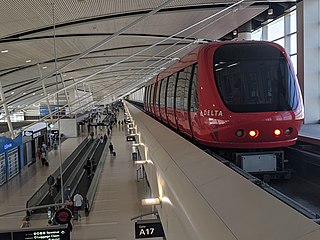
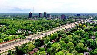
    Transportation in metropolitan Detroit comprises an expansive system of roadways, multiple public transit systems, a major international airport, freight railroads, and ports. Located on the Detroit River along the Great Lakes Waterway, Detroit is a significant city in international trade, with two land crossings to Canada. Three primary Interstate highways serve the region.

    References

    1. Lingeman, Stanley D. (April 6, 2001). Michigan Highway History Timeline 1701–2001: 300 Years of Progress. Lansing: Library of Michigan. p. 1. OCLC   435640179.
    2. World Trade Center Detroit/Windsor. Regional Advantages for International Business (PDF). World Trade Center Detroit/Windsor. Archived from the original (PDF) on September 25, 2007. Retrieved September 3, 2007.
    3. Baulch, Vivian M. (June 13, 1999). "Woodward Avenue, Detroit's Grand Old 'Main Street'". The Detroit News . Archived from the original on January 4, 2009. Retrieved January 31, 2010.
    4. Detroit 300 Conservancy (2006). "Photograph of Point of Origin medallion". Detroit 300 Conservancy. Archived from the original (JPG) on July 15, 2006.{{cite web}}: CS1 maint: numeric names: authors list (link)
    5. Detroit 300 Conservancy (2006). "Campus Martius Park site plan". Detroit 300 Conservancy.{{cite web}}: CS1 maint: numeric names: authors list (link)
    6. Greenwood, Tom (November 1, 2002). "Ribbon Cutting Opens New Road". The Detroit News.
    7. "Williams, John R." Encyclopedia of Detroit. Detroit Historical Society . Retrieved May 6, 2023.
    8. Hatcher, Beverly (November 13, 1991). "It's Lahser! Mispronounced road now gets misspelled". The Daily Tribune. Royal Oak, Michigan.
    9. Lyon Township - Supervisor's Office

    Further reading