
Stearns County is a county in the U.S. state of Minnesota. As of the 2020 census, the population was 158,292. Its county seat and largest city is St. Cloud. The county was founded in 1855. It was originally named for Isaac Ingalls Stevens, then renamed for Charles Thomas Stearns. Stearns County is part of the St. Cloud Metropolitan Statistical Area, which is also included in the Minneapolis-St. Paul Combined Statistical Area.

Sherburne County is a county in Central Minnesota. At the 2020 census, the population was 97,183. The county seat is Elk River.

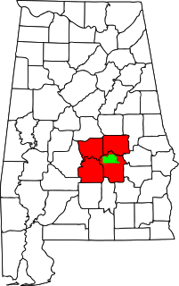
Benton County is a county in the East Central part of the U.S. state of Minnesota. As of the 2020 census, the population was 41,379. Its county seat is Foley.
Minden Township is a township in Benton County, Minnesota, United States. The population was 1,664 as of the 2010 census. Minden Township was organized in 1858.
Sauk Rapids Township is a township in Benton County, Minnesota, United States near the Mississippi River. The population was 584 at the 2010 census.

Sartell is a city in Benton and Stearns Counties in the U.S. state of Minnesota that straddles the Mississippi River. It is part of the St. Cloud Metropolitan Statistical Area. The population was 19,351 at the 2020 census, making it St. Cloud's most populous suburb and the fourth-largest city in central Minnesota, after St. Cloud, Elk River, and Willmar.

St. Cloud is a city in the U.S. state of Minnesota and the largest population center in the state's central region. The population was 68,881 at the 2020 census, making it Minnesota's 12th-largest city. St. Cloud is the county seat of Stearns County and was named after the city of Saint-Cloud, France, which was named after the 6th-century French monk Clodoald.

Clearwater is a city in Stearns and Wright counties in the U.S. state of Minnesota. The population was 1,735 at the 2010 census. Most of the city lies within Wright County.

The Lynchburg Metropolitan Statistical Area is a United States Metropolitan Statistical Area (MSA) in the state of Virginia, as defined by the Office of Management and Budget (OMB) as of June 2003. As of the 2000 census, the MSA had a population of 228,616. In 2009 this was estimated to have risen to 247,447; as of 2016, the Lynchburg MSA was estimated to have a population of 260,320, making it the fifth-largest metro area in the state.

The Charleston Metropolitan Statistical Area, as defined by the United States Census Bureau, is an area consisting of three counties in West Virginia, anchored by the city of Charleston. It is the largest metropolitan area entirely within the state of West Virginia. While the Huntington Metro Area is more populous, it spans three states, and the core county of the Charleston area, Kanawha County, is more populous than the West Virginia portion of the Huntington area.

The United States Census Bureau defines the Rochester, Minnesota Metropolitan Statistical Area (MSA) as an area consisting of five counties in southeast Minnesota, anchored by the city of Rochester. As of 2018, the US Census Bureau estimates that the Rochester metropolitan statistical area has a population of 221,587. The Rochester–Austin combined statistical area has a population of 259,813 as of 2018.

The Weirton–Steubenville, WV–OH Metropolitan Statistical Area, also known as the Upper Ohio Valley, is a metropolitan statistical area consisting of two counties in the Northern Panhandle of West Virginia and one in Ohio, anchored by the cities of Weirton and Steubenville. As of the 2020 census, the MSA had a population of 116,903. This puts it at 334th largest in the United States. It is also included in the larger Pittsburgh–New Castle–Weirton, PA–OH–WV Combined Statistical Area.

The Rockford Metropolitan Statistical Area, as defined by the United States Census Bureau, is an area consisting of four counties in north-central Illinois, anchored by the city of Rockford. As of the 2010 census, the MSA had a population of 349,431. The Rockford MSA abuts the southern portions of the Janesville-Beloit MSA and the Chicago MSA. It forms the main part of the larger Rockford–Freeport–Rochelle Combined Statistical Area.
The Montgomery, Alabama Metropolitan Statistical Area is a metropolitan area in central Alabama. As of 2020, the MSA had a population of 386,047, ranking it 142nd among United States Metropolitan Statistical Areas. That number is up +3.07% from the 2010 census number of 374,536. In September of 2018 the OMB formed the Montgomery-Selma-Alexander City CSA. It's made up of the 4 county Montgomery MSA and the Selma, AL and Alexander City, AL micropolitan areas. The 7 county CSA has a population of 522,873 as of the 2020 census.

The Cedar Rapids Metropolitan Statistical Area, as defined by the United States Census Bureau, is an area consisting of three counties in Iowa, anchored by the city of Cedar Rapids. As of the 2010 census, the MSA had a population of 257,940, and a 2013 population estimate of 262,421.

The Mankato — North Mankato Metropolitan Statistical Area, as defined by the United States Census Bureau, is an area consisting of two counties in south central Minnesota, anchored by the cities of Mankato and North Mankato. It was upgraded from a Micropolitan Statistical Area (μSA) to a Metropolitan Statistical Area (MSA) by the Office of Management and Budget on November 20, 2008. As of the 2020 census, the μSA had a population of 103,566.

The Bloomsburg–Berwick Metropolitan Statistical Area (MSA), as defined by the United States Census Bureau, is an area consisting of two counties in Pennsylvania, anchored by the town of Bloomsburg and the borough of Berwick. As of the 2010 census, the MSA had a population of 85,562.

The Madison, Wisconsin, metropolitan area, also known as Greater Madison, is the metropolitan area surrounding the city of Madison, Wisconsin. Madison is the state capital of Wisconsin and is Wisconsin's second largest city, and the metropolitan area is also the state's second largest.
The Johnson City Metropolitan Statistical Area, as defined by the United States Census Bureau, is an area consisting of three counties in East Tennessee, anchored by the city of Johnson City. As of the 2000 census, the MSA had a population of 181,607.
The Lafayette-West Lafayette, Indiana Metropolitan Statistical Area, as defined by the United States Census Bureau, is an area consisting of three counties in Indiana, anchored by the cities of Lafayette and West Lafayette. As of the July 1, 2021, the MSA had an estimated population of 224,709. Metro area population in 2021 is 237,130 and was 235,066 in 2020, a growth of 16% over 2010. In 2010, the Lafayette, Indiana metro area population was 210,297.

