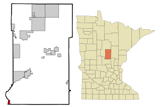
History
St. Hilaire was platted in 1882 and incorporated as a village on the auspicious date of July 4, 1883. Also on that date, St. Hilaire had rail service for the first time, as the Great Northern Railway opened a branch line from Crookston, Minnesota through Shirley, seven miles north of Crookston, Dorothy and Ives Station, to St. Hilaire.
St. Hilaire received its name in one of three ways:
- A Frenchman named St. Hilaire lived in a shack by the Red Lake River, selling items like gunpowder and tobacco, and when an item was needed, residents would "go to St. Hilaire" for it, and the name stuck.
- A Frenchman named Arthur Yvernault bought land on which the townsite was then platted and named for his hometown in France.
- It was named by Hon. Frank Ives for the French Statesman and author Jules Barthélemy-Saint-Hilaire, who was born in Paris, August 19, 1805, and died November 24, 1895. Frank Ives was a judge in Crookston, MN, which was the county seat of Polk County (of which Pennington was then a part) and his son, Harry Ives, was the postmaster when the St. Hilaire post office began in 1882 while still part of Polk County. Frank Ives owned land in St. Hilaire, but never lived there. This third possibility was favored by historian Warren Upham, and by extension by the Minnesota Historical Society. [6]
Harry Ives was also the publisher of the St. Hilaire Spectator, the first newspaper to serve this community. The Spectator was published from 1883 to 1942, when it closed and sold its subscription list to the Thief River Falls Times.
Demographics
2010 census
As of the census of 2010, there were 279 people, 123 households, and 71 families living in the city. The population density was 362.3 inhabitants per square mile (139.9/km2). There were 131 housing units at an average density of 170.1 per square mile (65.7/km2). The racial makeup of the city was 97.8% White, 1.1% Native American, 0.7% from other races, and 0.4% from two or more races. Hispanic or Latino of any race were 1.4% of the population.
There were 123 households, of which 30.9% had children under the age of 18 living with them, 43.1% were married couples living together, 6.5% had a female householder with no husband present, 8.1% had a male householder with no wife present, and 42.3% were non-families. 32.5% of all households were made up of individuals, and 8.2% had someone living alone who was 65 years of age or older. The average household size was 2.27 and the average family size was 2.87.
The median age in the city was 37.1 years. 25.1% of residents were under the age of 18; 9.7% were between the ages of 18 and 24; 22.9% were from 25 to 44; 30.9% were from 45 to 64; and 11.5% were 65 years of age or older. The gender makeup of the city was 53.0% male and 47.0% female.
2000 census
As of the census of 2000, there were 272 people, 121 households, and 68 families living in the city. The population density was 354.0 inhabitants per square mile (136.7/km2). There were 127 housing units at an average density of 165.3 per square mile (63.8/km2). The racial makeup of the city was 98.53% White, and 1.47% from two or more races.
There were 121 households, out of which 32.2% had children under the age of 18 living with them, 36.4% were married couples living together, 13.2% had a female householder with no husband present, and 43.0% were non-families. 33.9% of all households were made up of individuals, and 8.3% had someone living alone who was 65 years of age or older. The average household size was 2.25 and the average family size was 2.88.
In the city, the population was spread out, with 26.5% under the age of 18, 11.8% from 18 to 24, 30.5% from 25 to 44, 23.5% from 45 to 64, and 7.7% who were 65 years of age or older. The median age was 34 years. For every 100 females, there were 106.1 males. For every 100 females age 18 and over, there were 98.0 males.
The median income for a household in the city was $26,250, and the median income for a family was $37,143. Males had a median income of $27,188 versus $19,583 for females. The per capita income for the city was $13,317. About 3.3% of families and 14.1% of the population were below the poverty line, including 3.2% of those under the age of eighteen and 40.0% of those 65 or over.

Emily is a city in Crow Wing County, Minnesota, United States. The population was 813 at the 2010 census. It is part of the Brainerd Micropolitan Statistical Area.
Fort Ripley is a city in Crow Wing County, Minnesota, United States, near the confluence of the Mississippi and Nokasippi Rivers. The population was 69 at the 2010 census. It is part of the Brainerd Micropolitan Statistical Area.

Mendota is a city in Dakota County, Minnesota, United States. The name is derived from the Dakota language, meaning "mouth or junction of one river with another. The population was 198 at the 2010 census.

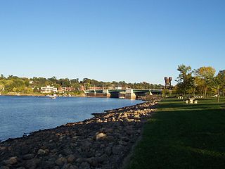
South St. Paul is a city in Dakota County, Minnesota, United States, immediately south and southeast of St. Paul and east of West St. Paul. The population was 20,759 at the 2020 census. The town was a major meat-packing location, and many residents are descended from immigrants of Southern European and Eastern European heritage, who came to work in the meat-packing plants in the early twentieth century.

Kenyon is a city in southwestern Goodhue County, Minnesota, United States, located along the North Fork of the Zumbro River. It was founded in 1856 and named in honor of Kenyon College. It is known for the Boulevard of roses on main street, which is the namesake of the town festival "Rosefest" held every August. The population was 1,815 at the 2010 census.

Coleraine is a city in Itasca County, Minnesota, United States. The population was 1,970 at the 2010 census. The community was named after Thomas F. Cole, President of the Oliver Iron Mining Company.

Lake Bronson is a city in Kittson County, Minnesota, United States. The population was 178 at the 2020 census. Lake Bronson State Park is nearby.

Tracy is a city in Lyon County, Minnesota, United States. The population was 2,163 at the 2010 census.
Truman is a city in Martin County, Minnesota, United States. The population was 1,115 at the 2010 census. In 2018, the U.S. Census Bureau estimated the population to be 1,053.

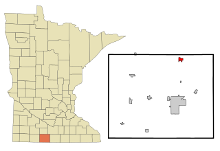
Iona is a city in Murray County, Minnesota, United States. The population was 137 at the 2010 census.

Andover Township is a township in Polk County, Minnesota, United States. Andover Township was organized in 1877. It is part of the Grand Forks-ND-MN Metropolitan Statistical Area. The population of the township was 154 at the 2000 census.

Crookston is a city in the U.S. state of Minnesota. It is the county seat of Polk County. The population was 7,482 at the 2020 census. It is part of the "Grand Forks, ND-MN Metropolitan Statistical Area" or "Greater Grand Forks".

Erskine is a city in Polk County, Minnesota. The population was 403 at the time of the 2020 census. It is part of the Greater Grand Forks region.
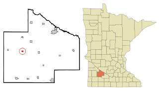
Lucan is a city in Redwood County, Minnesota, United States. The population was 191 at the 2010 census.

Lewiston is a city in Winona County, Minnesota, United States. The population was 1,620 at the 2010 census.

Crookston is a village in Cherry County, Nebraska, United States. The population was 69 at the 2010 census.

Saint Stephen is a city in Stearns County, Minnesota, United States. The population was 851 at the 2010 census.

St. Anthony is a city in Stearns County, Minnesota, United States. The population was 86 at the 2010 census. It is part of the St. Cloud Metropolitan Statistical Area. Main routes include Minnesota State Highway 238, Stearns County Road 153, and Trobec Street.
Prescott is a city in Pierce County, Wisconsin at the confluence of the St. Croix River and Mississippi River. The population was 4,258 at the 2010 census, making it the second-largest city in the county after River Falls, and the largest entirely within Pierce County.

Bellechester is a city in Goodhue and Wabasha counties in the U.S. state of Minnesota. The population was 175 at the 2010 census. Most of Bellchester is in Goodhue County, with only a small part extending into Wabasha County.

