
The River Stour is a river in Kent, England that flows into the North Sea at Pegwell Bay. Above Plucks Gutter, where the Little Stour joins it, the river is normally known as the Great Stour. The upper section of the river, above its confluence with the East Stour at Ashford is sometimes known as the Upper Great Stour or West Stour. In the tidal lower reaches, the artificial Stonar Cut short cuts a large loop in the natural river.

The River Wantsum is a tributary of the River Stour, in Kent, England. Formerly, the River Wantsum and the River Stour together formed the Wantsum Channel, which separated the Isle of Thanet from the mainland of Kent. Now the River Wantsum is little more than a drainage ditch starting at Reculver, and ending where it joins the Stour.

Minster, also known as Minster-in-Thanet, is a village and civil parish in the Thanet District of Kent, England. It is the site of Minster in Thanet Priory. The village is west of Ramsgate and to the north east of Canterbury; it lies just south west of Kent International Airport and just north of the River Stour. Minster is also the "ancient capital of Thanet". At the 2011 Census the hamlet of Ebbsfleet was included.

The Isle of Thanet is a peninsula forming the easternmost part of Kent, England. While in the past it was separated from the mainland by the 600-metre-wide (2,000 ft) Wantsum Channel, it is no longer an island.

Reculver is a village and coastal resort about 3 miles (5 km) east of Herne Bay on the north coast of Kent in south-east England. It is in the ward of the same name, in the City of Canterbury district of Kent.

Sturry is a village on the Great Stour river situated 3 miles (4.8 km) northeast of Canterbury in Kent. Its large civil parish incorporates several hamlets and, until April 2019, the former mining village of Hersden.

Monkton is a village and civil parish in the Thanet District of Kent, England. The village is located at the south-west edge of the Isle of Thanet and is situated mainly along the B2047 road, leading off the A253 road between Canterbury and Ramsgate. The civil parish stretches south to the River Stour and northwards towards Acol. The hamlet of Gore Street is included in the parish.
Thanet is a local government district in Kent, England. The council is based in Margate and the district also contains the towns of Broadstairs, Ramsgate and Westgate-on-Sea, along with several villages. It takes its name from the Isle of Thanet, a former island which gradually became connected to the mainland between the 12th and 16th centuries.

Westgate-on-Sea is a seaside town and civil parish on the north-east coast of Kent, England. It is within the Thanet local government district and borders the larger seaside resort of Margate. Its two sandy beaches have remained a popular tourist attraction since the town's development in the 1860s from a small farming community. The town had a population of 7,517 at the 2021 Census.
The Wantsum Channel was a strait separating the Isle of Thanet from the north-eastern extremity of the English county of Kent and connecting the English Channel and the Thames Estuary. It was a major shipping route when Britain was part of the Roman Empire, and continued in use until it was closed by silting in the late Middle Ages. Its course is now represented by the River Stour and the River Wantsum, which is little more than a drainage ditch lying between Reculver and St Nicholas-at-Wade and joins the Stour about 1.7 miles (2.7 km) south-east of Sarre.

Bethersden is a village and civil parish in the borough of Ashford in Kent, England, 5 miles (8 km) west of the town of Ashford. Located on the main road, A28, between Tenterden and Ashford.

Chislet is an English village and civil parish in northeast Kent between Canterbury and the Isle of Thanet. The parish is the second largest in the district. A former spelling, 'Chistlet', is seen in 1418. The population of the civil parish includes the hamlet of Marshside. Most of the land use is fertile agricultural and a significant minority of the land is marsh where low-lying.

Hoath is a semi-rural village and civil parish in the City of Canterbury local government district. The hamlets of Knaves Ash, Maypole, Ford, Old Tree, Shelvingford and Stoney Acre are included in the parish.

Sarre is a village and civil parish in Thanet District in Kent, England. The village is a part of St. Nicholas-at-Wade ecclesiastical parish, after having lost the local church of St. Giles in Elizabethan times; the ecclesiastical parishes were subsequently combined. In its own right Sarre is an Ancient Parish. It has a population of 130, increasing to 222 at the 2011 Census.

Herne is a village in the civil parish of Herne and Broomfield, in Canterbury district, in the county of Kent, England. It is divided by the Thanet Way from the seaside resort of Herne Bay. Between Herne and Broomfield, is the former hamlet of Hunters Forstal. Herne Common lies to the south on the A291 road.

All Saints' Church, Shuart, in the north-west of the Isle of Thanet, Kent, in the south-east of England, was established in the Anglo-Saxon period as a chapel of ease for the parish of St Mary's Church, Reculver, which was centred on the north-eastern corner of mainland Kent, adjacent to the island. The Isle of Thanet was then separated from the mainland by the sea, which formed a strait known as the Wantsum Channel. The last church on the site was demolished by the early 17th century, and there is nothing remaining above ground to show that a church once stood there.
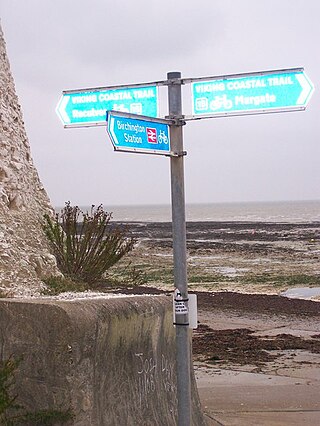
The Viking Coastal Trail is a 25-mile multi-user route around the Isle of Thanet, keeping as close as is possible to the coast. It is also Regional Route 15 of the National Cycle Network. From Reculver, the trail passes through Margate, Broadstairs and Ramsgate to reach Pegwell Bay, where Vikings first landed in Kent. The Trail then, uses an inland route on quiet lanes, passing through a couple of villages with ancient churches including Minster-in-Thanet Abbey and St Nicholas at Wade, to return to Reculver.

St Mary's Church, Reculver, was founded in the 7th century as either a minster or a monastery on the site of a Roman fort at Reculver, which was then at the north-eastern extremity of Kent in south-eastern England. In 669, the site of the fort was given for this purpose by King Ecgberht of Kent to a priest named Bassa, beginning a connection with Kentish kings that led to King Eadberht II of Kent being buried there in the 760s, and the church becoming very wealthy by the beginning of the 9th century. From the early 9th century to the 11th the church was treated as essentially a piece of property, with control passing between kings of Mercia, Wessex and England and the archbishops of Canterbury. Viking attacks may have extinguished the church's religious community in the 9th century, although an early 11th-century record indicates that the church was then in the hands of a dean accompanied by monks. By the time of Domesday Book, completed in 1086, St Mary's was serving as a parish church.

The Church of St Mary the Virgin, Reculver, is an Anglican church on Reculver Lane in the village of Hillborough, in the parish of Reculver, in north-eastern Kent, England. Built between 1876 and 1878, it is the second such church on its site. The first, consecrated in 1813, was a replacement for a church of St Mary that was founded in 669 within the remains of the Roman fort at Reculver, about 1.25 miles (2 km) to the north-east, but was mostly demolished in 1809.


