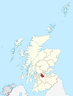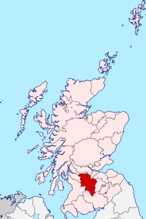
Lanarkshire, also called the County of Lanark is a historic county in the central Lowlands of Scotland.
Kilsyth is a town and civil parish in North Lanarkshire, roughly halfway between Glasgow and Stirling in Scotland. The estimated population is 9,860. The town is famous for the Battle of Kilsyth and the religious revivals of the 18th, 19th, and 20th centuries. The town now has links with Cumbernauld at one time being part of Cumbernauld and Kilsyth District Council. The towns also have the same members of parliament at Holyrood and Westminster.

Calderbank is a village outside the town of Airdrie, North Lanarkshire, Scotland. It lies west of the M73, on the west bank of the North Calder Water. The village lies 13 miles east of Glasgow city centre and around 34 miles west of Edinburgh. Other nearby towns include: Airdrie, Coatbridge, Bellshill and Motherwell. It has a population of about 1,610.

Cumbernauld Village is an area of Cumbernauld. Whilst Cumbernauld was designated a new town in 1955, the Village itself has a pre-mediaeval history, with a Roman settlement being built in the area due to its proximity to the Antonine Wall. After the Roman period the settlement remained and grew to such an extent that the Comyn family built their chapel there. It is recorded that, in 1500, the Black Death led to a special plea from the surviving people of Cumbernauld to the church authorities in Glasgow to allow them to establish their own cemetery rather than taking all their dead to St. Ninian's in Kirkintilloch. This source is also quoted in "Excavations at 3-11 Main Street, Cumbernauld". The villagers were granted permission to do so, and used the ground at the existing Comyns' chapel which dates from the end of the 12th century. Farming in long strips or Lang Riggs was carried out in the village.

Carbrain /kar 'bren/ is a neighborhood in Cumbernauld, North Lanarkshire in Scotland. It gets a brief mention on William Roy's eighteenth century map of the Scottish Lowlands. In the nineteenth century it was no more than a farm steading. An early map shows just a few buildings existed in 1864. By the start of the First World War it had not grown significantly, although there was a school near the railway station. It was sometimes spelled Carbrane. Even in 1956 Carbrain was mostly farmland with a small burn flowing through it. The map seems to show this flowing possibly down the Gully and eventually feeding the Red Burn in the Vault Glen. This burn isn't named so can't be identified with the Horseward Burn from historic maps.
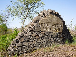
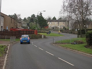
Dullatur is a village near Cumbernauld, Scotland. Like Condorrat, Castlecary and Luggiebank, it predates the new town of Cumbernauld, and of those only Condorrat was officially included in the designated area. Its name is anglicised from the Gaelic Dubh Leitir, which means "dark slope". The route of the Antonine Wall passes just to the north of Dullatur. Two Roman temporary marching camps were located at Dullatur between the forts at Croy Hill and Westerwood. The camps have been excavated several times by archaeologists following aerial photography and proposed housebuilding. Both camps have now been built over, and no visible remains can be seen on the ground today. Digital reconstructions of the larger and the smaller of the camps have been created. When building the nearby Forth and Clyde Canal in the 18th century a number of finds were made in Dullatur Bog. Thomas Watson recorded: "a number of swords, pistols, and other weapons were dug out; also the bodies of men and horses, and what seems somewhat marvellous, a trooper, completely armed, and seated on his horse, in the exact posture in which he had perished." It was supposed that the man was escaping the Battle of Kilsyth which is due north of Dullatur Bog.

Chryston is a village in North Lanarkshire, around 7 miles (11 km) east of Glasgow, in Scotland. It lies north of its sister village, Muirhead, which is on the A80. The village has around double Muirhead's population although the exact boundary between the two modern villages is difficult to find.

Upperton is a village in North Lanarkshire, Scotland, near Airdrie and Cumbernauld, about 20 miles (32 km) north-east of Glasgow. It lies close to the B803 between Greengairs and Slamannan. Other nearby roads include Hulks Road towards the A73, Fannyside Road to Abronhill and the road to Caldercruix via Longriggend. The Avon Water flows through the village and meets the Shielhill Burn, a tributary of the River Avon, just outside the village. William Forrest's 1816 map of Lanarkshire shows the site as Upper Town. The Ordnance Survey map sites "Uppertown" on Shiel Hill.

Greengairs is a village in North Lanarkshire, Scotland. Greengairs is shown on a map by Roy c.1754 under the name of Green Geirs. In toponymy the name means "green strips of grass". Lying 3 miles (5 km) southeast of Cumbernauld and 3 miles (5 km) north east of Airdrie, the village consists mainly of local authority housing. Between them Greengairs and Wattston have about 1,190 residents.

Craigmarloch is a private residential area of the town of Cumbernauld in North Lanarkshire, Scotland. It was the last such area that the Cumbernauld Development Corporation (CDC) laid out and began to construct. The area is designed to be like a village, with features such as: a village green, a main street, focal points, gateways, water features and recreational and community facilities. The responsibility for the development of the area passed from the CDC to North Lanarkshire Council in 1996.
Westfield is an area of the town of Cumbernauld in Scotland. Westfield is a popular residential area originally built by Cumbernauld Development Corporation in the late 1970s and early 1980s. It comprises a residential area and a large industrial estate. Historically there was a farm at Westfield as shown on Roy's map of the Lowlands and the 1st 25 inch Ordnance Survey Map of Scotland. It is located near Condorrat and Broadwood Stadium, home of Clyde FC. Historically, there were two local primary schools, St Francis of Assisi Primary School and Westfield Primary School. St. Francis of Assisi Primary School closed in 2009. The site has been re-developed by North Lanarkshire Council with new, high quality social housing available to rent. The new street is named Netherinch Way. Westfield also has other modern, private developments for example a new Bellway Housing development sits near Broadwood stadium along with a neighboring housing development. Westfield has a selection of frequent bus services to Airdrie, Cumbernauld Town Centre, Glasgow, Kilsyth and Kirkintilloch with buses operated by David Allan Coaches, First Group & McGills. In 2017 plans for a new retail park near Broadwood Studium were approved.

Wattston is a village on the B803, west of Greengairs in North Lanarkshire, Scotland. Between them Wattston and Greengairs have about 1,190 residents. It is around 4 km south of Cumbernauld, and 4 km north of Airdrie. Other places nearby include Caldercruix, Longriggend, Riggend and Slamannan.

Garnkirk is a settlement in North Lanarkshire, located a mile southwest of Muirhead. It is located 10 km northeast of Glasgow's city centre and 23 km southwest of Falkirk. Garnkirk is connected via the nearby motorways M8, M73 and M80. This provides access to Cumbernauld, Glasgow and Stirling. The nearest modern railway stations are in Gartcosh and Stepps.

Glenmavis is a village in the North Lanarkshire area of Scotland. It is situated about 2 miles north-west of Airdrie on the B802 road. A mid-2012 estimate recorded a population of about 2290.

Longriggend is a village in North Lanarkshire, Scotland, with a population of approximately 200. It is situated on moorland 8 km north-east of Airdrie, in the parish of New Monkland. It is roughly half way between Upperton and Caldercruix. The village appeared on a map by Timothy Pont, under the name of Langrodge. It was published in 1596 but the letters are difficult to read. The toponymy is listed along with other -rigg placenames. Longriggend is also shown on another map by Roy c1754. Slamannan Railway joined Longriggend with Airdrie and the Union Canal in 1840, but its gauge prevented its connection with the Edinburgh & Glasgow Railway. Coal pits in the area used the railway extensively, and by 1895 there was a station at Longriggend. By 1901 its population had reached over 1500, and it had a post and telegraph office, and an inn nearby.

The Luggie Water is one of two streams which flow out of Cumbernauld. The Scottish New Town’s name derives from the Gaelic for "the meeting of the waters" and it’s possible this refers to the Luggie Water and the Red Burn, both of which run through Cumbernauld but which never meet.

Cumbernauld Castle was the predecessor of Cumbernauld House in the Park in Cumbernauld. The Motte of the earliest castle survives, and stones of the second castle are incorporated in the present house.

Blairlinn is the site one of Cumbernauld's several industrial estates built as satellite developments on the periphery of the Scottish town's residential areas.

Carrickstone is an area of Cumbernauld, Scotland. It is on the north of the M80 and west of Cumbernauld Town Centre. The area it now occupies used to be covered by Carrickstone farm with the 25 inch Ordnance Survey map showing it between an ancient "standing stone" and The Village.