Standerton

Last updated
Standerton
Standerton Mpumalanga.jpg
Central business district in Standerton.
South Africa Mpumalanga location map.svg
Red pog.svg
Standerton
South Africa adm location map.svg
Red pog.svg
Standerton
Coordinates: 26°57′S29°15′E / 26.950°S 29.250°E / -26.950; 29.250
Country South Africa
Province Mpumalanga
District Gert Sibande
Municipality Lekwa
Established14 December 1878
Area
[1]
  Total17.56 km2 (6.78 sq mi)
Elevation
1,530 m (5,020 ft)
Population
 (2011) [1]
  Total10,611
  Density600/km2 (1,600/sq mi)
Racial makeup (2011)
[1]
   Black African 39.3%
   White 35.0%
   Coloured 15.4%
   Indian/Asian 9.1%
  Other1.2%
First languages (2011)
[1]
   Afrikaans 50.3%
   Zulu 21.2%
   English 17.4%
   Sotho 3.5%
  Other7.6%
Time zone UTC+2 (SAST)
Postal code (street)
2430
PO box
2430
Area code 017

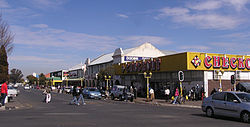
Standerton is a large commercial and agricultural town lying on the banks of the Vaal River in Mpumalanga, South Africa, which specialises in cattle, dairy, maize and poultry farming. The town was established in 1876 and named after Boer leader Commandant A. H. Stander. During the First Boer War a British garrison in the town was besieged by the Boers for three months. General Jan Smuts won this seat during elections and went on to assist in setting up the League of Nations. Standerton is the seat of the Lekwa Local Municipality. [2]

Contents

History

Standerton was founded in 1878 on a farm called Grootverlangen and named after its owner Commandant Adriaan Henrik Stander. [3] The South African Republic's Volksraad approved the formation of a town at the drift in 1876 and proclaimed two years later. [4] :301 It was granted municipal status in 1903. [3] The crossing over the Vaal River, now bridged, was known as Stander's Drift and a hill close to the town was called Standerskop were also named after Stander. [3] [5] :303 During the First Boer War (1880–81), a British unit was besieged by the Boer forces who shelled them from the nearby hill, the former holding out until the end of the war in February 1881. [4] :301

Great Trek memorial controversy

The town has received nationwide media attention in 2007 and 2008 following the destruction of an important voortrekker memorial. This monument, located near the facade of the municipality building, was constructed by Afrikaners to mark the 150th anniversary of the Great Trek. The Lekwa municipality's mayor Queen Radebe-Khumalo ordered the structure demolished in April 2007. "That piece of thing means nothing to us. It's just a piece of cement with tracks. I do not even know where it comes from", Radebe-Khumalo declared in a statement quoted by the Beeld newspaper. [6]

The incident led to widespread condemnation by the local Afrikaans community. Jan Bosman, a spokesperson for the Afrikanerbond, claimed that "actions like these undo the spirit of reconciliation as promoted by former president Nelson Mandela and Archbishop Desmond Tutu". [7] In June 2007, a joint initiative between AfriForum and Solidarity lodged an application to the Pretoria High Court requesting that the mayor offer compensation for damages claimed. A subsequent court order ruled that Radebe-Khumalo and her municipality would pay for the damage and prohibited attempts to remove another statue erected in memory of Anglo-Boer war concentration camp victims. [8]

Memorial to those who died in concentration camps during the Boer war. Old Water Fountain and memorial to family who died in the Standerton Concentration Camp. 02.JPG
Memorial to those who died in concentration camps during the Boer war.

In May 2010, the memorial was rebuilt on its original site. [9] [10]

Sakhile Township riots

The township of Sakhile near Standerton was the site of violent, service delivery riots that led to the Lekwa Municipality mayor Juliet Queen Radebe-Khumalo and other senior municipal officials, being recalled by the African National Congress in October 2009. The riots included the burning of tyres and blocking some entries to the town. [11]

Economy

Agriculture

The area around the town promotes mixed agriculture with crops such as maize, sunflower seeds, ground nuts and potatoes. Poultry and dairy farming is also conducted in the region. [4] :301

Manufacturing

Standerton Mills

Standerton Mills Pty Ltd was established in 1947. Mainly manufacturing and supplying yarn and woven industrial fabrics. [12]

Education

Infrastructure

Dams

Grootdraai Dam is situated in the upper reaches of the Vaal River less than 10 km upstream of Standerton. It has a catchment area of 8,195 km2, a mean annual precipitation of approximately 750 mm, a mean annual potential evaporation at the dam site of 1,400 mm and a natural inflow of 580 million m3/a. The full supply capacity of the reservoir is 364 million m3. The Grootdraai dam was completed in 1982.

Notable people

Although Standerton is a rural town surviving mainly on agriculture, it has produced talented people prominent in South African society.

Related Research Articles

<span class="mw-page-title-main">Pretoria</span> Administrative capital of South Africa

Pretoria, also known as Tshwane, is South Africa's administrative capital, serving as the seat of the executive branch of government, and as the host to all foreign embassies to South Africa.

<span class="mw-page-title-main">Vaal River</span> Tributary of the Orange River, South Africa

The Vaal River is the largest tributary of the Orange River in South Africa. The river has its source near Breyten in Mpumalanga province, east of Johannesburg and about 30 kilometres (19 mi) north of Ermelo and only about 240 kilometres (150 mi) from the Indian Ocean. It then flows westwards to its confluence with the Orange River southwest of Kimberley in the Northern Cape. It is 1,458 kilometres (906 mi) long, and forms the border between Mpumalanga, Gauteng and North West Province on its north bank, and the Free State on its south.

<span class="mw-page-title-main">Great Trek</span> 1836–1852 Boer migrations away from the British Cape Colony

The Great Trek was a northward migration of Dutch-speaking settlers who travelled by wagon trains from the Cape Colony into the interior of modern South Africa from 1836 onwards, seeking to live beyond the Cape's British colonial administration. The Great Trek resulted from the culmination of tensions between rural descendants of the Cape's original European settlers, known collectively as Boers, and the British Empire. It was also reflective of an increasingly common trend among individual Boer communities to pursue an isolationist and semi-nomadic lifestyle away from the developing administrative complexities in Cape Town. Boers who took part in the Great Trek identified themselves as voortrekkers, meaning "pioneers", "pathfinders" in Dutch and Afrikaans.

<span class="mw-page-title-main">Boer republics</span> Former countries in southern Africa

The Boer republics were independent, self-governing republics formed by Dutch-speaking inhabitants of the Cape Colony and their descendants. The founders – variously named Trekboers, Boers, and Voortrekkers – settled mainly in the middle, northern, north-eastern and eastern parts of present-day South Africa. Two of the Boer republics achieved international recognition and complete independence: the South African Republic and the Orange Free State. The republics did not provide for the separation of church and state, initially allowing only the Dutch Reformed Church, and later also other Protestant churches in the Calvinist tradition. The republics came to an end after the Second Boer War of 1899–1902, which resulted in British annexation and later incorporation of their lands into the Union of South Africa.

<span class="mw-page-title-main">Ladysmith, KwaZulu-Natal</span> Place in KwaZulu-Natal, South Africa

Ladysmith is a city in the Uthukela District of KwaZulu-Natal, South Africa. It lies 230 kilometres (140 mi) north-west of Durban and 365 kilometres (227 mi) south-east of Johannesburg. Important industries in the area include food processing, textiles, and tyre production. Ladysmith is the seat for both the Alfred Duma Local Municipality and Uthukela District Municipality.

<span class="mw-page-title-main">Potchefstroom</span> Place in North West, South Africa

Potchefstroom, colloquially known as Potch, is an academic city in the North West Province of South Africa. It hosts the Potchefstroom Campus of the North-West University. Potchefstroom is on the Mooirivier, roughly 120 km (75 mi) west-southwest of Johannesburg and 45 km (28 mi) east-northeast of Klerksdorp.

<span class="mw-page-title-main">Kroonstad</span> Town in Free State, South Africa

Kroonstad, officially named Maokeng, is the fourth largest town in the Free State and lies two hours' drive on the N1 from Gauteng. It is the second-largest commercial and urban centre in the Northern Free State, and an important railway junction on the main line from Cape Town to Johannesburg. Maokeng is Sesotho and means "place of the thorn trees ".

<span class="mw-page-title-main">Kestell</span> Place in Free State, South Africa

Kestell is a small maize farming town in the Free State province of South Africa.

<span class="mw-page-title-main">Petrus Steyn</span> Place in Free State, South Africa

Petrus Steyn, officially renamed Mamafubedu, is a small farming town between Tweeling and Kroonstad, 35 km north-east of Lindley in the Free State province of South Africa. It is at the centre of an agricultural area known for wheat, maize, sunflower, potato, cattle, hunting, sheep production and forms part of the breadbasket in the Free State. It is the highest town above sea level in the Free State. In 2012 the town's name was changed to Mamafubedu. Farming industries in Mamafubedu provide potatoes worldwide.

<span class="mw-page-title-main">Bothaville</span> Place in Free State, South Africa

Bothaville is a maize farming town situated near the Vaal River in the Lejweleputswa DM of the Free State province, South Africa. It is situated 60 km east of the Vaal, on the bank of its Vals River tributary. Bothaville and the adjacent Kgotsong township have a total of approximately 46,000 residents.

<span class="mw-page-title-main">Winburg</span> Place in Free State, South Africa

Winburg is a small mixed farming town in the Free State province of South Africa.

Lichtenburg is a town situated in North West Province, South Africa. It is the administrative centre of Ditsobotla Local Municipality.

<span class="mw-page-title-main">Gustav Preller</span> South African author and literary critic

Gustav Schoeman Preller was a journalist, historian, writer and literary critic. He fought for the recognition of Afrikaans. Preller helped the Afrikaner to realize the importance of the history of South Africa. He made great contributions to the writing of South African history, through his research and literature. He also contributed greatly to making South Africans aware of the legacy of the Voortrekkers and also played an early part in planning the Voortrekker Monument.

<span class="mw-page-title-main">Huguenots in South Africa</span>

Many people of European heritage in South Africa are descended from Huguenots. Most of these originally settled in the Cape Colony, but were absorbed into the Afrikaner and Afrikaans-speaking population, because they had religious similarities to the Dutch colonists.

Grootdraai Dam is a combined gravity and earth-fill type dam located on the Vaal River, near Standerton, Mpumalanga, South Africa. It was established in 1981.

<span class="mw-page-title-main">Lekwa Local Municipality</span> Local municipality in Mpumalanga, South Africa

Lekwa Municipality is a local municipality situated in the southwest of the Gert Sibande District Municipality, in the Mpumalanga province of South Africa. Standerton, an urban node, is the seat of the municipality. It was inaugurated on 5 December 2000 after the amalgamation of the Standerton, Sakhile and Morgenzon councils. Agriculture, forestry and fishing constitute about 30% of its economy. It is situated on open grassland plains of the Highveld region, which is traversed by the west-flowing Vaal River, for which it is named. Lekwa is the Sesotho name for the Vaal River. Lekwa's first two decades were marked by increasing maladministration, which culminated in a collapse in governance and service delivery by 2020. This had negative consequences for its residents and businesses, the environment, and utilities which were not paid for their services.

<span class="mw-page-title-main">Hoërskool Voortrekker (Boksburg)</span> Public school in Boksburg, Gauteng, South Africa

Hoërskool Voortrekker is a public Afrikaans medium co-educational high school situated in the municipality of Boksburg in the city of Ekurhuleni in the Gauteng province of South Africa. The academic school was established in 1920.

AfriForum is a South African non-governmental organisation which mainly focuses on the interests of Afrikaners, a subgroup of the country's white population. AfriForum has been described as a "white nationalist, alt-right, and Afrikaner nationalist group", though this description is rejected by the organisation's leadership, who refer to themselves as a civil rights group.

<span class="mw-page-title-main">Rand Water</span> South African water utility supplying the Gauteng province

Rand Water is a South African water utility that supplies potable water to the Gauteng province and other areas of the country and is the largest water utility in Africa. The water is drawn from numerous sources and is purified and supplied to industry, mining and local municipalities and is also involved in sanitation of waste water.

<span class="mw-page-title-main">Flag of the South African Republic</span> Flag

The South African Republic, which existed from 1852 to 1877, 1881 to 1902, and 1914 to 1915, used two flags: (1) the so-called 'Vierkleur' from 1857 to 1874, and again from 1875 to 1877 and 1881 to 1902, and (2) the so-called 'Burgers Flag' from 1874 to 1875. They were superseded by the flag of Transvaal. The Vierkleur was also used by the South African Republic declared in 1914 during the Maritz Rebellion, which lasted into February 1915.

References

  1. 1 2 3 4 "Sub Place Standerton". Census 2011.
  2. "LEKWA MUNICIPALITY in Standerton South Africa".
  3. 1 2 3 Raper, Peter E; Möller, Lucie A; du Plessis, L Theodorus (2014). Dictionary of South African Place Names (4th ed.). Johannesburg: Jonathan Ball. p. 529. ISBN   9781868425495.
  4. 1 2 3 Erasmus, B.P.J. (2014). On Route in South Africa: Explore South Africa region by region. Jonathan Ball Publishers. p. 401. ISBN   9781920289805.
  5. Leyds, Gerald Anton (1964). A History of Johannesburg: The Early Years. Nasional Boekhandel. p. 318.
  6. Ismail, Sumayya (April 13, 2007). "Tempers flare over Great Trek memorial damage". Mail & Guardian Online . Sapa-AFP. Retrieved October 2, 2019.
  7. "Afrikaner shock over demolition". News24. 2007-04-13. Archived from the original on 2008-10-30.
  8. "Mayor told to repair memorial". News 24. 2007-06-06.
  9. Kriel, Kallie (May 27, 2010). "Standerton memorial to be re-inaugurated". AfriForum . Retrieved March 27, 2015 via Politicsweb.
  10. "Standerton monument word weer herstel". Solidarity. 2010-05-01.
  11. Beauregard Tromp, "'The kingdom has fallen!'" IOL News , October 22, 2009.
  12. "Standerton Mills Home Page". www.standertonmills.co.za. Retrieved 2020-09-11.