Standing Rock, Alabama

Last updated

Standing Rock, Alabama
2021-03-15 Standing Rock, Alabama.jpg
Standing Rock, Alabama in 2021
Chambers County Alabama Incorporated and Unincorporated areas Standing Rock Highlighted 0172720.svg
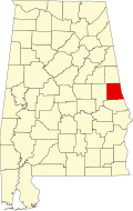
Location of Standing Rock in Chambers County, Alabama.
USA Alabama location map.svg
Red pog.svg
Standing Rock
Coordinates: 33°04′47″N85°15′11″W / 33.07972°N 85.25306°W / 33.07972; -85.25306
Country United States
State Alabama
County Chambers
Area
[1]
  Total3.23 sq mi (8.36 km2)
  Land3.19 sq mi (8.26 km2)
  Water0.04 sq mi (0.10 km2)
Elevation
794 ft (242 m)
Population
 (2020)
  Total132
  Density41.41/sq mi (15.99/km2)
Time zone UTC-6 (Central (CST))
  Summer (DST) UTC-5 (CDT)
Area code 334
GNIS feature ID127300 [2]

Standing Rock is a census-designated place and unincorporated community in Chambers County, Alabama, United States. Its population was 132 as of the 2020 census.

Demographics

Historical population
CensusPop.Note
1920 698
2010 168
2020 132−21.4%
U.S. Decennial Census [3]
1850-1870 [4] 1870-1880 [5]
1890-1910 [6] 1920 [7] 1930 [8]
1940 [9] 1950 [10] 1960 [11]
1970 [12] 1980 [13] 1990 [14]
2000 [15] 2010 [16]

Related Research Articles

<span class="mw-page-title-main">Huguley, Alabama</span> Census-designated place in Alabama, United States

Huguley is a census-designated place (CDP) and unincorporated community in Chambers County, Alabama, United States. At the 2020 census, the population was 2,470.

<span class="mw-page-title-main">Deenwood, Georgia</span> Place in Georgia, United States

Deenwood is an unincorporated community and census-designated place (CDP) in Ware County, Georgia, United States. The population was 2,207 at the 2020 census. It is part of the Waycross micropolitan statistical area. Deenwood Baptist Church is named after this geographical area.

Cataula is an unincorporated community and census-designated place (CDP) in Harris County, Georgia, United States.

<span class="mw-page-title-main">Pine Level, Autauga County, Alabama</span> Place in Alabama, United States

Pine Level is a town and former census-designated place (CDP) in Autauga County, Alabama, north of Prattville and west of Deatsville. As of the 2010 census, the CDP's population was 4,183. The town is part of the Montgomery Metropolitan Statistical Area.

<span class="mw-page-title-main">Rock Spring, Georgia</span> Place in Georgia, USA

Rock Spring is an unincorporated community and census-designated place located in northwest Georgia, United States, approximately 14 miles (23 km) south of Chattanooga, Tennessee. It is in Walker County which resides in Georgia's 14th congressional district. Rock Spring is included in the Chattanooga, TN-GA Metropolitan Statistical Area.

<span class="mw-page-title-main">Marbury, Alabama</span> Place in Alabama, United States

Marbury is an unincorporated community and census-designated place (CDP) in Autauga County, Alabama, United States. As of the 2010 census, its population was 1,418.

<span class="mw-page-title-main">Fredonia, Alabama</span> Census-designated place in Alabama, United States

Fredoniafree-DOH-nia is an unincorporated community and census-designated place in Chambers County, Alabama, United States. Its elevation is 794 feet (242 m), and it is located at 32°59′23″N85°17′19″W. As of the 2010 census, its population was 199. Other names for the community have included "Freedona" and "Hursts Store". It is the location of the New Hope Rosenwald School, which is listed on the National Register of Historic Places.

<span class="mw-page-title-main">Bristol, Georgia</span> Place in Georgia, United States

Bristol is an unincorporated community and census-designated place (CDP) in Pierce County, Georgia, United States. Bristol is located at the intersection of the concurrent Georgia State Route 15 and Georgia State Route 121, which runs north–south through Bristol, and Georgia State Route 32, which runs east–west. Bristol is 10 miles (16 km) north of Blackshear. Bristol is also known as Lightsey.

The Rock is an unincorporated community and census-designated place in Upson County, Georgia, United States. The Rock is located on Georgia State Route 36, 7 miles (11 km) northeast of Thomaston. The Rock has a post office with ZIP code 30285, although the post office is on the list to be closed. The Rock is also home to the area-famous Rock Ranch, a small theme park with a farming theme. The Rock is bordered by the cities of Barnesville, Hannahs Mill, Meansville, and Yatesville.

<span class="mw-page-title-main">Abanda, Alabama</span> Census-designated place in Alabama, United States

Abanda is a census-designated place and unincorporated community in Chambers County, Alabama, United States. Its population was 133 as of the 2020 census.

<span class="mw-page-title-main">Penton, Alabama</span> Census-designated place in Alabama, United States

Penton is a census-designated place and unincorporated community in Chambers County, Alabama, United States. Its population was 163 as of the 2020 census.

Epworth is an unincorporated community and census-designated place (CDP) in Fannin County, Georgia, United States. As of the 2010 census it had a population of 480. It lies at an elevation of 1,703 feet (519 m) in the north-central part of the county. A former name was Atalla. The ZIP code is 30541.

Empire is an unincorporated community and census-designated place in Dodge and Bleckley counties in the U.S. state of Georgia. As of the 2020 census, the CDP had a population of 319.

Cedar Springs is an unincorporated community and census-designated place (CDP) in Early County, Georgia, United States. At the time of the 2020 census, the population was 75. Cedar Springs has a post office with ZIP code 39832. Georgia State Route 273 passes through the community. Georgia Pacific is 2 miles southwest from it.

<span class="mw-page-title-main">Cherry Log, Georgia</span> Place in Georgia, United States

Cherry Log is an unincorporated community and census-designated place (CDP) in Gilmer County, Georgia, United States. Its population was 99 as of the 2020 census. Cherry Log has a post office with ZIP code 30522. U.S. Route 76 passes through the community. Through the heart of Cherry Log runs Cherry Log Street, on which is found the Post Office, Cornerstone Baptist Church, Cherry Log Christian Church, and the Pink Pig, a restaurant in operation since 1950.

Norristown is an unincorporated community and census-designated place (CDP) in Emanuel County, Georgia, United States. Its population was 54 as of the 2020 census.

Canoochee is an unincorporated community and census-designated place (CDP) in Emanuel County, Georgia, United States. Its population was 70 as of the 2020 census.

Satilla is a unincorporated community and census designated place in Jeff Davis County, Georgia, United States. Its population was 487 as of the 2020 census. U.S. Route 23 passes through the community.

Buckhead is an unincorporated community and census-designated place (CDP) in southeastern Bryan County, Georgia, United States. It is on Georgia State Route 144, 6 miles (10 km) southeast of Richmond Hill.

Cogdell is an unincorporated community and census-designated place (CDP) in the northeast corner of Clinch County, Georgia, United States. It is on Georgia State Route 122, 22 miles (35 km) west of Waycross and 24 miles (39 km) east of Lakeland. Homerville, the Clinch county seat, is 10 miles (16 km) to the south.

References

  1. "2020 U.S. Gazetteer Files". United States Census Bureau. Retrieved October 29, 2021.
  2. "Standing Rock". Geographic Names Information System . United States Geological Survey, United States Department of the Interior.
  3. "Decennial Census of Population and Housing by Decade". United States Census Bureau.
  4. "1870 Census of Population - Alabama - Population of Civil Divisions less than Counties" (PDF). United States Census Bureau. 1870.
  5. "1880 Census of Population - Alabama - Population of Civil Divisions less than Counties" (PDF). United States Census Bureau. 1880.
  6. "1910 Census of Population - Alabama" (PDF). United States Census Bureau. 1910.
  7. "1920 Census of Population - Alabama" (PDF). United States Census Bureau. 1920. p. 178-179.
  8. "1930 Census of Population - Alabama" (PDF). United States Census Bureau. 1930. p. 139.
  9. "1940 Census of Population - Alabama" (PDF). United States Census Bureau. 1940.
  10. "1950 Census of Population - Alabama" (PDF). United States Census Bureau. 1950.
  11. "1960 Census of Population - Population of all incorporated places; and all unincorporated places of 1,000 or more - Alabama" (PDF). United States Census Bureau. 1960.
  12. "1970 Census of Population - Alabama" (PDF). United States Census Bureau. 1970.
  13. "1980 Census of Population - Alabama" (PDF). United States Census Bureau. 1980.
  14. "1990 Census of Population - Alabama" (PDF). United States Census Bureau. 1990.
  15. "2000 Census of Population - Summary Population and Housing Characteristics - Alabama" (PDF). United States Census Bureau. 2000.
  16. "2010 Census of Population - General Population Characteristics - Alabama" (PDF). United States Census Bureau. 2010.