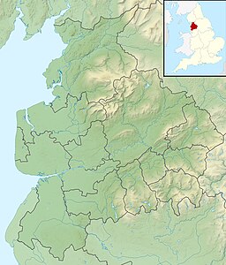
The Forest of Bowland, also known as the Bowland Fells and formerly the Chase of Bowland, is an area of gritstone fells, deep valleys and peat moorland, mostly in north-east Lancashire, England, with a small part in North Yorkshire. It is a western outlier of the Pennines.

The River Taff is a river in Wales. It rises as two rivers in the Brecon Beacons; the Taf Fechan and the Taf Fawr before becoming one just north of Merthyr Tydfil. Its confluence with the River Severn estuary is in Cardiff.
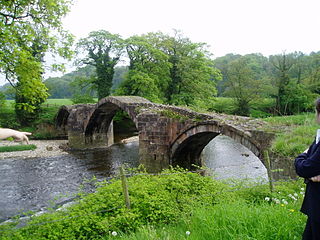
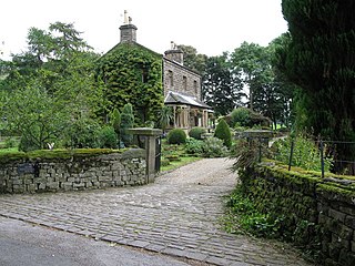
The River Hodder is in Lancashire, England. It is a County Biological Heritage Site.

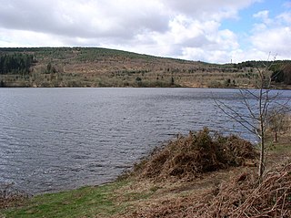
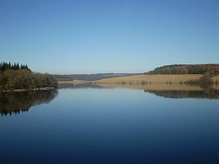
Beacons Reservoir is the northernmost of the three reservoirs in the Taff Fawr valley in South Wales. It was built by Cardiff Corporation Waterworks between 1893 and 1897, and the water is impounded by an earth dam with a clay core. Since 1973 it has been owned by Welsh Water. As its name suggests, it is located in the Brecon Beacons National Park in the Powys unitary authority area and within the historic county boundaries of Breconshire.

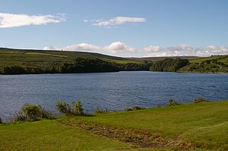
Cantref Reservoir is the middle of the three reservoirs in the Taff Fawr valley in Wales. It was built by Cardiff Corporation Waterworks between 1886 and 1892, but since 1973 has been owned by Welsh Water. It is located in the Brecon Beacons National Park, mostly in the Powys unitary authority area and within the historic county boundaries of Breconshire. Part of the south west corner is in the Rhondda Cynon Taff unitary authority area.
Llwyn-on Reservoir is the largest and southernmost of the three reservoirs in the Taf Fawr valley in South Wales. Cardiff Corporation Waterworks obtained an Act of Parliament in 1884 to authorise construction of the reservoirs, to increase the water supply for Cardiff, but construction of Llwyn-on Reservoir did not start until 1911 and was completed in the 1920s.
Long Preston is a village and civil parish in the Craven district of North Yorkshire, England, in the Yorkshire Dales. It lies along the A65 road, and is 12 miles (19 km) from Skipton and 4 miles (6 km) from Settle. The population of Long Preston in 2001 was 680, increasing to 742 at the 2011 Census.

The Stocksbridge Railway was a subsidiary of Samuel Fox and Company and linked the company's works at Stocksbridge, near Sheffield, South Yorkshire, England, with the main line of the Manchester, Sheffield and Lincolnshire Railway at Deepcar. As the size of Fox's steelworks expanded, better transport links were needed, and the railway was authorised by an Act of Parliament in 1874. It was completed in 1877, and remained an independent subsidiary until 1992, when it became part of the steelworks operation. When the Woodhead line was closed to the north of Deepcar, the line south to Sheffield was singled, and operates as a long siding.
The Preston and Longridge Railway (P&LR) was a branch line in Lancashire, England. Originally designed to carry quarried stone in horse-drawn wagons, it became part of an ambitious plan to link the Lancashire coast to the heart of Yorkshire. The ambition was never achieved, but the line continued to carry passengers until 1930 and goods until 1967.

Swinsty Reservoir is a reservoir in the Washburn valley north of Otley and west of Harrogate in Yorkshire, England. Construction began in 1871 and was completed in 1878. The capacity is about 866 million gallons, with a surface area of 63 hectares. It can be found from the A59 road.

Lindley Wood Reservoir is located in the Washburn valley north of Otley in Yorkshire, England.

Beacon Fell is a fell in the civil parish of Goosnargh in Lancashire, England. The high ground, which rises to 266 m (873 ft), has been a country park since 1970. It is situated within the south westerly part of the Forest of Bowland, an Area of Outstanding Natural Beauty.
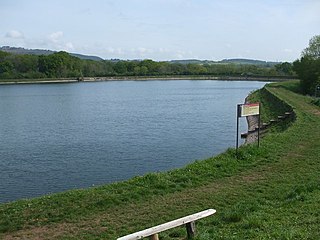
Leighton Reservoir is a reservoir which drains via the River Burn to the River Ure in North Yorkshire, England. It neighbours Roundhill Reservoir and is about 4 miles (6.4 km) west of Masham. It takes its name from the nearby village of Leighton.
Longridge Fell is the most southerly fell in England, near the town of Longridge, Lancashire. It lies at the southern end of the Forest of Bowland Area of Outstanding Natural Beauty. As its name suggests, it takes the form of a long ridge which rises in a north-easterly direction from within the town of Longridge to its summit 4.5 miles distant. As the ridge curves towards the east, it comes to a sudden end and drops into the Hodder Valley. The fell is a good example of a cuesta; the ridge has a sharp drop or escarpment on its northern side, and a gentler, more varying slope on its southern side. These features make it a popular takeoff for hang-gliders and paragliders on the relatively infrequent occurrences of a northerly wind.

The Trough of Bowland is a valley and high pass in the Forest of Bowland Area of Outstanding Natural Beauty, Lancashire, England.
Nidd Valley Light Railway was a light railway in upper Nidderdale in the West Riding of Yorkshire, England. It was owned by Bradford Corporation Waterworks Department and the corporation also operated its public passenger services. Power & Traction Ltd of London obtained a Light Railway Order for the 6.5-mile (10.5 km) railway from Pateley Bridge to Lofthouse in 1900, but these powers were taken over by Bradford Corporation. A contract to build Angram Reservoir was awarded to John Best & Son in 1903, and he also won the contract to build the public railway and a 6.5-mile (10.5 km) private extension to the reservoir site. This was initially built to 3 ft gauge but was converted to standard gauge by 1907, when the public railway opened. Best had his own locomotives, and Bradford Corporation equipped the public railway with second hand locomotives and carriages from the Metropolitan Railway.
Easington is a civil parish within the Ribble Valley district of Lancashire, England, with a population in 2001 of 52. The Census 2011 population details have been grouped with the parish of Slaidburn. Before 1974, it formed part of Bowland Rural District in the West Riding of Yorkshire. It covers just over 9000 acres.

Gisburn Forest is a civil parish in the Ribble Valley, in Lancashire, England. Mainly lying within the Forest of Bowland Area of Outstanding Natural Beauty, the parish includes the larger part of the village of Tosside and the hamlet of Grunsagill to the south. Historically, the parish lay within the West Riding of Yorkshire. It had a population of 151 at the 2011 Census.
Cardiff Corporation Waterworks, its predecessors and successors have provided a public water supply and sewerage and sewage treatment services to the Welsh city of Cardiff since 1850.

Upper Barden Reservoir is an upland fresh water reservoir, one of two reservoirs that collect water from Barden Moor, and dam Barden Beck, a tributary of the River Wharfe in the Yorkshire Dales, North Yorkshire, England. The reservoir was opened in 1882 and also supplies fresh water to the Nidd Aqueduct, which transports it to Bradford. Upper Barden Reservoir was the second of the reservoirs to be built,.