The Pennines, also known as the Pennine Chain or Pennine Hills, are a range of uplands mainly located in Northern England. Commonly described as the "backbone of England" because of its length and position, the range runs from Derbyshire and Staffordshire in the North Midlands to Northumberland in North East England, near the Anglo-Scottish border. The range starts near the valley of the River Trent to the south and extends northwards across the Peak District, South Pennines, Yorkshire Dales, and North Pennines, ending at the Tyne Gap. Beyond the gap are the Border Moors and Cheviot Hills, which are included in some definitions of the range.

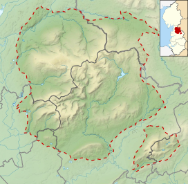
The Forest of Bowland, also known as the Bowland Fells and formerly the Chase of Bowland, is an area of gritstone fells, deep valleys and peat moorland, mostly in north-east Lancashire, England, with a small part in North Yorkshire. It is a western outlier of the Pennines.

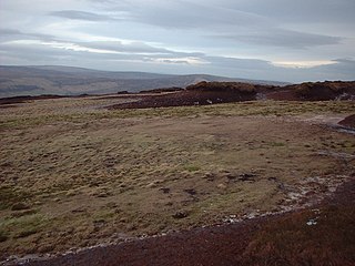
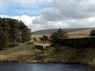
Grit Fell is a lonely hill between Clougha Pike and Ward's Stone in the Forest of Bowland in Lancashire, England. Covered by heather and large bogs, it is difficult walking country. The path from Jubilee Tower car park in the south is difficult and treacherous, with sheer-sided bogs 6 feet (1.83 m) deep. The path from Clougha Pike in the west is better, but still contains bogs crossed by the odd plank of wood. The path from Ward's Stone is the most treacherous of all. Crossing Cabin Flat, it weaves its way across hidden pools of stagnant water, the presence of which is betrayed by a form of red grass.

Wolfhole Crag is an isolated and seldom-visited hill in the Forest of Bowland in Lancashire, England. It has an elevation of 527 m (1,729 ft) and a prominence of 38 m (125 ft). Its seclusion is due in part to its low profile and long approach walks. The East crag has a 'Wolf hole' at the base of the south-facing side, presumably how it originally gained the name. Wolfhole Crag marks the northwesternmost boundary of the civil parish of Bowland Forest High, the historic Forest of Bowland, and the Lordship of Bowland.

Fair Snape Fell is one of the larger hills in the Forest of Bowland in Lancashire, England. It reaches 521.9 m (1,712 ft) with a prominence of 226.2 m (742 ft) and is classed as a Marilyn. It occupies a position in the very south of the main range of fells, alongside and just to the north of Parlick, to which it is joined by a ridge. The main paths approach the summit from Parlick in the south, Saddle Fell in the east and Bleasdale in the valley to the west. The Saddle Fell approach is as boggy as the hills to the north. The summit is covered in grass and peat groughs. A trig point and large cairn occupy the top of the western escarpment, with the highest point being about 700 metres (770 yd) to the north-east.

Pendle Hill is in the east of Lancashire, England, near the towns of Burnley, Nelson, Colne, Brierfield, Clitheroe and Padiham. Its summit is 557 metres (1,827 ft) above mean sea level. It gives its name to the Borough of Pendle. It is an isolated hill in the Pennines, separated from the South Pennines to the east, the Bowland Fells to the northwest, and the West Pennine Moors to the south. It is included in a detached part of the Forest of Bowland Area of Outstanding Natural Beauty.
Hawthornthwaite Fell is one of the larger hills in the Forest of Bowland in the north west of England. Hawthornthwaite Fell marks the extreme western limit of the West Riding of the historic county of York. Since 1974 it has fallen within the boundaries of the administrative county of Lancashire. However, most of the hill is on the Duke of Westminster's land. It occupies a north-facing position on the south-western range, close to Bleasdale and Fair Snape Fell. The only path to the summit comes over the hills from the south. The summit is boggy and flanked to the north by steep heather slopes. Grouse are farmed in the area and hen harriers can be seen frequently. The trig point and the remains of its foundations are no longer upright, lying horizontally pointing westward.

Mickle Fell is a mountain in the Pennines, the range of hills and moors running down the middle of Northern England. It has a maximum elevation of 788 m (2,585 ft). It lies slightly off the main watershed of the Pennines, about 10 miles south of Cross Fell. After Cross Fell, Mickle Fell is the highest Marilyn within the North Pennines designated Area of Outstanding Natural Beauty (AONB).

Galtymore or Galteemore is a mountain in the province of Munster, Ireland. At 917.9 metres, it is one of Ireland's highest mountains, being the 12th-highest on the Arderin list, and 14th-highest on the Vandeleur-Lynam list. Galtymore has the 4th-highest topographic prominence of any peak in Ireland, which classifies Galtymore as a P600, or "major mountain". It is one of the 13 Irish Munros.

Black Combe is a fell in the south-west corner of the Lake District National Park, England, just 4 miles (6.4 km) from the Irish Sea. It lies near the west coast of Cumbria in the borough of Copeland and more specifically, in the ancient district of Millom. It is 1,970 ft (600 m) high and stands in isolation, some 10 mi (16 km) away from any higher ground; this factor offers an excellent all-round panoramic view of land and sea, weather permitting.

Barley-with-Wheatley Booth is a civil parish in the Pendle district of Lancashire, England. It has a population of 298, and contains the village of Barley and the hamlet of White Hough or Whitehough. To the west of Barley is Pendle Hill; its summit, at 557 metres (1,827 ft), is within the parish.

Beacon Fell is a fell in the civil parish of Goosnargh in Lancashire, England. The high ground, which rises to 266 m (873 ft), has been a country park since 1970. It is situated within the south westerly part of the Forest of Bowland, an Area of Outstanding Natural Beauty.
Boulsworth Hill is a large expanse of moorland, the highest point of the South Pennines of south-eastern Lancashire, England, separating the Borough of Pendle from Calderdale.
Djouce at 725 metres (2,379 ft), is the 74th–highest peak in Ireland on the Arderin scale, and the 91st–highest peak on the Vandeleur-Lynam scale. Djouce is situated in the northeastern section of the Wicklow Mountains, and dominates the views of the Wicklow Mountains from Roundwood to Newtownmountkennedy. Djouce is one of a few Irish mountains for which the Irish Office of Public Works (OPW) maintain a boarded mountain trail, using railway sleepers, from its base to a point close to its summit; making the mountain even more accessible to the public, but while also protecting the underlying bog and soil from human erosion. Djouce is popular with hill walkers, and it lies along the 131-kilometre Wicklow Way; on its southern slopes at a senic viewpoint is the J.B. Malone memorial stone, dedicated to the creator of the Wicklow Way.

Top o'Selside is a hill in the Lake District in Cumbria, England. At 335 metres (1,099 ft), it is the highest point of the group of hills situated between Coniston Water and Windermere. This group also includes the Wainwright of Black Fell and the summits of Black Brows and Rusland Heights. Top o'Selside lies not in the centre of this region, but in the south-western corner, just outside the forestry plantations of Grizedale Forest and only two-thirds of a mile from the eastern shore of Coniston Water. This large separation from any higher ground gives it enough relative height to make it a Marilyn.
Longridge Fell is the most southerly fell in England, near the town of Longridge, Lancashire. It lies at the southern end of the Forest of Bowland Area of Outstanding Natural Beauty. As its name suggests, it takes the form of a long ridge which rises in a north-easterly direction from within the town of Longridge to its summit 4.5 miles distant. As the ridge curves towards the east, it comes to a sudden end and drops into the Hodder Valley. The fell is an example of a cuesta; the ridge has a sharp drop or escarpment on its northern side, and a gentler, more varying slope on its southern side. These features make it a popular takeoff for hang-gliders and paragliders on the relatively infrequent occurrences of a northerly wind.

Gragareth is a mountain straddling the border between Lancashire and North Yorkshire in England. At 627 metres (2,057 ft), its summit is the second highest point in the post-1974 county of Lancashire. The highest point in modern Lancashire is Green Hill, approximately 3.2 km (2.0 mi) to the north and the Old Man of Coniston in the Furness Fells of the Lake District at 803 metres (2,635 ft) is the county top of the traditional county of Lancashire. The summit of Gragareth lies about 200 m west of the county boundary, but inside the 2016 border of Yorkshire Dales National Park. The western slopes are known as Leck Fell and the southern slopes form Ireby Fell.

Moanbane at 703 metres (2,306 ft), is the 85th–highest peak in Ireland on the Arderin scale, and the 106th–highest peak on the Vandeleur-Lynam scale. Moanbane is in the central sector, at the western edge, of the Wicklow Mountains, in Wicklow, Ireland. Moanbane is on a small massif alongside Silsean 698 metres (2,290 ft) which lies between the Blessington lakes, and the taller mountain of Mullaghcleevaun 849 metres (2,785 ft).
The Lancashire Witches Walk is a 51-mile (82 km) long-distance footpath opened in 2012, between Barrowford and Lancaster, all in Lancashire, England. It starts at Pendle Heritage Centre in Barrowford before passing through the Forest of Pendle, the town of Clitheroe and the Forest of Bowland to finish at Lancaster Castle.