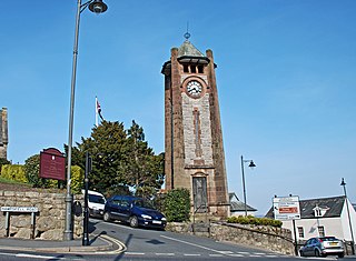
Grange-over-Sands is a town and civil parish located on the north side of Morecambe Bay in Cumbria, England, a few miles south of the Lake District National Park. In the 2001 census the parish had a population of 4,042, increasing at the 2011 census to 4,114. Historically part of Lancashire, the town was created as an urban district in 1894. Since the 1974 local government re-organisation, it has been of the South Lakeland district of Cumbria, though it remains part of the Duchy of Lancaster.

Carnforth is a market town and civil parish in the City of Lancaster in Lancashire, England, situated at the north-east end of Morecambe Bay. The parish of Carnforth had a population of 5,560 in the 2011 census, an increase from the 5,350 recorded in the 2001 census. The town is situated around 7 miles north of Lancaster, 17 miles south of Kendal, 40 miles east of Barrow-in-Furness and 28 miles northwest of Settle. The town is also close to the Cumbria/Lancashire border.
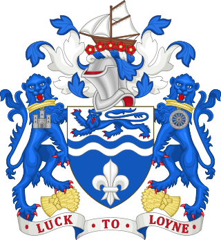
The City of Lancaster is a local government district of Lancashire, England, with the status of a city and non-metropolitan district. It is named after its largest settlement, Lancaster, but covers a far larger area, which includes the towns of Morecambe, Heysham, and Carnforth, as well as outlying villages, farms, rural hinterland and a section of the Yorkshire Dales National Park. The district has a population of 142,934 (2021), and an area of 222.5 square miles (576.2 km2).
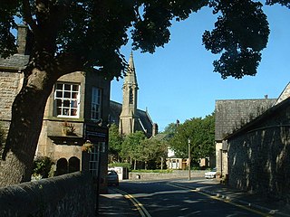
Bolton-le-Sands is a large village and civil parish of the City of Lancaster in Lancashire, England. The parish had a population of 4,098 recorded in the 2001 census, increasing to 4,127 at the 2011 Census.
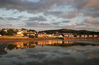
Arnside is a village and civil parish in Cumbria, historically part of Westmorland, near the border with Lancashire, England. The Lake District National Park is located a few miles north. Travelling by road, Arnside is 22 miles (35 km) to the south of Kendal, 25.3 miles (40.7 km) to the east of Ulverston, 35.2 miles (56.6 km) to the east of Barrow-in-Furness, 15.7 miles (25.3 km) to the west of Lancaster and 14.3 miles (23.0 km) to the east of Grange-over-Sands. In the 2001 census the parish had a population of 2,301, increasing at the 2011 census to 2,334.

Kents Bank is a small village in Cumbria, England, so named for its proximity to the River Kent estuary. Part of the historic County Palatine of Lancashire, it is located 2 miles (3.2 km) south-west of Grange-over-Sands.

Silverdale is a village and civil parish within the City of Lancaster district of Lancashire, England. The village stands on Morecambe Bay, near the border with Cumbria, 4.5 miles (7 km) north west of Carnforth and 8.5 miles (14 km) of Lancaster. The parish had a population of 1,519 recorded in the 2011 census.

Morecambe and Lunesdale is a constituency represented in the House of Commons of the UK Parliament since 2010 by David Morris, a Conservative.

Wennington is a civil parish in the City of Lancaster district in Lancashire, England. The 2001 Census recorded the parish's population as 102, and the 2011 Census recorded it as 178.

Aldingham is a village and civil parish in the South Lakeland district of Cumbria, England. Historically in Lancashire, it is situated on the east coast of the Furness peninsula, facing into Morecambe Bay, and is about 8 miles (13 km) east of Barrow-in-Furness, and 6 miles (9.7 km) south of Ulverston. The parish includes the nearby villages of Baycliff, Dendron, Leece, Gleaston, Newbiggin, Roosebeck, Scales and a number of smaller hamlets. According to the 2001 census the parish had a population of 1,187, reducing to 1,105 at the 2011 Census.

Overton is a village and civil parish in Lancashire, England, south west of Lancaster and south of Morecambe between Heysham and the estuary of the River Lune. Neighbouring villages include Middleton and Sunderland Point; Glasson is on the opposite side of the river. The parish had a population of 1,069 at the 2011 Census.

Warton is a village, civil parish and electoral ward in the City of Lancaster in north Lancashire in the north-west of England, close to the boundary with Cumbria, with a population of around 2,000, measured at the 2011 Census to be 2,360. It is a village steeped in history; its earliest recording as a settlement is made in Domesday Book written in 1086. The nearest town to Warton is Carnforth, which was originally part of Warton parish. It has connections to the first President of the United States, George Washington: Washington's ancestor of seven generations, Lawrence Washington, is rumoured to have helped build the village church of St Oswald. The parish covers an area in excess of 11,000 acres (45 km2) and is predominantly rural. The parish of Warton had a population of 2,315 recorded in the 2001 census, and 2,360 in the 2011 census.

Flookburgh is an ancient village on the Cartmel peninsula in Cumbria, England, until 1974 part of Lancashire. Being close to Morecambe Bay, cockle and shrimp fishing plays a big part in village life.

Claughton is a small village and civil parish in the City of Lancaster in Lancashire, England. The village is on the A683 road east of Lancaster and at the time of the 2001 census had a population of 132. In the 2011 census Claughton was grouped with Roeburndale to give a total of 223.

Torrisholme is a suburb of Morecambe, Lancashire, on the North West coast of England. In the 2001 census, the Torrisholme Ward had a population of 6,758 living in 3,118 households, decreasing marginally to 6,755 at the 2011 Census.
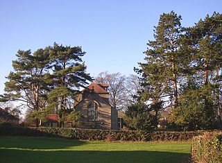
St Luke's Church is in Manor Lane, Slyne-with-Hest, Lancaster, Lancashire, England. It is an active Anglican parish church in the deanery of Tunstall, the archdeaconry of Lancaster, and the diocese of Blackburn. Its benefice is united with those of St Saviour, Aughton, and St Wilfrid, Halton. The church is recorded in the National Heritage List for England as a designated Grade II listed building.
Slyne-with-Hest is a civil parish in Lancaster, Lancashire, England. It contains 34 buildings that are recorded in the National Heritage List for England as designated listed buildings. Of these, one is at Grade II*, the middle grade, and the others are at Grade II, the lowest grade. The parish contains the villages of Slyne and Hest Bank, and most of the listed buildings are houses, or originated as houses, and associated structures. The Lancaster Canal passes through the parish, and eight bridges crossing it are listed. The other listed buildings include a public house, three milestones, a hotel, a church, a pinfold, and a set of stocks.
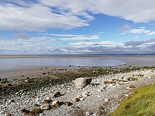
The Cross Bay Walk is a historical hiking route in Northwest England that crosses Morecambe Bay. It traditionally connected Hest Bank, Lancashire with Kents Bank, Cumbria. The exact route of the walk varies depending upon local conditions, but is usually between 6 to 8 mi in length.

The Lancaster/Morecambe Built-up area is an urban area which comprises the city of Lancaster and the towns of Morecambe and Heysham in Lancashire, England. The urban area covers an area which has a population of 97,150. The urban area includes the suburbs of both Lancaster and Morecambe. It has three subdivisions: Heysham, Lancaster and Morecambe. The built-up area and its subdivisions are entities defined algorithmically by the Office for National Statistics, which considers built-up land separated from another settlement by 200 metres (660 ft).


