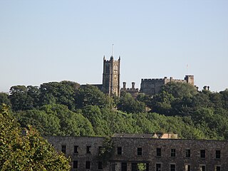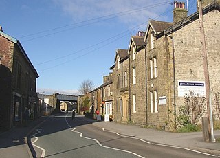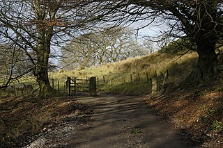
Carnforth is a market town and civil parish in the City of Lancaster in Lancashire, England, situated at the north-east end of Morecambe Bay. The parish of Carnforth had a population of 5,560 in the 2011 census, an increase from the 5,350 recorded in the 2001 census. The town is situated around 7 miles north of Lancaster, 17 miles south of Kendal, 40 miles east of Barrow-in-Furness and 28 miles northwest of Settle. The town is also close to the Cumbria/Lancashire border.

Lancaster, or the City of Lancaster, is a local government district with city status in Lancashire, England. It is named after its largest settlement, Lancaster, and also includes the towns of Carnforth, Heysham and Morecambe and a wider rural hinterland. The district has a population of 142,162 (2021), and an area of 218.9 square miles (566.9 km2).

Morecambe and Lunesdale is a constituency represented in the House of Commons of the UK Parliament since 2010 by David Morris, a Conservative.

Melling-with-Wrayton is a civil parish in the City of Lancaster in the English county of Lancashire. It includes the village of Melling and the hamlet of Wrayton, to the northeast. The parish had a population of 290 recorded in the 2001 census, increasing slightly to 299 at the 2011 census.

Hellifield is a village and civil parish in North Yorkshire, England. Historically part of the West Riding of Yorkshire, the village was once an important railway junction on the Settle-Carlisle Railway between the Midland Railway and the Lancashire and Yorkshire Railway, but Hellifield railway station is now a shadow of its former glory. It is situated on the A65, between Skipton and Settle. Hellifield had a population of 1,060 residents at the 2001 census, increasing to 1,426 at the 2011 census.

Wennington is a civil parish in the City of Lancaster district in Lancashire, England. The 2001 Census recorded the parish's population as 102, and the 2011 Census recorded it as 178.

The Furness and Midland Joint Railway was a joint railway in England owned by the Furness Railway and the Midland Railway. Construction was agreed in 1862 for a line from Carnforth, on the Furness system, to Wennington, on the Midland Railway line from Yorkshire to Morecambe. Royal assent was received in June 1863 and the contract for the route was let to Benton & Woodiwiss soon after at a cost of some £102,850.

Quernmore is a village and civil parish in the City of Lancaster in Lancashire, England. It is located about 3 miles (5 km) east of Lancaster. The parish of Quernmore had a population of 532 recorded in the 2001 census, increasing to 567 at the 2011 Census. Apart from Quernmore itself, the parish also includes Brow Top, once a local crafts mecca, now barn conversions.

Borwick is a village and civil parish in the City of Lancaster district of Lancashire, England, about 8 miles north of Lancaster, on the Lancaster Canal. It is situated just south of the border with Cumbria. The parish of Borwick had a population of 210 recorded in the 2001 census, decreasing to 181 at the 2011 Census.

Heapey is a village and civil parish of the Borough of Chorley, in Lancashire, England. The village is two miles from Chorley and on the western fringe of the West Pennine Moors. In 2001 the population was 955, increasing to 1,001 at the 2011 census.

Wray is a small village in Lancashire, England, part of the civil parish of Wray-with-Botton, in the City of Lancaster district. Wray is the point at which the River Roeburn joins the River Hindburn.

Over Kellet is a village and civil parish near Carnforth in the English county of Lancashire. The parish, which is in the City of Lancaster, includes the village of Capernwray, at its northern end, and has a population of 778, decreasing slightly to 761 at the 2011 Census. The Lancaster Canal passes through the parish.

Nether Kellet is a village and civil parish in the City of Lancaster in Lancashire, England, a few miles south of Carnforth. It had a population of 646 recorded in the 2001 census, increasing to 663 at the 2011 Census, and again to 738 at the 2021 census. The parish includes the small hamlet of Addington, to the east.

Arkholme for Kirkby Lonsdale railway station served the village of Arkholme in Lancashire, England. It is situated on what is now the Leeds–Morecambe line between the current Wennington and Carnforth stations.

Nether Wyresdale is a civil parish in Lancashire, England. In the 2001 United Kingdom census, it had a population of 613, rising to 655 at the 2011 census.

St John the Baptist's Church, is in the village of Arkholme, Lancaster, Lancashire, England. It is an active Anglican parish church in the deanery of Tunstall, the archdeaconry of Lancaster, and the diocese of Blackburn. Its benefice is united with those of St Margaret, Hornby, St John the Evangelist, Gressingham, and St Michael the Archangel, Whittington-in-Lonsdale. The church is recorded in the National Heritage List for England as a designated Grade II* listed building. It stands at the end of the village street, overlooking the River Lune, within the bailey of a former castle. The former 11th-century motte stands to the northeast of the church.
Broadband for the Rural North is a community-led project to bring high-speed broadband to homes and businesses in rural northern England as well as Cheshire and Norfolk. It functions as an Internet Service Provider.
Melling railway station served the village of Melling, Lancashire, England, from 1867 to 1952 on the Furness and Midland Joint Railway.


