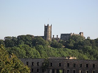
Lancaster, or the City of Lancaster, is a local government district with city status in Lancashire, England. It is named after its largest settlement, Lancaster, and also includes the towns of Carnforth, Heysham and Morecambe and a wider rural hinterland. The district has a population of 142,162 (2021), and an area of 218.9 square miles (566.9 km2).

Melling-with-Wrayton is a civil parish in the City of Lancaster in the English county of Lancashire. It includes the village of Melling and the hamlet of Wrayton, to the northeast. The parish had a population of 290 recorded in the 2001 census, increasing slightly to 299 at the 2011 census.

Rawcliffe is a village and civil parish in the East Riding of Yorkshire, England on the border with North Yorkshire. It is situated approximately 4 miles (6.4 km) west of Goole and 17 miles (27 km) south of York. It lies on the banks of the River Aire just north of the M62 and on the A614 road. Rawcliffe, along with nearby Airmyn, was the location of one of the first reliable reports of the practice of warping in agriculture in the 1730s.

Wennington is a civil parish in the City of Lancaster district in Lancashire, England. The 2001 Census recorded the parish's population as 102, and the 2011 Census recorded it as 178.

Tebay is a village and civil parish in Cumbria, England, within the historic borders of Westmorland. It lies in the upper Lune Valley, at the head of the Lune Gorge. The parish had a population of 728 in the 2001 census, increasing to 776 at the Census 2011.

Arkholme-with-Cawood is a civil parish of the City of Lancaster in Lancashire, England. The parish of Arkholme-with-Cawood had a population of 334 recorded in the 2001 census, falling marginally to 333 at the 2011 Census. The parish is north east of Lancaster and lies on the B6254 road.

Quernmore is a village and civil parish in the City of Lancaster in Lancashire, England. It is located about 3 miles (5 km) east of Lancaster. The parish of Quernmore had a population of 532 recorded in the 2001 census, increasing to 567 at the 2011 Census. Apart from Quernmore itself, the parish also includes Brow Top, once a local crafts mecca, now barn conversions.

Whittington is a small village and civil parish in Lancashire, England, forming part of a cluster of sites along the Lune valley, each with evidence of a motte - as with Melling and Arkholme. This is the densest distribution of Norman castles outside the Welsh border countryside.

Borwick is a village and civil parish in the City of Lancaster district of Lancashire, England, about 8 miles north of Lancaster, on the Lancaster Canal. It is situated just south of the border with Cumbria. The parish of Borwick had a population of 210 recorded in the 2001 census, decreasing to 181 at the 2011 Census.

Overton is a village and civil parish in Lancashire, England, south west of Lancaster and south of Morecambe between Heysham and the estuary of the River Lune. Neighbouring villages include Middleton and Sunderland Point; Glasson is on the opposite side of the river. The parish had a population of 1,069 at the 2011 Census.
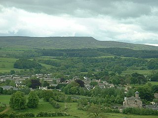
The civil parish of Caton-with-Littledale is situated in Lancashire, England, near the River Lune. The parish lies within the Forest of Bowland Area of Outstanding Natural Beauty and contains the villages of Caton, Brookhouse, Caton Green, Littledale and Townend.

Stalmine-with-Staynall is a civil parish within the Wyre borough of Lancashire, England, in a part of the Fylde known as Over Wyre. The parish contains the village of Stalmine and the hamlets of Staynall and Wardley. The civil parish had a population of 1,486 at the 2011 Census, of which 1,087 lived in Stalmine village.

Claughton is a small village and civil parish in the City of Lancaster in Lancashire, England. The village is on the A683 road east of Lancaster and at the time of the 2001 census had a population of 132. In the 2011 census Claughton was grouped with Roeburndale to give a total of 223.

Heaton-with-Oxcliffe is a civil parish situated near the River Lune. it is in the City of Lancaster and the English county of Lancashire. The parish contains the villages of Heaton, Oxcliffe Hill, plus the area around Salt Ayre, and had a population of 2,225 recorded in the 2001 census, decreasing to 2,059 at the 2011 census.

Glasson Dock, also known as Glasson, is a village in Lancashire, England, south of Lancaster at the mouth of the River Lune. In 2011, it had a population of around 600.

Nateby is a village and a civil parish in the Wyre district, in the English county of Lancashire near the town of Garstang. Nateby has a primary school, a place of worship and a post office. It once had a railway station called Nateby railway station, but the station closed on 31 March 1930. In 2001 the parish had a population of 475, increasing to 584 at the 2011 census.
Thurnham is a civil parish in Lancaster, Lancashire, England. It contains 37 listed buildings that are recorded in the National Heritage List for England. Of these, three are listed at Grade I, the highest of the three grades, three are at Grade II*, the middle grade, and the others are at Grade II, the lowest grade.
The Glasson Dock Branch Line was a railway line in Lancashire, England. Opened in 1883, this 5-mile branch line connected Glasson Dock to the UK rail network at Lancaster, with stations at Glasson Dock, Conder Green and at a private halt, Ashton Hall railway station. Passenger and freight services were provided, and its success came from transporting goods from the dock at Glasson and from St Georges Quay in Lancaster.
Glasson Dock railway station served the town of Glasson Dock, in Thurnham, Lancashire, England, with trains to nearby Conder Green and Lancaster along the Glasson Dock branch line.
Conder Green railway station served the hamlet of Conder Green, in Thurnham, Lancashire, England, with trains to nearby Glasson Dock and Lancaster along the Glasson Dock branch line.


