Lancaster is a city in Lancashire, England and the main cultural hub, economic and commercial centre of City of Lancaster district. The city is on the River Lune and directly inland from Morecambe Bay. Lancaster was the county town of Lancashire until the county council's administrative headquarters moved to Preston in 1974. The city's long history is marked by Lancaster Roman Fort, Lancaster Castle, Lancaster Priory Church, Lancaster Cathedral and the Ashton Memorial. It is the seat of Lancaster University and has a campus of the University of Cumbria. It had a population of 52,234 in the 2011 census compared to the district which had a population of 138,375. The city is an economic hub for the surrounding districts of Ribble Valley and Wyre as well as the Westmorland and Furness unitary area of Cumbria.

Kendal, once Kirkby in Kendal or Kirkby Kendal, is a market town and civil parish in the Westmorland and Furness district of Cumbria, England. It lies within the River Kent's dale, from which its name is derived, just outside the boundary of the Lake District National Park.

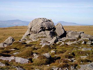
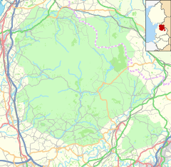
The Forest of Bowland, also known as the Bowland Fells and formerly the Chase of Bowland, is an area of gritstone fells, deep valleys and peat moorland, mostly in north-east Lancashire, England, with a small part in North Yorkshire. It is a western outlier of the Pennines.

Kirkby Lonsdale is a town and civil parish in the Westmorland and Furness district of Cumbria, England, on the River Lune. Historically in Westmorland, it lies 13 miles (21 km) south-east of Kendal on the A65. The parish recorded a population of 1,771 in the 2001 census, increasing to 1,843 at the 2011 Census.

The River Lune is a river 53 miles (85 km) in length in Cumbria and Lancashire, England.

The Eden Valley Railway (EVR) was a railway in Cumbria, England. It ran between Clifton Junction near Penrith and Kirkby Stephen via Appleby-in-Westmorland.

Bay Horse is a sparsely populated hamlet in the English county of Lancashire. It lies between Lancaster and Preston to the north and south respectively.

Halton-with-Aughton is a civil parish and electoral ward located 3 miles (5 km) east of Lancaster, England, on the north bank of the River Lune. The main settlement is the village of Halton, or Halton-on-Lune, in the west, and the parish stretches to the hamlet of Aughton in the east. It lies in the City of Lancaster district of Lancashire, and has a population of 2,227, down from 2,360 in 2001.

Kirkby-in-Furness, generally referred to simply as Kirkby locally, is a village that is the major part of the parish of Kirkby Ireleth in the Furness district of Cumbria, England. Historically part of Lancashire, it is close to the Lake District National Park. It is about 3 miles (5 km) south of Broughton in Furness, 5 miles (8 km) northwest of Ulverston and 9 miles (14 km) north of Barrow-in-Furness. It is one of the largest villages on the peninsula's north-western coast, looking out over the Duddon estuary. To its east is the SSSI of Kirkby Moor and to its west is the SSSI of Duddon Estuary. The 2021 census showed Kirkby to have a population of 580.

Clapham is a railway station on the Bentham Line, which runs between Leeds and Morecambe via Skipton. The station, situated 48 miles (77 km) north-west of Leeds, serves the village of Clapham in North Yorkshire. It is owned by Network Rail and managed by Northern Trains.
Burrow-with-Burrow is a civil parish in the English county of Lancashire. The parish of Burrow-with-Burrow had a population of 191 recorded in the 2001 census, decreasing to 182 at the 2011 Census.

The civil parish of Caton-with-Littledale is situated in Lancashire, England, near the River Lune. The parish lies within the Forest of Bowland Area of Outstanding Natural Beauty and contains the villages of Caton, Brookhouse, Caton Green, Littledale and Townend.

Casterton is a small village and civil parish close to Kirkby Lonsdale on the River Lune in the south east corner of Cumbria, England. In the 2001 census the parish had a population of 500, decreasing at the 2011 census to 425.

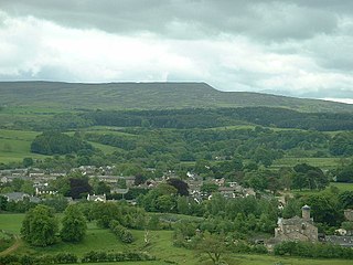
Wray-with-Botton is a civil parish in the City of Lancaster district and the English county of Lancashire. In 2001 it had a population of 521, increasing to 532 at the Census 2011. The parish includes the village of Wray. Wray is the home of the annual scarecrow festival on the 1st Monday in May every year.

Twicket was a village cricket match, streamed world-wide on the Internet on Easter Monday, 25 April 2011, with the intention of highlighting the need for high-capacity upstream broadband to enable community content provision. This innovative exercise—claimed to be a world first—caught media attention, making BBC television news, BBC Radio London, TalkSport, Radio New Zealand; and being written about by The Guardian, The Observer and Metro and mentioned on Twitter by Stephen Fry, the BBC's Rory Cellan-Jones and Jonathan Agnew.

The Ingleton branch line was a rural railway line in the West Riding of Yorkshire, Lancashire and Westmorland in England. It was originally planned in 1846 to form part of a main line route from London to Scotland, but fell victim to rivalry between railway companies. Completion was delayed until 1861, and it was only ever a rural branch line, serving the towns of Ingleton, Kirkby Lonsdale and Sedbergh. It closed to passengers in 1954 and was dismantled in 1967.
Broadband for the Rural North is a community-led project to bring high-speed broadband to homes and businesses in rural northern England as well as Cheshire and Norfolk. It functions as an Internet Service Provider.

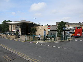
Lancaster bus station serves the city of Lancaster, Lancashire, England. The bus station was funded by both the Lancashire County Council and Lancaster City Council. The station, situated in the centre of the city, was re-built and opened in 2001, is staffed full-time, completely covered and consists of 20 stands, a travel centre, a refreshment kiosk, on site toilet facilities and an electronic passenger information board. Directly outside the bus station is Lancaster's main taxi rank.
Wray-with-Botton is a civil parish in Lancaster, Lancashire, England. It contains 44 listed buildings that are recorded in the National Heritage List for England. All of the listed buildings are designated at Grade II, the lowest of the three grades, which is applied to "buildings of national importance and special interest". The parish contains the village of Wray, and is otherwise rural containing scattered farms. Apart from a bridge, all the listed buildings are houses, farmhouses, farm buildings, and structures associated with them.
Melling railway station served the village of Melling, Lancashire, England, from 1867 to 1952 on the Furness and Midland Joint Railway.


