Sturt River

Last updated

Sturt
Sturt Creek
Sturt River, Adelaide.jpg
The Sturt River in Warriparinga
Australia South Australia relief location map.png
Red pog.svg
Location of the river mouth in South Australia
Etymology Charles Sturt [1]
Native nameWarri Parri  (Kaurna) [2]
Location
Country Australia
State South Australia
Region Adelaide
Physical characteristics
Source Adelaide Hills
  location Upper Sturt
  elevation395 m (1,296 ft)
Mouth confluence with the Patawalonga River
  location
Glenelg North
  coordinates
34°57′40″S138°30′56″E / 34.9611°S 138.5156°E / -34.9611; 138.5156 Coordinates: 34°57′40″S138°30′56″E / 34.9611°S 138.5156°E / -34.9611; 138.5156
  elevation
0 m (0 ft)
Length27 km (17 mi)
Basin size120 km2 (46 sq mi)
Basin features
Protected area Sturt Gorge Recreation Park
[3]

The Sturt River, also known as the Sturt Creek and Warri Parri (Warriparri) in the Kaurna language, is a river located in the Adelaide region of the Australian state of South Australia.

Contents

Course and features

The Sturt River rises in Upper Sturt in the Adelaide Hills, it flows through Coromandel Valley, the Sturt Gorge Recreation Park, Marion and Morphettville, before meeting the Patawalonga River in Glenelg North. Along with Brown Hill Creek, it is one of the Patawalonga's most important tributaries. It is considered a significant urban waterway, and was used by the indigenous Kaurna people as a link between the hills and the sea. The Sturt River catchment area extends over 120 square kilometres (46 sq mi), from Heathfield in the Mount Lofty Ranges, to Glenelg North. [4] The river descends 395 metres (1,296 ft) over its 27-kilometre (17 mi) course. [3]

History

Horner's Bridge, the first bridge to be constructed over the river in 1866, (photo taken 2007). Horner's Bridge, Coromandel Valley.jpg
Horner's Bridge, the first bridge to be constructed over the river in 1866, (photo taken 2007).

The first inhabitants of the greater Adelaide area, the Kaurna people, referred to Sturt River as Warri Parri, or 'the windy place by the river'. [2] They used it as a movement corridor between the Adelaide Hills and the sea. The river is also significant in Kaurna Dreaming, especially the area known as Warriparinga, where the river leaves its gorge to cross the Adelaide Plains. [5] Other important Kaurna campsites were located south of the Sturt-Patawalonga confluence, and at Chambers Gully in Coromandel Valley. [6]

The British named the river after the explorer Charles Sturt. [1] In the early days of British settlement, the new colony appointed Colonel William Light as Surveyor General; one of his tasks was to find a suitable location for the colony's capital. Light's first rough sketch, made in 1836, placed the city on the Sturt River, where the suburb of Marion is now located. [7] He later changed his plans to locate the city on the River Torrens instead.

The river is lined with many buildings of historic and cultural value, especially in the Coromandel Valley and Craigburn Farm areas, which mostly date back to the 1850s. The first bridge to be built over the river is Horner's Bridge, constructed in 1866 in Coromandel Valley. [8]

In 1879, flood mitigation works were carried out to prevent damage to properties in Glenelg, and to the Morphettville Racecourse. A trapezoidal concrete channel was constructed to line the river from Sturt Road to the Patawalonga Basin in 1965. A flood control dam was also constructed in 1965, in the part of the Sturt Gorge Recreation Park which falls in Flagstaff Hill. [6]

Present day

Flood control dam over the river in Flagstaff Hill, in 2007. Sturt River Dam, Flagstaff Hill.jpg
Flood control dam over the river in Flagstaff Hill, in 2007.

The river begins in Upper Sturt, continuing through the semi-rural suburbs of Ironbank and Coromandel East. Due to steep terrain and dense vegetation, the river is largely inaccessible in this section. It then flows through the residential suburbs of Coromandel Valley and Craigburn Farm, before reaching the Sturt Gorge Recreation Park, which extends along the suburbs of Craigburn Farm, Flagstaff Hill and Bellevue Heights. It leaves the gorge and continues along the Adelaide Plains at South Road, through urban and residential settings. It forms the northern boundary to the City of Onkaparinga with the City of Mitcham.

Due to urbanisation and agriculture, the Sturt River has suffered a degradation in water quality, biodiversity and visual and recreational value. [2] In 2005, the Patawalonga Catchment Water Management Board, part of the Adelaide and Mount Lofty Ranges Natural Resources Management Board, commenced the development of the Sturt River Linear Park Master Plan. This plan involves the establishment of a continuous open public space along the river, between Glenelg North and Coromandel Valley, and improving the environmental condition of the river. The plan also includes the possibility of forming connections between the proposed Linear Park and Belair National Park, via Minno Creek.

Waterwatch Adelaide, a government organisation which involves primary school children in the monitoring of water, considers the water quality of the river to be "generally good", with low salinity, turbidity, phosphorus and nitrogen levels, and a medium pH. [9]

Shared path

A sealed pedestrian and bicycle path runs along the Sturt River between the Southern Expressway and Glenelg, linking at its Southern end to the Adelaide Southern Veloway which, with the Coast to Vines rail trail, provides an almost non-stop bicycle route between Glenelg and Willunga. [10] [11]

See also

Related Research Articles

Brown Hill Creek

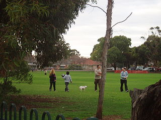
Brown Hill Creek, also known as Willawilla in the Kaurna language, is a watercourse flowing from the Adelaide Hills through in the inner south suburbs of the Adelaide metropolitan area, in the Australian state of South Australia. It is part of the Patawalonga River catchment.

The Kaurna people are a group of Aboriginal people whose traditional lands include the Adelaide Plains of South Australia. They were known as the Adelaide tribe by the early settlers. Kaurna culture and language were almost completely destroyed within a few decades of the British colonisation of South Australia in 1836. However, extensive documentation by early missionaries and other researchers has enabled a modern revival of both language and culture. The phrase Kaurna meyunna means "Kaurna people".

River Torrens River in Australia

The River Torrens, is the most significant river of the Adelaide Plains. It was one of the main reasons for the siting of the city of Adelaide, capital of South Australia. It flows 85 kilometres (53 mi) from its source in the Adelaide Hills near Mount Pleasant, across the Adelaide Plains, past the city centre and empties into Gulf St Vincent between Henley Beach South and West Beach. The upper stretches of the river and the reservoirs in its watershed supply a significant part of the city's water supply.

Glenelg, South Australia Suburb of Adelaide, South Australia

Glenelg is a beach-side suburb of the South Australian capital of Adelaide. Located on the shore of Holdfast Bay in Gulf St Vincent, it has become a tourist destination due to its beach and many attractions, home to several hotels and dozens of restaurants.

Marion, South Australia Suburb of Adelaide, South Australia

Marion is a suburb in the City of Marion, around 10 kilometres (6.2 mi) south-west of the city centre of Adelaide, the capital of South Australia. Founded as a rural village in 1838 on the banks of the Sturt River, Marion was found to have rich soil and the population expanded rapidly. Colonel William Light laid out the plan for the village, as he had done with the City of Adelaide itself.

Adelaide Plains South Australia

The Adelaide Plains is a plain in South Australia lying between the coast on the west and the Mount Lofty Ranges on the east. The southernmost tip of the plain is in the southern seaside suburbs of Adelaide around Brighton at the foot of the O'Halloran Hill escarpment with the south Hummocks Range and Wakefield River roughly approximating the northern boundary.

City of Mitcham Local government area in South Australia

The City of Mitcham is a local government area in the foothills of southern Adelaide, South Australia. Within its bounds is Flinders University, South Australia's third largest, and the notable, affluent suburb of Springfield which contains some of the city's most expensive properties.

Glengowrie, South Australia Suburb of Adelaide, South Australia

Glengowrie is a suburb of the Australian city of Adelaide, approximately 12 kilometres south west of the city centre. The name Glengowrie means "Glen of Gowrie", so called in honour of Lord Gowrie, Governor-General of Australia from 1936 to 1944.

West Beach, South Australia Suburb of Adelaide, South Australia

West Beach is a seaside suburb of Adelaide, South Australia. It is located in both the City of Charles Sturt and the City of West Torrens.

OHalloran Hill, South Australia Suburb of Adelaide, South Australia

O'Halloran Hill is a suburb in the south of Adelaide, South Australia, situated on the hills south of the O'Halloran Hill Escarpment, which rises from the Adelaide Plains and located 18 km from the city centre via the Main South Road. The suburb is split between the Cities of Marion and Onkaparinga, and it neighbours Happy Valley, Hallett Cove, Trott Park and Darlington. It includes a large area of farmland and commercial vineyards known as the Glenthorne Estate.

Marino, South Australia Suburb of Adelaide, South Australia

Marino is a coastal suburb in the south of Adelaide, South Australia that's surrounded by a conservation park and rugged coastline. Marino's elevated position provides panoramic views of the ocean – Gulf St Vincent, the metropolitan beaches and Adelaide CBD. Marino has access to the North or South via Brighton Road, has two railway stations on the main Seaford Line and a host of walking and cycle trails to the neighbouring beaches and wine region.

Onkaparinga River River in South Australia, Australia

The Onkaparinga River, known as Ngangkiparri or Ngangkiparingga in the Kaurna language, is a river located in the Southern Adelaide region in the Australian state of South Australia. Rising in the Mount Lofty Ranges, the river's estuary extends from Old Noarlunga to the river's mouth between the suburbs of Port Noarlunga and Port Noarlunga South.

Flagstaff Hill, South Australia Suburb of Adelaide, South Australia

Flagstaff Hill is a suburb in the City of Onkaparinga local government area. It is named after the hill by that name in the area, where Colonel William Light erected a flagstaff during his survey, which was then used as a trig point. Flagstaff Hill is a leafy suburb established around the Sturt Gorge Recreation Park, maintaining many parks and reserves throughout the suburb.

Morphettville, South Australia Suburb of Adelaide, South Australia

Morphettville is a suburb of Adelaide, South Australia in the City of Marion.

Panalatinga Creek

The Panalatinga Creek is an urban watercourse located in the southern suburbs of Adelaide in the Australian state of South Australia.

Warriparinga

Warriparinga, also spelt Warriparingga, is a nature reserve comprising 3.5 hectares in the metropolitan suburb of Bedford Park, in the southern suburbs of Adelaide, South Australia. Also known as Fairford, Laffer's Triangle and the Sturt Triangle, Warriparinga is bordered by Marion Road, Sturt Road and South Road, and is traversed by the Sturt River as it exists from Sturt Gorge to travel west across the Adelaide Plains.

Coromandel Valley, South Australia Suburb of Adelaide, South Australia

Coromandel Valley is a semirural south-eastern suburb of Adelaide, South Australia. Part is in the City of Mitcham and the City of Onkaparinga with the Sturt River being the boundary between the two council areas.

Patawalonga River river in Australia

The Patawalonga River is a river located in the western suburbs of the Adelaide metropolitan area, in the Australian state of South Australia. It drains an area of flat, swampy lands formerly known as the Cowandilla Plains or The Reedbeds, which in the mid-20th century were drained by engineering works, enabling the establishment of Adelaide Airport and the development of residential housing.

The Southern Metropolitan Football League (SMFL) was an Australian rules football competition based in the southern suburbs of Adelaide, South Australia until it folded at the end of the 1986 season. It first formed in 1912 as the Sturt Football Association, and during its history was also known as the Mid-Southern Football Association (1920-1930), Glenelg District Football Association (1931–1949), Glenelg-South-West District Football Association (1950–1966) and Glenelg-South Adelaide Football Association (1967–1983), before finally being named Southern Metropolitan Football League (1984–1986).

Hundred of Noarlunga Cadastral in South Australia

The Hundred of Noarlunga is a cadastral unit of hundred in South Australia covering the far south-western Adelaide metropolitan area south and west of the Sturt River and north and west of the Onkaparinga River. It is one of the eleven hundreds of the County of Adelaide stretching from Glenelg in the northwest to Port Noarlunga in the southwest; and spanning inland between the Sturt and Onkaparinga to Bridgewater in the Adelaide foothills. It was named in 1846 by Governor Frederick Robe, Noarlunga being likely derived from 'nurlongga', an indigenous word referring to the curvature in the Onkaparinga River at Old Noarlunga, dubbed Horseshoe Bend by European settlers.

References

  1. 1 2 "Captain Charles Sturt". Flinders Ranges Research and South Australian History. Retrieved 24 December 2007.
  2. 1 2 3 "Sturt River Linear Park Master Plan" (PDF). AILA – Australian Institute of Landscape Architects. Retrieved 24 December 2007.[ dead link ]
  3. 1 2 "Map of Sturt River, SA". Bonzle Digital Atlas of Australia. Retrieved 25 March 2017.
  4. "Residents – Patawalonga Catchment – Information Regarding". City of Marion . Archived from the original on 5 August 2012. Retrieved 24 December 2007.
  5. "Postcards – Previous Feature: Warriparinga: City of Marion". Archived from the original on 25 July 2008. Retrieved 24 December 2007.
  6. 1 2 "Residents – Sturt River – Information Regarding". City of Marion . Archived from the original on 27 September 2011. Retrieved 24 December 2007.
  7. "History South Australia – Adelaide Park Lands public nomination 2004 – Chronology 3". Archived from the original on 9 September 2007. Retrieved 2007-12-24.
  8. "Horner's Bridge over the Sturt River... Photo Gallery by Yvonne" . Retrieved 24 December 2007.
  9. "Sturt River Catchment" (PDF). Waterwatch Adelaide. 2005. Retrieved 24 December 2007.[ permanent dead link ]
  10. "Bikedirect bicycle maps". Transport SA. 2011. Retrieved 20 June 2014.
  11. "Sturt River Linear Park". City of Marion. Archived from the original on 19 August 2010. Retrieved 20 August 2010.