Sylvania, Ohio

Last updated

Sylvania, Ohio
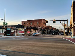
Main Street, Downtown Sylvania, Ohio.jpg
Main Street, downtown Sylvania
Flag of Sylvania, Ohio.svg
Nickname: 
City of Trees
Motto: 
"Serving the Community"
Lucas County Ohio incorporated and unincorporated areas Sylvania highlighted.svg
Location in Lucas County and the state of Ohio.
Coordinates: 41°42′37″N83°42′34″W / 41.71028°N 83.70944°W / 41.71028; -83.70944
Country United States
State Ohio
County Lucas
Government
   Mayor Craig A. Stough (R) [1]
Area
[2]
  Total6.72 sq mi (17.40 km2)
  Land6.67 sq mi (17.26 km2)
  Water0.05 sq mi (0.14 km2)
Elevation
[3]
646 ft (197 m)
Population
 (2020)
  Total19,011
  Density2,852.36/sq mi (1,101.26/km2)
Time zone UTC-5 (Eastern (EST))
  Summer (DST) UTC-4 (EDT)
ZIP code
43560
Area code 419
FIPS code 39-76022 [4]
GNIS feature ID2396020 [3]
Website www.cityofsylvania.com

Sylvania is a city in Lucas County, Ohio, United States. The population was 19,011 at the 2020 census. [5] Sylvania is a suburb of Toledo, and encompassed by Sylvania Township. Its northern border is the southern border of the state of Michigan. [6]

Contents

The name "Sylvania" is borrowed from the Latin sylvan or sylva , meaning "forest land", owing to the dense forests that once made up the region, part of the Great Black Swamp. [7]

History

The original Sylvania railroad depot, along the Erie & Kalamazoo Railroad, now part of the Sylvania Historical Village Sylvania Historical Village - Railroad Depot.jpg
The original Sylvania railroad depot, along the Erie & Kalamazoo Railroad, now part of the Sylvania Historical Village

General David White is considered the founder of Sylvania as the first pioneer settler and town supervisor, originally from Palmyra, New York. In 1832, White was given the title of General (possibly after services rendered during the War of 1812), which allowed him to explore the western Lake Erie region. In realizing the potential of some available land to the north of Maumee, Ohio, a notable port city at the time, he acquired a title to the land and built a log cabin at what would eventually be the corner of Summit and Monroe streets near downtown Sylvania. [8] [9] [10] [11]

Prior to White's acquisition, the land was a part of Port Lawrence Township, Monroe County, Michigan. Over the course of several years, White, along with his associate, Judge William Wilson, purchased a total of 1,920 acres (780 ha) of Port Lawrence and surrounding land in what would eventually become Sylvania, and 1,720 acres (700 ha) of what would become Whiteford Township, Michigan, where he also served as the first town supervisor. The relationship between White and Wilson did not last, and when the boundary dispute that lead to the largely bloodless Toledo War began in 1834, they began splitting the lands they had purchased, platting their own towns. That year, White established the first area school in Whiteford, and platted the township there one year later in 1835. Wilson presented the original plat for Sylvania in June 1836, with the town of Whiteford directly adjacent. [12] [10]

Throughout the 1830s and 1840s, rail transportation saw significant expansion throughout the Great Lakes region. In 1833, the Erie and Kalamazoo Railroad was chartered as part of the Lake Shore and Michigan Southern Railway, running from former Port Lawrence, Michigan (now Toledo, Ohio), to the mouth of the Kalamazoo River at Lake Michigan. [13] Trains were at first pulled by horse until the first steam locomotive was installed in 1837. Sylvania built its own railroad depot along the Erie-Kalamazoo Railroad in 1858. [14] While the depot is no longer in operation, the original station building exists as an exhibit in the Sylvania Historical Village, still next to the railroad which remains in use.

Sylvania was incorporated in 1867. [10] A post office called Sylvania has been in operation since 1859. [15]

Geography

Sylvania is located approximately 10 miles (16 km) west-northwest of Toledo. According to the United States Census Bureau, the city has a total area of 6.68 square miles (17.30 km2), of which 6.63 square miles (17.17 km2) are land and 0.05 square miles (0.13 km2) are water. [16]

The city lies at the junction of two creeks: Ottawa Creek, flowing south from the community of Ottawa Lake, Michigan, about four miles north of the city, and Ten Mile Creek, a tributary of Ottawa Creek running about 30 miles (48 km) from the west, which becomes the Ottawa River and empties into the Maumee River. [17]

The city is built on large shale deposits, which over hundreds of years have been mined in quarries to make concrete, cement and other stone products. [18] Silica shale from the region is renowned among paleontologists for its high-quality fossils from the early Devonian period. [19]

Demographics

Historical population
CensusPop.Note
1880 523
1890 5454.2%
1900 61713.2%
1910 1,00262.4%
1920 1,22222.0%
1930 2,10872.5%
1940 2,1994.3%
1950 2,43310.6%
1960 5,187113.2%
1970 12,031131.9%
1980 15,55629.3%
1990 17,30111.2%
2000 18,6707.9%
2010 18,9711.6%
2020 19,0110.2%
2021 (est.)19,0340.1%
Sources: [4] [20] [21] [22] [23] [24] [25]

2010 census

As of the census [26] of 2010, there were 18,971 people, 7,642 households, and 5,092 families residing in the city. The population density was 2,926.7 inhabitants per square mile (1,130.0/km2). There were 8,165 housing units at an average density of 1,260.0 per square mile (486.5/km2). The racial makeup of the city was 92.4% White, 2.7% African American, 0.1% Native American, 2.3% Asian, 0.1% Pacific Islander, 0.7% from other races, and 1.7% from two or more races. Hispanic or Latino of any race were 2.9% of the population.

There were 7,642 households, of which 31.3% had children under the age of 18 living with them, 53.0% were married couples living together, 10.1% had a female householder with no husband present, 3.5% had a male householder with no wife present, and 33.4% were non-families. 28.7% of all households were made up of individuals, and 12.8% had someone living alone who was 65 years of age or older. The average household size was 2.43 and the average family size was 3.02.

The median age in the city was 42.7 years. 23.6% of residents were under the age of 18; 7.8% were between the ages of 18 and 24; 21.5% were from 25 to 44; 29.9% were from 45 to 64; and 17.2% were 65 years of age or older. The gender makeup of the city was 47.3% male and 52.7% female.

2000 census

Largest ancestries (2000)Percent
German 32.8%
Irish 15.7%
Polish 10.7%
Italian 6.2%
American 4.9%

As of the census [4] of 2000, there were 18,670 people, 7,151 households, and 5,070 families residing in the city. The population density was 3,223.2 inhabitants per square mile (1,244.5/km2). There were 7,392 housing units at an average density of 1,276.2 per square mile (492.7/km2). The racial makeup of the city was 95.20% White, 1.00% African American, 0.10% Native American, 2.10% Asian, 0.01% Pacific Islander, 0.64% from other races, and 0.96% from two or more races. Hispanic or Latino of any race were 1.63% of the population. The city has a significant Jewish community.

There were 7,151 households, out of which 37.2% had children under the age of 18 living with them, 59.8% were married couples living together, 8.7% had a female householder with no husband present, and 29.1% were non-families. 25.7% of all households were made up of individuals, and 11.2% had someone living alone who was 65 years of age or older. The average household size was 2.59 and the average family size was 3.16.

In the city, the population was spread out, with 28.2% under the age of 18, 6.7% from 18 to 24, 26.7% from 25 to 44, 25.0% from 45 to 64, and 13.3% who were 65 years of age or older. The median age was 38 years. For every 100 females, there were 90.7 males. For every 100 females age 18 and over, there were 86.6 males.

The median income for a household in the city was $57,358, and the median income for a family was $73,947. Males had a median income of $52,892 versus $34,583 for females. The per capita income for the city was $28,163. About 3.7% of families and 4.2% of the population were below the poverty line, including 4.2% of those under age 18 and 3.9% of those age 65 or over.

Arts and culture

The Lathrop House in Sylvania, used as a stop along the Underground Railroad Lathrop House, Sylvania, Ohio.jpg
The Lathrop House in Sylvania, used as a stop along the Underground Railroad
An original log cabin in the Sylvania Historical Village, ca. 1840s Sylvania Historical Village - Original Log Cabin.jpg
An original log cabin in the Sylvania Historical Village, ca. 1840s
Limestone deposit in Fossil Park Dundee Limestone (Middle Devonian; Medusa North-North Quarry, Sylvania, Ohio, USA).jpg
Limestone deposit in Fossil Park

Notable events

Parks and recreation

The city is home to over 250 acres of parkland, which include Olander Park, Harroun Community Park, Pacesetter Park, Veterans Memorial Park, and Burnham Park. The Olander Park System ("TOPS") has a large 28 acre pond as well as other satellite parks (Fossil Park, Sylvan Prairie Park, Whetstone Park and Southview Oak Savanna). [38] Pacesetter Park has lacrosse, soccer, and baseball fields, and Burnham Park contains Plummer Pool, a public swimming pool.

Many of Sylvania's recreational activities are organized by the Sylvania Area Joint Recreation Department (SAJRD). They operate multiple facilities and parks, including Pacesetter, Veterans Memorial and Burnham parks, as well as a recreation center, Tam-O-Shanter, with two ice skating rinks and two indoor soccer fields. The center offers indoor sports such as soccer, baseball, lacrosse, ice hockey, and ice skating. [39] [40]

The city has received the "Tree City" designation from the Tree City USA program for over 30 years, which recognizes communities for urban and community forestry. [41] The nickname of the city is the literal translation of its name, "City of Trees". [42]

In 2016, a steel beam from the World Trade Center was installed in the "9/11 First Responders Last Call Memorial" at the Toledo Memorial Park cemetery in Sylvania. [43]

Government

Sylvania City Hall Sylvania city hall.jpg
Sylvania City Hall

The City of Sylvania follows a mayor–council government. [44] The mayor of Sylvania is Craig Stough. [45] The charter and laws of the City of Sylvania are documented in the Codified Ordinances of the City of Sylvania, Ohio. [46] The judicial branch of the city government is run by the Sylvania Municipal Court, [47] which is presided over by the Honorable Judge Michael A. Bonfiglio. [48]

City council

The city council has seven members, comprising eight committees: Building & Grounds, Employee & Community Relations, Finance, Parks & Forestry, Safety, Streets, Utilities & Environment, and Zoning & Annexation. The current members of the council are Mark Frye, Patrick Richardson, Katie Cappellini, Douglas Haynam, Brian McCann, Lyndsey Stough and Mary Westphal. [49]

Education

Public

Public schools in Sylvania, Ohio are all part of the Sylvania City School District. [50]

Elementary schools
Junior high schools
High schools

Private

Colleges

Libraries

Sylvania has two public libraries, one near each high school, which are branches of the Toledo-Lucas County Public Library. The Sylvania Branch Library, located near Northview High School, was built in the 1950s, and was expanded and remodeled in 2017. [51] A second library at King Road near Southview High School was built in 2016. [52]

Notable people

Sister city

Sylvania is the sister city of Woodstock, Ontario, Canada. [54]

Related Research Articles

<span class="mw-page-title-main">Toledo, Ohio</span> City in Ohio, United States

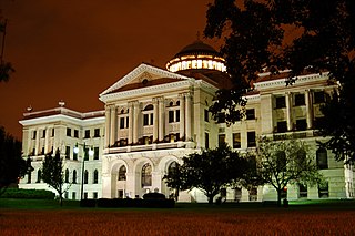
Toledo is a city in and the county seat of Lucas County, Ohio, United States. At the 2020 census, it had a population of 270,871, making Toledo the fourth-most populous city in Ohio, after Columbus, Cleveland, and Cincinnati. Toledo is the 84th-most populous city in the United States. It is the principal city of the Toledo metropolitan area, which had 606,240 residents in 2020. Toledo also serves as a major trade center for the Midwest; its port is the fifth-busiest on the Great Lakes.
<span class="mw-page-title-main">Lucas County, Ohio</span> County in Ohio, United States

Lucas County is a county located in the northwestern part of the U.S. state of Ohio. It is bordered to the east by Lake Erie, and to the southeast by the Maumee River, which runs to the lake. As of the 2020 census, the population was 431,279. Its county seat and largest city is Toledo, located at the mouth of the Maumee River on the lake. The county was named for Robert Lucas, 12th governor of Ohio, in 1835 during his second term. Its establishment provoked the Toledo War conflict with the Michigan Territory, which claimed some of its area. Lucas County is the central county of the Toledo Metropolitan Statistical Area.

<span class="mw-page-title-main">Fulton County, Ohio</span> County in Ohio, United States

Fulton County is a county located in the U.S. state of Ohio west of Toledo. As of the 2020 census, the population was 42,713. Its county seat and largest city is Wauseon. The county was created in 1850 with land from Henry, Lucas, and Williams counties and is named for Robert Fulton, inventor of the steamboat. Fulton County is a part of the Toledo metropolitan area.

<span class="mw-page-title-main">Wauseon, Ohio</span> City in Ohio, USA

Wauseon is a city in and the county seat of Fulton County, Ohio, approximately 31 mi (51 km) west of Toledo. The population was 7,568 at the time of the 2020 census.

<span class="mw-page-title-main">Mentor, Ohio</span> City in Ohio, United States

Mentor is the largest city in Lake County, Ohio, United States. The population was 47,450 at the 2020 census. It is part of the Cleveland metropolitan area.

<span class="mw-page-title-main">Holland, Ohio</span> Village in Ohio, United States

Holland is a village in eastern Springfield Township, Lucas County, Ohio, United States. Holland is a suburb of Toledo. The population was 1,664 at the 2020 census.

<span class="mw-page-title-main">Maumee, Ohio</span> City in Ohio, United States

Maumee is a city in Lucas County, Ohio, United States. Located along the Maumee River, it is a suburb about 10 miles (16 km) southwest of Toledo. The population was 13,896 at the 2020 census. Maumee was declared an All-America City by the National Civic League in June 2006.
<span class="mw-page-title-main">Oregon, Ohio</span> City in Lucas County, Ohio

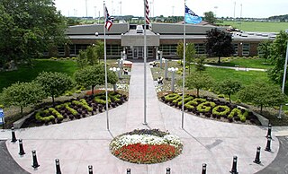
Oregon is a city in Lucas County, Ohio, United States. Located on Lake Erie, it is a suburb of Toledo lying east of the city and is home to Maumee Bay State Park. The population was 19,950 at the 2020 census.

<span class="mw-page-title-main">Waterville, Ohio</span> City in Ohio, United States

Waterville is a city in Lucas County, Ohio, United States, along the Maumee River. A suburb of Toledo, the population was 6,003 at the 2020 census.

<span class="mw-page-title-main">Whitehouse, Ohio</span> Village in Ohio, United States

Whitehouse is a village within the Toledo Metropolitan Area in Lucas County, Ohio, United States. The population was 4,990 at the 2020 census.

<span class="mw-page-title-main">Bowling Green, Ohio</span> City in Wood County, Ohio

Bowling Green is a city in and the county seat of Wood County, Ohio, United States, located 20 miles (32 km) southwest of Toledo. The population was 30,808 at the 2020 census. It is part of the Toledo metropolitan area and a member of the Toledo Metropolitan Area Council of Governments. Bowling Green is the home of Bowling Green State University.

<span class="mw-page-title-main">Northwood, Ohio</span> City in Ohio, United States

Northwood is a city and eastern suburb in Wood County, Ohio, United States, within the Toledo metropolitan area. The population was 5,160 at the 2020 census.

<span class="mw-page-title-main">Perrysburg, Ohio</span> City in Ohio, United States

Perrysburg is a city located in Wood County, Ohio, United States, along the south side of the Maumee River. The population was 25,041 at the 2020 census. Part of the Toledo metropolitan area, the city is 12 miles (19 km) southwest of Toledo. Perrysburg served as the county seat from 1822 to 1868.

<span class="mw-page-title-main">Rossford, Ohio</span> City in Ohio, United States

Rossford is a city in Wood County, Ohio, United States, located along the Maumee River in the Toledo metropolitan area. The population was 6,299 at the 2020 census. The town includes the intersection of Interstate 75 and the Ohio Turnpike. Rossford Public Library and WPAY serve the community.
<span class="mw-page-title-main">Delphos, Ohio</span> City in Ohio, United States

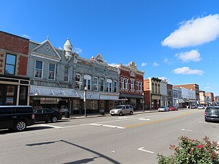
Delphos is a city in Allen and Van Wert counties in the U.S. state of Ohio approximately 14 mi (23 km) northwest of Lima and 13 mi (21 km) east of Van Wert. The population was 7,117 at the 2020 census.

<span class="mw-page-title-main">Bellevue, Ohio</span> City in Ohio, United States

Bellevue is a city in Erie, Huron, Seneca, and Sandusky counties in the U.S. state of Ohio, located 61 miles southwest of Cleveland and 45 miles southeast of Toledo. The population was 8,249 at the 2020 census. The National Arbor Day Foundation has designated Bellevue as a Tree City USA.

<span class="mw-page-title-main">Pickerington, Ohio</span> City in Ohio, United States

Pickerington is a city in Fairfield and Franklin counties in the central region of the U.S. state of Ohio. It is a suburb of Columbus. The population was 23,094 at the 2020 census. It was founded in 1815 as Jacksonville, named after Andrew Jackson. The name was changed in 1827 in honor of its founder, Abraham Pickering. As land annexation, development, and immigration into the Columbus area continues, the city of Pickerington has generally followed suit. Pickerington is home to the Motorcycle Hall of Fame, located off of Interstate 70.

<span class="mw-page-title-main">Sylvania Township, Lucas County, Ohio</span> Township in Ohio, United States

Sylvania Township is one of the eleven townships of Lucas County, Ohio, United States. As of 2020, the total population was 50,679, making it the second most populous municipality of Lucas County, Northwest Ohio, and the 419 / 567 area codes.
<span class="mw-page-title-main">Springfield Township, Lucas County, Ohio</span> Township in Ohio, United States

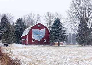
Springfield Township is one of the eleven townships of Lucas County, Ohio, United States. As of the 2020 census, the total population was 26,957, making it the third most populous part of Lucas County, behind Toledo and Sylvania Township.

<span class="mw-page-title-main">Toledo metropolitan area</span> Toledo Metropolitan Area in Ohio, United States

The Toledo Metropolitan Area, or Greater Toledo, or Northwest Ohio is a metropolitan area centered on the American city of Toledo, Ohio. As of the 2020 census, the four-county Metropolitan Statistical Area (MSA) had a population of 646,604. It is the sixth-largest metropolitan area in the state of Ohio, behind Cincinnati–Northern Kentucky, Cleveland, Columbus, Dayton, and Akron.
References

  1. "Office Holder Details". Lucas County Board of Elections. 31 December 2015. p. 19. Archived from the original on 16 June 2016. Retrieved 1 February 2016.
  2. "ArcGIS REST Services Directory". United States Census Bureau. Retrieved September 20, 2022.
  3. 1 2 U.S. Geological Survey Geographic Names Information System: Sylvania, Ohio
  4. 1 2 3 "U.S. Census website". United States Census Bureau . Retrieved January 31, 2008.
  5. "Total Population: 2020 Census DEC Summary File 1 (P1), Sylvania city, Ohio". data.census.gov. U.S. Census Bureau. Retrieved November 24, 2021.
  6. Mangus, Michael; Herman, Jennifer L. (2008). Ohio Encyclopedia. North American Book Dist LLC. p. 542. ISBN   978-1-878592-68-2. Archived from the original on June 18, 2016. Retrieved March 14, 2016.
  7. Scribner, pp. 181
  8. Cosgrobe, pp. 10-11
  9. Scribner, pp. 893-894
  10. 1 2 3 Waggoner, Clark (1888). History of the City of Toledo and Lucas County, Ohio. Munsell & Company. p. 892. Archived from the original on June 17, 2016. Retrieved January 22, 2016.
  11. 1 2 "A Brief History of Sylvania". City of Sylvania. Archived from the original on April 3, 2019. Retrieved October 27, 2019.
  12. Scribner, p. 185,893
  13. "Erie & Kalamazoo Rail Road". Ohio History Connection . Archived from the original on March 14, 2019. Retrieved October 27, 2019.
  14. "Lucas County, 32-48: Erie and Kalamazoo Railroad". Ohio History Connection . Archived from the original on July 7, 2017. Retrieved October 27, 2019.
  15. "Lucas County". Jim Forte Postal History. Archived from the original on 19 January 2016. Retrieved 21 January 2016.
  16. "2019 U.S. Gazetteer Files". United States Census Bureau. Retrieved July 28, 2020.
  17. Cosgrove, Maynard Giles (1933). A history of Sylvania for the first hundred years [1833-1933];and centennial celebration program. Sylvania, Ohio: Sentinel Publishing Company. pp. 9–10. OCLC   950553827.
  18. Cosgrove, p. 85
  19. "Sylvania, Ohio - Trilobites in the Heartland". American Museum of Natural History . Archived from the original on August 2, 2019. Retrieved October 21, 2019.
  20. "Population of Civil Divisions Less than Counties" (PDF). Statistics of the Population of the United States at the Tenth Census. U.S. Census Bureau. Archived (PDF) from the original on 29 June 2014. Retrieved 28 November 2013.
  21. "Population: Ohio" (PDF). 1910 U.S. Census. U.S. Census Bureau. Archived (PDF) from the original on 10 November 2013. Retrieved 28 November 2013.
  22. "Population: Ohio" (PDF). 1930 US Census. U.S. Census Bureau. Archived (PDF) from the original on 9 June 2011. Retrieved 28 November 2013.
  23. "Report and Tables: New York through South Carolina" (PDF). 1960 Census of Population, Final Population Counts for States. U.S. Census Bureau. p. 69. Retrieved November 2, 2019.
  24. "Ohio: Population and Housing Unit Counts" (PDF). U.S. Census Bureau. Archived (PDF) from the original on 9 January 2014. Retrieved 22 November 2013.
  25. "Sylvania city, Ohio". census.gov. Retrieved July 6, 2022.
  26. "U.S. Census website". United States Census Bureau . Retrieved January 6, 2013.
  27. "Lathrop House". Heritage Sylvania. Archived from the original on October 21, 2019. Retrieved April 8, 2020.
  28. "Lathrop House has rich history". The Blade . October 29, 2003. Archived from the original on October 19, 2019. Retrieved October 21, 2019.
  29. "The Lathrops Family Home". City of Sylvania. Archived from the original on April 3, 2019. Retrieved October 19, 2019.
  30. Haddad, Keith (2003). Lathrop House Project (PDF). City of Sylvania. Archived (PDF) from the original on October 19, 2019.
  31. Alkalimat, Abdul; Patterson, Rubin (November 13, 2017). Black Toledo: A Documentary History of the African American Experience in Toledo, Ohio. Brill Publishers. pp. 18–19. ISBN   9789004281899.
  32. "Lucas County, 55-48: The Harroun Family Barn". Ohio History Connection . Archived from the original on July 7, 2017. Retrieved October 26, 2019.
  33. "About Us". Heritage Sylvania. Archived from the original on October 21, 2019. Retrieved October 21, 2019.
  34. "Sylvania Historical Village". Toledo.com. Archived from the original on October 21, 2019. Retrieved October 21, 2019.
  35. Weber, Ann (July 13, 2008). "Sylvania's Fossil Park is a fun place to look for the past". The Blade .
  36. Norfleet, Michele. "The History of Olander Park in Sylvania, Ohio". USA Today . Archived from the original on May 20, 2016. Retrieved April 3, 2019.
  37. Ryan, Carl (February 21, 2010). "Sylvania's Burnham Building begins its tumble". The Blade . Archived from the original on October 27, 2019. Retrieved October 27, 2019.
  38. Norfleet, Michele. "The History of Olander Park in Sylvania, Ohio". traveltips.usatoday.com. Archived from the original on May 20, 2016. Retrieved April 3, 2019.
  39. "Recreation - There's Plenty to Do Outdoors". City of Sylvania. Archived from the original on September 10, 2017. Retrieved April 3, 2019.
  40. "Pacesetter Park". Sylvania Recreation District. Archived from the original on July 8, 2018. Retrieved April 3, 2019.
  41. "Our Tree Commission". Archived from the original on October 21, 2019. Retrieved October 21, 2019.
  42. Romaker, Janet (April 18, 2007). "Sylvania achieves 'Tree City' milestone Events mark 25th year of winning award". The Blade . Archived from the original on October 21, 2019. Retrieved October 21, 2019.
  43. "World Trade Center beam installed at Sylvania memorial". Congresswoman Marcy Kaptur. September 11, 2016. Archived from the original on April 3, 2019. Retrieved April 3, 2019.
  44. "City Offices". City of Sylvania. Archived from the original on April 3, 2019. Retrieved October 8, 2019.
  45. "Mayor's Office". City of Sylvania. Archived from the original on October 16, 2020. Retrieved December 12, 2020.
  46. "Codified Ordinances of the City of Sylvania, Ohio". American Legal Publishing Corporation. January 17, 2019. Archived from the original on July 25, 2019. Retrieved October 8, 2019.
  47. "Our Mission". Sylvania Municipal Court. Archived from the original on August 5, 2019. Retrieved October 8, 2019.
  48. "Presiding Judge". Sylvania Municipal Court. Archived from the original on August 5, 2019. Retrieved October 8, 2019.
  49. "City Council". City of Sylvania. Archived from the original on October 27, 2020. Retrieved December 12, 2020.
  50. "Our District". Sylvania City School District . Archived from the original on October 18, 2019. Retrieved October 27, 2019.
  51. Reiter, Mark (July 27, 2017). "Library moves ahead with Sylvania branch remodel". The Blade. Archived from the original on April 29, 2019. Retrieved April 29, 2019.
  52. Guyton, Lisa (September 26, 2016). "New multi-million dollar library branch opens in Sylvania". 13ABC.com. Archived from the original on September 28, 2016. Retrieved April 29, 2019.
  53. Smith, Ryan E. (August 17, 2008). "Sylvania area native gives city a role in his TV series". The Toledo Blade. Archived from the original on April 25, 2019. Retrieved February 5, 2019.
  54. "Sister City Garden". Sylvania Historical Village. Archived from the original on 4 February 2016. Retrieved 11 April 2015.

Bibliography