Walbridge, Ohio

Last updated

Walbridge, Ohio
Walbridge former high school.jpg
Former high school
Motto: 
"Town on the Right Track"
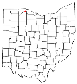
OHMap-doton-Walbridge.png
Location of Walbridge, Ohio
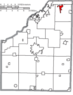
Map of Wood County Ohio Highlighting Walbridge Village.png
Location of Walbridge in Wood County
Coordinates: 41°35′18″N83°30′12″W / 41.58833°N 83.50333°W / 41.58833; -83.50333
Country United States
State Ohio
County Wood
Township Lake
Area
[1]
  Total2.20 sq mi (5.70 km2)
  Land2.19 sq mi (5.66 km2)
  Water0.01 sq mi (0.04 km2)
Elevation
[2]
617 ft (188 m)
Population
 (2020)
  Total3,011
  Density1,377.40/sq mi (531.71/km2)
Time zone UTC-5 (Eastern (EST))
  Summer (DST) UTC-4 (EDT)
ZIP code
43465
Area code 419
FIPS code 39-80486
GNIS feature ID2400082 [2]
Website https://www.walbridgeohio.org/

Walbridge is a village in Wood County, Ohio, United States, within the Toledo metropolitan area. The population was 3,011 at the 2020 census.

Contents

History

Walbridge was platted in 1874. [3] A post office called Walbridge has been in operation since 1871. [4] The village was incorporated in 1912. [5]

Geography

According to the United States Census Bureau, the village has a total area of 2.21 square miles (5.72 km2), of which 2.19 square miles (5.67 km2) is land and 0.02 square miles (0.05 km2) is water. [6]

Demographics

Historical population
CensusPop.Note
1920 584
1930 90555.0%
1940 9858.8%
1950 1,15217.0%
1960 2,14285.9%
1970 3,20849.8%
1980 2,900−9.6%
1990 2,736−5.7%
2000 2,546−6.9%
2010 3,01918.6%
2020 3,011−0.3%
U.S. Decennial Census [7]

2010 census

At the 2010 census there were 3,019 people, 1,458 households, and 825 families living in the village. The population density was 1,378.5 inhabitants per square mile (532.2/km2). There were 1,635 housing units at an average density of 746.6 per square mile (288.3/km2). The racial makeup of the village was 95.9% White, 0.7% African American, 0.3% Native American, 0.3% Asian, 1.1% from other races, and 1.8% from two or more races. Hispanic or Latino of any race were 5.6%. [8]

Of the 1,458 households 21.5% had children under the age of 18 living with them, 40.3% were married couples living together, 11.7% had a female householder with no husband present, 4.6% had a male householder with no wife present, and 43.4% were non-families. 37.5% of households were one person and 16.7% were one person aged 65 or older. The average household size was 2.07 and the average family size was 2.68.

The median age in the village was 47.4 years. 17.7% of residents were under the age of 18; 8.2% were between the ages of 18 and 24; 20.8% were from 25 to 44; 29.5% were from 45 to 64; and 23.8% were 65 or older. The gender makeup of the village was 46.1% male and 53.9% female.

2000 census

At the 2000 census there were 2,546 people, 1,078 households, and 743 families living in the village. The population density was 1,532.0 inhabitants per square mile (591.5/km2). There were 1,110 housing units at an average density of 667.9 per square mile (257.9/km2). The racial makeup of the village was 97.29% White, 0.51% African American, 0.31% Native American, 0.24% Asian, 0.71% from other races, and 0.94% from two or more races. Hispanic or Latino of any race were 2.67%. [9]

Of the 1,078 households 28.4% had children under the age of 18 living with them, 53.0% were married couples living together, 12.3% had a female householder with no husband present, and 31.0% were non-families. 27.5% of households were one person and 10.4% were one person aged 65 or older. The average household size was 2.35 and the average family size was 2.85.

The age distribution was 23.4% under the age of 18, 9.0% from 18 to 24, 26.7% from 25 to 44, 24.7% from 45 to 64, and 16.3% 65 or older. The median age was 40 years. For every 100 females there were 90.0 males. For every 100 females age 18 and over, there were 88.7 males.

The median household income was $40,234 and the median family income was $54,063. Males had a median income of $44,185 versus $26,042 for females. The per capita income for the village was $19,783. About 3.7% of families and 4.7% of the population were below the poverty line, including 2.5% of those under age 18 and 4.6% of those age 65 or over.

Education

Walbridge has a public library, a branch of the Wood County District Public Library. [10]

Notable people

Related Research Articles

<span class="mw-page-title-main">Blackhawk-Camino Tassajara, California</span> Former census-designated place in California, United States

Blackhawk-Camino Tassajara is a former census-designated place (CDP) in Contra Costa County, California, near the town of Danville. The unincorporated area consisted of the Blackhawk planned community and the surrounding Camino Tassajara area. At the 2000 census, the CDP's population was 10,048. The CDP was split between Blackhawk and Camino Tassajara before the 2010 census.

<span class="mw-page-title-main">New Sharon, Maine</span> Town in the state of Maine, United States

New Sharon is a town in Franklin County, Maine, incorporated in 1794. The population was 1,458 at the 2020 census. The town is roughly bisected by the Sandy River, a tributary of the Kennebec River.

<span class="mw-page-title-main">Brooks, Maine</span> Town in the state of Maine, United States

Brooks is a town in Waldo County, Maine, United States. The population was 1,010 at the 2020 census.

Wheeler Township is a civil township of Gratiot County in the U.S. state of Michigan. As of the 2020 census, the township population was 1,374. Inside the township is the Village of Breckenridge.

<span class="mw-page-title-main">Watertown, Minnesota</span> City in Minnesota, United States

Watertown is a small city in Carver County, Minnesota, United States, along the South Fork of the Crow River, on the outskirts of the Twin Cities metro area. The population was 4,659 at the 2020 census.

Fair Haven Township is a township in Stearns County, Minnesota, United States. The population was 1,507 at the 2010 census. The unincorporated community of Fairhaven is located within Fair Haven Township.

<span class="mw-page-title-main">Bella Villa, Missouri</span> City in Missouri, United States

Bella Villa is a city in St. Louis County, Missouri, in the United States. As of the 2010 census, the city population was 729.

<span class="mw-page-title-main">Merriam Woods, Missouri</span> City in Missouri, United States

Merriam Woods is a city in Taney County, Missouri, United States. The population was 2,006 at the 2020 census. It is part of the Branson, Missouri Micropolitan Statistical Area.

<span class="mw-page-title-main">Centerville, Minnesota</span> City in Minnesota, United States

Centerville is a city in Anoka County, Minnesota, United States. The population was 3,896 at the 2020 census.

Munsons Corners is a hamlet and census-designated place (CDP) in Cortland County, New York, United States. The population was 2,728 at the 2010 census.

<span class="mw-page-title-main">Bradner, Ohio</span> Village in Ohio, United States

Bradner is a village in Wood County, Ohio, United States. The population was 971 at the 2020 census.

<span class="mw-page-title-main">Hoytville, Ohio</span> Village in Ohio, United States

Hoytville is a village in Wood County, Ohio, United States. The population was 220 at the 2020 census.

<span class="mw-page-title-main">Risingsun, Ohio</span> Village in Ohio, United States

Risingsun is a village in Wood County, Ohio, United States. The population was 541 at the 2020 census.

<span class="mw-page-title-main">East McKeesport, Pennsylvania</span> Borough in Pennsylvania, United States

East McKeesport is a borough in Allegheny County, Pennsylvania, United States, and is part of the Pittsburgh Metro Area. The population was 2,076 at the 2020 census.

<span class="mw-page-title-main">Upper Paxton Township, Pennsylvania</span> Township in Pennsylvania, United States

Upper Paxton Township is a township in Dauphin County, Pennsylvania, United States. The population was 4,014 at the 2020 census.

<span class="mw-page-title-main">Biron, Wisconsin</span> Village in Wisconsin, United States

Biron is a village in Wood County, Wisconsin, United States. The population was 839 at the 2010 census. It is the site of ND Paper's Biron Mill.

<span class="mw-page-title-main">Hewitt, Wood County, Wisconsin</span> Village in Wisconsin, United States

Hewitt is a village in Wood County, Wisconsin, United States. The population was 828 at the 2010 census.

<span class="mw-page-title-main">Milladore, Wisconsin</span> Village in Wisconsin, United States

Milladore is a village in Wood County and overlapping into Portage County in the U.S. state of Wisconsin. The population was 276 at the 2010 census. Most of the village is located within the Town of Milladore in Wood County, while only a very small portion of the village lies in Portage County. All of its 2010 census population resided in the Wood County portion of the village.

<span class="mw-page-title-main">Lodi (town), Wisconsin</span> Town in Wisconsin, United States

Lodi is a town in Columbia County, Wisconsin, United States. The population was 3,282 at the 2020 census. The unincorporated communities of Harmony Grove and Okee are in the town and the census-designated place of Lake Wisconsin is partially in the town.

<span class="mw-page-title-main">Eden, Wisconsin</span> Village in Wisconsin, United States

Eden is a village in Fond du Lac County, Wisconsin, United States. The population was 875 at the 2010 census. The village is located within the Town of Eden.

References

  1. "ArcGIS REST Services Directory". United States Census Bureau. Retrieved September 20, 2022.
  2. 1 2 U.S. Geological Survey Geographic Names Information System: Walbridge, Ohio
  3. Leeson, Michael A. (1897). Commemorative Historical and Biographical Record of Wood County, Ohio: Its Past and Present, Early Settlement and Development. J.H. Beers & Company. p. 301.
  4. "Wood County". Jim Forte Postal History. Retrieved January 11, 2016.
  5. "Cities, Townships, & Villages". Wood County Government. Archived from the original on June 6, 2015. Retrieved January 11, 2016.
  6. "US Gazetteer files 2010". United States Census Bureau . Retrieved January 6, 2013.
  7. "Census of Population and Housing". Census.gov. Retrieved June 4, 2015.
  8. "U.S. Census website". United States Census Bureau . Retrieved January 6, 2013.
  9. "U.S. Census website". United States Census Bureau . Retrieved January 31, 2008.
  10. "Hours & Locations". Wood County District Public Library. Retrieved March 3, 2018.