Wayne, Ohio

Last updated

Wayne, Ohio
Main in Wayne downtown.jpg
Main Street downtown
OHMap-doton-Wayne.png
Location of Wayne, Ohio
Map of Wood County Ohio Highlighting Wayne Village.png
Location of Wayne in Wood County
Coordinates: 41°18′03″N83°28′18″W / 41.30083°N 83.47167°W / 41.30083; -83.47167
Country United States
State Ohio
County Wood
Township Montgomery
Area
[1]
  Total0.32 sq mi (0.83 km2)
  Land0.32 sq mi (0.83 km2)
  Water0.00 sq mi (0.00 km2)
Elevation
[2]
702 ft (214 m)
Population
 (2020)
  Total841
  Density2,611.80/sq mi (1,007.92/km2)
Time zone UTC-5 (Eastern (EST))
  Summer (DST) UTC-4 (EDT)
ZIP code
43466
Area code 419
FIPS code 39-82334
GNIS feature ID2400111 [2]

Wayne is a village in Wood County, Ohio, United States. The population was 841 at the 2020 census.

Contents

History

Wayne was originally called Freeport, and under the latter name was platted in 1836. [3] [4] Another early variant name was Prairie Depot. [4] The present name honors Anthony Wayne. [5] The village was incorporated in 1836. [4] A post office called Prairie Depot was established in 1852, and the name was changed to Wayne in 1927. [6]

Geography

According to the United States Census Bureau, the village has a total area of 0.32 square miles (0.83 km2), all land. [7]

Demographics

Historical population
CensusPop.Note
1900 815
1910 733−10.1%
1920 578−21.1%
1930 6064.8%
1940 6263.3%
1950 76121.6%
1960 94924.7%
1970 921−3.0%
1980 894−2.9%
1990 803−10.2%
2000 8424.9%
2010 8875.3%
2020 841−5.2%
U.S. Decennial Census [8]

2010 census

As of the census [9] of 2010, there were 887 people, 324 households, and 231 families living in the village. The population density was 2,771.9 inhabitants per square mile (1,070.2/km2). There were 362 housing units at an average density of 1,131.3 per square mile (436.8/km2). The racial makeup of the village was 94.5% White, 0.2% African American, 0.2% Native American, 2.5% from other races, and 2.6% from two or more races. Hispanic or Latino of any race were 6.0% of the population.

There were 324 households, of which 43.5% had children under the age of 18 living with them, 48.5% were married couples living together, 16.0% had a female householder with no husband present, 6.8% had a male householder with no wife present, and 28.7% were non-families. 21.6% of all households were made up of individuals, and 8.7% had someone living alone who was 65 years of age or older. The average household size was 2.74 and the average family size was 3.17.

The median age in the village was 32.3 years. 29.5% of residents were under the age of 18; 10% were between the ages of 18 and 24; 28% were from 25 to 44; 22.6% were from 45 to 64; and 10% were 65 years of age or older. The gender makeup of the village was 48.1% male and 51.9% female.

2000 census

As of the census [10] of 2000, there were 842 people, 313 households, and 230 families living in the village. The population density was 2,613.7 inhabitants per square mile (1,009.2/km2). There were 336 housing units at an average density of 1,043.0 per square mile (402.7/km2). The racial makeup of the village was 95.13% White, 0.36% African American, 0.48% Native American, 0.12% Asian, 2.02% from other races, and 1.90% from two or more races. Hispanic or Latino of any race were 3.56% of the population.

25.2% of the total population were of French descent. [11]

There were 313 households, out of which 38.7% had children under the age of 18 living with them, 57.8% were married couples living together, 10.5% had a female householder with no husband present, and 26.5% were non-families. 20.1% of all households were made up of individuals, and 9.3% had someone living alone who was 65 years of age or older. The average household size was 2.69 and the average family size was 3.07.

In the village, the population was spread out, with 28.3% under the age of 18, 7.8% from 18 to 24, 32.9% from 25 to 44, 20.1% from 45 to 64, and 10.9% who were 65 years of age or older. The median age was 34 years. For every 100 females there were 99.1 males. For every 100 females age 18 and over, there were 94.2 males.

The median income for a household in the village was $46,071, and the median income for a family was $52,750. Males had a median income of $34,135 versus $22,386 for females. The per capita income for the village was $17,028. About 7.0% of families and 7.6% of the population were below the poverty line, including 9.6% of those under age 18 and none of those age 65 or over.

Library

Wayne is served by the Wayne Public Library. In 2005, the library loaned more than 97,000 items to its cardholders. Total holdings as of 2005 were over 39,000 volumes with over 120 periodical subscriptions. [12]

Related Research Articles

<span class="mw-page-title-main">Flushing, Ohio</span> Village in Ohio, United States

Flushing is a village in Belmont County, Ohio, United States. The population was 830 at the 2020 census.

<span class="mw-page-title-main">Wayne Lakes, Ohio</span> Village in Ohio, United States

Wayne Lakes is a village in Darke County, Ohio, United States. The population was 693 at the 2020 census.

<span class="mw-page-title-main">Addyston, Ohio</span> Village in Ohio, United States

Addyston is a village in Miami Township, Hamilton County, Ohio, United States. Located along the Ohio River, it is a western suburb of the neighboring city of Cincinnati. The population was 927 at the 2020 census.

<span class="mw-page-title-main">Cleves, Ohio</span> City in Ohio, United States

Cleves is a village in Miami Township, Hamilton County, Ohio, United States. Located along the Ohio River, it is a western suburb of Cincinnati. The population was 3,414 at the 2020 census.

<span class="mw-page-title-main">Evendale, Ohio</span> Village in Ohio, United States

Evendale is a village in Hamilton County, Ohio, United States, within the Cincinnati metropolitan area. The population was 2,669 at the 2020 census.

<span class="mw-page-title-main">Whitehouse, Ohio</span> Village in Ohio, United States

Whitehouse is a village within the Toledo Metropolitan Area in Lucas County, Ohio, United States. The population was 4,990 at the 2020 census.

<span class="mw-page-title-main">Payne, Ohio</span> Village in Ohio, United States

Payne is a village in Paulding County, Ohio, United States. The population was 1,192 at the 2020 census.

<span class="mw-page-title-main">Helena, Ohio</span> Village in Ohio, United States

Helena is a village in Sandusky County, Ohio, United States. The population was 211 at the 2020 census.

<span class="mw-page-title-main">Corwin, Ohio</span> Village in Ohio, United States

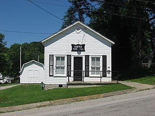
Corwin is a village in Wayne Township, Warren County, Ohio, United States. The population was 484 at the 2020 census.

<span class="mw-page-title-main">Waynesville, Ohio</span> Village in Ohio, United States

Waynesville is a village in Wayne Township, Warren County, Ohio, United States. The population was 2,669 at the 2020 census. It is named for General "Mad" Anthony Wayne. The village, located at the crossroads of U.S. Route 42 and State Route 73, is known for its antique stores and its annual sauerkraut festival. Caesar Creek State Park is located 5 miles (8.0 km) east of the village.

<span class="mw-page-title-main">Apple Creek, Ohio</span> Village in Ohio, United States

Apple Creek is a village in East Union Township, Wayne County, Ohio, United States. The population was 1,188 at the 2020 census.

<span class="mw-page-title-main">Burbank, Ohio</span> Village in Ohio, United States

Burbank is a village in Wayne County, Ohio, United States, along Killbuck Creek. The population was 296 at the 2020 census.

<span class="mw-page-title-main">Congress, Ohio</span> Village in Ohio, United States

Congress is a village in Wayne County, Ohio, United States. The population was 132 at the 2020 census.

<span class="mw-page-title-main">Dalton, Ohio</span> Village in Ohio, United States

Dalton is a village in Wayne County, Ohio, United States. The 2020 census indicated a population of 1,927.

<span class="mw-page-title-main">Marshallville, Ohio</span> Village in Ohio, United States

Marshallville is a village in Wayne County, Ohio. The population was 789 at the time of the 2020 census. Marshallville was originally called Bristol, and under the latter name was laid out in 1817.

<span class="mw-page-title-main">Shreve, Ohio</span> Village in Ohio, United States

Shreve is a village in Clinton Township, Wayne County, Ohio, United States. The population was 1,497 at the 2020 census. Shreve is served by a branch of the Wayne County Public Library.

<span class="mw-page-title-main">Smithville, Ohio</span> Village in Ohio, United States

Smithville is a village in Wayne County, Ohio, United States. The population was 1,338 at the time of the 2020 census. The village derives its name from Thomas Smith, a pioneer settler.

<span class="mw-page-title-main">West Salem, Ohio</span> Village in Ohio, United States

West Salem is a village in Wayne County, Ohio. The population was 1,430 at the time of the 2020 census. West Salem is served by a branch of the Wayne County Public Library.

<span class="mw-page-title-main">Creston, Ohio</span> Village in Ohio, United States

Creston is a village in Medina and Wayne counties in the U.S. state of Ohio. The population was 2,139 at the 2020 census.

<span class="mw-page-title-main">Rittman, Ohio</span> City in Ohio, United States

Rittman is a city in Medina and Wayne counties in the U.S. state of Ohio. All but a small portion of the city is in Wayne County, within commuting distance of Akron, Canton and Cleveland. The population was 6,131 at the 2020 census.

References

  1. "ArcGIS REST Services Directory". United States Census Bureau. Retrieved September 20, 2022.
  2. 1 2 U.S. Geological Survey Geographic Names Information System: Wayne, Ohio
  3. Leeson, Michael A. (1897). Commemorative Historical and Biographical Record of Wood County, Ohio: Its Past and Present, Early Settlement and Development. J.H. Beers & Company. p.  334.
  4. 1 2 3 "Cities, Townships, & Villages". Wood County Government. Archived from the original on June 6, 2015. Retrieved January 11, 2016.
  5. Overman, William Daniel (1958). Ohio Town Names. Akron, OH: Atlantic Press. p. 140.
  6. "Wood County". Jim Forte Postal History. Retrieved January 11, 2016.
  7. "US Gazetteer files 2010". United States Census Bureau . Retrieved January 6, 2013.
  8. "Census of Population and Housing". Census.gov. Retrieved June 4, 2015.
  9. "U.S. Census website". United States Census Bureau . Retrieved January 6, 2013.
  10. "U.S. Census website". United States Census Bureau . Retrieved January 31, 2008.
  11. "French Communities". Archived from the original on October 23, 2005.
  12. "2005 Ohio Public Library Statistics:Statistics by County and Town". State Library of Ohio. Archived from the original on September 24, 2006. Retrieved November 10, 2006.