
Alcona Township is a civil township of Alcona County in the U.S. state of Michigan. The population was 966 at the 2020 census.

Caledonia Township is a civil township of Alcona County in the U.S. state of Michigan. The population was 1,032 at the 2020 census.

Manitou Beach–Devils Lake is a census-designated place (CDP) in Lenawee County in the U.S. state of Michigan. The population of the CDP was 2,032 at the 2020 census. It is located within Rollin Township to the south and Woodstock Township to the north.
Garfield Township is a civil township of Mackinac County in the U.S. state of Michigan. The population was 1,146 at the 2010 census, and 1,166 in 2020.

Frenchtown Charter Township is a charter township within Monroe County in the U.S. state of Michigan. The population was 21,609 as per the 2020 census.

Beckett Ridge is a census-designated place (CDP) in West Chester Township, Butler County, Ohio, United States. The population was 9,192 at the 2020 census.

Plymouth is a census-designated place (CDP) in the town of Plymouth in Plymouth County, Massachusetts, United States. It is often referred to as Downtown Plymouth or Plymouth Center. The population was 7,494 at the 2010 census.

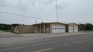
Tornado, also called Upper Falls, is a census-designated place (CDP) in Kanawha County, West Virginia, United States.

East Liberty is an unincorporated community and census-designated place (CDP) located in Perry Township, Logan County, Ohio, United States. As of the 2020 census, it had a population of 371. It is located just off U.S. Route 33, 10 miles (16 km) east of Bellefontaine and 46 miles (74 km) northwest of Columbus. It has a post office with the ZIP code 43319.
Trucksville is a census-designated place (CDP) in Kingston Township, Luzerne County, Pennsylvania, United States. The population was 2,152 at the 2010 census.

Tippecanoe is an unincorporated community and census-designated place (CDP) in central Washington Township, Harrison County, Ohio, United States. It is located along State Route 800 in the valley of Stillwater Creek, a north-flowing tributary of the Tuscarawas River. It had a post office until 2011 with the ZIP code 44699. The population was 83 at the 2020 census.
Rudolph is an unincorporated community and census-designated place (CDP) in eastern Liberty Township, Wood County, Ohio, United States. As of the 2020 census, it had a population of 415. It has a post office with the ZIP code 43462.

Sulphur Springs is a census-designated place (CDP) in eastern Liberty Township, Crawford County, Ohio, United States. As of the 2020 census it had a population of 197. It has a post office with the ZIP code 44881. It is located along State Route 98 northeast of the city of Bucyrus, the county seat of Crawford County.

Oceola is a census-designated place (CDP) in central Tod Township, Crawford County, Ohio, United States. As of the 2020 census its population was 156. It has a post office with the ZIP code 44860. It is located along the road that was U.S. Route 30 until being upgraded to a freeway.

Rosewood is an unincorporated community and census-designated place (CDP) in northwestern Adams Township, Champaign County, Ohio, United States. As of the 2020 census it had a population of 224. It has a post office with the ZIP code 43070. It lies along State Route 29, an east–west highway.

East Rochester is an unincorporated community and census-designated place (CDP) in southern West Township, Columbiana County, Ohio, United States. The population was 224 as of the 2020 census. It lies along U.S. Route 30, and has a post office with the ZIP code 44625. It is a part of the Salem micropolitan area, about 20 miles (32 km) east of Canton.

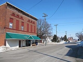
Falun is an unincorporated community in southwestern Saline County, Kansas, United States. As of the 2020 census, the population of the community and nearby areas was 83. It lies southwest of Salina and northwest of Lindsborg at the intersection of Forsse Road and Hedberg Road, about 7.5 miles west of Interstate 135 highway, or about 8 miles west of Assaria. It lies next to an abandoned railroad.
Delmita is a census-designated place in Starr County, Texas, United States. Its elevation is 272 feet (83 m). Although Delmita is unincorporated, it has a post office, with the ZIP code of 78536. This CDP was new for the 2010 census, with a population of 216.

Fort Seneca is a census-designated place in Pleasant Township, Seneca County, Ohio, United States. It is located on State Route 53, approximately 6 miles (9.7 km) North of Tiffin. The population was 230 at the 2020 census.

Sparrow Bush is a hamlet in the town of Deerpark, in Orange County, New York, United States. The population as of the 2020 census is 981. The community is located along state routes 42 and 97, 2.3 miles (3.7 km) northwest of Port Jervis. Sparrow Bush has a post office with ZIP code 12780. The community is named after Henry L. Sparrow who owned a large piece of woodland near the D&H canal.The locals started to call this piece of land Sparrow's “Bosh” and Sparrow's “Bosk”. Over time the name of the town gradually evolved into Sparrow bush.


