Tamassee, South Carolina

Last updated
Tamassee
Blue Ridge Mountains at Tamassee, South Carolina.jpg
Taken from Tamassee Knob Mountain
CountryUnited States
State South Carolina
County Oconee
Area
[1]
  Total1.17 sq mi (3.02 km2)
  Land1.17 sq mi (3.02 km2)
  Water0.00 sq mi (0.00 km2)
Population
 (2020) [2]
  Total60
  Density51.50/sq mi (19.89/km2)
Time zone UTC-5 (Eastern (EST))
  Summer (DST) UTC-4 (EDT)
ZIP code
29686 [3]
Area code 864
FIPS code 45-71170

Tamassee is an unincorporated community and census-designated place (CDP) located in northwestern Oconee County, South Carolina, United States. [4] It was first listed as a CDP in the 2020 census with a population of 60. [5]

Contents

Overview

The Tamassee area is located in and very near the Blue Ridge Mountains. A large part of the community occupies the scenic Cheohee Valley, "a beautiful rolling meadow framed by mountains and a wide triangle of sky." [6] [7]

The valley, in fact, is surrounded by a portion of the southern Blue Ridge Mountains called the "Chattooga Escarpment" in reference to a Federally Designated Wild and Scenic River, the Chattooga, which flows just beyond these mountain ridges. [7]

Tamassee is bordered on the west and north by the Pickens Ranger District of the Sumter National Forest. This area of national forest is characterized by a portion of the Blue Ridge Escarpment, rivers, waterfalls and hiking trails. The area is noted for its extremely rich biological diversity; which is said to owe to unique soil characteristics and elevated annual precipitation levels. [7]

History: Cherokee origins

The name "Tamassee" means "Place of the Sunlight of God", according to an interpretation of the Cherokee word which gave the area its original title. [8] Tamassee was the name given by the Cherokee to originally describe a Cherokee village in the area, which legend tells, was home to a magical and powerful Cherokee prophet. [9] The Cherokee town of Tamassee was destroyed and abandoned on August 12, 1776 when Major Andrew Pickens of the South Carolina Militia fought in the famed "Ring Fight". The Ring Fight happened when a scouting detachment numbering around 25 men under Major (later General) Andrew Pickens was ambushed by a local band of Cherokees and Loyalists numbering over 100. Pickens ordered his men to make a circle and another circle within the circle. When one circle would fire, the other would fire while the others where reloading. Fierce hand to hand fighting with tomahawks and knives erupted. The Patriot Militia set fire to the nearby cane plants, which made a popping noise that sounded like musket fire and reinforcements. The Cherokee fled back to Tamassee Town. The Battle was won by the time the reinforcements arrived. Later on in the day, the South Carolina Militiamen under Major Andrew Williamson destroyed and drove the Cherokee from the otherwise peaceful village. There is currently a South Carolina state historical marker denoting the Cherokee Village of "Tamassee Town" in the Cheohee Valley of Tamassee. [10]

Today, the Tamassee area maintains a rural and agricultural foundation, and provides a pleasant setting for day hikes, country drives and historical investigation. [7]

Demographics

Historical population
CensusPop.Note
2020 60
U.S. Decennial Census [11]
2020 [12] [2]

2020 census

Tamassee CDP, South Carolina – Demographic Profile
(NH = Non-Hispanic)
Race / EthnicityPop 2020 [12] % 2020
White alone (NH)5388.33%
Black or African American alone (NH)46.67%
Native American or Alaska Native alone (NH)00.00%
Asian alone (NH)00.00%
Pacific Islander alone (NH)00.00%
Some Other Race alone (NH)00.00%
Mixed Race/Multi-Racial (NH)35.00%
Hispanic or Latino (any race)00.00%
Total60100.00%

Note: the US Census treats Hispanic/Latino as an ethnic category. This table excludes Latinos from the racial categories and assigns them to a separate category. Hispanics/Latinos can be of any race.

See also

Related Research Articles

<span class="mw-page-title-main">DeKalb County, Alabama</span> County in Alabama, United States

DeKalb County is a county located in the northeastern part of the U.S. state of Alabama. As of the 2020 census, the population was 71,608. Its county seat is Fort Payne, and it is named after Major General Baron Johan DeKalb. DeKalb County is part of the Huntsville-Decatur-Albertville, AL Combined Statistical Area.

<span class="mw-page-title-main">Pickens County, South Carolina</span> County in South Carolina, United States

Pickens County is located in the northwest part of the U.S. state of South Carolina. As of the 2020 census, its population was 131,404. Its county seat is Pickens. The county was created in 1826. It is part of the Greenville-Anderson-Mauldin, SC Metropolitan Statistical Area.

<span class="mw-page-title-main">Oconee County, South Carolina</span> County in South Carolina, United States

Oconee County is the westernmost county in the U.S. state of South Carolina. As of the 2020 census, the population was 78,607. Its county seat is Walhalla and its largest city is Seneca. Oconee County is included in the Seneca, SC Micropolitan Statistical Area, which is also included in the Greenville-Spartanburg-Anderson, SC Combined Statistical Area. South Carolina Highway 11, the Cherokee Foothills National Scenic Highway, begins in southern Oconee County at Interstate Highway 85 at the Georgia state line.

<span class="mw-page-title-main">Anderson County, South Carolina</span> County in South Carolina, United States

Anderson County is a county located in the U.S. state of South Carolina. As of the 2020 census, its population was 203,718. Its county seat is Anderson. Named for Revolutionary War leader Robert Anderson, the county is located in northwestern South Carolina, along the state line of Georgia. Anderson County is included in the Greenville-Anderson-Mauldin, SC Metropolitan Statistical Area. Anderson County contains 55,950-acre (226 km2) Lake Hartwell, a U.S. Army Corps of Engineers lake with nearly 1,000 miles (2,000 km) of shoreline for residential and recreational use. The area is a growing industrial, commercial and tourist center. It is the home of Anderson University, a private, selective comprehensive university of approximately 3,000 undergraduate and graduate students

<span class="mw-page-title-main">Chattooga County, Georgia</span> County in Georgia, United States

Chattooga County is a county located in the northwestern part of the U.S. state of Georgia. As of the 2020 census, the population was 24,965. The county seat is Summerville. The county was created on December 28, 1838.

<span class="mw-page-title-main">Cashiers, North Carolina</span> Unincorporated village in Jackson County, North Carolina

Cashiers is a census-designated place (CDP) and unincorporated village located in southern Jackson County, North Carolina, United States. As of the 2020 United States census, the community had a total population of 657, up from 157 at the 2010 census. Cashiers is pronounced KASH-erz locally, and is one of several communities in the area popular with tourists and owners of vacation homes.

<span class="mw-page-title-main">Cullowhee, North Carolina</span> Census-designated place in North Carolina, United States

Cullowhee is a census-designated place (CDP) in Jackson County, North Carolina, United States. It is located on the Tuckasegee River, and the permanent population was 7,682 at the 2020 census up from 6,228 at the 2010 census.

<span class="mw-page-title-main">Scenic Oaks, Texas</span> Census-designated place in Texas, United States

Scenic Oaks is a census-designated place (CDP) in Bexar County, Texas, United States. It is part of the San Antonio Metropolitan Statistical Area. The population was 10,458 at the 2010 census, up from 4,957 at the 2010 census.

<span class="mw-page-title-main">Chattooga River</span> River in the Southeastern USA

The Chattooga River is the main tributary of the Tugaloo River.

<span class="mw-page-title-main">Sumter National Forest</span>

The Sumter National Forest is one of two forests in South Carolina that are managed together by the United States Forest Service, the other being the Francis Marion National Forest. The Sumter National Forest consists of 370,442 acres (1,499.13 km2) which are divided into 3 distinct sections in western and central South Carolina. The Enoree Ranger District is the largest, comprising roughly 170,000 acres in Chester, Fairfield, Laurens, Newberry, and Union counties. Next is the Long Cane Ranger District, comprising about 120,000 acres in Abbeville, Edgefield, Greenwood, McCormick, and Saluda counties. The smallest district is the Andrew Pickens Ranger District comprising over 85,000 acres which lies entirely in Oconee county and is part of the Appalachian Mountains. Forest headquarters of both South Carolina forests are located together in the state's capital city of Columbia.

<span class="mw-page-title-main">Barnardsville, North Carolina</span> Census-designated place in North Carolina, United States

Barnardsville is an unincorporated community and census-designated place (CDP) in Buncombe County, North Carolina, United States. It was first listed as a CDP in the 2020 census with a population of 559.

<span class="mw-page-title-main">Linville, North Carolina</span> Census-designated place in North Carolina, United States

Linville is an unincorporated community and census-designated place (CDP) in Avery County, North Carolina, United States. It was first listed as a CDP in the 2020 census with a population of 283. Centered just south of US 221 and NC 105, the community is known as a summer mountain resort and host of the Grandfather Mountain Highland Games, the largest modern Highland games in North Carolina.

Dacusville is a small unincorporated community and census-designated place (CDP) in Pickens County, South Carolina, United States. It is best known for its tractor show once a year in the month of September. The community also has an elementary school and a middle school. It was first listed as a CDP in the 2020 census with a population of 399.

Pine Ridge is an unincorporated community and census-designated place (CDP) in Darlington County, South Carolina, United States. It was first listed as a CDP prior to the 2020 census with a population of 807.

Keowee Key is a lakeside community and census-designated place (CDP) in Oconee County, South Carolina, United States. It is considered part of the Salem community. It was first listed as a CDP prior to the 2020 census with a population of 2,716.

South Union is an unincorporated community and census-designated place (CDP) in Oconee County, South Carolina, United States. It was first listed as a CDP prior to the 2020 census with a population of 341.

Cateechee is an unincorporated community and census-designated place (CDP) in Pickens County, South Carolina, United States. It was first listed as a CDP prior to the 2020 census. The population as of 2020 was 321.

The Cliffs Valley is a resort community and census-designated place (CDP) in Greenville County, South Carolina, United States. It was first listed as a CDP prior to the 2020 census with a population of 736.

Whitney is an unincorporated area and census-designated place (CDP) adjacent to the city of Spartanburg in Spartanburg County, South Carolina, United States. It was first listed as a CDP prior to the 2020 census with a population of 4,409.

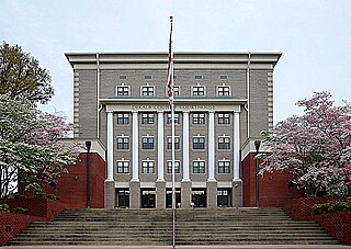
Clemson University is a census-designated place (CDP) covering the Clemson University campus in Pickens County, South Carolina, United States.

References

  1. "ArcGIS REST Services Directory". United States Census Bureau. Retrieved October 15, 2022.
  2. 1 2 "Census Population API". United States Census Bureau. Retrieved Oct 15, 2022.
  3. "Tamassee SC ZIP Code". zipdatamaps.com. 2023. Retrieved February 17, 2023.
  4. U.S. Geological Survey Geographic Names Information System: Tamassee, South Carolina
  5. "Tamassee CDP, South Carolina". United States Census Bureau . Retrieved April 7, 2022.
  6. http://www.dnr.sc.gov/managed/wild/jocassee/newsletters/jocvol6no1.pdf [ bare URL PDF ]
  7. 1 2 3 4 "Chattooga Conservancy".
  8. "Wizard of Tamassee Chapter, NSDAR". Archived from the original on 2008-05-17. Retrieved 2009-12-23.
  9. "Legend". Archived from the original on 2009-01-04. Retrieved 2009-12-23.
  10. http://www.oconeecountry.com/oconeestories.html
  11. "Decennial Census of Population and Housing by Decades". US Census Bureau.
  12. 1 2 "P2 HISPANIC OR LATINO, AND NOT HISPANIC OR LATINO BY RACE – 2020: DEC Redistricting Data (PL 94-171) – Tamassee CDP, South Carolina". United States Census Bureau .

Coordinates: 34°52′49″N83°01′11″W / 34.88028°N 83.01972°W / 34.88028; -83.01972