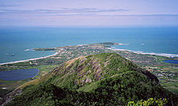
Fort-Dauphin is a city on the southeast coast of Madagascar. It is the capital of the Anosy Region and of the Taolagnaro District. It has been a port of local importance since the early 1500s. A new port, the Ehoala Port was built in 2006–2009. Fort-Dauphin was the first French settlement in Madagascar.
Tsivory is a rural commune in Anosy region in southern Madagascar. It is located at 225km from Fort Dauphin and 148 km from Amboasary Sud to which it is connected by the provincial road RIP 107. In 2018 it had a population of 18694.

Ihosy[iˈusʲ] is a city with 283,047 inhabitants (2015) in Ihorombe Region in central south Madagascar.
Midongy Atsimo or Midongy Sud is a district in the region of Atsimo-Atsinanana in Madagascar.
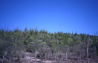
The Andohahela National Park is situated in Anosy in the south-east of Madagascar. It is remarkable for the extremes of habitats that are represented within it. The park covers 760 km2 (293 sq mi) of the Anosy mountain range, the southernmost spur of the Malagasy Highlands and contains the last humid rainforests in the southern part of Madagascar.

Androy is the most southerly region of Madagascar. It covers an area of 19,540 km2, and had a population of 903,376 inhabitants in 2018. The administrative capital is Ambovombe-Androy, and the chief administrator is Michael Andrianirina.

Atsimo-Atsinanana is a region in Madagascar. Its capital is Farafangana. The region used to be part of the Fianarantsoa Province.
The Roman Catholic Diocese of Tolagnaro is a Latin suffragan diocese in the Ecclesiastical province of Fort-Dauphin in Madagascar, yet still depends on the missionary Roman Congregation for the Evangelization of Peoples.

Anosy is one of the 22 regions of Madagascar. It is located in the southeast of the country, on the eastern side of what was once the Toliara Province. The name Anosy means "island(s)" in Malagasy.

Ampasy Nahampoa is a rural municipality in Madagascar. It belongs to the district of Taolanaro, which is a part of Anosy Region. The population of the commune was estimated to be approximately 6,000 in 2001 commune census. It is situated at a distance of 7 km from Fort-Dauphin.
Mahatalaky is a rural commune in Madagascar. It belongs to the district of Taolanaro, which is a part of Anosy Region. It is situated at 35 km from Fort Dauphin. The population of the commune was estimated to be approximately 25,000 in 2001 commune census.
Sarasambo is a municipality in Madagascar. It belongs to the district of Taolanaro, which is a part of Anosy Region. The population of the commune was estimated to be approximately 9,000 in 2001 commune census.
Masianaka is a rural municipality in Madagascar. It belongs to the district of Vangaindrano, which is a part of Atsimo-Atsinanana Region. The population of the commune was estimated to be approximately 18,000 in 2001 commune census.

There is a small but recognizable community of French people in Madagascar, of whom the vast majority are born in Madagascar and are descended from former settlers and colonists from France who settled in Madagascar during the 19th and 20th centuries. They constitute a minority ethnic group of Madagascar.
Abraham Samuel, also known as "Tolinar Rex," born in Martinique, was a mulatto pirate of the Indian Ocean in the days of the Pirate Round in the late-1690s. Being shipwrecked on his way back to New York, he briefly led a combined pirate-Antanosy kingdom from Fort Dauphin, Madagascar, from 1697 until he died there in 1705.

Amboasary Sud is a town in Anosy Region, Madagascar. It is the main town of Amboasary Sud District. It has a population of 45,989 in 2018.

Route nationale 13 is a primary highway in Madagascar of 493 km, running from Ihosy to Tolagnaro (Fort-Dauphin). It crosses the regions of Ihorombe, Androy and Anosy.
The Lavasoa dwarf lemur is a small, nocturnal strepsirrhine primate and a species of lemur that is endemic to three small, isolated patches of forest on the southern slopes of the Lavasoa Mountains in southern Madagascar. Fewer than 50 individuals are thought to exist. Its habitat lies in a transitional zone between three ecoregions: dry spiny bush, humid littoral forest, and humid forest. First collected in 2001 and thought to be a subpopulation of the furry-eared dwarf lemur (C. crossleyi), it was not formally described until 2013. It is one of six species of dwarf lemur, though the research that identified it also suggested the existence of many more new species.
Vangaindrano is a district of Atsimo-Atsinanana in Madagascar.

Route nationale 12a is a primary highway in Madagascar of 232 km, running from Vangaindrano to Tôlanaro. It crosses the regions of Anosy and Atsimo-Atsinanana. 10 ferries have to be taken along this road.


