Tar Heel, North Carolina

Last updated

Tar Heel, North Carolina
Baby bull and football.JPG
A pasture on the edge of Tar Heel
Bladen County North Carolina incorporated and unincorporated areas Tar Heel highlighted.svg
Location in Bladen County and the state of North Carolina.
Coordinates: 34°44′02″N78°47′27″W / 34.73389°N 78.79083°W / 34.73389; -78.79083
Country United States
State North Carolina
County Bladen
Government
  TypeMayor–council government
   Mayor Sam Allen
Area
[1]
  Total0.23 sq mi (0.60 km2)
  Land0.23 sq mi (0.60 km2)
  Water0.00 sq mi (0.00 km2)
Elevation
[2]
131 ft (40 m)
Population
 (2020)
  Total90
  Density387.93/sq mi (149.87/km2)
Time zone UTC-5 (Eastern (EST))
  Summer (DST) UTC-4 (EDT)
ZIP code
28392
Area codes 910, 472
FIPS code 37-66740 [3]
GNIS feature ID2406713 [2]

Tar Heel is a town located in Bladen County, North Carolina, United States. As of the 2010 census, the town population was 117. [4]

Contents

Tar Heel is home to the largest pig processing plant in the world, which opened in 1992, operated by Smithfield Foods and is located just north of the town limits.

Geography

Tar Heel is located on the banks of the Cape Fear River. Its major highways are NC 87 and NC 131. Fayetteville is 25 miles (40 km) to the north, Elizabethtown is 15 miles (24 km) to the southeast, and Lumberton is 16 miles (26 km) to the southwest.

According to the United States Census Bureau, the town has a total area of 0.15 square miles (0.4 km2), all land. [4]

History

This farming community has a history dating back to the Revolutionary War. Colonel Thomas Robeson, for whom Robeson County was named, lived in the Tar Heel community. His home is located just to the east of the town. It is listed in the National Register of Historic Places as Walnut Grove.

The town of Mayville, no longer in existence, was on the Robeson and Bladen County line and was the village mentioned in the diary of Elizabeth Ellis Robeson (1847–1866). [5] Just when the village moved to what is now Tar Heel is unknown. During the Civil War, Colonel Thomas Purdie and Captain Daniel Munn, residents of the Tar Heel area, led troops at Gettysburg and Fort Fisher.

The Town of Tar Heel was incorporated by the State of North Carolina in 1963.

The town was known for its landing on the Cape Fear River. The state operated a ferry at this landing, and it was a major loading point for vessels that transported agricultural goods to the market in Wilmington. The major product was barrels of turpentine. Tar Heel had several turpentine stills, and the remains of some of the old stills can be found in the area. The results of transporting the barrels of turpentine, leaking barrels, caused a tar-like material to be found around the landing and the access to the river. When the community people talked of going to the village, it was said they were going to get tar on their heels, thus the name Tar Heel.

The town of Tar Heel is often confused with Chapel Hill, North Carolina, home of the University of North Carolina Tar Heels.

The Purdie House and Purdie Methodist Church and Walnut Grove are listed on the National Register of Historic Places. [6]

Government

The town of Tar Heel is governed by a mayor/council governing body. The mayor and council are elected to four-year terms. The town's council meets monthly. In July 2011, the town of Tar Heel made world news when it was announced that no one was running for any of the four positions on the town board. [7] [8] The town held the election and Roy Dew was elected mayor of Tar Heel by write-in votes in November 2011. Also elected to the town's council by write-in votes were Angela Hall, Sam Allen, and Derek Druzak (2013). [9] The Town Mayor is now Sam Allen; he was selected to serve the remainder of Dew's term, after the latter passed while in office. In 2021, Allen was elected to a full term as Mayor with Hall and Druzak re-elected to the town council by write-in, as well as Steve Dowless who was the only listed candidate for town council.[ citation needed ]

Services

The services provided by this small rural community are:

Education

Public schools, part of the Bladen County School system, in the Tar Heel area:

Churches

The greater Tar Heel community is home to these churches:

Demographics

Historical population
CensusPop.Note
1970 87
1980 11835.6%
1990 115−2.5%
2000 70−39.1%
2010 11767.1%
2020 90−23.1%
U.S. Decennial Census [14]

As of the census of 2010, there are 117 people, 60 households, and 34 families residing in the town. The racial makeup of the town is majority White (93.2% or 107 persons). 5.1% (or 6 persons) are Mexican; and 3.4% (4 persons) are Native American with 2 people identifying solely as Native American and 2 others identifying as also White. There are 0.00% African American and 0.00% Asian or Pacific Islander. [15]

See also

Related Research Articles

<span class="mw-page-title-main">Chapel Hill, North Carolina</span> Town in North Carolina, United States

Chapel Hill is a town in Orange and Durham County, North Carolina, United States. Its population was 61,960 in the 2020 census, making Chapel Hill the 17th-most populous municipality in the state. Chapel Hill and Durham make up the Durham-Chapel Hill, NC Metropolitan Statistical Area, which had an estimated population of 608,879 in 2023. When it's combined with Raleigh, the state capital, they make up the corners of the Research Triangle, which had an estimated population of 2,368,947 in 2023.

<span class="mw-page-title-main">Scotland County, North Carolina</span> County in North Carolina, United States

Scotland County is a county located in the southern part of the U.S. state of North Carolina. Its county seat is and largest community is Laurinburg. The county was formed in 1899 from part of Richmond County and named in honor of the Scottish settlers who occupied the area in the 1700s. As of the 2020 census, its population was 34,174.

<span class="mw-page-title-main">Robeson County, North Carolina</span> County in North Carolina, United States

Robeson County is a county in the southern part of the U.S. state of North Carolina and is its largest county by land area. Its county seat and largest community is Lumberton. The county was formed in 1787 from part of Bladen County and named in honor of Thomas Robeson, a colonel who had led Patriot forces in the area during the Revolutionary War. As of the 2020 census, the county's population was 116,530. It is a majority-minority county; its residents are approximately 38 percent Native American, 22 percent white, 22 percent black, and 10 percent Hispanic. It is included in the Fayetteville-Lumberton-Pinehurst, NC Combined Statistical Area. The state-recognized Lumbee Tribe of North Carolina is headquartered in Pembroke.

<span class="mw-page-title-main">Hoke County, North Carolina</span> County in North Carolina, United States

Hoke County is a county in the U.S. state of North Carolina. As of the 2020 census, its population was 52,082. Its county seat is Raeford.

<span class="mw-page-title-main">Bladen County, North Carolina</span> County in North Carolina, United States

Bladen County is a county located in the U.S. state of North Carolina. As of the 2020 census, the population was 29,606. Its county seat is Elizabethtown. The county was created in 1734 as Bladen Precinct and gained county status in 1739.

<span class="mw-page-title-main">Bladenboro, North Carolina</span> Town in North Carolina, United States

Bladenboro is a town in Bladen County, North Carolina, United States. As of the 2010 census, the town population was 1,750.

<span class="mw-page-title-main">Concord, North Carolina</span> City in North Carolina, United States

Concord is the county seat and most populous city in Cabarrus County, in the U.S. state of North Carolina. At the 2020 census, the city had a population of 105,240. In terms of population, the city of Concord is the second-most populous city in the Charlotte metropolitan area and is the 10th-most populous city in North Carolina and 287th-most populous city in the U.S.

<span class="mw-page-title-main">Centerville, North Carolina</span> Census-designated place in North Carolina, United States

Centerville is a census-designated place (CDP) in the rural northeastern corner of Franklin County, North Carolina, United States. The population was 149 at the 2020 census. It was an incorporated town from 1965 to 2017.

<span class="mw-page-title-main">Franklinton, North Carolina</span> Town in North Carolina, United States

Franklinton is a town in Franklin County, North Carolina, United States. The population was 2,456 at the 2020 census.

<span class="mw-page-title-main">Lincolnton, North Carolina</span> City in North Carolina, United States

Lincolnton is a city in Lincoln County, North Carolina, United States within the Charlotte metropolitan area. The population was 10,486 at the 2010 census. Lincolnton is northwest of Charlotte, on the South Fork of the Catawba River. The city is the county seat of Lincoln County.

<span class="mw-page-title-main">Jacksonville, North Carolina</span> City in North Carolina, United States

Jacksonville is a city in Onslow County, North Carolina, United States. As of the 2020 census, the population was 72,723, which makes Jacksonville the 14th-most populous city in North Carolina. Jacksonville is the county seat and most populous community of Onslow County, which is coterminous with the Jacksonville, NC Metropolitan Statistical Area. Demographically, Jacksonville is the youngest city in the United States, with an average age of 22.8 years old, which can be attributed to the large military presence. The low age may also be in part due to the population drastically increasing over the past 80 years, from 783 in the 1930 census to 72,723 in the 2020 census.

<span class="mw-page-title-main">Carrboro, North Carolina</span> Town in North Carolina, United States

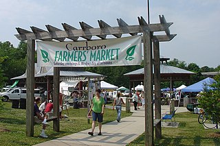
Carrboro is a town in Orange County in the U.S. state of North Carolina. The population was 21,295 at the 2020 census. The town, which is part of the Raleigh-Durham-Chapel Hill combined statistical area, was named after North Carolina industrialist Julian Shakespeare Carr.

<span class="mw-page-title-main">Fairmont, North Carolina</span> Town in North Carolina, United States

Fairmont is a town in Robeson County, North Carolina, United States. The population was 2,663 at the 2010 census.

<span class="mw-page-title-main">Lumberton, North Carolina</span> City in North Carolina, United States

Lumberton is a city in Robeson County, North Carolina, United States. As of 2020, its population was 19,025. It is the seat of Robeson County's government.

<span class="mw-page-title-main">Raynham, North Carolina</span> Town in North Carolina, United States

Raynham is a town in Robeson County, North Carolina, United States. The population was 72 at the 2010 census.

Oak Grove is an unincorporated community in northern Surry County, North Carolina, United States, located near Bottom.

<span class="mw-page-title-main">Bahama, North Carolina</span> Unincorporated community in North Carolina, United States

Bahama is an unincorporated community in northern Durham County, North Carolina, United States.

<span class="mw-page-title-main">Outline of North Carolina</span> Overview of and topical guide to North Carolina

The following outline is provided as an overview of and topical guide to the U.S. state of North Carolina. Wikipedia:WikiProject North Carolina Category:Top-importance North Carolina articles are indicated.

Purdie House and Purdie Methodist Church is a historic home and Methodist church located near Tar Heel, Bladen County, North Carolina. The house was built about 1803–1806, and is a two-story, four bay by two bay, brick Federal style dwelling. It has a steep gable roof and two-story gallery porches. Purdie Methodist Church is a mid-19th century temple-form Greek Revival style frame building.

<span class="mw-page-title-main">Moss Neck, North Carolina</span>

Moss Neck is a community in Robeson County, North Carolina, United States.

References

  1. "ArcGIS REST Services Directory". United States Census Bureau. Retrieved September 20, 2022.
  2. 1 2 U.S. Geological Survey Geographic Names Information System: Tar Heel, North Carolina
  3. "U.S. Census website". United States Census Bureau . Retrieved January 31, 2008.
  4. 1 2 "Geographic Identifiers: 2010 Demographic Profile Data (G001): Tar Heel town, North Carolina". U.S. Census Bureau, American Factfinder. Archived from the original on February 12, 2020. Retrieved February 6, 2014.
  5. Robeson, Elizabeth Ellis (1975). The Diary of Elizabeth Ellis Robeson Bladen County, North Carolina From 1847 to 1866 (Paperback ed.). Bladen Co. Historical Society. OCLC   2924746.
  6. "National Register Information System". National Register of Historic Places . National Park Service. July 9, 2010.
  7. "No one signs up to run for office in Tar Heel". WECT . July 15, 2011.
  8. "No one bothers to run in small NC town's election". Associated Press. July 15, 2011 via The San Diego Union-Tribune.
  9. "Cape Fear Region Results". Fayetteville Observer. November 9, 2011.
  10. Tar Heel Rural Volunteer Fire Department
  11. Plain View Elementary
  12. Tar Heel Middle School
  13. West Bladen High School
  14. "Census of Population and Housing". Census.gov. Retrieved June 4, 2015.
  15. "Profile of General Population and Housing Characteristics: 2010 Demographic Profile Data (DP-1): Tar Heel town, North Carolina". U.S. Census Bureau, American Factfinder. Archived from the original on February 12, 2020. Retrieved February 6, 2014.