Related Research Articles

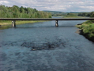
Temple is a town in Franklin County, Maine, United States. The town was named after Temple, New Hampshire. It is located at the end of Maine State Route 43, and is said to be one of only two towns in Maine to be situated at the end of a public highway. The population was 527 at the 2020 census.

The St. Croix River is a river in northeastern North America, 71 miles (114 km) in length, that forms part of the Canada–United States border between Maine (U.S.) and New Brunswick (Canada). The river rises in the Chiputneticook Lakes and flows south and southeast, between Calais and St. Stephen. It discharges into Passamaquoddy Bay, in the Bay of Fundy.

The Kennebec River is a 170-mile-long (270 km) river within the U.S. state of Maine. It rises in Moosehead Lake in west-central Maine. The East and West Outlets join at Indian Pond and the river flows southward. Harris Station Dam, the largest hydroelectric dam in the state, was constructed near that confluence. The river is joined at The Forks by its tributary the Dead River, also called the West Branch.

The Penobscot River is a 109-mile-long (175 km) river in the U.S. state of Maine. Including the river's West Branch and South Branch increases the Penobscot's length to 264 miles (425 km), making it the second-longest river system in Maine and the longest entirely in the state. Its drainage basin contains 8,610 square miles (22,300 km2).
The Aroostook River is a 112-mile-long (180 km) tributary of the Saint John River in the U.S. state of Maine and the Canadian province of New Brunswick. Its basin is the largest sub-drainage of the Saint John River.
The St. Francis River is a tributary of the Mississippi River, about 426 miles (686 km) long, in southeastern Missouri and northeastern Arkansas in the United States. The river drains a mostly rural area and forms part of the Missouri-Arkansas state line along the western side of the Missouri Bootheel.

The Farmington River is a river, 46.7 miles (75.2 km) in length along its main stem, located in northwest Connecticut with major tributaries extending into southwest Massachusetts. The longest route of the river, from the origin of its West Branch, is 80.4 miles (129.4 km) long, making it the Connecticut River's longest tributary by 2.3 miles (3.7 km) over the major river directly to its north, the Westfield River. The Farmington River's watershed covers 609 square miles (1,580 km2). Historically, the river played an important role in small-scale manufacturing in towns along its course, but it is now mainly used for recreation and drinking water.

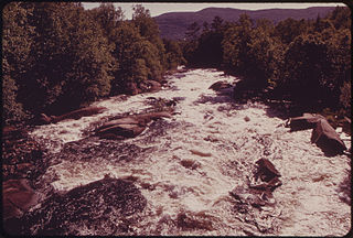
The Atlantic salmon is a species of ray-finned fish in the family Salmonidae. It is the third largest of the Salmonidae, behind Siberian taimen and Pacific Chinook salmon, growing up to a meter in length. Atlantic salmon are found in the northern Atlantic Ocean and in rivers that flow into it. Most populations are anadromous, hatching in streams and rivers but moving out to sea as they grow where they mature, after which the adults seasonally move upstream again to spawn.

The Androscoggin River is a river in the U.S. states of Maine and New Hampshire, in northern New England. It is 178 miles (286 km) long and joins the Kennebec River at Merrymeeting Bay in Maine before its water empties into the Gulf of Maine on the Atlantic Ocean. Its drainage basin is 3,530 square miles (9,100 km2) in area. The name "Androscoggin" comes from the Eastern Abenaki term /aləssíkɑntəkw/ or /alsíkɑntəkw/, meaning "river of cliff rock shelters" ; or perhaps from Penobscot /aləsstkɑtəkʷ/, meaning "river of rock shelters". The Anglicization of the Abenaki term is likely an analogical contamination with the colonial governor Edmund Andros.

The River Shin is a river in the Scottish North West Highlands.
The Magalloway River is a river in northwestern Maine and northern New Hampshire in the United States. It is a tributary of the Androscoggin River, which flows to the Kennebec River at Merrymeeting Bay in Maine, near the Atlantic Ocean. The total length of the river is 30 miles (48 km), or 48 miles (77 km) if the distances across intervening lakes are included.

The Naugatuck River is a 40.2-mile-long (64.7 km) river in the U.S. state of Connecticut. Its waters carve out the Naugatuck River Valley in the western reaches of the state, flowing generally due south and eventually emptying into the Housatonic River at Derby, Connecticut and thence 11 miles (18 km) to Long Island Sound. The Plume and Atwood Dam in Thomaston, completed in 1960 following the Great Flood of 1955, creates a reservoir on the river and is the last barrier to salmon and trout migrating up from the sea.

The River Hipper is a tributary of the River Rother in Derbyshire, England. Its source is a large expanse of wetlands, fed by the surrounding moors between Chatsworth and Chesterfield, known as the Hipper Sick on Beeley Moor, which is part of the Chatsworth Estate. It then passes through Holymoorside and down into Chesterfield, just south of the town centre, before flowing into the River Rother. In July 2007, parts of Chesterfield flooded when the River Hipper burst its banks during a substantial storm that caused extensive flooding in North Derbyshire and South Yorkshire. The river burst its banks again after torrential rain in October 2023. The surrounding landscape is known as the Hipper Valley.

Edwards Dam was a hydroelectric dam on the Kennebec River in the U.S. state of Maine. It was located in Augusta, Maine, about 40 miles (64 km) upstream from the Atlantic Ocean. Built in 1837 of timber and concrete, it was 917 feet (280 m) long and 24 feet (7.3 m) high. It is most famous for its removal in 1999, the first removal of a hydroelectric dam by the government against the wishes of the dam owner.

The Sandy River is a 73.3-mile-long (118.0 km) tributary of the Kennebec River in the U.S. state of Maine.

The Sheepscot River is a 66-mile-long (106 km) river in the U.S. state of Maine. Its lower portion is a complex island estuary with connections to the Kennebec River downstream of Merrymeeting Bay.

The West Branch Penobscot River is a 117-mile-long (188 km) tributary of the Penobscot River through the North Maine Woods in Maine. The river is also known as Abocadneticook, Kahgognamock, and Kettegwewick.

William Roorbach is an American novelist, short story and nature writer, memoirist, journalist, blogger and critic. He has authored fiction and nonfiction works including Big Bend, which won the Flannery O'Connor Award for Short Fiction and the O. Henry Prize. Roorbach's memoir in nature, Temple Stream, won the Maine Literary Award for Nonfiction, 2005. His novel, Life Among Giants, won the 2013 Maine Literary Award for Fiction.[18] And The Remedy for Love, also a novel, was one of six finalists for the 2014 Kirkus Fiction Prize.. His latest book, The Girl of the Lake, is a short story collection published in June 2017. His novel in progress is Lucky Turtle.
The Belgrade Lakes are a chain of lakes around Belgrade, Maine. The flow sequence is from East Pond to North Pond to Great Pond to Long Pond to Messalonskee Lake and thence via Messalonskee Stream to the Kennebec River at Waterville. The lakes have long been an important resort area for fishing, boating, and swimming; and shoreline development includes residences for individuals employed in the cities of Waterville and Augusta.

Climate change in Maine encompasses the effects of climate change, attributed to man-made increases in atmospheric carbon dioxide, methane, and nitrous oxides, in the U.S. state of Maine. The United States Environmental Protection Agency reports that Maine has warmed roughly three degrees F since 1900. Sea level in Maine has risen eight inches since the 1950s.
References
- 1 2 Press, Associated (2021-07-22). "Federal program will support Maine dam removal project to help salmon". Press Herald. Retrieved 2023-11-08.
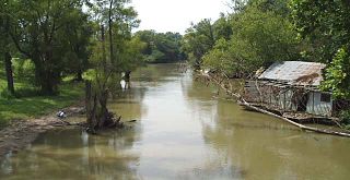
- ↑ Water Quality in Temple Stream, Farmington, Maine – Maine Department of Environmental Protection, April 2022
- ↑ "Temple Stream flowing freely for first time in 240 years – Daily Bulldog". 2022-08-08. Retrieved 2023-11-08.
- ↑ Revitalizing Temple Stream for the Farmington Community – Atlantic Salmon Federation
- ↑ admin_bm (2005-11-01). "A Review of: Temple Stream: A Rural Odyssey by Bill Roorbach". Believer Magazine. Retrieved 2023-11-08.