Franklin County, Maine

Last updated

Franklin County
Franklin County Courthouse Farmington 5.JPG
Franklin County Courthouse
Map of Maine highlighting Franklin County.svg
Location within the U.S. state of Maine
Maine in United States.svg
Maine's location within the U.S.
Coordinates: 44°52′45″N70°23′17″W / 44.879196°N 70.387917°W / 44.879196; -70.387917
CountryFlag of the United States.svg United States
StateFlag of Maine.svg  Maine
FoundedMay 9, 1838
Named for Benjamin Franklin
Seat Farmington
Largest townFarmington
Area
  Total1,743 sq mi (4,510 km2)
  Land1,697 sq mi (4,400 km2)
  Water47 sq mi (120 km2)  2.7%
Population
 (2020)
  Total29,456 Decrease2.svg
  Density17.4/sq mi (6.7/km2)
Time zone UTC−5 (Eastern)
  Summer (DST) UTC−4 (EDT)
Congressional district 2nd
Website franklincountymaine.gov

Franklin County is a county located in the state of Maine, United States. As of the 2020 census, the population was 29,456, [1] making it the second-least populous county in Maine. Its county seat is Farmington. [2] The county was established on May 9, 1838, and named for Benjamin Franklin. [3]

Contents

History

Franklin County was formed on 9 May 1838 from portions of Kennebec, Oxford and Somerset counties. Smaller adjustments were made during the following fourteen years. [4]

Geography

According to the U.S. Census Bureau, the county has a total area of 1,743 square miles (4,510 km2), of which 1,697 square miles (4,400 km2) is land and 47 square miles (120 km2) (2.7%) is water. [5] The county high point is Sugarloaf Mountain, the ski mountain in Carrabassett Valley whose elevation is 4237 feet.

Adjacent counties and municipalities

Demographics

Historical population
CensusPop.Note
1840 20,801
1850 20,027−3.7%
1860 20,4031.9%
1870 18,807−7.8%
1880 18,180−3.3%
1890 17,053−6.2%
1900 18,4448.2%
1910 19,1193.7%
1920 19,8253.7%
1930 19,9410.6%
1940 19,896−0.2%
1950 20,6824.0%
1960 20,069−3.0%
1970 22,44411.8%
1980 27,09820.7%
1990 29,0087.0%
2000 29,4671.6%
2010 30,7684.4%
2020 29,456−4.3%
2023 (est.)30,828 [6] 4.7%
U.S. Decennial Census [7]
1790–1960 [8] 1900–1990 [9]
1990–2000 [10] 2010–2016 [11]

2015

As of 2015 the largest self-reported ancestry groups in Franklin County, Maine are: [12]

Largest ancestries (2015)Percent
English Flag of England.svg 22.4%
French or French Canadian Flag of France.svg Drapeau Franco-Americain.svg19.1%
Irish Flag of Ireland.svg 14.9%
"American" Flag of the United States.svg 8.5%
German Flag of Germany.svg 6.1%
Scottish Flag of Scotland.svg 5.0%
Italian Flag of Italy.svg 4.2%
Scots-Irish Flag of Ulster.svg 1.7%

2000 census

As of the census [13] of 2000, there were 29,467 people, 11,806 households, and 7,744 families living in the county. The population density was 17 people per square mile (6.6 people/km2). There were 19,159 housing units at an average density of 11 per square mile (4.2/km2). The racial makeup of the county was 97.96% White, 0.24% Black or African American, 0.37% Native American, 0.43% Asian, 0.02% Pacific Islander, 0.17% from other races, and 0.81% from two or more races. 0.54% of the population were Hispanic or Latino of any race. 26.3% were of English, 13.8% United States or American, 12.2% French, 9.2% Irish, 7.9% French Canadian, and 5.3% Scottish ancestry according to Census 2000. 95.7% spoke English and 2.9% French as their first language.

There were 11,806 households, out of which 29.50% had children under the age of 18 living with them, 52.40% were married couples living together, 9.20% had a female householder with no husband present, and 34.40% were non-families. 25.80% of all households were made up of individuals, and 10.50% had someone living alone who was 65 years of age or older. The average household size was 2.40 and the average family size was 2.88.

In the county, the population was spread out, with 23.50% under the age of 18, 11.10% from 18 to 24, 26.40% from 25 to 44, 24.80% from 45 to 64, and 14.20% who were 65 years of age or older. The median age was 38 years. For every 100 females there were 93.40 males. For every 100 females age 18 and over, there were 89.20 males.

The median income for a household in the county was $31,459, and the median income for a family was $37,863. Males had a median income of $30,475 versus $20,442 for females. The per capita income for the county was $15,796. About 10.70% of families and 14.60% of the population were below the poverty line, including 17.90% of those under age 18 and 9.50% of those age 65 or over.

2010 census

As of the 2010 United States Census, there were 30,768 people, 13,000 households, and 8,129 families living in the county. [14] The population density was 18.1 inhabitants per square mile (7.0/km2). There were 21,709 housing units at an average density of 12.8 per square mile (4.9/km2). [15] The racial makeup of the county was 97.3% white, 0.4% Asian, 0.4% American Indian, 0.2% black or African American, 0.2% from other races, and 1.4% from two or more races. Those of Hispanic or Latino origin made up 1.0% of the population. [14] In terms of ancestry, 23.3% were English, 14.2% were Irish, 7.7% were French Canadian, 7.5% were German, 6.4% were Scottish, and 5.0% were American. [16]

Of the 13,000 households, 26.2% had children under the age of 18 living with them, 48.6% were married couples living together, 9.4% had a female householder with no husband present, 37.5% were non-families, and 28.9% of all households were made up of individuals. The average household size was 2.28 and the average family size was 2.76. The median age was 43.4 years. [14]

The median income for a household in the county was $39,831 and the median income for a family was $48,634. Males had a median income of $38,563 versus $30,024 for females. The per capita income for the county was $20,838. About 10.2% of families and 15.5% of the population were below the poverty line, including 21.2% of those under age 18 and 8.8% of those age 65 or over. [17]

Politics

Voter registration

Voter registration and party enrollment as of March 2024 [18]
Republican 7,439
Unenrolled6,210
Democratic 5,985
Green Independent 924
No Labels 166
Libertarian 52
Total20,776
United States presidential election results for Franklin County, Maine [19]
Year Republican Democratic Third party
No.%No.%No.%
2020 8,75450.34%8,06946.40%5673.26%
2016 7,91848.02%7,01642.55%1,5549.43%
2012 6,36939.12%9,36757.53%5463.35%
2008 6,62738.58%10,11358.87%4382.55%
2004 7,37842.74%9,46554.83%4182.42%
2000 6,45941.81%7,59349.15%1,3969.04%
1996 3,75725.74%7,75953.16%3,08021.10%
1992 4,60827.89%6,73940.79%5,17631.33%
1988 7,18054.16%5,96044.96%1160.88%
1984 8,33062.40%4,95437.11%650.49%
1980 5,68046.83%4,97941.05%1,46912.11%
1976 5,79950.94%5,14045.15%4453.91%
1972 5,95866.50%2,98833.35%140.16%
1968 4,12748.01%4,30750.10%1621.88%
1964 2,88733.29%5,78466.69%20.02%
1960 6,13665.00%3,30435.00%00.00%
1956 6,30778.97%1,68021.03%00.00%
1952 5,88573.23%2,13726.59%140.17%
1948 3,74163.19%2,13536.06%440.74%
1944 4,12760.90%2,64639.04%40.06%
1940 4,54858.47%3,22441.44%70.09%
1936 4,95762.53%2,85936.06%1121.41%
1932 4,52158.46%3,17141.01%410.53%
1928 4,92376.54%1,48723.12%220.34%
1924 3,38972.40%1,12323.99%1693.61%
1920 3,82069.13%1,66830.18%380.69%
1916 1,98849.89%1,90847.88%892.23%
1912 66817.57%1,42137.37%1,71445.07%
1908 2,17368.40%93029.27%742.33%
1904 2,13572.25%75525.55%652.20%
1900 2,23565.99%1,08532.03%671.98%
1896 2,57872.60%88624.95%872.45%
1892 1,96455.50%1,45641.14%1193.36%
1888 2,48560.95%1,51837.23%741.82%
1884 2,38757.80%1,37533.29%3688.91%
1880 2,39051.49%2,17846.92%741.59%
1876 2,11657.58%1,55942.42%00.00%
1872 2,18770.30%92429.70%00.00%
1868 2,42963.32%1,40736.68%00.00%
1864 2,24855.67%1,79044.33%00.00%
1856 2,52964.71%1,35834.75%210.54%
1852 99734.34%1,31045.13%59620.53%
1848 88628.33%1,43145.76%81025.90%
1844 1,13236.13%1,60951.36%39212.51%
1840 1,84847.05%2,05852.39%220.56%

Government

Franklin County is governed by a three-member county commission. Commissioners meet at 10am on the first and third Monday of each month and are elected in the November general election, serving four year terms. Currently, the three commissioners are: [20]

District One: Gary McGrane (Jay, Wilton, Temple, Carthage)

District Two: Charles Webster (Farmington, Chesterville, New Sharon)

District Three: Clyde Barker (Avon, Carrabassett Valley, Coplin Plantation, Dallas Plantation, Eustis, Industry, Kingfield, New Vineyard, Phillips, Rangeley Plantation, Rangeley, Sandy River Plantation, Strong, Weld, and unorganized territories of East Central Franklin, North Franklin, South Franklin, West Central Franklin and Wyman)

Commissioner Charles Webster was appointed by Governor Paul LePage in 2015 to serve out the rest of Fred Hardy's term, who died on July 4. [21] Webster and Barker are members of the Republican Party, while McGrane belongs to the Democratic Party.

Franklin County belongs to Maine Prosecutorial District Three, which is composed of Franklin, Oxford and Androscoggin Counties. The current district attorney is Andrew S. Robinson, of Farmington who was elected to his first term in 2014. The deputy district attorney is James A. Andrews, who was appointed to that post by Robinson in 2015. [22]

The current county treasurer is Pamela Prodan. She was elected to that position in 2014 and will serve a four term through December 2018. Prodan succeeded Mary Frank, who decided to retire instead of running for a second term. The duties of county treasurer include: overseeing fiscal accounting matters, including paying bills, collecting amounts owed the county, reserve/investment accounts, maintaining the county's financial records and other matters related to the county's finances. [23]

Law enforcement

Only five municipalities in Franklin County have their own police department (Carrabassett Valley, Farmington, Jay, Rangeley, and Wilton). The Franklin County Sheriff's Department is responsible for patrol and emergency calls in the remaining communities in the county without their own agency. The current sheriff is Scott Nichols, of New Sharon. Nichols was elected to that post in November 2012, defeating incumbent sheriff, Dennis Pike. Pike had spent 46 years in Franklin County law enforcement prior to being defeated by Nichols. [24]

The status of the Franklin County Jail has been contentiously debated issue within the county and state for several years. In 2008, Governor John Baldacci signed into law a bill which consolidated county jails in an effort to reduce costs. As a result, the Franklin County jail was designated a 72-hour holding facility. Any inmates who needed to be held longer than the three-day maximum had to be transported to the Somerset County Jail in East Madison, which county jail officials said was a waste of department time and money. Jail consolidation has also led to jail overcrowding statewide. [25] When the Somerset Jail reached its maximum capacity, inmates were forced to be transported to another jail within the state, sometimes hours away which Franklin County officials again said wasted time and money.

In 2012, the Somerset County Commissioners voted not to accept any more inmates from outside the county as the state Board of Corrections withheld its third quarter payment. While the vote allowed current inmates to stay at the jail, it required all future inmates to be sent to Two Bridges Regional Jail in Wiscasset. In 2013, the Maine Legislature's Public Safety and Criminal Justice Committee voted 11–0 to allow the Franklin County jail to return to full service status. [26]

In 2014, the Franklin County Commissioners voted to withhold all payments to the state for jail inmates. Public outrage over the jail issue also pressured the state to give the county full service rights. In 2014 an 800-member Facebook group was created and several protests were staged in front of the county courthouse. In 2015, the State Board of Corrections voted to grant the county a fully operational jail, officially ending the seven year conflict between the county and the state. [27]

Communities

Smalls Falls Rest Area on Route 4 just south of Rangeley, Maine Smalls Falls.jpg
Smalls Falls Rest Area on Route 4 just south of Rangeley, Maine

Towns

Plantations

Census-designated places

Unorganized territories

Unincorporated communities

See also

Related Research Articles

<span class="mw-page-title-main">Somerset County, Maine</span> County in Maine, United States

Somerset County is a county in the state of Maine, United States. As of the 2020 census, the population was 50,477. Its county seat is Skowhegan.

Avon is a town in Franklin County, Maine, United States. The population was 450 at the 2020 census. Avon is home to Mount Blue, part of Mount Blue State Park.

Carrabassett Valley is a town in Franklin County, Maine, United States. The population was 673 at the 2020 census.

<span class="mw-page-title-main">Carthage, Maine</span> Town in the state of Maine, United States

Carthage is a town in Franklin County, Maine, United States. The population was 509 at the 2020 census.

<span class="mw-page-title-main">Kingfield, Maine</span> Town in the state of Maine, United States

Kingfield is a town in Franklin County, Maine, United States. The population was 960 at the 2020 census. Kingfield, the primary village in the town, is a census-designated place.

<span class="mw-page-title-main">Phillips, Maine</span> Town in the state of Maine, United States

Phillips is a town in Franklin County, Maine, United States. The population was 898 at the 2020 census. It is home to the Sandy River and Rangeley Lakes Railroad, a heritage railroad.

<span class="mw-page-title-main">Sandy River Plantation, Maine</span> Plantation in Maine, United States

Sandy River Plantation is a plantation in Franklin County, Maine, United States. The population was 128 at the 2020 census. It is home to the popular Saddleback Mountain Ski Resort and the Rangeley Lakes Nordic Trail Center.

Brighton Plantation is a plantation in Somerset County, Maine, United States. The population was 62 at the 2020 census.

Embden is a town in Somerset County, Maine, United States. The population was 902 at the 2020 census.

<span class="mw-page-title-main">New Portland, Maine</span> Town in the state of Maine, United States

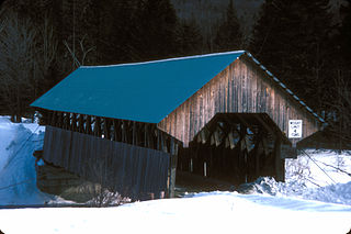
New Portland is a town in Somerset County, Maine, United States. It is perhaps best known for its Wire Bridge, a cable suspension bridge completed in 1866 that is the last remaining bridge of its type in Maine, and possibly the U.S. Much of North New Portland's Main Street burned to the ground in the fire of 1919, including a hotel. The annual town fair draws large crowds from around, and is held in September. The population was 765 at the 2020 census. The town was given to the residents of Falmouth by the Massachusetts legislature to repay them for their loss when the British fleet burned Falmouth in 1775.

North Franklin is an unorganized territory in Franklin County, Maine, United States. The population was 41 at the 2020 census. The territory consists of 13 townships and three gores, namely Lang, Davis, Tim Pond, Stetsontown, Jim Pond, Alder Stream, Seven Ponds, Kibby, Chain of Ponds, Massachusetts Gore, Coburn Gore, Skinner, Merrill Strip, Lowelltown, Gorham Gore, and Beattie.

<span class="mw-page-title-main">Farmington, Maine</span> Town in Maine, United States

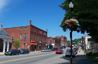
Farmington is a town in and the county seat of Franklin County, Maine, United States. As of the 2020 census, its population was 7,592. Farmington is home to the University of Maine at Farmington, Nordica Memorial Auditorium, the Nordica Homestead, and the annual Farmington Fair.

<span class="mw-page-title-main">Lincoln Plantation, Maine</span> Plantation in Maine, United States

Lincoln Plantation is a plantation in Oxford County, Maine, United States. It contains the village of Wilson's Mills. The population was 41 at the 2020 census.

<span class="mw-page-title-main">Farmington (CDP), Maine</span> Census-designated place in Maine, United States

Farmington is a census-designated place (CDP) comprising the center of the town of Farmington, which is the county seat of Franklin County in Maine, United States. The population of the CDP was 4,288 at the 2010 census, out of 7,760 people in the town as a whole. The University of Maine at Farmington is located within the CDP.

<span class="mw-page-title-main">Rangeley Plantation, Maine</span> Plantation in Maine, United States

Rangeley Plantation is a plantation in Franklin County, Maine, United States. The population was 184 at the 2020 census.

<span class="mw-page-title-main">Rangeley, Maine</span> Town in the state of Maine, United States

Rangeley is a town in Franklin County, Maine, United States. The population was 1,222 at the 2020 census. Rangeley is the center of the Rangeley Lakes Region, a resort area. The town includes the villages of Rangeley and Oquossoc, as well as the communities of Mooselookmeguntic, Bald Mountain, Mountainview, and South Rangeley.

<span class="mw-page-title-main">Wilton (CDP), Maine</span> Census-designated place in Maine, United States

Wilton is a census-designated place (CDP) consisting of the main settlement within the town of Wilton in Franklin County, Maine, United States. The CDP population was 2,198 at the 2010 census, out of a total town population of 4,116.

<span class="mw-page-title-main">Wilton, Maine</span> Town in Maine, United States

Wilton is a town in Franklin County, Maine, United States. The population was 3,835 at the 2020 census. Situated beside Wilson Pond, the former mill town is today primarily a recreation area.

<span class="mw-page-title-main">Anson, Maine</span> Town in the state of Maine, United States

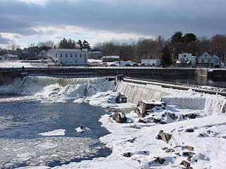
Anson is a town in Somerset County, Maine, United States. The population was 2,291 at the time of the 2020 census. It includes the villages of Anson and North Anson.

Kingfield is a census-designated place (CDP) and the primary village in the town of Kingfield, Franklin County, Maine, United States. It is in the southeastern part of the town, along the Carrabassett River where it is joined by its West Branch. It is bordered partly to the south by the town of New Portland in Somerset County.

References

  1. "Census - Geography Profile: Franklin County, Maine". United States Census Bureau . Retrieved November 21, 2021.
  2. "Find a County". National Association of Counties. Archived from the original on May 31, 2011. Retrieved June 7, 2011.
  3. Gannett, Henry (1905). The Origin of Certain Place Names in the United States. Govt. Print. Off. pp.  131.
  4. Maine – An Encyclopedia: Franklin County. Accessed 20 Feb 2023.
  5. "2010 Census Gazetteer Files". United States Census Bureau. August 22, 2012. Archived from the original on September 9, 2014. Retrieved September 7, 2014.
  6. "Annual Estimates of the Resident Population for Counties: April 1, 2020 to July 1, 2023". United States Census Bureau. Retrieved April 3, 2024.
  7. "U.S. Decennial Census". United States Census Bureau. Retrieved September 7, 2014.
  8. "Historical Census Browser". University of Virginia Library. Retrieved September 7, 2014.
  9. "Population of Counties by Decennial Census: 1900 to 1990". United States Census Bureau. Retrieved September 7, 2014.
  10. "Census 2000 PHC-T-4. Ranking Tables for Counties: 1990 and 2000" (PDF). United States Census Bureau. Archived (PDF) from the original on March 27, 2010. Retrieved September 7, 2014.
  11. "State & County QuickFacts". United States Census Bureau. Archived from the original on June 6, 2011. Retrieved August 19, 2013.
  12. Bureau, U.S. Census. "American FactFinder - Results". factfinder.census.gov. Archived from the original on February 13, 2020. Retrieved April 18, 2018.
  13. "U.S. Census website". United States Census Bureau . Retrieved January 31, 2008.
  14. 1 2 3 "DP-1 Profile of General Population and Housing Characteristics: 2010 Demographic Profile Data". United States Census Bureau. Archived from the original on February 13, 2020. Retrieved January 21, 2016.
  15. "Population, Housing Units, Area, and Density: 2010 - County". United States Census Bureau. Archived from the original on February 13, 2020. Retrieved January 21, 2016.
  16. "DP02 Selected Social Characteristics in the United States – 2006-2010 American Community Survey 5-Year Estimates". United States Census Bureau. Archived from the original on February 13, 2020. Retrieved January 21, 2016.
  17. "DP03 SELECTED ECONOMIC CHARACTERISTICS – 2006-2010 American Community Survey 5-Year Estimates". United States Census Bureau. Archived from the original on February 13, 2020. Retrieved January 21, 2016.
  18. Bureau of Corporations, Elections & Commissions (March 29, 2024). "Registered & Enrolled Voters Statewide" (PDF). Maine SOS. Retrieved April 9, 2024.
  19. Leip, David. "Dave Leip's Atlas of U.S. Presidential Elections". uselectionatlas.org. Retrieved April 18, 2018.
  20. "franklincountyme-gov". franklincountyme-gov. Retrieved May 24, 2016.
  21. Perry, Donna M.; Journal, Sun (August 10, 2015). "LePage appoints Charlie Webster as Franklin County commissioner". The Bangor Daily News. Retrieved May 24, 2016.
  22. "franklincountyme-gov". franklincountyme-gov. Retrieved May 24, 2016.
  23. "franklincountyme-gov". franklincountyme-gov. Retrieved May 24, 2016.
  24. Schroeder, Karen (December 30, 2012). "After 46 years, Franklin County Sheriff Dennis Pike hits the road". Central Maine. Retrieved May 24, 2016.
  25. "Overcrowding intensifies problems at Maine's county jails - The Portland Press Herald / Maine Sunday Telegram". The Portland Press Herald / Maine Sunday Telegram. January 19, 2015. Retrieved May 26, 2016.
  26. "Bill to return local jail to full service fails; Somerset County refuses Franklin County's detainees | Daily Bulldog". www.dailybulldog.com. April 2, 2013. Retrieved May 26, 2016.
  27. Schroeder, Kaitlin (January 13, 2015). "Franklin County jail to return to full-time lockup status". Central Maine. Retrieved May 26, 2016.

44°59′N70°26′W / 44.98°N 70.44°W / 44.98; -70.44