Demographics
2010 census
As of the census [4] of 2010, there were 757 people, 325 households, and 216 families living in the town. The population density was 21.2 inhabitants per square mile (8.2/km2). There were 503 housing units at an average density of 14.1 per square mile (5.4/km2). The racial makeup of the town was 96.2% White, 0.4% Native American, 0.5% Asian, and 2.9% from two or more races. Hispanic or Latino of any race were 0.7% of the population.
There were 325 households, of which 27.4% had children under the age of 18 living with them, 55.4% were married couples living together, 7.4% had a female householder with no husband present, 3.7% had a male householder with no wife present, and 33.5% were non-families. 26.5% of all households were made up of individuals, and 9.2% had someone living alone who was 65 years of age or older. The average household size was 2.33 and the average family size was 2.76.
The median age in the town was 46 years. 20.7% of residents were under the age of 18; 7.5% were between the ages of 18 and 24; 20.6% were from 25 to 44; 37% were from 45 to 64; and 14.1% were 65 years of age or older. The gender makeup of the town was 48.2% male and 51.8% female.
2000 census
As of the census [5] of 2000, there were 725 people, 279 households, and 198 families living in the town. The population density was 20.2 people per square mile (7.8/km2). There were 432 housing units at an average density of 12.0 per square mile (4.7/km2). The racial makeup of the town was 98.07% White, 0.41% African American, 0.14% Native American, 0.14% Asian, 0.14% from other races, and 1.10% from two or more races. Hispanic or Latino of any race were 0.28% of the population.
There were 279 households, out of which 34.1% had children under the age of 18 living with them, 59.9% were married couples living together, 7.2% had a female householder with no husband present, and 29.0% were non-families. 21.5% of all households were made up of individuals, and 8.2% had someone living alone who was 65 years of age or older. The average household size was 2.60 and the average family size was 3.07.
In the town, the population was spread out, with 28.4% under the age of 18, 7.0% from 18 to 24, 26.9% from 25 to 44, 27.2% from 45 to 64, and 10.5% who were 65 years of age or older. The median age was 39 years. For every 100 females, there were 95.4 males. For every 100 females age 18 and over, there were 98.9 males.
The median income for a household in the town was $29,688, and the median income for a family was $33,646. Males had a median income of $26,776 versus $18,250 for females. The per capita income for the town was $15,268. About 11.4% of families and 14.0% of the population were below the poverty line, including 12.2% of those under age 18 and 21.4% of those age 65 or over.

Sardis City is a town in Etowah and Marshall counties in the U.S. state of Alabama. It is part of the Gadsden Metropolitan Statistical Area. It originally incorporated in May 1963 under the name of "Sardis". It became Sardis City in the 1980s. At the 2020 census, the population was 1,814.

Granite Hills is a census-designated place in San Diego County, California. The name is also applied to a neighborhood within the city limits of El Cajon in the eastern part of that city. The population of the CDP, which does not include the people living within the city of El Cajon, was 3,035 at the 2010 census, down from 3,246 at the 2000 census.

Hersey is a town in Aroostook County, Maine, United States. The population was 73 at the 2020 census.

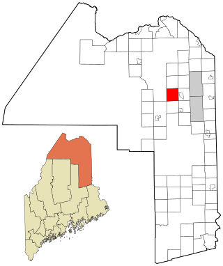
Masardis is a town in Aroostook County, Maine, United States. The population was 204 at the 2020 census.

Merrill is a town in Aroostook County, Maine, United States. The population was 208 at the 2020 census.

New Canada is a town in Aroostook County, Maine, United States. The population was 310 at the 2020 census.
Wade is a town in Aroostook County, Maine, United States. The population was 229 at the 2020 census.
Otis is a town in Hancock County, Maine, United States. The population was 673 at the 2020 census.
Waltham is a town in Hancock County, Maine, United States. The population was 332 at the 2020 census.

Vienna is a town in Kennebec County, Maine, United States. The population was 578 at the 2020 census.
Plymouth is a town in Penobscot County, Maine, United States. The population was 1,325 at the 2020 census.
Detroit is a town in Somerset County, Maine, United States. The population was 885 at the 2020 census.

Burnham is a town in Waldo County, Maine, United States. The population was 1,096 at the 2020 census.
Cooper is a town in Washington County, Maine, United States. The community was named after General John Cooper, a landowner. The population was 168 at the 2020 census.

Lancaster is a city in Kittson County, Minnesota, United States. As of the 2020 census, the city population was 364.

McSherrystown is a borough in Adams County, Pennsylvania, United States. The population was 3,077 as of the 2020 census.

North Hills is a town in Wood County, West Virginia, United States. It is a suburb of Parkersburg. The population was 837 at the 2020 census. North Hills was incorporated on February 15, 1979.

Altoona is a city in Eau Claire County, Wisconsin, United States. The population was 8,292 at the 2020 census with an estimated population in 2022 of 9,149. The city is a railroad terminal on the Union Pacific Railroad.

Taylor is a village in Jackson County, Wisconsin, United States, along the Trempealeau River. The population was 484 at the 2020 census.

Lohrville is a village in Waushara County, Wisconsin, United States. The population was 402 at the 2010 census.
This page is based on this
Wikipedia article Text is available under the
CC BY-SA 4.0 license; additional terms may apply.
Images, videos and audio are available under their respective licenses.

