Burnham, Maine

Last updated

Burnham, Maine
Waldo County Maine Incorporated Areas Burnham Highlighted.png
Location of Burnham (in yellow) in Waldo County and the state of Maine
Coordinates: 44°40′50″N69°23′1″W / 44.68056°N 69.38361°W / 44.68056; -69.38361
Country United States
State Maine
County Waldo
Area
[1]
  Total41.22 sq mi (106.76 km2)
  Land38.89 sq mi (100.72 km2)
  Water2.33 sq mi (6.03 km2)
Elevation
200 ft (61 m)
Population
 (2020)
  Total1,096
  Density28/sq mi (10.9/km2)
Time zone UTC-5 (Eastern (EST))
  Summer (DST) UTC-4 (EDT)
ZIP code
04922
Area code 207
FIPS code 23-09270
GNIS feature ID0582379

Burnham is a town in Waldo County, Maine, United States. The population was 1,096 at the 2020 census. [2]

Contents

Geography

According to the United States Census Bureau, the town has a total area of 41.22 square miles (106.76 km2), of which 38.89 square miles (100.72 km2) is land and 2.33 square miles (6.03 km2) is water, chiefly Unity Pond. The town is drained by Twentyfive Mile Stream and the Sebasticook River. [1]

Burnham is crossed by Interstate 95, Maine State Route 11 and 100. The town is bordered by Pittsfield on the north, Detroit on the northeast, Troy on the east, Unity and Unity Township on the south and Clinton on the west.

Demographics

Historical population
CensusPop.Note
1830 409
1840 60247.2%
1850 78430.2%
1860 8579.3%
1870 788−8.1%
1880 96722.7%
1890 846−12.5%
1900 766−9.5%
1910 733−4.3%
1920 643−12.3%
1930 6643.3%
1940 643−3.2%
1950 7069.8%
1960 7556.9%
1970 8026.2%
1980 95118.6%
1990 9611.1%
2000 1,14218.8%
2010 1,1641.9%
2020 1,096−5.8%
U.S. Decennial Census [3]

2010 census

As of the census [4] of 2010, there were 1,164 people, 502 households, and 332 families living in the town. The population density was 29.9 inhabitants per square mile (11.5/km2). There were 714 housing units at an average density of 18.4 per square mile (7.1/km2). The racial makeup of the town was 98.4% White, 0.2% African American, 0.2% Native American, 0.2% Asian, 0.1% from other races, and 1.0% from two or more races. Hispanic or Latino of any race were 0.3% of the population.

There were 502 households, of which 28.5% had children under the age of 18 living with them, 48.8% were married couples living together, 10.2% had a female householder with no husband present, 7.2% had a male householder with no wife present, and 33.9% were non-families. 27.1% of all households were made up of individuals, and 9% had someone living alone who was 65 years of age or older. The average household size was 2.32 and the average family size was 2.75.

The median age in the town was 43.3 years. 20.5% of residents were under the age of 18; 9.5% were between the ages of 18 and 24; 22.3% were from 25 to 44; 33.7% were from 45 to 64; and 13.9% were 65 years of age or older. The gender makeup of the town was 52.3% male and 47.7% female.

2000 census

As of the census [5] of 2000, there were 1,142 people, 442 households, and 326 families living in the town. The population density was 29.3 inhabitants per square mile (11.3/km2). There were 649 housing units at an average density of 16.7 per square mile (6.4/km2). The racial makeup of the town was 96.85% White, 0.18% African American, 0.44% Native American, 0.09% Asian, 0.53% from other races, and 1.93% from two or more races. Hispanic or Latino of any race were 0.35% of the population.

There were 442 households, out of which 34.4% had children under the age of 18 living with them, 59.5% were married couples living together, 9.0% had a female householder with no husband present, and 26.2% were non-families. 20.6% of all households were made up of individuals, and 7.0% had someone living alone who was 65 years of age or older. The average household size was 2.58 and the average family size was 2.97.

In the town, the population was spread out, with 26.4% under the age of 18, 7.4% from 18 to 24, 28.8% from 25 to 44, 26.6% from 45 to 64, and 10.8% who were 65 years of age or older. The median age was 37 years. For every 100 females, there were 103.2 males. For every 100 females age 18 and over, there were 103.1 males.

The median income for a household in the town was $31,071, and the median income for a family was $33,580. Males had a median income of $23,828 versus $21,053 for females. The per capita income for the town was $14,030. About 13.8% of families and 16.0% of the population were below the poverty line, including 23.3% of those under age 18 and 7.8% of those age 65 or over.

Related Research Articles

<span class="mw-page-title-main">Underwood-Petersville, Alabama</span> Census-designated place in Alabama, United States

Underwood-Petersville is a census-designated place (CDP) in Lauderdale County, Alabama United States. It is part of the Florence - Muscle Shoals Metropolitan Statistical Area known as "The Shoals". As of the 2010 census, the population of the CDP is 3,247.
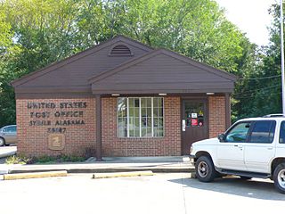
<span class="mw-page-title-main">Steele, Alabama</span> Town in Alabama, United States

Steele is a town in northeastern St. Clair County, Alabama, United States. It was incorporated in 1952. At the 2010 census the population was 1,043, down from 1,093. The town is a part of the Birmingham–Hoover–Cullman Combined Statistical Area. It was initially known as Steel's Station or Steele's Depot in the late 19th century.

<span class="mw-page-title-main">Eagle Lake, Maine</span> Town in the state of Maine, United States

Eagle Lake is a town in Aroostook County, Maine, United States. The population was 772 at the 2020 census. The town was named by a body of troops heading from Bangor to the Aroostook War for the many eagles that they saw around the lake. A total of 49.0% of the population speaks French, reflecting a trend in Northeastern Maine.

<span class="mw-page-title-main">Mapleton, Maine</span> Town in the state of Maine, United States

Mapleton is a town in Aroostook County, Maine, United States. The population was 1,886 at the 2020 census.

<span class="mw-page-title-main">Sherman, Maine</span> Town in the state of Maine, United States

Sherman is a town in Aroostook County, Maine, United States. The population was 815 at the 2020 census.

Orland is a town in Hancock County, Maine, United States. The population was 2,221 at the 2020 census.

Otis is a town in Hancock County, Maine, United States. The population was 673 at the 2020 census.

Waltham is a town in Hancock County, Maine, United States. The population was 332 at the 2020 census.

<span class="mw-page-title-main">Vienna, Maine</span> Town in the state of Maine, United States

Vienna is a town in Kennebec County, Maine, United States. The population was 578 at the 2020 census.

<span class="mw-page-title-main">Hartford, Maine</span> Town in the state of Maine, United States

Hartford is a town in Oxford County, Maine, United States. Hartford is included in the Lewiston-Auburn, Maine metropolitan New England City and Town Area. The population was 1,203 at the 2020 census.

Bradley is a town in Penobscot County, Maine, United States. It is part of the Bangor Metropolitan Statistical Area. The population was 1,532 at the 2020 census. The village of Bradley is in the northwestern corner of the town.

Winn is a town in Penobscot County, Maine, United States, on the east bank of the Penobscot River. The town was named for John M. Winn, an early landholder. The population was 399 at the 2020 census.

<span class="mw-page-title-main">Abbot, Maine</span> Town in the state of Maine, United States

Abbot is a town in Piscataquis County, Maine, United States. The population was 650 at the 2020 census. It was named for the treasurer of Bowdoin College, John Abbot.

Detroit is a town in Somerset County, Maine, United States. The population was 885 at the 2020 census.

<span class="mw-page-title-main">Brooks, Maine</span> Town in the state of Maine, United States

Brooks is a town in Waldo County, Maine, United States. The population was 1,010 at the 2020 census.

<span class="mw-page-title-main">Troy, Maine</span> Town in the state of Maine, United States

Troy is a town in Waldo County, Maine, United States. The population was 1,018 at the 2020 census.

<span class="mw-page-title-main">Cherryfield, Maine</span> Town in Maine, United States

Cherryfield is a town in Washington County, Maine, United States on the Narraguagus River. It was named for the wild cherries that once peppered the banks of the river. The town population was 1,107 at the 2020 census. The town bills itself as the "Blueberry Capital of the World". Roughly 75 acres (300,000 m2) on both sides of the river are a historic district on the National Register of Historic Places known as the Cherryfield Historic District. This district comprises a collection of period structures dating from c. 1750–1890. The town was first settled about 1760. In 1826,the part of Steuben known as Narraguagus was annexed onto Cherryfield.

<span class="mw-page-title-main">North Hills, West Virginia</span> Town in West Virginia, United States

North Hills is a town in Wood County, West Virginia, United States. It is a suburb of Parkersburg. The population was 837 at the 2020 census. North Hills was incorporated on February 15, 1979.

<span class="mw-page-title-main">Clinton, Maine</span> Town in the state of Maine, United States

Clinton is a town in Kennebec County, Maine, United States. The town was named for New York Governor DeWitt Clinton. The population was 3,370 at the 2020 census. The main village in town is the Clinton census-designated place, with a population of 1,386 at the 2020 census.

Unity is a town in Waldo County, Maine, United States. The population was 2,292 at the 2020 census. The town is the service center for the northern portion of Waldo County. Outside of Waldo County, it is best known as the home of the Maine Organic Farmers and Gardeners Association, its Common Ground Country Fair and Unity College. Unity College was founded in 1965 to offset the economic effects of the declining chicken farming industry. As of 2007, the college is the town's largest employer.

References

  1. 1 2 "US Gazetteer files 2010". United States Census Bureau . Retrieved December 16, 2012.
  2. "Census - Geography Profile: Burnham town, Waldo County, Maine" . Retrieved January 21, 2022.
  3. "Census of Population and Housing". Census.gov. Retrieved June 4, 2015.
  4. "U.S. Census website". United States Census Bureau . Retrieved December 16, 2012.
  5. "U.S. Census website". United States Census Bureau . Retrieved January 31, 2008.

44°41′34″N69°25′39″W / 44.69278°N 69.42750°W / 44.69278; -69.42750