Northport, Maine

Last updated

Northport, Maine
Famous Northport Inn and Eastern Steamship Company's Landing, Northport, Me (NYPL b12647398-79308).tiff
Postcard, early 20th century
Waldo County Maine Incorporated Areas Northport Highlighted.png
Location of Northport (in yellow) in Waldo County and the state of Maine
Coordinates: 44°20′38″N68°59′17″W / 44.34389°N 68.98806°W / 44.34389; -68.98806
Country United States
State Maine
County Waldo
Established1849(175 years ago) (1849)
Area
[1]
  Total34.99 sq mi (90.62 km2)
  Land23.78 sq mi (61.59 km2)
  Water11.21 sq mi (29.03 km2)
Elevation
420 ft (128 m)
Population
 (2020)
  Total1,550
  Density65/sq mi (25.2/km2)
Time zone UTC-5 (Eastern (EST))
  Summer (DST) UTC-4 (EDT)
ZIP code
04849
Area code 207
FIPS code 23-52845
GNIS feature ID0582636

Northport is a town on Penobscot Bay in Waldo County, Maine, United States. [2] The population was 1,550 at the 2020 census. [3] The coastal Bayside residential area is home to over one hundred Victorian seaside cottages, a marina, and the Cobe Estate.

Contents

Geography

According to the United States Census Bureau, the town has a total area of 34.99 square miles (90.62 km2), of which 23.78 square miles (61.59 km2) is land and 11.21 square miles (29.03 km2) is water. [1] Principal bodies of water include: Pitcher Pond (370 acres),Knight Pond (95 acres) and Belfast Reservoir #1 (37 acres).

Northport is served by U.S. Route 1 and Maine State Route 52. The town is bordered by Belfast on the north, Belmont on the west and Lincolnville on the south and Penobscot Bay on the east.

Demographics

Historical population
CensusPop.Note
1800 482
1810 78061.8%
1820 93920.4%
1830 1,08315.3%
1840 1,20711.4%
1850 1,2604.4%
1860 1,178−6.5%
1870 902−23.4%
1880 872−3.3%
1890 691−20.8%
1900 545−21.1%
1910 518−5.0%
1920 466−10.0%
1930 413−11.4%
1940 48517.4%
1950 57418.4%
1960 65814.6%
1970 75514.7%
1980 95826.9%
1990 1,20125.4%
2000 1,33110.8%
2010 1,52014.2%
2020 1,5502.0%
U.S. Decennial Census [4]

2010 census

As of the census [5] of 2010, there were 1,520 people, 681 households, and 429 families living in the town. The population density was 63.9 inhabitants per square mile (24.7/km2). There were 1,162 housing units at an average density of 48.9 per square mile (18.9/km2). The racial makeup of the town was 98.1% White, 0.3% African American, 0.1% Native American, 0.3% Asian, 0.1% from other races, and 1.1% from two or more races. Hispanic or Latino of any race were 0.7% of the population.

There were 681 households, of which 25.1% had children under the age of 18 living with them, 50.7% were married couples living together, 7.6% had a female householder with no husband present, 4.7% had a male householder with no wife present, and 37.0% were non-families. 29.5% of all households were made up of individuals, and 13.3% had someone living alone who was 65 years of age or older. The average household size was 2.23 and the average family size was 2.74.

The median age in the town was 47.8 years. 19.6% of residents were under the age of 18; 5.7% were between the ages of 18 and 24; 20.4% were from 25 to 44; 34.3% were from 45 to 64; and 20.2% were 65 years of age or older. The gender makeup of the town was 48.7% male and 51.3% female.

2000 census

As of the census [6] of 2000, there were 1,331 people, 566 households, and 369 families living in the town. The population density was 56.2 inhabitants per square mile (21.7/km2). There were 943 housing units at an average density of 39.9 per square mile (15.4/km2). The racial makeup of the town was 98.05% White, 0.08% African American, 0.15% Native American, 0.60% Asian, 0.08% from other races, and 1.05% from two or more races. Hispanic or Latino of any race were 0.45% of the population.

There were 566 households, out of which 26.0% had children under the age of 18 living with them, 54.1% were married couples living together, 7.1% had a female householder with no husband present, and 34.8% were non-families. 27.4% of all households were made up of individuals, and 10.2% had someone living alone who was 65 years of age or older. The average household size was 2.35 and the average family size was 2.83.

In the town, the population was spread out, with 21.9% under the age of 18, 4.7% from 18 to 24, 26.7% from 25 to 44, 31.5% from 45 to 64, and 15.2% who were 65 years of age or older. The median age was 43 years. For every 100 females, there were 94.9 males. For every 100 females age 18 and over, there were 91.7 males.

The median income for a household in the town was $39,435, and the median income for a family was $45,000. Males had a median income of $31,193 versus $26,875 for females. The per capita income for the town was $21,438. About 6.0% of families and 11.5% of the population were below the poverty line, including 17.0% of those under age 18 and 6.9% of those age 65 or over.

Bayside

Bayside is a coastal residential area of Northport. [7] The Bayside Historic District contains over one hundred Victorian seaside cottages, a marina and the Cobe Estate. [8]

The village is laid out on narrow roads branching off of two main streets that pass through. [9] From the north, Bayside Road exits U.S. Route 1 before forking just beyond Edna Drinkwater Elementary School: to the north, closer to the coast, is Shore Road, while a few yards inland is Bluff Road. The two roads merge as Bluff Road before rejoining Route 1 at the southern end of the village, near Saturday Cove. Main Street runs north-to-south between the marina and Bluff Road.

At the village's marina, a row of Victorian houses reminiscent of San Francisco's Painted ladies lines Park Row, which bounds Ruggles Park on its western side. The Northport Inn formerly stood at the top of Ruggles Park. It burned down in 1919. [10]

Related Research Articles

<span class="mw-page-title-main">Waldo County, Maine</span> County in Maine, US

Waldo County is a county in the state of Maine, United States. As of the 2020 census, the population was 39,607. Its county seat is Belfast. The county was founded on February 7, 1827, from a portion of Hancock County and named after Brigadier-General Samuel Waldo, proprietor of the Waldo Patent.

<span class="mw-page-title-main">Verona Island, Maine</span> Town in Maine, United States

Verona Island is a town located on an island of the same name in the Penobscot River in Hancock County, Maine, United States. The population was 507 at the 2020 census.

<span class="mw-page-title-main">Charleston, Maine</span> Town in the state of Maine, United States

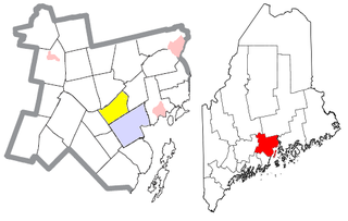
Charleston is a town in Penobscot County, Maine, United States. It is part of the Bangor Metropolitan Statistical Area. The population was 1,558 at the 2020 census. Charleston includes the village of West Charleston and is home to the Higgins Classical Institute, a Christian school.

<span class="mw-page-title-main">Belmont, Maine</span> Town in the state of Maine, United States

Belmont is a town in Waldo County, Maine, United States. The population was 976 at the 2020 census. It was originally known as Green Plantation. The squatters who lived there would, when alerted to the impending arrival of law officers, dress as Indians and then ignore the officers.

<span class="mw-page-title-main">Brooks, Maine</span> Town in the state of Maine, United States

Brooks is a town in Waldo County, Maine, United States. The population was 1,010 at the 2020 census.

<span class="mw-page-title-main">Burnham, Maine</span> Town in the state of Maine, United States

Burnham is a town in Waldo County, Maine, United States. The population was 1,096 at the 2020 census.

<span class="mw-page-title-main">Frankfort, Maine</span> Town in the state of Maine, United States

Frankfort is a town on the Penobscot River estuary in Waldo County, Maine, United States. The population was 1,231 at the 2020 census.

<span class="mw-page-title-main">Knox, Maine</span> Town in the state of Maine, United States

Knox is a town in Waldo County, Maine, United States. The town was named for General Henry Knox, the first United States Secretary of War. The population was 811 at the 2020 census.

<span class="mw-page-title-main">Lincolnville, Maine</span> Town in the state of Maine, United States

Lincolnville is a town in Waldo County, Maine, United States. The population was 2,312 at the 2020 census. Lincolnville is the mainland terminal for Maine State Ferry Service transport to Islesboro.

<span class="mw-page-title-main">Monroe, Maine</span> Town in the state of Maine, United States

Monroe is a town in Waldo County, Maine, United States named for President James Monroe. The population was 931 at the 2020 census.

<span class="mw-page-title-main">Montville, Maine</span> Town in the state of Maine, United States

Montville is a town in Waldo County, Maine, United States. The population was 1,020 at the 2020 census.

<span class="mw-page-title-main">Morrill, Maine</span> Town in the state of Maine, United States

Morrill is a town in Waldo County, Maine, United States. The population was 971 at the 2020 census.

<span class="mw-page-title-main">Prospect, Maine</span> Town in the state of Maine, United States

Prospect is a town in Waldo County, Maine, United States. The population was 698 at the 2020 census.

<span class="mw-page-title-main">Stockton Springs, Maine</span> Town in the state of Maine, United States

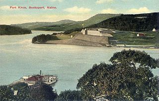
Stockton Springs is a town in Waldo County, Maine, United States. The population was 1,533 at the 2020 census. Stockton Springs is home to Fort Point State Park and Fort Point Light, both located on Fort Point, a peninsula on Cape Jellison.

<span class="mw-page-title-main">Swanville, Maine</span> Town in the state of Maine, United States

Swanville is a town in Waldo County, Maine, United States. The population was 1,377 at the 2020 census.

<span class="mw-page-title-main">Thorndike, Maine</span> Town in the state of Maine, United States

Thorndike is a town in Waldo County, Maine, United States. The town was named after Israel Thorndike, a landowner. The population was 774 at the 2020 census.

<span class="mw-page-title-main">Troy, Maine</span> Town in the state of Maine, United States

Troy is a town in Waldo County, Maine, United States. The population was 1,018 at the 2020 census.

<span class="mw-page-title-main">Waldo, Maine</span> Town in the state of Maine, United States

Waldo is a town in Waldo County, Maine, United States. The population was 795 at the 2020 census. It is the home town of Heather Hemmens, who is known for her role on Hellcats.

Unity is a town in Waldo County, Maine, United States. The population was 2,292 at the 2020 census. The town is the service center for the northern portion of Waldo County. Outside of Waldo County, it is best known as the home of the Maine Organic Farmers and Gardeners Association, its Common Ground Country Fair and Unity College. Unity College was founded in 1965 to offset the economic effects of the declining chicken farming industry. As of 2007, the college is the town's largest employer.

<span class="mw-page-title-main">Winterport, Maine</span> Town in the state of Maine, United States

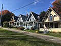
Winterport is a town in Waldo County, Maine, United States. The population was 3,817 at the 2020 census. The Winterport Historic District, extending several blocks along Main Street, was listed on the National Register of Historic Places in 1975.

References

  1. 1 2 "US Gazetteer files 2010". United States Census Bureau . Retrieved December 16, 2012.
  2. DeLorme Mapping Company The Maine Atlas and Gazetteer (13th edition) (1988) ISBN   0-89933-035-5 map 15
  3. "Census - Geography Profile: Northport town, Waldo County, Maine" . Retrieved January 19, 2022.
  4. "Census of Population and Housing". Census.gov. Retrieved June 4, 2015.
  5. "U.S. Census website". United States Census Bureau . Retrieved December 16, 2012.
  6. "U.S. Census website". United States Census Bureau . Retrieved January 31, 2008.
  7. Wolfe, Paul (June 9, 2021). "This Maine Oceanside Village Will Take You Back To Simpler Times". Q106.5. Retrieved March 27, 2022.
  8. "Bayside Historic District" - National Register of Historic Places nomination form, National Park Service, November 15, 1996
  9. "Bayside | The Cultural Landscape Foundation". www.tclf.org. Retrieved March 27, 2022.
  10. "Northport Hotel, ca. 1900". Maine Memory Network. Retrieved March 28, 2022.

44°20′16″N68°57′41″W / 44.33778°N 68.96139°W / 44.33778; -68.96139