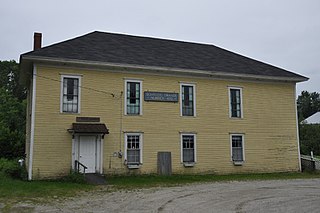
Brooks, Maine

Last updated

Brooks, Maine
Waldo County Maine Incorporated Areas Brooks Highlighted.png
Location of Brooks (in yellow) in Waldo County and the state of Maine
Coordinates: 44°32′17″N69°7′26″W / 44.53806°N 69.12389°W / 44.53806; -69.12389
Country United States
State Maine
County Waldo
Area
[1]
  Total25.37 sq mi (65.71 km2)
  Land24.67 sq mi (63.90 km2)
  Water0.70 sq mi (1.81 km2)
Elevation
741 ft (226 m)
Population
 (2020)
  Total1,010
  Density41/sq mi (15.8/km2)
Time zone UTC-5 (Eastern (EST))
  Summer (DST) UTC-4 (EDT)
ZIP code
04921
Area code 207
FIPS code 23-07870
GNIS feature ID0582371
Website Town of Brooks

Brooks is a town in Waldo County, Maine, United States. The population was 1,010 at the 2020 census. [2]

Contents

The town was incorporated on December 10, 1816, and was named after John Brooks, the Federalist candidate for Governor of Massachusetts in 1815–1816, when the town incorporated. The town of Dexter, which incorporated the same year, was named after the opposing candidate Samuel Dexter. It was during Gov. Brooks' administration that Maine ceased to be a territory of Massachusetts and became a state.

Geography

According to the United States Census Bureau, the town has a total area of 25.37 square miles (65.71 km2), of which 24.67 square miles (63.90 km2) is land and 0.70 square miles (1.81 km2) is water. [1] The town is drained by Marsh Stream. Principal bodies of water include Lake Passagassawakeag (a.k.a. Randall Pond) (117 acres), Ellis Pond (100 acres), Halfmoon Pond (37 acres) and Sanborn Pond (90 acres). The town is crossed by state routes SR 7, SR 203 and SR 139. It is bordered on the north by Jackson, on the northeast by Monroe, on the east by Swanville, on the south by Waldo, and on the west by Knox.

Demographics

Historical population
CensusPop.Note
1820 318
1830 60189.0%
1840 91051.4%
1850 1,02112.2%
1860 988−3.2%
1870 868−12.1%
1880 8771.0%
1890 730−16.8%
1900 669−8.4%
1910 7045.2%
1920 691−1.8%
1930 7295.5%
1940 7442.1%
1950 7470.4%
1960 7581.5%
1970 751−0.9%
1980 8047.1%
1990 90011.9%
2000 1,02213.6%
2010 1,0785.5%
2020 1,010−6.3%
U.S. Decennial Census [3]

2010 census

As of the census [4] of 2010, there were 1,078 people, 446 households, and 285 families living in the town. The population density was 43.7 inhabitants per square mile (16.9/km2). There were 562 housing units at an average density of 22.8 per square mile (8.8/km2). The racial makeup of the town was 96.7% White, 0.4% African American, 0.8% Native American, 0.4% Asian, 0.1% from other races, and 1.7% from two or more races. Hispanic or Latino of any race were 0.6% of the population.

There were 446 households, of which 30.9% had children under the age of 18 living with them, 48.0% were married couples living together, 11.0% had a female householder with no husband present, 4.9% had a male householder with no wife present, and 36.1% were non-families. 28.9% of all households were made up of individuals, and 12.8% had someone living alone who was 65 years of age or older. The average household size was 2.42 and the average family size was 2.97.

The median age in the town was 40.2 years. 23.6% of residents were under the age of 18; 7.2% were between the ages of 18 and 24; 25.7% were from 25 to 44; 27.7% were from 45 to 64; and 15.8% were 65 years of age or older. The gender makeup of the town was 51.4% male and 48.6% female.

2000 census

As of the census [5] of 2000, there were 1,022 people, 410 households, and 275 families living in the town. The population density was 41.8 inhabitants per square mile (16.1/km2). There were 522 housing units at an average density of 21.4 per square mile (8.3/km2). The racial makeup of the town was 98.83% White, 0.10% African American, 0.20% Native American, 0.10% Asian, 0.10% from other races, and 0.68% from two or more races. Hispanic or Latino of any race were 0.88% of the population.

There were 410 households, out of which 31.2% had children under the age of 18 living with them, 55.9% were married couples living together, 6.6% had a female householder with no husband present, and 32.7% were non-families. 27.6% of all households were made up of individuals, and 11.2% had someone living alone who was 65 years of age or older. The average household size was 2.47 and the average family size was 2.98.

In the town, the population was spread out, with 26.3% under the age of 18, 6.8% from 18 to 24, 28.4% from 25 to 44, 24.6% from 45 to 64, and 14.0% who were 65 years of age or older. The median age was 38 years. For every 100 females, there were 97.3 males. For every 100 females age 18 and over, there were 90.2 males.

The median income for a household in the town was $30,104, and the median income for a family was $38,393. Males had a median income of $25,833 versus $18,977 for females. The per capita income for the town was $14,446. About 14.2% of families and 19.5% of the population were below the poverty line, including 24.9% of those under age 18 and 27.8% of those age 65 or over.

Related Research Articles

<span class="mw-page-title-main">Franklin, Maine</span> Town in the state of Maine, United States

Franklin is a town in Hancock County, Maine, United States. The population was 1,567 at the 2020 census. The town's namesake is Benjamin Franklin.

<span class="mw-page-title-main">Verona Island, Maine</span> Town in Maine, United States

Verona Island is a town located on an island of the same name in the Penobscot River in Hancock County, Maine, United States. The population was 507 at the 2020 census.

Caratunk is a town in Somerset County, Maine, United States. The population was 81 at the 2020 census.

<span class="mw-page-title-main">Belmont, Maine</span> Town in the state of Maine, United States

Belmont is a town in Waldo County, Maine, United States. The population was 976 at the 2020 census. It was originally known as Green Plantation. The squatters who lived there would, when alerted to the impending arrival of law officers, dress as Indians and then ignore the officers.

<span class="mw-page-title-main">Burnham, Maine</span> Town in the state of Maine, United States

Burnham is a town in Waldo County, Maine, United States. The population was 1,096 at the 2020 census.
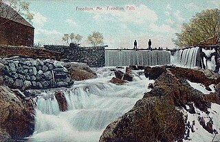
<span class="mw-page-title-main">Freedom, Maine</span> Town in the state of Maine, United States

Freedom is a town in Waldo County, Maine, United States. The population was 711 at the 2020 census. Freedom is a residential and recreational area.

<span class="mw-page-title-main">Jackson, Maine</span> Town in the state of Maine, United States

Jackson is a town in Waldo County, Maine, United States. The town was named after General Henry Jackson of the Revolutionary War. The population was 610 at the 2020 census.
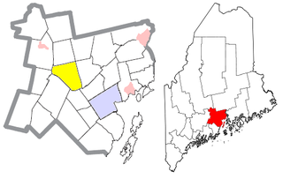
<span class="mw-page-title-main">Knox, Maine</span> Town in the state of Maine, United States

Knox is a town in Waldo County, Maine, United States. The town was named for General Henry Knox, the first United States Secretary of War. The population was 811 at the 2020 census.

<span class="mw-page-title-main">Monroe, Maine</span> Town in the state of Maine, United States

Monroe is a town in Waldo County, Maine, United States named for President James Monroe. The population was 931 at the 2020 census.

<span class="mw-page-title-main">Morrill, Maine</span> Town in the state of Maine, United States

Morrill is a town in Waldo County, Maine, United States. The population was 971 at the 2020 census.

<span class="mw-page-title-main">Northport, Maine</span> Town in the state of Maine, United States

Northport is a town on Penobscot Bay in Waldo County, Maine, United States. The population was 1,550 at the 2020 census. The coastal Bayside residential area is home to over one hundred Victorian seaside cottages, a marina, and the Cobe Estate.

<span class="mw-page-title-main">Palermo, Maine</span> Town in Maine, United States

Palermo is a town in Waldo County, Maine, United States. The population was 1,570 at the 2020 census. Palermo is included in the Augusta, Maine, micropolitan New England City and Town Area.
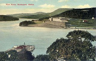
<span class="mw-page-title-main">Prospect, Maine</span> Town in the state of Maine, United States

Prospect is a town in Waldo County, Maine, United States. The population was 698 at the 2020 census.
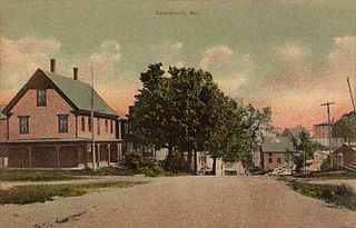
<span class="mw-page-title-main">Searsmont, Maine</span> Town in the state of Maine, United States

Searsmont is a town in Waldo County, Maine, United States. The population was 1,400 at the 2020 census.

<span class="mw-page-title-main">Swanville, Maine</span> Town in the state of Maine, United States

Swanville is a town in Waldo County, Maine, United States. The population was 1,377 at the 2020 census.

<span class="mw-page-title-main">Thorndike, Maine</span> Town in the state of Maine, United States

Thorndike is a town in Waldo County, Maine, United States. The town was named after Israel Thorndike, a landowner. The population was 774 at the 2020 census.

<span class="mw-page-title-main">Troy, Maine</span> Town in the state of Maine, United States

Troy is a town in Waldo County, Maine, United States. The population was 1,018 at the 2020 census.
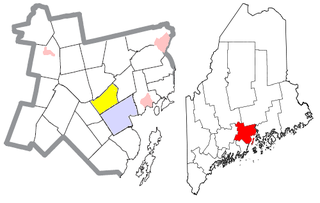
<span class="mw-page-title-main">Waldo, Maine</span> Town in the state of Maine, United States

Waldo is a town in Waldo County, Maine, United States. The population was 795 at the 2020 census. It is the home town of Heather Hemmens, who is known for her role on Hellcats.
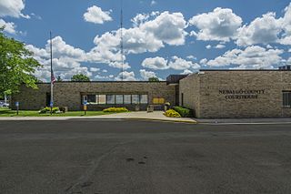
<span class="mw-page-title-main">White Cloud, Michigan</span> City in Michigan, United States

White Cloud is a city in the U.S. state of Michigan, a small town on the bank of the White River. As of the 2020 census, the city population was 1,479. It is the county seat of Newaygo County. Being designated a trail town, the outdoors are a big part of life in White Cloud, with the 4,600 mile North Country Trail stretching nearby, the Mill Pond Park with a beach and playground, and the White Cloud County Park and Campground, being major draws to the area. White Cloud was recognized by the North Country Trail Association as a "Trail Town".

Unity is a town in Waldo County, Maine, United States. The population was 2,292 at the 2020 census. The town is the service center for the northern portion of Waldo County. Outside of Waldo County, it is best known as the home of the Maine Organic Farmers and Gardeners Association, its Common Ground Country Fair and Unity College. Unity College was founded in 1965 to offset the economic effects of the declining chicken farming industry. As of 2007, the college is the town's largest employer.

References

  1. 1 2 "US Gazetteer files 2010". United States Census Bureau . Retrieved December 16, 2012.
  2. "Census - Geography Profile: Brooks town, Waldo County, Maine" . Retrieved January 21, 2022.
  3. "Census of Population and Housing". Census.gov. Retrieved June 4, 2015.
  4. "U.S. Census website". United States Census Bureau . Retrieved December 16, 2012.
  5. "U.S. Census website". United States Census Bureau . Retrieved January 31, 2008.

44°33′01″N69°07′15″W / 44.55028°N 69.12083°W / 44.55028; -69.12083