Tennessee State Route 12

Last updated

Tennessee 12.svg Secondary Tennessee 12.svg

State Route 12

Route information
Maintained by TDOT
Length62.46 mi (100.52 km)
ExistedOctober 1, 1923 [1] –present
Major junctions
South endUS 31.svgUS 41.svgUS 431.svgUS 41A.svg US 31  / US 41  / US 431  / US 41A in Nashville
Major intersectionsI-65.svg I-65 in Nashville

Tennessee 155.svg SR 155 (Briley Parkway) in Nashville
Secondary Tennessee 455.svg SR 455 in Ashland City
Tennessee 49.svgSecondary Tennessee 249.svg SR 49  / SR 249 in Ashland City
Tennessee 48.svg SR 48 in Clarksville
By-pass plate.svg
US 41A.svg
US 41A.svgUS 79.svg US 41A Byp.  / US 41A  / US 79 in Clarksville

Contents

Tennessee 374.svg SR 374 in Clarksville
North endAlternate plate.svg
US 41.svg
US 41 Alt. at the Kentucky State Line
Location
Country United States
State Tennessee
Counties Davidson, Cheatham, Montgomery
Highway system
Tennessee 11.svg SR 11 Tennessee 13.svg SR 13

State Route 12 (SR 12) is a highway from Davidson County, Tennessee to Montgomery County, Tennessee.

Route description

Davidson County

SR 12 begins in downtown Nashville at an intersection with US 31/US 41/US 431/US 41A/SR 6/SR 11, concurrent with US 41A as its unsigned companion route. They go north and have an interchange with I-65. They then curve to the east and start paralleling the Cumberland River before they cross it. US 41A/SR 12 then enter Nashville's northern suburbs before they separate at a y-intersection where child route SR 112 begins and US 41A follows SR 112. SR 12 becomes signed as a primary highway and turns west, coming to an interchange with SR 155 (Briley Parkway). It continues east and then leaves Nashville. SR 12 then passes through the mountains of the Highland Rim before exiting it and Davidson County and entering Cheatham County.

Cheatham County

In Cheatham County, SR 12 starts paralleling the Cumberland River before entering Ashland City. In Ashland City, it has a junction with SR 455 (Ashland City Bypass) before entering downtown and having an intersection and short concurrency with SR 49/SR 249. SR 12 then has another intersection with SR 455 (Ashland City Bypass) before leaving Ashland City. It then turns north and goes through some rural farmland before crossing into Montgomery County.

Montgomery County

In Montgomery County, SR 12 passes through Fredonia before entering Clarksville at an intersection with US 41A Bypass. SR 12 then becomes unsigned again as it runs along the southeast boundary of Clarksville before coming to an intersection and becoming concurrent with SR 13/SR 48, turning north. They then continue into downtown, again following the Cumberland River, and coming to an intersection were SR 48 separates. They then continue north on the banks of the river to an intersection with US 41A, US 79, SR 76, and SR 112 where US 41A bypass ends. While SR 112 ends at this intersection, SR 12 turns north on US 41A/US 79/SR 76, and SR 13 turns east on US 79. They then go north through a business district before US 79/SR 76 split of and go west, and US 41A/SR 12 go north and have an interchange with SR 374 (Purple Heart Parkway) before leaving Clarksville. US 41A/SR 12 then continues north and have a junction with SR 236 before crossing the Kentucky state line and entering Oak Grove, KY where SR 12 ends and US 41A continues as US 41 ALT. [2]

Secondary Tennessee 455.svg

State Route 455

Location Ashland City
Length1.91 mi [3]  (3.07 km)
Existed1997–present

State Route 455, the Tennessee Waltz Parkway, is a short bypass around Ashland City in Cheatham County. The general routing is southeast–northwest. SR 455 is less than 2 miles (3.2 km) in length. The route is a continuation of a bypass from State Route 12 to State Route 49 which runs by the A.O. Smith water heater factory to a point just north of the Cumberland River bridge which was not originally designated a state route, but came under state maintenance when SR 455 was created. State Route 455 has its origins in a 1997 referendum in which the voters of Ashland City authorized a 1/2 cent sales tax increase with proceeds going to build and maintain a continuation of the bypass back around to Route 12. The road was finally completed in 2005.

Major intersections

CountyLocationmikmDestinationsNotes
Davidson Nashville 0.00.0US 31.svgUS 41.svgUS 431.svgSouth plate.svg
US 41A.svg
US 31  / US 41  / US 431  / US 41A south (SR 6/SR 11/James Robertson Parkway)
Southern end of unsigned US 41A concurrency; US 41A continues south concurrent with US 41/US 31/US 431/SR 6/SR 11
I-65.svg I-65  Louisville, Huntsville I-65 exit 85
Bridge over Cumberland River
North plate.svg
US 41A.svg
US 41A north (SR 112 west/Clarksville Pike) Pleasant View
Northern end of unsigned US 41A concurrency; eastern terminus of SR 112; SR 12 becomes signed as a primary highway
Tennessee 155.svg SR 155 (Briley Parkway)SR 155 exit 24; Beltway around downtown Nashville
Cheatham Ashland City North plate.svg
Secondary Tennessee 455.svg
SR 455 north (Tennessee Waltz Parkway)
Southern terminus of SR 455; Bypass around the west side of downtown
East plate.svg
Tennessee 49.svg
North plate.svg
Secondary Tennessee 249.svg
SR 49 east / SR 249 north (Frey Street) Pleasant View
Southern end of SR 49/SR 249 concurrency
West plate.svg
Tennessee 49.svg
South plate.svg
Secondary Tennessee 249.svg
SR 49 west / SR 249 south (Cumberland Street) Charlotte, Pegram
Northern end of SR 49/SR 249 concurrency
South plate.svg
Secondary Tennessee 455.svg
SR 455 south (Tennessee Waltz Parkway)
Northern terminus of SR 455; Bypass around the west side of downtown
Montgomery Clarksville South plate.svg
By-pass plate.svg
US 41A.svg
US 41A Byp. south (S Riverside Drive)
Southern end of unsigned US 41A Bypass concurrency; southern and western bypass around downtown Clarksville; SR 12 becomes unsigned
South plate.svg
Tennessee 13.svg
South plate.svg
Tennessee 48.svg
SR 13 south / SR 48 south (Cumberland Drive) Charlotte, Erin
Southern end of SR 13/SR 48 concurrency
South plate.svg
Secondary Tennessee 48.svg
SR 48 south (College Street) – Downtown
Northern end of SR 48 concurrency
US 41A.svgUS 79.svgTo plate blue.svg
I-24.svg
US 41A  / US 79 (SR 13 north/SR 76 north/SR 112 east/Kraft Street/N 2nd Street) to I-24  – Downtown, Guthrie, KY
Northern terminus of US 41A Bypass; western terminus of SR 112; southern end of US 41A/US 79/SR 76 concurrency
South plate.svg
US 79.svg
US 79 south (SR 76 south/Dover Road) Dover
Northern end of US 79/SR 76 concurrency
Tennessee 374.svg SR 374 (Purple Heart Parkway/101st Airborne Division Parkway)Interchange; beltway around the north and east sides of Clarksville
East plate.svg
Secondary Tennessee 236.svg
To plate blue.svg
I-24.svg
SR 236 east (Tiny Town Road) to I-24
Western terminus of SR 236
62.46100.52North plate.svg
Alternate plate.svg
US 41.svg
US 41 Alt. north (Fort Campbell Boulevard) Oak Grove, Hopkinsville
Kentucky state line; northern terminus; US 41A continues north as US 41 Alt; provides access to Fort Campbell
1.000 mi = 1.609 km; 1.000 km = 0.621 mi

See also

Related Research Articles

<span class="mw-page-title-main">Interstate 24</span> Interstate Highway in Illinois, Kentucky, Tennessee, and Georgia

Interstate 24 (I-24) is an Interstate Highway in the Midwestern and Southeastern United States. It runs diagonally from I-57, 10 miles (16 km) south of Marion, Illinois, to Chattanooga, Tennessee, at I-75. It travels through Illinois, Kentucky, Tennessee, and Georgia. As an even-numbered Interstate, it is signed as an east–west route, though the route follows a more southeast–northwest routing, passing through Nashville, Tennessee. The numbering deviates from the standard Interstate Highway System grid, lying further north than its number would indicate west of Nashville.

<span class="mw-page-title-main">Tennessee State Route 155</span> Highway in Tennessee

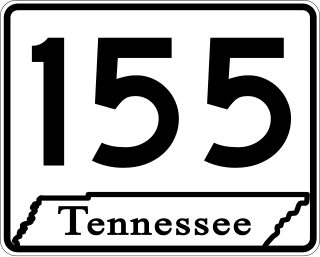
State Route 155, mostly designated as Briley Parkway, is a major freeway and parkway beltway around Nashville, Tennessee. It is 35.1 miles (56.5 km) long.

<span class="mw-page-title-main">Tennessee State Route 56</span> Highway in Tennessee

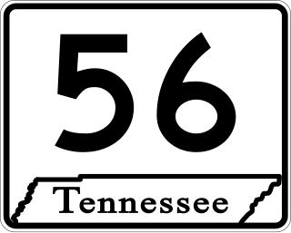
State Route 56 is a 160.6-mile-long (258.5 km) state highway that runs south to north in Middle Tennessee, from the Alabama state line near Sherwood to the Kentucky state line near Red Boiling Springs.

<span class="mw-page-title-main">Tennessee State Route 24</span> State highway in Tennessee, United States

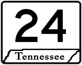
State Route 24 is an unsigned west–east state highway in Tennessee, as it coincides with U.S. Route 70 and U.S. Route 70N for its entire duration from Nashville to Crossville. The road begins in western Nashville and ends in Crossville. It runs alongside Interstate 40 for its entire length.

<span class="mw-page-title-main">U.S. Route 31W</span> U.S. Highway in Kentucky and Tennessee

U.S. Route 31W is the westernmost of two parallel routes for U.S. Route 31 from Nashville, Tennessee to Louisville, Kentucky.

<span class="mw-page-title-main">U.S. Route 45E</span> U.S. Highway in Tennessee

U.S. Route 45E (US 45E) is a 61.23-mile-long (98.54 km) state highway in West Tennessee, connecting Jackson with South Fulton via Milan and Martin. For the majority of its length, it runs concurrently with unsigned State Route 43 (SR 43) for most of that highway’s length except for short segments at Martin and South Fulton, where it is cosigned with SR 216 and SR 215, respectively.

<span class="mw-page-title-main">Tennessee State Route 455</span>

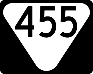
State Route 455 is a state highway and bypass around downtown Ashland City in Middle Tennessee.

<span class="mw-page-title-main">Tennessee State Route 251</span>

State Route 251 is a west–east secondary state highway in Middle Tennessee.

<span class="mw-page-title-main">Tennessee State Route 10</span> Highway in Tennessee

State Route 10 is a south–north route from the Alabama state line in Lincoln County to the Kentucky state line in Macon County.

<span class="mw-page-title-main">Tennessee State Route 13</span> Highway in Tennessee

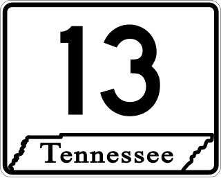
State Route 13, in the United States, is a south–north route from the Alabama border in Wayne County to the Kentucky border in Montgomery County. The entire route is located in western Middle Tennessee.

<span class="mw-page-title-main">Tennessee State Route 15</span> Highway in Tennessee

State Route 15 is a west–east route from Memphis to Monteagle. For much of its route it has an unsigned concurrency with U.S. Route 64. SR 15 does travel through the southern part of all 3 Grand Divisions of the state: West Tennessee, Middle Tennessee, and East Tennessee.

<span class="mw-page-title-main">Tennessee State Route 76</span> Highway in Tennessee

State Route 76 (SR 76) is a state highway in Tennessee, traversing the state in a northeast-southwest axis from east of Memphis to north of Nashville. SR 76 is unique in that it actually changes its cardinal directions in Clarksville at the junction with US 41A and US 41A Bypass.

<span class="mw-page-title-main">U.S. Route 79 in Tennessee</span>

U.S. Route 79 in Tennessee enters the state from Arkansas via the Memphis & Arkansas Bridge in Memphis, and runs northeast through western and the northwestern portions of middle Tennessee, and leaving the state into Kentucky northeast of Clarksville. Along the route, US 79 is accompanied with several concurrencies, including hidden designations, throughout its alignment in Tennessee.

<span class="mw-page-title-main">U.S. Route 31A</span> U.S. Highway in Tennessee

U.S. Route 31A is a 76.94-mile-long (123.82 km) alternate route of U.S. Route 31 that exists between Nashville and Pulaski, Tennessee. It is located entirely in Middle Tennessee and except for the Lewisburg bypass, where it is concurrent with SR 106, it is entirely concurrent with unsigned State Route 11.

<span class="mw-page-title-main">Tennessee State Route 49</span>

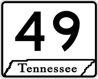
State Route 49 is a state highway in Tennessee. The route forms a broad southern arc that passes through the rural Middle Tennessee towns of Dover, Erin, Charlotte, Ashland City, Pleasant View, and Springfield.

<span class="mw-page-title-main">Tennessee State Route 48</span>

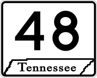
State Route 48 (SR 48) is a long north–south state highway in Middle Tennessee. It traverses six counties, and it is 103.86 miles (167.15 km) long.

<span class="mw-page-title-main">U.S. Route 231 in Tennessee</span>

U.S. Route 231 in Tennessee runs north–south for 121.15 miles (194.97 km), entirely in Middle Tennessee, that starts south of Fayetteville at the Alabama state line, and ends north of Westmoreland at the Kentucky state line. For the majority of its length, between the Alabama state line and Trousdale County, it is concurrent with unsigned State Route 10.

<span class="mw-page-title-main">Tennessee State Route 28</span> State highway in Tennessee, United States

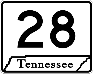
State Route 28 is a state highway in the state of Tennessee, traversing the state in a north–south axis from south of Jasper to the Kentucky state line at Static.

<span class="mw-page-title-main">Tennessee State Route 46</span> State highway in Tennessee, United States

State Route 46 is a north–south state highway located in Middle Tennessee. It mainly goes on a northwest to southeast course while passing through towns and cities such as Cumberland City, Dickson, Leipers Fork, along with mainly rural areas of Stewart, Houston, Dickson, Hickman and Williamson Counties.

<span class="mw-page-title-main">U.S. Route 41 Alternate (Tennessee–Kentucky)</span> U.S. Highway in Tennessee and Kentucky

U.S. Route 41 Alternate, also signed U.S. Route 41A in Tennessee (US 41A), connects the town of Monteagle, Tennessee, with Hopkinsville, Kentucky, 10 miles (16 km) north of the Tennessee line. It serves the city of Clarksville, Tennessee, on its way to Nashville, where it briefly runs concurrently with US 41. It then separates again to serve Shelbyville, Winchester, and Tullahoma before rejoining the main route atop Monteagle Mountain. US 41A runs west of US 41 for its entire length, aside from one mile in downtown Nashville where they are concurrent. US 41A is also concurrent with U.S. Route 31A from Nashville to Triune, Tennessee, for a distance of approximately 25 miles (40 km).

References

  1. Highway Planning Survey Division (1925). Biennial Report of the Commissioner of the Department of Highways and Public Works State of Tennessee for the Years 1923 and 1924 (PDF) (Report). Nashville: Tennessee Department of Highways and Public Works. pp. 39–44. Retrieved May 19, 2023.
  2. Tennessee Atlas & Gazetteer (Map) (2004 ed.). DeLorme.
  3. TDOT Region 3 Pavement Condition Data