U.S. Route 79 in Tennessee

Last updated
US 79.svg
U.S. Route 79
U.S. Route 79 in Tennessee
US 79 highlighted in red
Route information
Maintained by TDOT
Length209.83 mi (337.69 km)
Existed1944–present
Major junctions
West endI-55.svgUS 61 (AR).svgUS 64 (AR).svgUS 70 (AR).svgUS 79 (AR).svg I-55  / US 61  / US 64  / US 70  / US 79 at the Arkansas state line/Mississippi River in Memphis
Major intersectionsI-55.svg I-55 (Exit 12) in Memphis

US 51.svg US 51 in downtown Memphis
I-40.svg I-40 (Exit 12A) in Memphis
US 64.svg US 64 in Bartlett
Tennessee 385.svg SR 385 in Arlington
US 70.svgUS 70A.svg US 70  / US 70A in Brownsville
US 412.svg US 412 in Bells
US 45W.svg US 45W in Humboldt
US 45E.svg US 45E in Milan
US 641.svg US 641 in Paris
Tennessee 374.svg SR 374 in Clarksville
By-pass plate.svg
US 41A.svg
US 41A.svg US 41A Byp.  / US 41A in Clarksville

Contents

I-24.svg I-24 (Exit 4) in Clarksville
North endUS 79.svg US 79 at the Kentucky state line northeast of Clarksville
Location
Country United States
State Tennessee
Counties Shelby, Fayette, Tipton, Haywood, Crockett, Gibson, Carroll, Henry, Stewart, Montgomery
Highway system
Tennessee 78.svg SR 78 Tennessee 79.svg SR 79

U.S. Route 79 (US 79) in Tennessee enters the state from Arkansas via the Memphis & Arkansas Bridge in Memphis, and runs northeast through western and the northwestern portions of middle Tennessee, and leaving the state into Kentucky northeast of Clarksville. Along the route, US 79 is accompanied with several concurrencies, including hidden designations, throughout its alignment in Tennessee.

Route description

Map showing the route of US 79 in downtown Memphis. Downtown Memphis.svg
Map showing the route of US 79 in downtown Memphis.

Memphis to Brownsville

From I-55, US 79 continues to follow US 61/64/70 (SR 1) on E.H. Crump Boulevard. US 64/70/79 then turns north onto Danny Thomas Boulevard northward, then it makes a right turn onto Union Avenue, where US 51 (SR 3) gets involved in the concurrency until Bellevue Boulevard. US 64/70/79 then joins SR 277 northward until the U.S. routes turn onto Summer Avenue eastward. US 64 splits from US 70/79 at their intersection with SR !5 in Bartlett, in northeastern Shelby County.

US 79 continues to run concurrently with US 70 (SR 1) from here until Brownsville, in Haywood County. In Brownsville, US 70/79 joins the Ah Gray/C.A. Rawls Bypass with SR 19. The intersection with Anderson Avenue marks the beginning of US 79's long concurrency with SR 76, while the overlaps with SR 19 and US 70/SR 1 both end at the intersections with Jefferson Street and East Main Street, respectively. US 79/SR 76 begins a concurrency with US 70A at that point. [1]

Brownsville to Paris Landing

US 79/70A (SR 76) continues northeastward to have major junctions with US 412, US 45W and US 45E in the towns of Bells, Humboldt, and Milan, respectively. US 70A becomes a standalone route in Atwood. US 79 continues northeast to McKenzie and Paris. US 79 is the main thoroughfare accessing Paris Landing State Park before crossing the Tennessee River. [2] [3]

Tennessee River to Kentucky state line

After entering Stewart County, US 79 becomes known as Donelson Parkway, and forms a portion of the southern boundary of the Land Between the Lakes National Recreation Area before entering Dover, where it crosses the Cumberland River, and then continues eastward to Clarksville. It then becomes known as Dover Road between the Stewart-Montgomery County line and the city of Clarksville. [4]

US 79 then runs concurrently with US 41A on the northwestern side of Clarksville, and it then turns left to bypass the downtown area, while beginning its concurrency with SR 13 for the remainder of its path to the Kentucky state line. Wilma Rudolph Boulevard is the name given to the portion of U.S. Route 79 between the Red River (Lynnwood-Tarpley) bridge near the Kraft Street intersection and I-24’s exit 4 interchange. This section of Highway 79 in Clarksville was previously called the Guthrie Highway, for nearby Guthrie, Kentucky, but in 1994, the name was changed to honor Wilma Rudolph, an Olympic runner from Clarksville, who won three gold medals in the 1960 Rome Summer Olympic Games in Italy. [5]

The highway then enters Todd County, Kentucky after exiting the city of Clarksville. The state line coincides with the northern terminus of SR 13.

Concurrency list

U.S. 79 runs concurrently with the following interstate and U.S. routes:

Additionally, all areas of US 79 run concurrently with Tennessee state routes throughout its course through the state as “hidden,” or secret designations as the state routes are not signed. They include:

History

US 79 did not have any presence in Tennessee or southern Kentucky until it was routed into the state in 1944. Until then, the route ended in West Memphis, Arkansas, and US 79's current route in Tennessee was signed solely as SR 76 from Brownsville to Clarksville, and SR 13 from Clarksville to the Kentucky line. [6]

Major intersections

The mileposts listed in the following table is only an estimated calculation. Actual mile markers may vary and subject to change due to any future reroutings that may occur

CountyLocationmikmDestinationsNotes
Mississippi River 0.000.00I-55.svgUS 61 (AR).svgUS 64 (AR).svgUS 70 (AR).svgUS 79 (AR).svg I-55 north / US 61 north / US 64 west / US 70 west / US 79 south West Memphis, St. Louis, MO Continuation into Arkansas
Memphis & Arkansas Bridge; Arkansas state line; begin concurrency with unsigned SR 1
see U.S. Route 70
Haywood Brownsville 65.4105.3US 70.svg US 70 east (East Main Street/SR 1 east) Jackson Eastern end of US 70/SR 1 concurrency; western end of US 70A.svg US 70A concurrency; western terminus of US 70A; concurrency with unsigned SR 76 began during US 79’s concurrency with US 70 and SR 1.
66.6107.2Secondary Tennessee 369.svg SR 369 south (North Washington Avenue) – Downtown BrownsvilleNorthern terminus of SR 369
Crockett Bells 77.7125.0Secondary Tennessee 88.svg SR 88 west (Main Street) Alamo Southern end of SR 88 concurrency
77.9125.4Secondary Tennessee 88.svg SR 88 east (Central Avenue)Northern end of SR 88 concurrency
79.3–
79.5
127.6–
127.9
US 412.svg US 412 (SR 20) Dyersburg, Jackson Interchange
Gadsden 84.8136.5Secondary Tennessee 221.svg SR 221 west (Quincy Street) Alamo Eastern terminus of SR 221
Gibson Humboldt 88.9143.1By-pass plate.svg
US 79.svg
By-pass plate.svg
US 70A.svg
US 79 Byp. north / US 70A Byp. east (SR 366 east)
Western terminus of US 79 Bypass/US 70A Bypass/SR 366
90.1145.0Business plate.svg
US 45W.svg
US 45W Bus. north (Central Avenue/SR 5 north)
Southern end of US 45W Business concurrency
90.6145.8Business plate.svg
US 45W.svg
US 45W Bus. south (Main Street/SR 5 south)
Northern end of US 45W Business/SR 5 concurrency
90.9146.3Secondary Tennessee 152.svg SR 152 (Mitchell Street) Medina
92.0148.1US 45W.svgBy-pass plate.svg
US 79.svg
By-pass plate.svg
US 70A.svg
US 45W  / US 79 Byp.  / US 70A Byp. (SR 366) Union City, Jackson
Eastern terminus of US 79 Byp./US 70A Bypass
93.8151.0Secondary Tennessee 187.svg SR 187 eastWestern terminus of SR 187
Gibson 96.0154.5Secondary Tennessee 186.svg SR 186 (Main Street) Trenton, Three Way
Milan 101.9164.0US 45E.svg US 45E (South 1st Street/SR 43/SR 77 west/SR 104) Martin, Jackson Southern end of SR 77 concurrency
103.8167.0Secondary Tennessee 425.svg SR 425 west (Middle Road)Eastern terminus of SR 425
Carroll Atwood 107.7173.3Secondary Tennessee 220.svg SR 220 south (Church Street)Northern terminus of SR 220
108.3174.3US 70A.svg US 70A east (SR 77 east) Huntingdon Northern end of US 70A/SR 77 concurrency
Trezevant 121.8196.0Secondary Tennessee 105.svg SR 105 (Main Street) Bradford, McLemoresville
McKenzie 131.5211.6Secondary Tennessee 436.svg SR 436 south (Cherrywood Avenue) McLemoresville Northern terminus of SR 436
132.0212.4Secondary Tennessee 124.svg SR 124 west (Cedar Street/Old McKenzie Road) – Downtown, Greenfield
132.4213.1Secondary Tennessee 423.svg SR 423 east (Shiloh Road)Western terminus of SR 423
133.4–
133.6
214.7–
215.0
Tennessee 22.svg SR 22  Dresden, Huntingdon Interchange
Henry Paris 146.4235.6Secondary Tennessee 218.svg SR 218 (Highway 218 Bypass)Beltway around Paris
148.2238.5US 641.svg US 641 (Veterans Drive/Mineral Wells Avenue/SR 69) – Paris Business District, Camden
149.0239.8Secondary Tennessee 356.svg SR 356 west (East Wood Street)Old US 79/SR 76; eastern terminus of SR 356
152.3245.1Secondary Tennessee 218.svg SR 218 west (Highway 218 Bypass)Southern end of SR 218 concurrency; beltway around Paris
155.3249.9Secondary Tennessee 218.svg SR 218 east (Buchanan Road) Buchanan Northern end of SR 218 concurrency
162.4261.4Secondary Tennessee 140.svg SR 140 west Buchanan Eastern terminus of SR 140
Paris Landing State Park 165.0265.5Secondary Tennessee 119.svg SR 119 north Murray (KY) Southern terminus of SR 119
Tennessee River
(Kentucky Lake)
166.1–
166.8
267.3–
268.4
Governor Ned R. McWherter Bridge
Stewart Land Between the Lakes National Recreation Area 170.8274.9Secondary Tennessee 232.svg SR 232 south McKinnon Northern terminus of SR 232
Dover 177.6285.8Secondary Tennessee 461.svg SR 461 north (The Trace) Land Between the Lakes National Recreation Area Southern terminus of SR 461
179.6289.0Tennessee 49.svg SR 49 east (Spring Street) Tennessee Ridge, Erin Western terminus of SR 49
166.1–
166.8
267.3–
268.4
US 79 Bridge over Cumberland River
Big Rock 188.5303.4Secondary Tennessee 120.svg SR 120 north Bumpus Mills, Cadiz (KY) Southern terminus of SR 120
192.0309.0Secondary Tennessee 46.svg SR 46 (Red Top Road) Cumberland City Western terminus of SR 46
Montgomery Woodlawn 199.8321.5Secondary Tennessee 233.svg SR 233 south (Lylewood Road) Cumberland City Northern terminus of SR 233
203.9328.1Tennessee 374.svg SR 374 east (Paul B. Huff Memorial Parkway)Western terminus of SR 374; interchange; partial beltway around Clarksville
Clarksville 207.6334.1US 41A.svg US 41A north (Fort Campbell Boulevard/SR 12 north) Oak Grove, Fort Campbell, Hopkinsville Southern end of US 41A/SR 12 concurrency
209.4337.0US 41A.svgBy-pass plate.svg
US 41A.svg
US 41A south (N 2nd Street/SR 76 north) / US 41A Byp. (N Riverside Drive/SR 12 south/SR 13 south) – Downtown Clarksville
Northern terminus of US 41A Bypass; Southern end of SR 13 concurrency; northern end of US 41A/SR 12 concurrency
211.1339.7Secondary Tennessee 48.svg SR 48 south (College Street)Southern end of SR 48 concurrency
212.4341.8Dunbar Cave Road Dunbar Cave State Park
213.3343.3Secondary Tennessee 48.svg SR 48 north (Trenton Road) Trenton, KY Northern end of SR 48 concurrency
214.1344.6Tennessee 374.svg SR 374 (101st Airborne Division Parkway) Single-point urban interchange; partial beltway around Clarksville
216.2–
216.4
347.9–
348.3
I-24.svg I-24  Nashville, Paducah I-24 Exit 4
221.7356.8US 79.svg US 79 north (Russellville Road) Guthrie, Russellville Continuation into Kentucky; northern end of SR 13 concurrency
1.000 mi = 1.609 km; 1.000 km = 0.621 mi

See also

Related Research Articles

Interstate 40 (I-40) is a major east–west Interstate Highway running through the south-central portion of the United States. At a length of 2,556.61 miles (4,114.46 km), it is the third-longest Interstate Highway in the country, after I-90 and I-80. From west to east, it passes through California, Arizona, New Mexico, Texas, Oklahoma, Arkansas, Tennessee, and North Carolina. Its western end is at I-15 in Barstow, California, while its eastern end is at a concurrency of U.S. Route 117 (US 117) and North Carolina Highway 132 (NC 132) in Wilmington, North Carolina. Major cities served by the interstate include Flagstaff, Arizona; Albuquerque, New Mexico; Amarillo, Texas; Oklahoma City, Oklahoma; Little Rock, Arkansas; Memphis, Nashville, and Knoxville in Tennessee; and Asheville, Winston-Salem, Greensboro, Durham, Raleigh, and Wilmington in North Carolina.

U.S. Route 79 Highway in the United States

U.S. Route 79 is a United States highway in the Southern United States. The route is officially considered and labeled as a north-south highway, but it is actually more of a diagonal northeast-southwest highway. The highway's northern/eastern terminus is in Russellville, Kentucky, at an intersection with U.S. Highway 68 and KY 80. Its southern/western terminus is in Round Rock, Texas, at an intersection with Interstate 35, ten miles (16 km) north of Austin. US 79, US 68, and Interstate 24/US 62 are the primary east–west access points for the Land Between the Lakes recreation area straddling the Kentucky/Tennessee border.

U.S. Route 41, also U.S. Highway 41 (US 41), is a major north–south United States Numbered Highway that runs from Miami, Florida, to the Upper Peninsula of Michigan. Until 1949, the part in southern Florida, from Naples to Miami, was US 94. The highway's southern terminus is in the Brickell neighborhood of Downtown Miami at an intersection with Brickell Avenue (US 1), and its northern terminus is east of Copper Harbor, Michigan, at a modest cul-de-sac near Fort Wilkins Historic State Park at the tip of the Keweenaw Peninsula. US 41 closely parallels Interstate 75 (I-75) from Naples, Florida, all the way through Georgia to Chattanooga, Tennessee.

U.S. Route 70 or U.S. Highway 70 is an east–west United States highway that runs for 2,381 miles (3,832 km) from eastern North Carolina to east-central Arizona. It is a major east–west highway of the Southeastern, Southern and Southwestern United States. It formerly ran from coast to coast, with the current Eastern terminus near the Atlantic Ocean in Atlantic, North Carolina, and the former Western terminus near the Pacific Ocean in Los Angeles, California. The current Western terminus is at US 60 / SR 77 in Globe, Arizona. Before the completion of the Interstate system, U.S. Highway 70 was sometimes referred to as the "Broadway of America", due to its status as one of the main east–west thoroughfares in the nation. It was also promoted as the "Treasure Trail" by the U.S. Highway 70 Association as of 1951.

U.S. Route 431

U.S. Route 431 (US 431) is a spur of U.S. Route 31. It currently travels for approximately 556 miles (895 km) from US 231/Alabama State Route 210 and US 231 Business and US 431 Bus. in Dothan, Alabama, to Owensboro, Kentucky, at US 60 and Kentucky Route 2831.

Tennessee State Route 1 State highway in Tennessee, United States

State Route 1, known as the Memphis to Bristol Highway, is a 538.8-mile-long (867.1 km) mostly-unsigned state highway in the U.S. state of Tennessee. It stretches all the way from the Arkansas state line at Memphis in the southwest corner of the state to Bristol in the northeast part. Most of the route travels concurrently with U.S. Route 70 and US 11W. It is the longest highway of any kind in the state of Tennessee. The route is signed as both in the state of Tennessee, a Primary and Secondary Highway

State Route 14 is a south–north route from the Mississippi border in Memphis, Tennessee to an intersection with State Route 54 in Tipton County.

State Route 52 is an east–west state highway that crosses eight counties in northern and northeastern Tennessee. The 141.4-mile-long (227.6 km) route originates in Orlinda along SR 49 and ends in Elgin along U.S. Route 27.

State Route 12 is a highway from Davidson County, Tennessee to Montgomery County, Tennessee.

Interstate 65 (I-65) runs from Ardmore north in Tennessee to just south of Franklin, Kentucky, forming part of the national highway that goes from Mobile, Alabama, to Gary, Indiana. In Tennessee the highway's official name is the Albert Arnold Gore Sr. Memorial Highway, named for Albert Gore Sr., the former US Senator.

U.S. Route 70 Alternate is a 61.7-mile-long (99.3 km) alternate route to US 70 between Brownsville, and Huntingdon in West Tennessee. Signage along this route, and on most maps, show it as US 70A and not US 70 Alternate.

State Route 13, in the United States, is a south–north route from the Alabama border in Wayne County to the Kentucky border in Montgomery County. The entire route is located in western Middle Tennessee.

State Route 76 (SR 76) is a state highway in Tennessee, traversing the state in a northeast-southwest axis from east of Memphis to north of Nashville. SR 76 is unique in that it actually changes its cardinal directions in Clarksville at the junction with US 41A and US 41A Bypass.

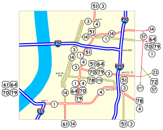
U.S. Route 70 enters the state of Tennessee from Arkansas via the Memphis & Arkansas Bridge in Memphis, and runs west to east across 21 counties in all three grand divisions of Tennessee, with a total length of 478.48 miles (770.04 km), to end at the North Carolina state line in eastern Cocke County. Along the route, US 70 is accompanied with various U.S. and state highways, including those in three of the state's four major cities.

In Tennessee, U.S. Route 64 stretches 404.1 miles (650.3 km) from the Mississippi River in Memphis to the North Carolina state line near Ducktown. The highway, along with US 72, is a major route for travel between Memphis and Chattanooga.

U.S. Route 431 in Tennessee totals an estimated 116 miles (187 km) through Lincoln, Marshall, Maury, Williamson, Davidson, and Robertson Counties in Middle Tennessee.

Several special routes of U.S. Route 41 exist, including three in Wisconsin. In order from south to north they are as follows.

State Route 54 is a west–east rural highway in West Tennessee, which runs from Covington to just north of Paris.

U.S. Route 41 Alternate, also signed U.S. Route 41A in Tennessee (US 41A), connects the town of Monteagle, Tennessee, with Hopkinsville, Kentucky, 10 miles (16 km) north of the Tennessee line. It serves the city of Clarksville, Tennessee, on its way to Nashville, where it briefly runs concurrently with US 41. It then separates again to serve Shelbyville, Winchester, and Tullahoma before rejoining the main route atop Monteagle Mountain. US 41A runs west of US 41 for its entire length, aside from one mile in downtown Nashville where they are concurrent. US 41A is also concurrent with U.S. Route 31A from Nashville to Triune, Tennessee, for a distance of approximately 25 miles (40 km).

State Route 77 (SR 77), is an east–west state highway in the U.S. state of Tennessee. The 84.86-mile-long (136.57 km) route traverses the flat farmland of West Tennessee.

References

Route map:

KML file (edithelp)
    KML is not from Wikidata
    1. Tennessee Department of Transportation (2017). Tennessee's Official Transportation Map [front] (PDF) (Map) (2017 ed.). Nashville: Tennessee Department of Transportation. § D2 and D3. Retrieved February 28, 2017.
    2. Rand McNally (2016). "Tennessee" (Map). The Road Atlas (2016 Walmart ed.). 1 in≈19 mi. Chicago: Rand McNally. p. 94. §§ C6-C7, D5-D6, E4-D5. ISBN   0-528-01329-7.
    3. Tennessee Department of Transportation (2017). Tennessee's Official Transportation Map [front] (PDF) (Map) (2017 ed.). Nashville: Tennessee Department of Transportation. § A5, B4-B5, C3-C4, and D4. Retrieved February 28, 2017.
    4. /Tennessee Department of Transportation (2017). Tennessee's Official Transportation Map [front] (PDF) (Map) (2017 ed.). Nashville: Tennessee Department of Transportation. § A5 and A6. Retrieved February 28, 2017.
    5. “Leaders of Afro-American Nashville”. Archived from the original on July 14, 2010. Retrieved January 29, 2017.
    6. Rand McNally Road Atlas 1959, page 34.
    US 79.svg U.S. Route 79
    Previous state:
    Arkansas
    Tennessee Next state:
    Kentucky