Tennessee State Route 16

Last updated

Tennessee 16.svg

State Route 16

Route information
Maintained by TDOT
Length76.94 mi [1]  (123.82 km)
ExistedOctober 1, 1923 [2] –present
Major junctions
South endAlabama 79.svg SR 79 at the Alabama State Line
Major intersectionsUS 64.svg US 64 near Winchester
US 41A.svgTennessee 50.svg US 41A  / SR 50 in Winchester

Tennessee 55.svg SR 55 in Tullahoma
Tennessee 437.svg SR 437 in Shelbyville
Tennessee 64.svg SR 64 in Shelbyville

Contents

US 231.svg US 231 in Shelbyville
North endUS 31A.svgUS 41A.svg US 31A  / US 41A in Kirkland
Location
Country United States
State Tennessee
Counties Franklin, Coffee, Moore, Bedford, Rutherford, Williamson
Highway system
Tennessee 15.svg SR 15 Secondary Tennessee 17.svg SR 17

State Route 16 (SR 16) is a state highway in the U.S. state of Tennessee. Its southern terminus is at the Alabama state line, where it continues as State Route 79 (SR 79) in Alabama. From there, it continues to Winchester, where it becomes unsigned in a concurrency with U.S. Route 41A (US 41A). This concurrency lasts until its northern terminus in Williamson County, at a junction with U.S. Route 31A (US 31A). [3]

Route description

Franklin County

SR 16 begins at the Alabama State Line in Franklin County, on top of a very tall ridge, where it continues as State Route 79, several miles north of Scottsboro, AL. It continues north as a very curvy 2-lane highway before exiting the mountains and lowering down into some farmland. It then goes north to enter Winchester at an interchange with US 64 and SR 15, a 4-lane bypass of Winchester, before turning east and entering downtown. In downtown, it comes to an intersection with US 41A, SR 50, and SR 130. [4] SR 16 continues east and becomes the unsigned companion route of US 41A, while also being concurrent with SR 50. US 41A/SR 16 then turn north at an intersection where SR 50 separates and continues east into Decherd. They then have an intersection with SR 127 before leaving Winchester. They then go north as a 2-lane highway through flat farmland before crossing the Elk River and going through Estill Springs, where it has an intersection with SR 279 and passes by the Arnold Air Force Base and the Woods Reservoir before crossing the Coffee County line and entering Tullahoma.

Coffee County

US 41A/SR 16 then immediately enter downtown Tullahoma after crossing into Coffee County, where they intersect and become concurrent with SR 55/SR 130. They then go north through downtown before SR 55/SR 130 split off and west concurrent with each other and US 41A/SR 16 then pass through a major business district before intersecting with SR 269 and leaving Tullahoma, where it briefly crosses into Moore County before entering Bedford County.

Bedford County

In Bedford County, US 41A/SR 16 then turn west and pass just south of Normandy before having an intersection with SR 276. They then enter Shelbyville at an intersection with SR 437, just feet before their intersection with SR 64. US 41A/SR 16 then continue through some suburban areas and pass by an industrial park before entering downtown and having an intersection with US 231 Business/SR 10/SR 82. They then have an intersection with US 231/SR 387 before leaving downtown and going through another suburban area before leaving Shelbyville and turning northwest. US 41A/SR 16 go northwest through some countryside and have an intersection with SR 270 before passing through Unionville, turning north temporarily before going northwest again. They then pass through more countryside before crossing into Rutherford County.

Rutherford County

In Rutherford County, US 41A/SR 16 then go northwest to an intersection and becoming concurrent with SR 99 before entering Eagleville, where they have another intersection and short concurrency with SR 269, where SR 99 splits off and goes east to follow SR 269. US 41A/SR 16 then continue through Eagleville before continuing northwest and crossing into Williamson County.

Williamson County

After crossing into Williamson County, US 41A/SR 16 then continues for a very short distance before coming to a Y-intersection with US 31A/SR 11 in Kirkland, just north of College Grove and just south of I-840 and Triune. At this intersection, US 41A continues north and becomes concurrent with US 31A/SR 11 while SR 16 ends here. [3]

Major intersections

CountyLocationmikmDestinationsNotes
Franklin 0.000.00South plate.svg
Alabama 79.svg
SR 79 south Hytop, Skyline, Scottsboro
Continuation into Alabama; southern terminus; SR 16 begins as a signed primary highway
Winchester US 64.svgBusiness plate.svg
US 64.svg
Secondary Tennessee 50.svgTo plate blue.svg
I-24.svg
Airport Sign.svg US 64 (Veterans Memorial Drive/SR 15 west/SR 433 north) / US 64 Bus. (David Crockett Highway) / SR 50 (George Fraley Parkway) to I-24  Fayetteville, Pelham, Decherd, Lynchburg
Southern end of unsigned SR 15 concurrency; southern terminus of unsigned SR 433; western terminus of US 64 Bus.; southern end of SR 50 concurrency
Secondary Tennessee 130.svg SR 130 (N High Street) Tullahoma Eastern terminus of SR 130
South plate.svg
US 41A.svg
US 41A south (S College Street/SR 15 east) Cowan, Sewanee
Southern end of unsigned US 41A concurrency; eastern terminus of US 64 Bus.; northern end of unsigned SR 15 concurrency; SR 16 becomes unsigned
Decherd East plate.svg
Tennessee 50.svg
SR 50 east (W Main Street) Pelham
Northern end of SR 50 concurrency
North plate.svg
Secondary Tennessee 127.svg
SR 127 north (Aedc Road) Hillsboro
Southern terminus of SR 127
Estill Springs East plate.svg
Secondary Tennessee 279.svg
SR 279 east (Spring Creek Road) Franklin County Park, Elk River Dam
Western terminus of SR 279
UTSI Road – University of Tennessee Space Institute, Arnold Air Force Base
Coffee Tullahoma East plate.svg
Tennessee 55.svg
South plate.svg
Secondary Tennessee 130.svg
To plate blue.svg
I-24.svg
SR 55 east (East Carroll Street) / SR 130 south (West Carroll Street) to I-24  Arnold Air Force Base, Manchester
Southern end of SR 55 and SR 130 concurrencies; I-24 via 55 east
West plate.svg
Tennessee 55.svg
North plate.svg
Secondary Tennessee 130.svg
SR 55 west / SR 130 north (Wilson Avenue) Lynchburg, Motlow State Community College
Northern end of SR 55 and SR 130 concurrencies
Airport Sign.svg William Northern Boulevard – Tullahoma Regional Airport
North plate.svg
Secondary Tennessee 269.svg
SR 269 north (Marbury Crossing) Normandy, Wartrace
Eastern (signed southern) terminus of SR 269; Harton Regional Medical Center west of this intersection
Moore
No major junctions
Bedford South plate.svg
Secondary Tennessee 276.svg
SR 276 south (Thompson Creek Road)
Northern terminus of SR 276
West plate.svg
Tennessee 437.svg
Hospital sign.svg SR 437 west (Shelbyville Bypass)
Eastern terminus of SR 437; northern and eastern bypass of Shelbyville
Shelbyville Tennessee 64.svgTo plate blue.svg
I-24.svg
SR 64 (Wartrace Pike) to I-24  Wartrace
Business plate.svg
US 231.svg
Secondary Tennessee 82.svgHospital sign.svg US 231 Bus.  / SR 82 (Main Street/SR 10)
Former route of US 231; Bedford County Medical Center to the north
US 231.svg US 231 (Colloredo Boulevard/Lake Parkway/SR 387) Fayetteville, Murfreesboro
West plate.svg
Secondary Tennessee 270.svg
SR 270 west (Old Columbia Road) Chapel Hill
Eastern terminus of SR 270
Rutherford West plate.svg
Secondary Tennessee 99.svg
SR 99 west (Chapel Hill Pike) Chapel Hill
Southern end of SR 99 concurrency
Eagleville East plate.svg
Secondary Tennessee 99.svg
East plate.svg
Secondary Tennessee 269.svg
SR 99 east / SR 269 east Murfreesboro
Northern end of SR 99 concurrency; southern end of SR 269 concurrency
West plate.svg
Secondary Tennessee 269.svg
SR 269 west (Allisona Road) Allisona
Northern end of SR 269 concurrency
Williamson Kirkland 76.94123.82US 31A.svgNorth plate.svg
US 41A.svg
To plate blue.svg
I-840.svg
US 31A  / US 41A north (Horton Highway/SR 11) to I-840  Chapel Hill, Nolensville
Northern terminus; US 41A continues north along US 31A
1.000 mi = 1.609 km; 1.000 km = 0.621 mi

Related Research Articles

<span class="mw-page-title-main">U.S. Route 431</span>

U.S. Route 431 (US 431) is a spur of U.S. Route 31. It currently travels for approximately 556 miles (895 km) from US 231/Alabama State Route 210 and US 231 Business and US 431 Bus. in Dothan, Alabama, to Owensboro, Kentucky, at US 60 and Kentucky Route 2831. The major cities US 431 connects to are Dothan and Huntsville, Alabama, Franklin and Nashville, Tennessee, and Owensboro, Kentucky.

<span class="mw-page-title-main">Tennessee State Route 2</span> State highway in Tennessee, United States

State Route 2 is a 197-mile-long (317 km) west–to–east state highway in the U.S. state of Tennessee. It begins in Murfreesboro, in Rutherford County, and ends near Farragut in Loudon County. The route is both a primary and secondary route. Most of the route is unsigned.

<span class="mw-page-title-main">Tennessee State Route 22</span> State Highway in Tennessee

State Route 22 is a 172.8-mile long (278.1 km) south-to-north state highway in the western part of Tennessee, United States. It begins at the Mississippi state line in McNairy County, where the roadway continues as Mississippi Highway 2. It ends at the Kentucky state line in Lake County, when it crosses into the Kentucky Bend, a detached portion of Fulton County, Kentucky. The monument for the 1862 Battle of Island Number Ten in the American Civil War is located on SR 22, about 3 mi (4.8 km) north of Tiptonville.

<span class="mw-page-title-main">Tennessee State Route 12</span> State highway in Tennessee, United States

State Route 12 is a highway from Davidson County, Tennessee to Montgomery County, Tennessee.

<span class="mw-page-title-main">Tennessee State Route 96</span> Highway in Tennessee

State Route 96 is an east–west and north–south highway in Middle Tennessee. The road begins in Dickson and ends in Granville. The current length is 126.7 mi (203.9 km). Along its path it goes through 10 counties. Locals mostly refer to it as Highway 96.

<span class="mw-page-title-main">Tennessee State Route 99</span>

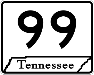
State Route 99 is a long east–west highway in Middle Tennessee. The route travels through large sections of rural areas and for most of the length is a secondary highway. The route begins near Waynesboro and ends in Bradyville after logging 126.7 mi (203.9 km) and passing through six counties.

<span class="mw-page-title-main">Tennessee State Route 10</span> Highway in Tennessee

State Route 10 is a south–north route from the Alabama state line in Lincoln County to the Kentucky state line in Macon County.

<span class="mw-page-title-main">Tennessee State Route 13</span> Highway in Tennessee

State Route 13, in the United States, is a south–north route from the Alabama border in Wayne County to the Kentucky border in Montgomery County. The entire route is located in western Middle Tennessee.

<span class="mw-page-title-main">Tennessee State Route 15</span> Highway in Tennessee

State Route 15 is a west–east route from Memphis to Monteagle. For much of its route it has an unsigned concurrency with U.S. Route 64. SR 15 does travel through the southern part of all 3 Grand Divisions of the state: West Tennessee, Middle Tennessee, and East Tennessee.

<span class="mw-page-title-main">Tennessee State Route 76</span> Highway in Tennessee

State Route 76 (SR 76) is a state highway in Tennessee, traversing the state in a northeast-southwest axis from east of Memphis to north of Nashville. SR 76 is unique in that it actually changes its cardinal directions in Clarksville at the junction with US 41A and US 41A Bypass.

<span class="mw-page-title-main">U.S. Route 41 in Tennessee</span>

U.S. Route 41 (US 41) is a United States Numbered Highway that runs from Miami, Florida, to Copper Harbor, Michigan. In Tennessee, the highway is paralleled by Interstate 24 all the way from Georgia to Kentucky, and I-24 has largely supplanted US-41 as a major highway, especially for large and heavy vehicles, such as tractor-trailer trucks and buses.

<span class="mw-page-title-main">Tennessee State Route 107</span> Highway in Tennessee

State Route 107 is a 78.77-mile (126.77 km) state highway in eastern Tennessee, United States. It begins at an intersection with Round Mountain Road south of Del Rio and ends at the North Carolina state line east of Unicoi, where it becomes NC 226.

<span class="mw-page-title-main">U.S. Route 31A</span> U.S. Highway in Tennessee

U.S. Route 31A is a 76.94-mile-long (123.82 km) alternate route of U.S. Route 31 that exists between Nashville and Pulaski, Tennessee. It is located entirely in Middle Tennessee and except for the Lewisburg bypass, where it is concurrent with SR 106, it is entirely concurrent with unsigned State Route 11.

<span class="mw-page-title-main">Tennessee State Route 55</span> Highway in Tennessee

State Route 55 is an east–west highway in Middle Tennessee. The road begins at SR 50 in Lynchburg and ends at U.S. Route 70S and SR 380 in McMinnville. The current length is 49.3 mi (79.3 km). SR 55 heads northeast from Lynchburg to Tullahoma as a two-lane road. In Tullahoma, the route runs concurrent with US 41A. From here, SR 55 heads northeast as a multilane highway to Manchester, where it intersects US 41 and Interstate 24 (I-24). The route continues northeast, serving Summitville and Morrison before it reaches McMinnville.

<span class="mw-page-title-main">Tennessee State Route 50</span>

State Route 50 (SR 50) is a west–to–east highway in Middle Tennessee. The road begins near Only and ends in Altamont. The current length is 161.3 miles (259.6 km).

<span class="mw-page-title-main">U.S. Route 231 in Tennessee</span>

U.S. Route 231 in Tennessee runs north–south for 121.15 miles (194.97 km), entirely in Middle Tennessee, that starts south of Fayetteville at the Alabama state line, and ends north of Westmoreland at the Kentucky state line. For the majority of its length, between the Alabama state line and Trousdale County, it is concurrent with unsigned State Route 10.

<span class="mw-page-title-main">Tennessee State Route 82</span>

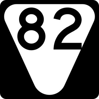
State Route 82 is a secondary state highway that runs through Moore and Bedford counties in south central Tennessee in the United States. The route runs from an intersection with SR 55 in Lynchburg north and east to SR 64 near Beech Grove.

<span class="mw-page-title-main">U.S. Route 41 Alternate (Tennessee–Kentucky)</span> U.S. Highway in Tennessee and Kentucky

U.S. Route 41 Alternate, also signed U.S. Route 41A in Tennessee (US 41A), connects the town of Monteagle, Tennessee, with Hopkinsville, Kentucky, 10 miles (16 km) north of the Tennessee line. It serves the city of Clarksville, Tennessee, on its way to Nashville, where it briefly runs concurrently with US 41. It then separates again to serve Shelbyville, Winchester, and Tullahoma before rejoining the main route atop Monteagle Mountain. US 41A runs west of US 41 for its entire length, aside from one mile in downtown Nashville where they are concurrent. US 41A is also concurrent with U.S. Route 31A from Nashville to Triune, Tennessee, for a distance of approximately 25 miles (40 km).

<span class="mw-page-title-main">Tennessee State Route 130</span>

State Route 130 is 51.3-mile long east–west state highway in Middle Tennessee.

<span class="mw-page-title-main">Tennessee State Route 269</span>

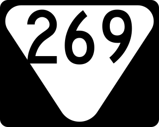
State Route 269 is a 49.2 miles (79.2 km) long east-west state highway in central Middle Tennessee.

References

  1. "DeLorme Street Atlas USA".{{cite web}}: Missing or empty |url= (help)
  2. Highway Planning Survey Division (1925). Biennial Report of the Commissioner of the Department of Highways and Public Works State of Tennessee for the Years 1923 and 1924 (PDF) (Report). Nashville: Tennessee Department of Highways and Public Works. pp. 39–44. Retrieved May 19, 2023.
  3. 1 2 "TN-16 · Tennessee".
  4. "Rowe Gap Rd · Tennessee".