
Steyr is a statutory city, located in the Austrian federal state of Upper Austria. It is the administrative capital, though not part of Steyr-Land District. Steyr is Austria's 12th most populated town and the 3rd largest city in Upper Austria.

Bischofshofen is a town in the district of St. Johann im Pongau in the Austrian federal state of Salzburg. It is an important traffic junction located both on the Salzburg-Tyrol Railway line and at the Tauern Autobahn, a major highway route crossing the main chain of the Alps.

Trattenbach is a village in Austria, situated in Lower Austria. It is in the industrial part (Industrieviertel) of Lower Austria. The village's total area is 30.91 km2 (11.93 sq mi), of which 81.31% is forested.
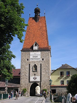
Freistadt is a small Austrian town in the state of Upper Austria in the region Mühlviertel. With a population of approximately 7,500 residents, it is a trade centre for local villages. Freistadt is the economic centre of a district of the same name District Freistadt. The nearest sizeable cities are Linz, the capital of Upper Austria, about 40 km in the south, and České Budějovice, the capital of Southern Bohemia, about 60 km in the north.

Frauenkirchen is an Austrian town in the district of Neusiedl am See, Burgenland.

Sankt Lambrecht is a market town in the district of Murau in Styria, Austria. It is known for St. Lambrecht's Abbey, one of the most important Benedictine monasteries in Austria. The monastery complex and its gardens are part of the Zirbitzkogel-Grebenzen nature park.
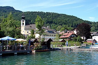
Unterach is a village in the Austria state of Upper Austria on the southern shore of lake Attersee in the centre of the Salzkammergut region.
Zell is a municipality in the district of Klagenfurt-Land in the Austrian state of Carinthia.

Alland is a market town in the district of Baden in the Austrian state of Lower Austria.

Heiligenkreuz is a municipality in the district of Baden, in the Austrian state of Lower Austria. It is known for the Cistercian monastery of Heiligenkreuz Abbey, the associated papal college Benedict XVI, commonly known as Hochschule Heiligenkreuz, and the Catholic Leopoldinum seminary.
Bramberg am Wildkogel is a municipality in the district of Zell am See, in the state of Salzburg, Austria. The town lies at the south foot of the 2,225-metre (7,300 ft) high Wildkogel mountain. The town's average elevation is 819 metres (2,687 ft).

Steinbach an der Steyr is a municipality in the district of Kirchdorf an der Krems in the Austrian state of Upper Austria.

Windischgarsten is a municipality in the district of Kirchdorf an der Krems in the Austrian state of Upper Austria. Since 1964, the town has been classified as a Luftkurort, a mountain spa town.
Dimbach is a municipality in the district Perg in Upper Austria, Austria. It had a population of 1015 according to the 2015 census.
Aschach an der Steyr is a municipality in the district of Steyr-Land in the Austrian state of Upper Austria.

Garsten is a municipality in the district of Steyr-Land in the Austrian state of Upper Austria.

Sierning is a municipality in the district of Steyr-Land in the Austrian state of Upper Austria.
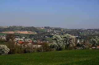
Sankt Ulrich bei Steyr is a municipality in the district of Steyr-Land in the Austrian state of Upper Austria.
Since 2015 Gratwein-Straßengel is a market town in the Graz-Umgebung District of Styria, Austria. The town took effect as part of the Styria municipal structural reform, from the end of 2014 with the merging of the former municipalities Gratwein, Judendorf-Straßengel, Eisbach and Gschnaidt. The merger made the market town population to be the 6th-largest in Styria.
Seiersberg-Pirka is a municipality with 12,112 residents, and after Gratwein-Straßengel, the 2nd-largest municipality of Graz-Umgebung District in Styria, Austria.


