
Hawthorne is an unincorporated community and census-designated place (CDP) in Mineral County, Nevada, United States. As of the 2020 census, the population was 3,118. It is the county seat of Mineral County. The nearby Hawthorne Army Depot is the primary economic base of the town.

Ely is the largest city and county seat of White Pine County, Nevada, United States. Ely was founded as a stagecoach station along the Pony Express and Central Overland Route. In 1906 copper was discovered. Ely's mining boom came later than the other towns along US 50. The railroads connecting the transcontinental railroad to the mines in Austin, Nevada and Eureka, Nevada have long been removed, but the railroad to Ely is preserved as a heritage railway by the Nevada Northern Railway and known as the Ghost Train of Old Ely. As of the 2020 census, the population was 3,924.

Rhyolite is a ghost town in Nye County, in the U.S. state of Nevada. It is in the Bullfrog Hills, about 120 miles (190 km) northwest of Las Vegas, near the eastern boundary of Death Valley National Park.

Mina is an unincorporated community and census-designated place (CDP) in Mineral County in west-central Nevada, United States. It is located along U.S. Route 95 at an elevation of 4,560 feet (1,390 m). The population at the 2020 census was 127.

Mound House is a small unincorporated community in Lyon County, Nevada on U.S. Route 50 that is situated between Nevada's capital, Carson City, and Dayton. Its elevation is 4,974 feet (1,516 m). It is in Lyon County, one of eight Nevada counties that allow for legalized prostitution, and is home to four brothels.

Valmy is a census-designated place in Humboldt County, Nevada, United States, named after the Battle of Valmy in France. The Lone Tree gold-mining complex is located adjacent to I-80; mining ended there in 2007, though a small gold resource remains in place there. In 2021, Nevada Gold Mines sold the mine to i-80 Gold, who hope to process ore there.

Luning is an unincorporated town in Mineral County, Nevada, in the United States. Luning is located on U.S. Route 95, between Hawthorne and Mina. Luning had an active railroad loading facility for many years. Magnesium ore from Gabbs was trucked to Luning and transferred to railroad cars bound for the West in World War II. The Basic Refractories mine in Gabbs was opened in 1955; it produced magnesium that was also trucked to the Luning loading platform, where most men in town worked.
Belleville, Nevada, in Mineral County, Nevada, United States, was a mining town that rose up around the milling of ore shipped in from nearby mines. Today it is a ghost town.

Millers is a ghost town located in Esmeralda County, Nevada. Deserted today, Millers sprang up as a mining boomtown after the Tonopah boom began. A highway rest stop is located there, resulting in Millers still being listed on many travel maps.
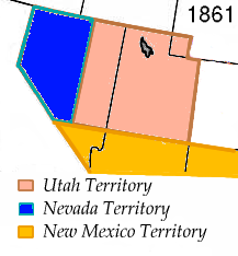
The History of Nevada as a state began when it became the 36th state on October 31, 1864, after telegraphing the Constitution of Nevada to the Congress days before the November 8 presidential election. Statehood was rushed to help ensure three electoral votes for Abraham Lincoln's reelection and add to the Republican congressional majorities.

The Los Angeles and Independence Railroad, opened on October 17, 1875, was a steam-powered rail line which ran between the Santa Monica Long Wharf and 5th and San Pedro streets in downtown Los Angeles.

Ruby Hill is a ghost town in Eureka County, in the central part of the U.S. state of Nevada, approximately 2.6 mi (4.2 km) west of the town of Eureka, Nevada. In 1910, the Ruby Hill Railroad was washed out, after which there were only three businesses in town.

Fairview is a ghost town in Churchill County, Nevada, in the United States of America.
Barnwell, originally a rail camp named Summit, then Manvel, was a former railhead serving local mining camps, now a ghost town, in San Bernardino County, California. It lies at an elevation 4806 feet in the New York Mountains.
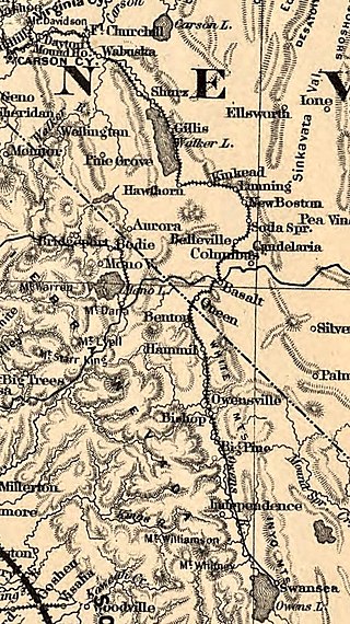
Basalt is a formerly populated place located in Mineral County, Nevada.

The Farmville and Powhatan Railroad went bankrupt in 1905 and became the Tidewater and Western Railroad. The line survived until 1917 when it was pulled up and sent to France for the World War I effort. The Tidewater and Western Railroad carried freight and passengers along a route from Farmville, Virginia to Bermuda Hundred. The Tidewater and Western Railroad continued to have Western Union Telegraphs run along the rails. These connected to telegraphs on the Atlantic Coast Line along the East Coast of the US and to Europe.
Eagleville is a former populated place in Mineral County, Nevada, that is now a ghost town.
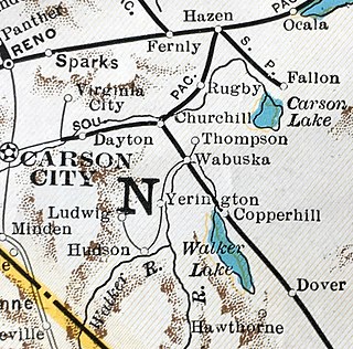
The Nevada Copper Belt Railroad was a railroad in the state of Nevada connecting Nevada-Douglas Copper Company mining facilities to the Southern Pacific's former Carson and Colorado Railway subsidiary at Wabuska, Nevada. The railroad was built south from Wabuska to the Walker River at Mason, Nevada in 1910, and began operations on 1 March. Railroad construction then proceeded up the West Walker River canyon from Mason to leave the river at Hudson reaching the Nevada-Douglas Copper Company mine at Ludwig on 1 November 1911. Rails also extended 2.54 miles (4.09 km) north from Wabuska to a smelter at Thompson. Agricultural products from irrigated ranches along the Walker River provided revenues in addition to the ore traffic.
Lodi is an extinct town in Nye County, in the U.S. state of Nevada. The GNIS classifies it as a populated place.
Glendon is an unincorporated community in Moore County, North Carolina, United States.


