
Mission San Gabriel Arcángel is a Californian mission and historic landmark in San Gabriel, California. It was founded by Spaniards of the Franciscan order on "The Feast of the Birth of Mary," September 8, 1771, as the fourth of what would become twenty-one Spanish missions in California. San Gabriel Arcángel was named after the Archangel Gabriel and often referred to as the "Godmother of the Pueblo of Los Angeles." The mission was built and run using what has been described as slave labor from nearby Tongva villages, such as Yaanga and was built on the site of the village of Toviscanga. When the nearby Pueblo de los Ángeles was built in 1781, the mission competed with the emerging pueblo for control of Indigenous labor.

The Tongva are an Indigenous people of California from the Los Angeles Basin and the Southern Channel Islands, an area covering approximately 4,000 square miles (10,000 km2). In the precolonial era, the people lived in as many as 100 villages and primarily identified by their village rather than by a pan-tribal name. During colonization, the Spanish referred to these people as Gabrieleño and Fernandeño, names derived from the Spanish missions built on their land: Mission San Gabriel Arcángel and Mission San Fernando Rey de España. Tongva is the most widely circulated endonym among the people, used by Narcisa Higuera in 1905 to refer to inhabitants in the vicinity of Mission San Gabriel. Some people who identify as direct lineal descendants of the people advocate the use of their ancestral name Kizh as an endonym.

Claremont is a suburban city on the eastern edge of Los Angeles County, California, United States, 30 miles (48 km) east of downtown Los Angeles. It is in the Pomona Valley, at the foothills of the San Gabriel Mountains. As of the 2010 census it had a population of 34,926, and in 2019 the estimated population was 36,266.

The San Gabriel Valley, often referred to by its initials as SGV, is one of the principal valleys of Southern California, with the city of Los Angeles directly bordering it to the west, and occupying the vast majority of the southeastern part of Los Angeles County. Surrounding landforms and other features include the following:

The Pomona Valley is located in the Greater Los Angeles Area between the San Gabriel Valley and San Bernardino Valley in Southern California. The valley is approximately 30 miles (48 km) east of downtown Los Angeles.

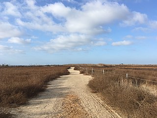
Puvunga is an ancient village and sacred site of the Tongva nation, the Indigenous people of the Los Angeles Basin, and the Acjachemen, the Indigenous people of Orange County. The site is now located within California State University, Long Beach and the surrounding area. The Tongva know Puvunga as the "place of emergence" and it is where they believed "their world and their lives began." Puvunga is an important ceremonial site and is the end to an annual pilgrimage for the Tongva, Acjachemen, and Chumash.
Olive is an unincorporated parcel of about 32.67 acres (132,200 m2) in the city of Orange, located along Lincoln Avenue, between Eisenhower Park and Orange Olive Road.
Bell Canyon Park is a large open-space regional park located in the Simi Hills at the western end of the San Fernando Valley in West Hills, Los Angeles and Bell Canyon, California. Bell Creek, a primary tributary to the Los Angeles River, flows through the park with riparian zone vegetation along its natural banks. The geographic landmark Escorpión Peak is high above it to the south in adjacent El Escorpión Park.
The history of the San Fernando Valley from its exploration by the 1769 Portola expedition to the annexation of much of it by the City of Los Angeles in 1915 is a story of booms and busts, as cattle ranching, sheep ranching, large-scale wheat farming, and fruit orchards flourished and faded. Throughout its history, settlement in the San Fernando Valley was shaped by availability of reliable water supplies and by proximity to the major transportation routes through the surrounding mountains.
Shevaanga or Sibagna is a former Tongva village located at the area of what would become San Gabriel, California. It was closely situated to the village of Toviscanga. It lay at an elevation of 430 feet. It was located near Mission San Gabriel Arcángel and the Whittier Narrows, in the San Gabriel Valley.

Cahuenga ( or "place of the hill" is a former Tongva–Tataviam Native American settlement in the San Fernando Valley of Los Angeles, Los Angeles County, California. One source suggests kawe means mountain in Tongva language. Recent linguistic work suggests an alternative meaning of "place of the fox". The Tongva-language suffix -nga indicates place, and the suffix -bet or -bit indicates person from place; people from Cahuenga were recorded in mission registers as Capuebet.
Chokishgna is a former Tongva village located at what is now Bell Gardens, California. The village declined with the growth of Mission San Gabriel, which was located at the site of the nearby village of Toviscanga in 1776. The original village site was located at the later site of a jabonería established in 1832 by Lemuel Carpenter, which is currently the site of the city of Bell Gardens.

Kaawchama, alternatively referred to as Wa’aachnga, was a significant Tongva village in the San Bernardino Valley located in what is now west Redlands, California. The village became referred to by the Spanish as the Guachama Rancheria in 1810 after a supply station was constructed at the village for Mission San Gabriel, which then became part of Rancho San Bernardino following the secularization of the missions in 1833.
Genga, alternative spelling Gengaa and Kengaa, was a Tongva and Acjachemen village located on Newport Mesa overlooking the Santa Ana River in the Newport Beach and Costa Mesa, California area which included an open site now referred to as Banning Ranch. Archaeological evidence dates the village at over 9,000 years old. Villagers were recorded as Gebit in Spanish Mission records. The village may have been occupied as late as 1829 or 1830.
Wapijanga was a Tongva village located in what is now Chino Hills, California, between the San Gabriel Mountains and Saddleback Peak. The village was located along Chino Creek, upstream from the village of Pashiinonga. It has been alternatively referred to as Wajijanga and Wapijangna. It was recorded as a large village in San Gabriel Mission records.
Tooypinga, alternatively spelled Toibingna, was a Tongva village located between the San Gabriel Mountains and Saddleback Peak at the base of the San Jose Hills along San Jose Creek. Nearby villages included Pashiinonga and Wapijanga. According to José Zalvidea, an informant of the era, the name "is derived from tojtsh, the devil woman who is there at El Rincon, near San José." People from the village were recorded as Toibipet.

Lupukngna was a coastal Tongva village that was at least 3,000 years old located on the bluffs along the Santa Ana River in Huntington Beach near the Newland House Museum. Other nearby coastal villages included Genga, located in West Newport Beach, and Moyongna, located down the coast near Corona del Mar. The village has also been referred to as Lukup and Lukupa. The village has been chronicled in the history of Costa Mesa, California.

Achooykomenga is a former settlement that was located at the site of Mission San Fernando Rey de España before it was founded in 1797. Prior to the mission's founding, in the 1780s, it functioned as a shared native settlement for an agricultural rancho of Pueblo de Los Ángeles that was worked by Ventureño Chumash, Fernandeño (Tongva), and Tataviam laborers.

Guashna was a Tongva village located at Playa Vista, Los Angeles at the mouth of Ballona Creek. The site has also been referred to as Sa'angna, with various sources debating whether Sa'angna, meaning "place of tar," was a regional referent rather than a village name or whether it was a separate nearby village. The initial place name was said to be Sa'an; the village suffix "ngna" was added by Bernice Johnston to her 1962 map of Gabrieleño villages "despite her having found no mention of the term in baptismal records." Sa'angna is also not to be confused with Suangna. The Tongva referred to the Ballona Wetlands as Pwinukipar, meaning "full of water." Another alternate name may Waachnga.
Comicranga was a coastal Tongva village located at what is now the area of Santa Monica, California. It is most notable as the home village in the early 19th century of Bartolomea, better known as Victoria Reid after her second marriage. She was a respected Indigenous woman in Mexican California, who was among the few indigenous people to receive a land grant. As a young widow, she married Scottish immigrant Hugo Reid, who became a naturalized Mexican citizen. The village is referred in various records and spellings to as Comigranga, Comicraibit, Comicrabit, and possibly Coronababit.
