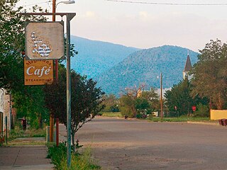
Branson is a Statutory Town located in Las Animas County, Colorado, United States. The town population was 57 at the 2020 United States Census. Branson is the southernmost town in the State of Colorado, located just 0.3 miles (0.48 km) from the New Mexico border.

Magdalena is a village in Socorro County, New Mexico, United States. The population was 938 at the 2010 census.

Folsom is a village in Union County, New Mexico, United States. Its population was 56 at the 2010 census, down from 75 in 2000. The town was named after Frances Folsom, the fiancée of President Grover Cleveland.
Aguanga is a census-designated place located within the Inland Empire, Riverside County, California. It is located about 18 miles (29 km) east of Temecula and 22 miles (35 km) south-southeast of Hemet. Aguanga lies at an elevation of 1955 feet. As of the 2010 census, it had a population of 1,028.

Leona Valley is a census-designated place located in the geographic Leona Valley of northern Los Angeles County, California, in the transition between the Sierra Pelona Mountains and Mojave Desert, just west of Palmdale and the Antelope Valley. The population was 1,607 at the 2010 census.

Canyon Country is a neighborhood in the eastern part of the city of Santa Clarita, in northwestern Los Angeles County, California, United States. It lies along the Santa Clara River between the Sierra Pelona Mountains and the San Gabriel Mountains. It is the most populous of Santa Clarita's four neighborhoods.
Oro Grande is an unincorporated community in the Mojave Desert of San Bernardino County, California, United States. It lies on the city boundary of Victorville and Adelanto. It is at 3,000 feet (910 m) elevation in Victor Valley north of the San Bernardino mountain range. It is located on old Route 66 near Interstate 15 between Victorville and Barstow. The ZIP code is 92368 and the community is inside area codes 442 and 760. Less than 1,000 residents live in the unincorporated area.

Lake Hughes is an unincorporated community in northern Los Angeles County, California. It is in the Sierra Pelona Mountains, northwest of Palmdale and north of the Santa Clarita Valley, in the Angeles National Forest. It is on the sag pond waters of Lake Hughes and Elizabeth Lake. The community is rural in character, with a population of 649 in 2010, but also has a strong recreational element centered on the three lakes in the vicinity. The community of Elizabeth Lake is located just east of Lake Hughes, sharing the same ZIP code.

Arivaca is an unincorporated community in Pima County, Arizona, United States. It is located 11 miles (18 km) north of the Mexican border and 35 miles (56 km) northwest of the port of entry at Nogales. The European-American history of the area dates back at least to 1695, although the community was not founded until 1878. Arivaca has the ZIP code 85601. The 85601 ZIP Code Tabulation Area had a population of 909 at the 2000 census.

Carmel Valley is a suburban planned community in the northwestern corner of San Diego, California, United States. The community is composed of commercial offices, residential units, hotels, retail stores and restaurants.

Ladera is a census-designated place (CDP) in southern San Mateo County, California, adjacent to Portola Valley. Primarily a residential community, it comprises approximately 520 homes, governed by the Ladera Community Association. The ZIP Code is 94028 and the community is inside area code 650. The population was 1,557 at the 2020 census.

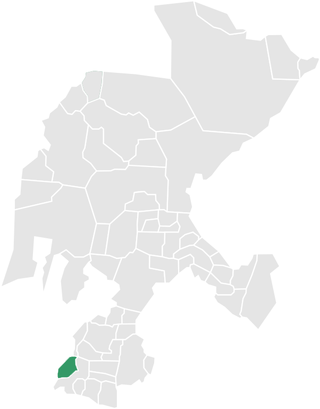
Benito Juárez is a municipality located on the edge of the Canyon of Tlaltenango in the southern extreme of the Mexican state of Zacatecas. The municipal seat is the town of Florencia.
Hereford is a populated place in Cochise County along the San Pedro Riparian National Conservation Area in the southern part of the U.S. state of Arizona. It is southeast of Sierra Vista and is a part of the Sierra Vista-Douglas micropolitan area. The elevation is 4,193 feet at the location of the original townsite at the far eastern end of the unincorporated area; the residential area runs for another 8 miles west from this location, blending into the unincorporated area of Nicksville at an elevation of approximately 4800'. Hereford Station Post Office is located at the far western end of Nicksville, at the foot of the Huachuca Mountains.

Carson is an unincorporated community in southwestern Taos County, New Mexico, United States. Named after frontiersman and Taos resident Kit Carson, Carson was founded c. 1908, when the surrounding area was opened for homesteading. Carson is a low-density rural residential area.

Los Alamos is a census-designated place in Los Alamos County, New Mexico, United States, that is recognized as one of the development and creation places of the atomic bomb—the primary objective of the Manhattan Project by Los Alamos National Laboratory during World War II. The town is located on four mesas of the Pajarito Plateau, and had a population of about 13,200 as of 2020. It is the county seat and one of two population centers in the county known as census-designated places (CDPs); the other is White Rock.
Ranchita is an unincorporated community in San Diego County, California. Ranchita is 9 miles (14 km) southwest of Borrego Springs. Ranchita has a ZIP code of 92066. A notable feature is the Rancheti, an 11-foot-tall, 300-pound fiberglass Yeti statue erected by local real estate broker Joe Rauh on Montezuma Valley Road in December 2007. The statue was featured on the March 4, 2016 installment of Zippy.

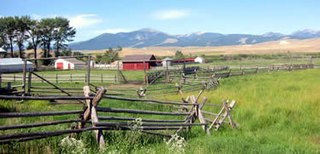
A ranch is an area of land, including various structures, given primarily to ranching, the practice of raising grazing livestock such as cattle and sheep. It is a subtype of farm. These terms are most often applied to livestock-raising operations in Mexico, the Western United States and Western Canada, though there are ranches in other areas. People who own or operate a ranch are called ranchers, cattlemen, or stockgrowers. Ranching is also a method used to raise less common livestock such as horses, elk, American bison, ostrich, emu, and alpaca.

Hinsdale is an unincorporated community and census-designated place in Valley County, Montana, United States. The town's population was 217 and the community's population as a whole was 583 as of the 2010 census. The community is located on the Milk River and U.S. Route 2, with Montana Highway 537 headed north out of town and South Bench Road crossing the railroad tracks and running south of town. Hinsdale has a post office with ZIP code 59241.

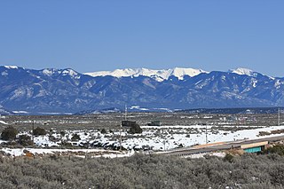
Tres Piedras is an unincorporated community in Taos County, northern New Mexico, United States, adjacent to Carson National Forest.

Spanish Americans are Americans whose ancestry originates wholly or partly from Spain. They are the longest-established European American group in the modern United States, with a very small group descending from those explorations leaving from Spain and the Viceroyalty of New Spain, and starting in the early 1500s, of 42 of the future U.S. states from California to Florida; and beginning a continuous presence in Florida since 1565 and New Mexico since 1598. In the 2020 United States census, 978,978 self-identified with "Spaniard" origins representing (0.4%) of the white alone or in combination population who responded to the question. Other results include 866,356 (0.4%) identifying as "Spanish" and 50,966 who identified with "Spanish American".


