U.S. Route 70S

Last updated

US 70S.svg

U.S. Route 70S

U.S. Route 70S
US 70S highlighted in red
Route information
Auxiliary route of US 70
Maintained by TDOT
Length113.1 mi [1]  (182.0 km)
Existed1939–present
Major junctions
West endUS 70.svg US 70 in Nashville
Major intersectionsI-440.svg I-440 in Nashville
I-40.svgI-65.svg I-40  / I-65 in Nashville
I-24.svg I-24 in Nashville
I-840.svg I-840 in Murfreesboro
East endUS 70.svgTennessee 111.svg US 70  / SR 111 in Sparta
Location
Country United States
State Tennessee
Counties Davidson, Rutherford, Cannon, Warren, Van Buren, White
Highway system
US 70N.svg US 70N US 70A.svg US 70A

U.S. Route 70S (US 70S) is an alternative to U.S. Route 70 between the western part of Nashville and Sparta in Tennessee. It runs concurrent with US 70 for several blocks in downtown Nashville. The highway follows Murfreesboro Pike from Nashville to Murfreesboro then heads due east to McMinnville then northeast to Sparta where it ends at its junction with US 70. It was originally designated as U.S. Route 270 in 1926.

Contents

Route description

US 70S begins at a junction with US 70 and SR 24 as the Charlotte Pike, and runs concurrently with SR 1. The road descends to an interchange with I-40, before passing through the community of Bellevue and intersecting SR 251. After this, US 70S enters the urban Nashville area along Harding Pike, intersecting SR 100 and then crossing I-440 as West End Avenue. US 70S and SR 1 merge with US 431 and SR 106 and crosses the I-40 and I-65 freeway as Broadway. At that interchange, the one-way couplet of US 70 and SR 24 meets US 70S, and all these routes continue into downtown Nashville. At the intersection of Rosa Parks Boulevard and Broadway, US 31 and US 41 run concurrently with the other routes on 8th Avenue South and then Lafayette Street, while US 431 splits off with US 31 and US 41 headed north, and US 70 and SR 24 continue east. US 31 eventually continues south, splitting from the other routes. US 70S and SR 1 and US 41 come to an interchange with I-24 near the I-40 interchange, before the three routes leave the Nashville area as Murfreesboro Pike, intersecting SR 155 and passing under the runways of Nashville International Airport. [1]

East of the airport, US 70S intersects SR 255, Donelson Pike, and later SR 254 as well as SR 171 (Hobson Pike), as it passes through the suburbs east of Nashville. In Rutherford County, US 70S has an interchange with SR 266 near the airport before passing through Smyrna. The highway then has an interchange with Lee Victory Parkway (SR 102) and I-840 before briefly paralleling the west fork of the Stones River and entering the city of Murfreesboro. U.S. Route 231 and SR 10 briefly run concurrently with the route, and SR 96 intersects it. Southeast of town, US 41 and SR 2 continue south, splitting off from SR 1 and US 70S. As Dr. Martin Luther King Jr. Boulevard, and then as the John Bragg Highway, the two routes leave the city and continue east through forested areas and farmland for several miles. [1]

In the town of Woodbury, the highway intersects with SR 145, and passes through the town as Main Street, also briefly running concurrently with SR 53. The road then winds through foothills before intersecting SR 281, SR 146 (both in the Bluewing community), and SR 287 (in the town of Centertown). Main Street comes to an interchange with SR 380 and SR 55, and US 70S and SR 1 continue northeast on the Bobby Ray Memorial Parkway. The parkway continues along the outskirts of McMinnville, intersecting SR 56 and SR 380. As Sparta Highway, the routes continue east, intersecting SR 30 and SR 288 before passing near Campaign and becoming first Bone Cave Parkway and then Memorial Highway. After several miles, the routes run concurrently with SR 111 before heading due north on Spencer Highway before SR 1 exits from the divided highway. US 70S and SR 111 continue north to the diamond interchange with US 70 and SR 26 just west of downtown Sparta. [1]

History

Route changes

During the 1980s, the section of the route between Belle Meade and Smyrna was widened from two to four lanes.

In 1991, the portion from Smyrna to Murfreesboro was also widened to four lanes.

In the early 1990s, the 18-mile (29 km) stretch from Murfreesboro to Woodbury was widened from two to four lanes.

Between 1994 and 2002, the section between McMinnville and Sparta was widened to four lanes and a four lane bypass around McMinnville was built. The former routing through downtown McMinnville is now designated State Route 380.

In 2006, besides the two-mile (3.2 km) western terminus near Bellevue past Interstate 40 to the intersection with US 70, the only section of US 70S that lacked four lanes was between Woodbury and McMinnville. Construction began outside McMinnville on widening to five lanes (including one left turn lane) for three miles (5 km) as a way to avoid congestion.

In 2018, most of the section between McMinnville and Woodbury had been widened to a four-lane divided highway. From McMinnville west to where the road starts up the ridge is four-laned. The stretch of highway going through Woodbury proper is still two-lanes. As the remaining two-lane portion will be adjacent to the site chosen in late January 2017 by the Metropolitan Nashville-Davidson County Board of Education for the relocation of Hillwood High School, [2] this may also be upgraded.

Junction list

CountyLocationmikmDestinationsNotes
Davidson 0.00.0US 70.svg US 70 (Charlotte Pike/SR 1 west/SR 24 east) Pegram Western terminus of US 70S; western end of SR 1 concurrency; western terminus of unsigned SR 24
Bellevue 1.8–
1.9
2.9–
3.1
I-40.svg I-40  Memphis, Nashville I-40 exit 196
3.96.3North plate.svg
Secondary Tennessee 251.svg
SR 251 north (Old Hickory Boulevard)
Southern terminus of SR 251; continues south as Old Hickory Boulevard
Belle Meade 7.311.7West plate.svg
Tennessee 100.svg
SR 100 west Pasquo, Fairview
Eastern terminus of SR 100; provides access to Natchez Trace Parkway
8.714.0Bridge over Richland Creek
9.515.3North plate.svg
Secondary Tennessee 155.svg
SR 155 north (White Bridge Pike)
Woodmount Boulevard
Southern terminus of SR 155; continues south as Woodmount Boulevard; beltway around Nashville
Nashville 11.1–
11.3
17.9–
18.2
I-440.svg I-440 (Four-Forty Parkway) Memphis, Knoxville I-440 west exit 1, east exit 1A.
13.221.2South plate.svg
US 431.svg
US 431 south (Broadway/SR 106 south) Forest Hills
Western end of US 431 concurrency; northern terminus of unsigned SR 106
13.421.6East plate blue.svg
I-40.svg
South plate blue.svg
I-65.svg
I-40 east / I-65 south Knoxville, Huntsville
I-40 EB/I-65 SB accessed via 14th Avenue S
13.521.7West plate blue.svg
I-40.svg
North plate blue.svg
I-65.svg
I-40 west / I-65 north Memphis, Louisville
West plate.svg
US 70.svg
US 70 west (13th Avenue N/SR 24 west)
Western end of US 70 / SR 24 concurrency
13.922.4East plate.svg
US 70.svg
North plate.svg
US 31.svg
North plate.svg
US 41.svg
North plate.svg
US 41A.svg
North plate.svg
US 431.svg
US 70 east (Broadway/SR 24 east) / US 31 north / US 41 north / US 41A north / US 431 north (8th Avenue/SR 6 north/SR 11 north)
Eastern end of US 70/US 431/SR 24 concurrency; western end of US 31/US 41/US 41A/SR 6/SR 11 concurrency
14.222.9South plate.svg
US 31.svg
US 31 south (8th Avenue South/SR 6 south) Berry Hill, Oak Hill
Begin plate.svg
US 31A.svg
US 31A begins
Eastern end of US 31/SR 6 concurrency; Roundabout; northern terminus of US 31A; southern end of US 31A concurrency
14.8–
15.0
23.8–
24.1
South plate.svg
US 31A.svg
South plate.svg
US 41A.svg
US 31A south / US 41A south (2nd Avenue S/4th Avenue S/SR 11 south)
I-40.svg I-40  Memphis, Knoxville
Eastern end of US 31A/US 41A/SR 11 concurrency; I-40 exit 210C
17.3–
17.5
27.8–
28.2
I-24.svgI-40.svg I-24  / I-40  Chattanooga, Nashville, Knoxville I-24 exit 52; I-40 exit 213 (westbound only)
18.429.6Bridge over Mill Creek
19.3–
19.5
31.1–
31.4
Tennessee 155.svg SR 155 (Briley Parkway)SR 155 exit 4; Single-point urban interchange; beltway around Nashville
20.4–
20.6
32.8–
33.2
Tunnel under Nashville International Airport
21.234.1Secondary Tennessee 255.svgAirport Sign.svg SR 255 (Donelson Pike) Oak Hill, Donelson Provides access to Nashville International Airport
Antioch 24.439.3West plate.svg
Tennessee 254.svg
SR 254 west (Bell Road) Brentwood
Eastern terminus of SR 254
27.043.5Secondary Tennessee 171.svg SR 171 (Old Hickory Boulevard/Hobson Pike) Mount Juliet
Rutherford Smyrna 32.2–
32.6
51.8–
52.5
Secondary Tennessee 266.svgAirport Sign.svg SR 266 (Sam Ridley Parkway)Provides access to Smyrna Airport; interchange
35.4–
36.1
57.0–
58.1
Secondary Tennessee 102.svg SR 102 (Lee Victory Parkway/Nissan Drive)Interchange
Murfreesboro 39.9–
40.8
64.2–
65.7
I-840.svg I-840  Knoxville, Chattanooga I-840 exit 55 A/B
42.368.1Van Cleve Lane - McFadden Farm (Stones River National Battlefield)
42.768.7East plate.svg
Secondary Tennessee 268.svg
SR 268 east (N Thompson Lane)
S Thompson Lane - Stones River National Battlefield main entrance
Western terminus of SR 268
42.8–
42.9
68.9–
69.0
Bridge over the West Fork of the Stones River
45.0–
45.1
72.4–
72.6
North plate.svg
US 231.svg
Tennessee 96.svgWest plate.svg
Secondary Tennessee 99.svg
US 231 north (Memorial Boulevard/SR 10 north) / SR 96  / SR 99 west (Old Fort Parkway)
Western end of US 231/SR 10/SR 99 concurrency; interchange
45.773.5South plate.svg
US 231.svg
US 231 south (South Church Street/SR 10 south)
Eastern end of US 231/SR 10 concurrency
46.274.4South plate.svg
US 41.svg
West plate.svg
Secondary Tennessee 99.svg
US 41 south / SR 99 west (Southeast Broad Street/SR 2 east)
Eastern end of US 41/SR 99 concurrency; western terminus of unsigned SR 2
Cannon Readyville 59.996.4West plate.svg
Secondary Tennessee 64.svg
SR 64 west (Bradyville Road) Bradyville
Eastern terminus of SR 64
Woodbury 63.6102.4 William Bill Smith Bridge over the East Fork of the Stones River
64.1103.2North plate.svg
Secondary Tennessee 145.svg
SR 145 north Auburntown
Southern terminus of SR 145
64.4–
64.5
103.6–
103.8
Bridge over the East Fork of the Stones River
64.9104.4South plate.svg
Tennessee 53.svg
SR 53 south (South McCrary Street) Manchester
Western end of SR 53 concurrency
65.6105.6North plate.svg
Tennessee 53.svg
SR 53 north (Gassaway Road) Liberty
Eastern end of SR 53 concurrency
Bluewing 70.6113.6Secondary Tennessee 281.svg SR 281 (Center Hill Road/Manaustown Road)
72.3116.4North plate.svg
Secondary Tennessee 146.svg
SR 146 north (Short Mountain Road) Smithville
Southern terminus of SR 146
Warren Centertown 76.5123.1South plate.svg
Secondary Tennessee 287.svg
SR 287 south (W Green Hill Road) Centertown
Western end of short SR 287 concurrency
76.6123.3North plate.svg
Secondary Tennessee 287.svg
SR 287 north (W Green Hill Road)
Eastern end of short SR 287 concurrency
81.5131.2Airport Sign.svg Old Nashville Highway to Airport Road - Warren County Memorial Airport
McMinnville 83.7134.7West plate.svg
Tennessee 55.svg
East plate.svg
Secondary Tennessee 380.svg
SR 55 west (H T Pelham Memorial Parkway) / SR 380 east (W Main Street) Manchester, Downtown
Interchange; eastern terminus of SR 55; western terminus of SR 380; SR 380 is the former routing of US 70S/SR 1
85.0136.8Tennessee 56.svg SR 56 (N Chancery Street/Smithville Highway) Smithville, Downtown
86.8–
87.0
139.7–
140.0
West plate.svg
Secondary Tennessee 380.svg
SR 380 west (Sparta Street) – Downtown
Eastern terminus of SR 380; former routing of US 70S/SR 1
88.1–
88.2
141.8–
141.9
Veterans Memorial Bridge over the Collins River
89.8–
90.0
144.5–
144.8
East plate.svg
Tennessee 30.svg
SR 30 east (Spencer Road) Spencer
Western terminus of SR 30
90.8146.1North plate.svg
Secondary Tennessee 288.svg
SR 288 north (Old Rock Island Road)
Southern terminus of SR 288
Campaign 97.0156.1North plate.svg
Secondary Tennessee 136.svg
SR 136 north (Rock Island Road) Rock Island, Rock Island State Park, Walling
Southern terminus of SR 136
WarrenVan Buren
county line
Bone Cave 97.4–
97.5
156.8–
156.9
Great Bone Cave Bridge over the Rocky River
Van Buren
No major junctions
Van BurenWhite
county line
Quebeck 100.3–
100.4
161.4–
161.6
John Steele Cooper Bridge over the Caney Fork River
White Doyle 105.2169.3W Gooseneck Road - Doyle
East plate.svg
Secondary Tennessee 285.svg
SR 285 east (E Gooseneck Road) Fall Creek Falls State Park
Wester terminus of SR 285; W Gooseneck Road is an access road into the town of Doyle
107.4–
107.5
172.8–
173.0
Bridge over the Calfkiller River
108.0–
108.2
173.8–
174.1
South plate.svg
Tennessee 111.svg
SR 111 south (Spencer Highway) Spencer
Western end of SR 111 concurrency; interchange
Sparta 110.5–
110.6
177.8–
178.0
James R. Tubb Bridge over the Calfkiller River
110.9–
111.4
178.5–
179.3
East plate.svg
Tennessee 1.svg
SR 1 east (Mayberry Street) Sparta
Eastern end of SR 1 concurrency; interchange
113.1182.0US 70.svg US 70 (W Bockman Way/SR 26) Sparta, Smithville
North plate.svg
Tennessee 111.svg
SR 111 north Cookeville
Eastern terminus of US 70S; interchange; eastern end of SR 111 concurrency
1.000 mi = 1.609 km; 1.000 km = 0.621 mi

See also

Related Research Articles

<span class="mw-page-title-main">U.S. Route 41</span> Highway in the United States

U.S. Route 41, also U.S. Highway 41 (US 41), is a major north–south United States Numbered Highway that runs from Miami, Florida, to the Upper Peninsula of Michigan. Until 1949, the part in southern Florida, from Naples to Miami, was US 94. The highway's southern terminus is in the Brickell neighborhood of Downtown Miami at an intersection with Brickell Avenue (US 1), and its northern terminus is east of Copper Harbor, Michigan, at a modest cul-de-sac near Fort Wilkins Historic State Park at the tip of the Keweenaw Peninsula. US 41 closely parallels Interstate 75 (I-75) from Naples, Florida, all the way through Georgia to Chattanooga, Tennessee.

<span class="mw-page-title-main">U.S. Route 31</span> Highway in the United States

U.S. Route 31 or U.S. Highway 31 (US 31) is a major north–south U.S. highway connecting southern Alabama to northern Michigan. Its southern terminus is at an intersection with US 90/US 98 in Spanish Fort, Alabama. Its northern terminus is at an interchange with Interstate 75 (I-75) south of Mackinaw City, Michigan.

<span class="mw-page-title-main">U.S. Route 411</span> Numbered U.S. Highway in Alabama, Georgia, and Tennessee in the United States

U.S. Route 411 (US 411) is an alternate parallel-highway associated with US 11. It extends for about 309.7 miles (498.4 km) from US 78 in Leeds, Alabama, to US 25W/US 70 in Newport, Tennessee. US 411 travels through northeastern Alabama, northwestern Georgia, and southeastern Tennessee. It is signed north-south, as with most highways that have odd numbers, but the route runs primarily in a northeast-southwest direction, and covers a more east-west mileage than it does north-south. Notable towns and cities along its route include Gadsden, Alabama; Rome, Georgia; Cartersville, Georgia; Maryville, Tennessee; Sevierville, Tennessee, and Newport, Tennessee.

<span class="mw-page-title-main">U.S. Route 231</span> Highway in the United States

U.S. Route 231 (US 231) is a north–south U.S highway that is a parallel route of US 31. It runs for 912 miles (1,468 km) from St. John, Indiana, at US 41 to south of US 98 in downtown Panama City, Florida. One of its most notable landmarks is the William H. Natcher Bridge, a 0.853 miles (1.373 km) long cable-stayed bridge that connects Rockport, Indiana, to Owensboro, Kentucky, spanning the Ohio River.

<span class="mw-page-title-main">U.S. Route 431</span> Highway in the United States

U.S. Route 431 (US 431) is a spur of U.S. Route 31. It currently travels for approximately 556 miles (895 km) from US 231/Alabama State Route 210 and US 231 Business and US 431 Bus. in Dothan, Alabama, to Owensboro, Kentucky, at US 60 and Kentucky Route 2831. The major cities US 431 connects to are Dothan and Huntsville, Alabama, Franklin and Nashville, Tennessee, and Owensboro, Kentucky.

<span class="mw-page-title-main">Tennessee State Route 155</span> Highway in Tennessee

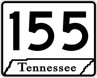
State Route 155, mostly designated as Briley Parkway, is a major freeway and parkway beltway around Nashville, Tennessee. It is 35.1 miles (56.5 km) long.

<span class="mw-page-title-main">Tennessee State Route 1</span> State highway in Tennessee, United States

State Route 1, known as the Memphis to Bristol Highway, is a 538.8-mile-long (867.1 km) mostly-unsigned state highway in the U.S. state of Tennessee. It stretches all the way from the Arkansas state line at Memphis in the southwest corner of the state to Bristol in the northeast part. Most of the route travels concurrently with U.S. Route 70 and US 11W. It is the longest highway of any kind in the state of Tennessee. The route is signed as both in the state of Tennessee, a Primary and Secondary Highway

<span class="mw-page-title-main">Tennessee State Route 2</span> State highway in Tennessee, United States

State Route 2 is a 197-mile-long (317 km) west–to–east state highway in the U.S. state of Tennessee. It begins in Murfreesboro, in Rutherford County, and ends near Farragut in Loudon County. The route is both a primary and secondary route. Most of the route is unsigned.

<span class="mw-page-title-main">Tennessee State Route 266</span> State highway in Tennessee, United States

State Route 266 is a state highway in Middle Tennessee. The southern terminus is in a currently undeveloped section of Smyrna at an interchange with I-24. The northern terminus is in Lebanon at an intersection with US 70.

<span class="mw-page-title-main">Tennessee State Route 96</span> Highway in Tennessee

State Route 96 is an east–west and north–south highway in Middle Tennessee. The road begins in Dickson and ends in Granville. The current length is 126.7 mi (203.9 km). Along its path it goes through 10 counties. Locals mostly refer to it as Highway 96.

Old Hickory Boulevard is a historic road that encircles Nashville, Tennessee, lying entirely within Davidson County. Originally the road, aided by ferries, formed a nearly unbroken loop around the city. Today, it is interrupted by a lake and several rerouted sections, which consist of roughly 69 miles (111 km). Just over half the distance–36.2 miles (58.3 km)–is part of several Tennessee state highways, including SR 45, SR 171, SR 251, and SR 254. Unsigned concurrencies exist very briefly along US 31E, US 41/US 70S, and SR 100.

<span class="mw-page-title-main">U.S. Route 27 in Tennessee</span> United States Numbered Highway in Tennessee

U.S. Route 27 (US 27) in Tennessee runs from the Georgia state line in Chattanooga to the Kentucky state line in Isham. It forms the informal border between the Eastern and Central timezones of the state. It stays, however, in the Eastern Time Zone.

<span class="mw-page-title-main">Tennessee State Route 10</span> Highway in Tennessee

State Route 10 is a south–north route from the Alabama state line in Lincoln County to the Kentucky state line in Macon County.

<span class="mw-page-title-main">U.S. Route 431 in Tennessee</span> United States Numbered Highway in Tennessee

U.S. Route 431 in Tennessee totals an estimated 116 miles (187 km) through Lincoln, Marshall, Maury, Williamson, Davidson, and Robertson counties in Middle Tennessee.

<span class="mw-page-title-main">Tennessee State Route 26</span> State highway in Tennessee, United States

State Route 26 is an east–west highway in Middle Tennessee. The road begins in Lebanon and ends in Sparta. The current length is 59.25 mi (95.4 km).

<span class="mw-page-title-main">Tennessee State Route 111</span> State highway in Tennessee, United States

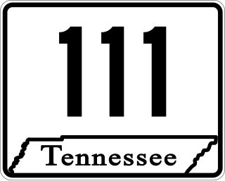
State Route 111 (SR 111) is a north–south highway in Middle and East Tennessee. The road begins in Soddy-Daisy and ends north of Byrdstown in the community of Static, at the Tennessee/Kentucky state line. The length is 116 mi (186.7 km).

<span class="mw-page-title-main">Tennessee State Route 55</span> Highway in Tennessee

State Route 55 is an east–west highway in Middle Tennessee. The road begins at SR 50 in Lynchburg and ends at U.S. Route 70S and SR 380 in McMinnville. The current length is 49.3 mi (79.3 km). SR 55 heads northeast from Lynchburg to Tullahoma as a two-lane road. In Tullahoma, the route runs concurrent with US 41A. From here, SR 55 heads northeast as a multilane highway to Manchester, where it intersects US 41 and Interstate 24 (I-24). The route continues northeast, serving Summitville and Morrison before it reaches McMinnville.

<span class="mw-page-title-main">Tennessee State Route 53</span> Highway in Tennessee

State Route 53 (SR 53) is a north–south state highway that traverses six counties in Middle Tennessee. It is 113.5 miles (182.7 km) long.

<span class="mw-page-title-main">U.S. Route 231 in Tennessee</span> Section of U.S. Highway in Tennessee

U.S. Route 231 in Tennessee runs north–south for 121.15 miles (194.97 km), entirely in Middle Tennessee, that starts south of Fayetteville at the Alabama state line, and ends north of Westmoreland at the Kentucky state line. For the majority of its length, between the Alabama state line and Trousdale County, it is concurrent with unsigned State Route 10.

<span class="mw-page-title-main">U.S. Route 31 in Tennessee</span> Segment of American highway

U.S. Route 31 (US 31) is a part of the United States Numbered Highway System that runs from Spanish Fort, Alabama, to Mackinaw City, Michigan. In the U.S. state of Tennessee, it runs concurrently with Interstate 65 (I-65) for the first mile northward from the Tennessee state line. There US 31 parallels I-65 to downtown Nashville. At Pulaski US 31 meets the southern terminus of US 31A in Tennessee. US 31 continues due north through Lynnville, Columbia, Spring Hill, Franklin and Brentwood to Nashville. The route splits into US 31E and US 31W in Nashville and go into Kentucky.

References

  1. 1 2 3 4 Google (March 3, 2013). "U.S. Route 70S" (Map). Google Maps . Google. Retrieved March 3, 2013.
  2. WKRN, January 24, 2017
Template:Attached KML/U.S. Route 70S
KML is from Wikidata

Commons-logo.svg Media related to U.S. Route 70S at Wikimedia Commons