U.S. Route 93 in Nevada

Last updated

US 93.svg

U.S. Route 93

U.S. Route 93 in Nevada
US 93 highlighted in red
Route information
Maintained by NDOT
Length527 mi [1]  (848 km)
437.200 mi (703.605 km) separate from other routes [2]
Existed1926–present
Major junctions
South endI-11 (Future).svgUS 93.svg Future I-11  / US 93 at the Arizona state line on the Mike O'Callaghan–Pat Tillman Memorial Bridge
Major intersections
North endUS 93.svg US 93 at the Idaho state line in Jackpot
Location
Country United States
State Nevada
Counties Clark, Lincoln, White Pine, Elko
Highway system
  • Nevada State Highway System
Nevada 88.svg SR 88 US 95.svg US 95

In the U.S. state of Nevada, U.S. Route 93 (US 93) is a major United States Numbered Highway traversing the eastern edge of the state. The highway connects the Las Vegas area to the Great Basin National Park, and provides further connections to Ely and Wells. US 93 also provides the majority of the most direct connection from the major metropolitan areas of Las Vegas and Phoenix (via Boulder City, Kingman and Wickenburg with a final link to Phoenix via US 60) to the Boise, Idaho metropolitan area (with a final connection to Boise via Interstate 84 from Twin Falls, Idaho).

Contents

Route description

Near Interstate 15, looking north in 2006 Great Basin Highway 1.jpg
Near Interstate 15, looking north in 2006

U.S. Route 93 in Nevada is known as the Great Basin Highway from Interstate 15 in North Las Vegas to Interstate 80 in Wells. [3] It begins at the Mike O'Callaghan–Pat Tillman Memorial Bridge in Boulder City. The highway overlaps U.S. Route 95 from State Route 173 in Boulder City to Interstate 15 in downtown Las Vegas. It runs to the Las Vegas Valley passing through the cities of Henderson, Las Vegas and North Las Vegas. US 93 merges with Interstate 15 at the Spaghetti Bowl interchange and overlaps I-15 for approximately 21 miles. After overlapping I-15, US 93 heads northwest towards Alamo.

Signage along the Scenic Byway section of US 93, as seen in 2014 2014-08-09 11 31 57 Signs along southbound U.S. Route 93 about 26.7 miles north of the Lincoln County line near Majors Place, Nevada.JPG
Signage along the Scenic Byway section of US 93, as seen in 2014

Near Crystal Springs, US 93 curves right while intersecting State Routes 318 and 375. US 93 continues east to mountainous terrain to the town of Caliente. The highway turns left to go north to Pioche. 80 miles later, the highway turns left at an intersection with U.S. Routes 6 and 50. From State Route 318 to the US Routes 6 and 50 intersection, the highway is a Nevada Scenic Byway. Near Ely, the three U.S. routes separate. US 6 turns left before the intersection US 50 and 93 separate, heading southwest. US 50 and 93 separate, with route 50 heading northwest towards Austin, Nevada and route 93 heading northeast.

At Lages Station, US 93 turns left, while US 93 Alternate continues straight. In Wells, US 93 intersects Interstate 80. The highway continues into Idaho after passing through Jackpot. Between Ely and Wells there are no services for 136 miles.

History

Establishment

U.S. Route 93 was not one of the original U.S. highways proposed in the 1925 Bureau of Public Roads plan.[ citation needed ] However, the revised numbering plan approved by the American Association of State Highway Officials (AASHO) on November 11, 1926 established US 93 from the Canada–US border near Eureka, Montana south through Montana and Idaho to a southern terminus at Wells, Nevada. [4] The establishment of the highway was reflected on Nevada's 1927 official highway map. [5] The Nevada section was approximately 70 miles (110 km), commissioned along what was then the northern portion of State Route 13. [6]

AASHO, at its June 8, 1931 meeting, approved a southerly extension of US 93 south to Glendale, Nevada. [4] By 1932, the Nevada Department of Highways had marked the continuation of the highway using the routing of several preexisting state highways as follows: [7]

At the request of the Arizona State Highway Department, the AASHO route numbering committee approved another extension of US 93 in 1935. This shifted the southern terminus south to Kingman, Arizona by way of Las Vegas. [4] However, Nevada officials may not have signed the extension of US 93 right away, since it was not shown on state-published maps until 1939. [4] [8] [9] The highway was again extended along existing highways: [8] [9]

The new routing put the Nevada mileage of U.S. Route 93 at approximately 540 miles (870 km). The entire highway within Nevada was paved by 1939. [9]

View south along US 93 just north of Wells 2014-06-10 18 21 15 View south along U.S. Route 93 a little north of Nevada State Route 223 in Wells, Nevada.JPG
View south along US 93 just north of Wells

Route changes

After US 93 was extended to Arizona in the 1930s, the route remained unchanged for many years. A 19-mile (31 km) concurrency with U.S. Route 95 between Las Vegas and Alunite was added in 1940, when that highway was extended through southern Nevada along State Route 5. [10]

The first major shift of US 93 occurred in 1967, when a new highway connection was completed between US 91 (now I-15) and a point 24 miles (39 km) northwest of Glendale. The new alignment was oriented more north–south, shortening the distance between the Las Vegas area and Caliente by 23 miles (37 km). The old section of US 93 northwest of Glendale paralleling the Muddy River remained as State Route 7, [11] and was renumbered in 1976 to State Route 168.

In 1982, a "truck bypass" along the upper reaches of Hemenway Wash, to skirt the central portion of Boulder City and allow a straighter, more steady climb for commercial vehicles, was nearing completion. But by the time this new route opened, it had been signed as mainline US 93, with the old, winding route of US 93 on the Nevada Highway (original SR 26) through town being changed to SR 500. This state highway designation was later dropped and that roadway is now maintained by Boulder City as "Nevada Way". The western end of this 1982 bypass was also later realigned from Colorado Street south to intersect directly at Buchanan Boulevard (in place of a wye intersection with Nevada Way a block to the east at Joshua Street), by using a small portion of abandoned railroad right-of-way. A shopping center now sits where the original truck bypass alignment once ran.

US 93 was realigned again on October 19, 2010, when the Mike O'Callaghan–Pat Tillman Memorial Bridge over the Black Canyon of the Colorado River opened to vehicular traffic. With that, the highway no longer passes over Hoover Dam, and the state-maintained portion of the replaced route was renamed as Hoover Dam Access Road (SR 172). [12] In 2011, US 93 from Buchanan Boulevard to the Nevada terminus of the Hoover Dam Bypass was expanded to four through lanes with dedicated turn lanes at major intersections to better handle increased traffic loads from the Hoover Dam Bypass until its long-planned companion freeway around Boulder City was completed in 2018. [13]

On August 9, 2018, US 93 was rerouted onto the Boulder City Bypass around the historic town. The most recent previous alignment (1982–2018) through the heart of Boulder City and along Hemenway Wash has now been re-signed as U.S. Route 93 Business.

Major intersections

Note: Mileposts in Nevada reset at county lines; the start and end mileposts for each county are given in the county column.
CountyLocationmi [14] kmDestinationsNotes
Colorado River 0.000.00South plate.svg
US 93.svg
US 93 south Kingman
Continuation into Arizona; southern end of I-11 concurrency
Mike O'Callaghan–Pat Tillman Memorial Bridge; Arizona—Nevada state line
Clark
CL 0.00–86.58
Lake Mead NRA to Henderson US-93 concurrent with I-11 and US 95 (exits 2 to 23)
Henderson West plate blue.svg
I-215.svg
East plate.svg
Nevada 564.svg
I-215 west (Bruce Woodbury Betlway) / SR 564 east (Lake Mead Parkway) Las Vegas, Lake Mead
Northern end of I-11 concurrency; southern end of I-515 concurrency; I-215 Exit 1
Henderson to Las Vegas US 93 concurrent with I-515 and US 95 (exits 62 to 76)
Las Vegas South plate blue.svg
I-15.svg
North plate.svg
US 95.svg
I-15 south / US 95 north Los Angeles, Reno
Northern end of I&8209;515/US 95 concurrency; southern end of I-15 concurrency; I-515/US 95 Exit 76; I-15 Exit 42
Las Vegas to North Las Vegas US 93 overlaps with I-15 (exits 42 to 64)
Garnet 52.0383.73North plate blue.svg
I-15.svg
I-15 north Salt Lake City
Northern end of I-15 concurrency; Diverging diamond interchange
East plate.svg
Nevada 168.svg
SR 168 east (Glendale–Moapa Road) Moapa, Glendale
SR 168 east was former US 93 south
Lincoln
LN 0.00–172.87
Crystal Springs North plate.svg
Nevada 318.svg
SR 318 north Hiko, Sunnyside, Ely
Caliente South plate.svg
Nevada 317.svg
SR 317 south Elgin
Panaca East plate.svg
Nevada 319.svg
SR 319 east Cedar City (Utah)
West plate.svg
Nevada 816.svg
SR 816 west (Airport Road)
Serves Lincoln County Airport
North plate.svg
Nevada 320.svg
SR 320 north (Caselton Mine Road)
North plate.svg
Nevada 321.svg
SR 321 north Pioche
Pioche Nevada 322.svg SR 322  Ursine, Spring Valley State Park
South plate.svg
Nevada 321.svg
SR 321 south Pioche
South plate.svg
Nevada 320.svg
SR 320 south (Caselton Mine Road)
White Pine
WP 0.00–116.69
South plate.svg
Nevada 894.svg
SR 894 south Shoshone
Majors Place 27.6144.43East plate.svg
US 6.svg
East plate.svg
US 50.svg
US 6 east / US 50 east Baker, Delta (Utah)
Southern end of US 6/US 50 concurrency
Ely West plate.svg
US 6.svg
US 6 west Las Vegas, Tonopah
Northern end of US 6 concurrency
53.4586.02West plate.svg
US 50.svg
US 50 west Eureka, Austin
Northern end of US 50 concurrency
West plate.svg
Nevada 490.svg
SR 490 west (Ely Prison Road)
Serves Ely State Prison
Lages Station North plate.svg
Alt plate.svg
US 93.svg
US 93 Alt. north West Wendover
Elko
EL 0.00–127.54
West plate.svg
Nevada 229.svg
SR 229 west (Secret Pass Road) Ruby Valley
Serves Ruby Lake National Wildlife Refuge
South plate.svg
Nevada 232.svg
SR 232 south (Clover Valley Road)
Wells I-80.svgSouth plate.svg
Alt plate.svg
US 93.svg
I-80  / US 93 Alt. south Salt Lake City, Elko, Reno
West plate green.svg
Business Loop 80.svg
West plate.svg
Nevada 223.svg
I-80 BL west / SR 223 west (6th Street)
Jackpot 127.54205.26North plate.svg
US 93.svg
US 93 north Twin Falls
Continuation into Idaho
1.000 mi = 1.609 km; 1.000 km = 0.621 mi

Special routes

See also


Related Research Articles

<span class="mw-page-title-main">Interstate 15</span> Interstate in the Western United States

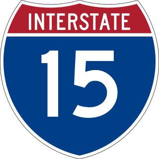
Interstate 15 (I-15) is a major Interstate Highway in the Western United States, running through Southern California and the Intermountain West. I-15 begins near the Mexican border in San Diego County and stretches north to Alberta, Canada, passing through the states of California, Nevada, Arizona, Utah, Idaho, and Montana. The Interstate serves the cities of San Diego, San Bernardino, Las Vegas, Salt Lake City, Idaho Falls, and Great Falls. It also passes close to the urban areas of Los Angeles, Orange, and Riverside counties, California. The stretches of I-15 in Idaho, Utah, and Arizona have been designated as the "Veterans Memorial Highway". The southern end is at a junction with I-8 and State Route 15 (SR 15) in San Diego, and the northern end is at a connection with Alberta Highway 4 at the Sweetgrass–Coutts Border Crossing.

<span class="mw-page-title-main">U.S. Route 93</span> Highway in the western United States

U.S. Route 93 (US 93) is a major north–south 1,359-mile (2,187 km) U.S. Numbered Highway in the western United States, that connects U.S. Route 60 (US 60) in Wickenburg, Arizona with British Columbia Highway 93 at the Canadian border. The highway passes through Kingman, Arizona; Las Vegas, Nevada; Twin Falls, Idaho; and Missoula, Montana.

<span class="mw-page-title-main">U.S. Route 95</span> Highway in the United States

U.S. Route 95 (US 95) is a major north–south United States Highway in the western United States. It travels through the states of Arizona, California, Nevada, Oregon, and Idaho, staying inland from the Pacific Coast. US 95 begins in San Luis, Arizona, at the Mexican border, where Calle 1—a short spur—leads to Highway 2 in San Luis Río Colorado, Sonora. Its northern terminus is at the Canadian border in Eastport, Idaho, where the roadway continues north as British Columbia Highway 95.

<span class="mw-page-title-main">U.S. Route 91</span> Numbered Highway in Utah and Idaho in the United States

U.S. Route 91 or U.S. Highway 91 is a 172.7-mile-long (277.9 km) north–south United States highway running from Brigham City, Utah, to Idaho Falls, Idaho, in the U.S. states of Idaho and Utah. Despite the "1" as the last digit in the number, US 91 is no longer a cross-country artery, as it has mostly been replaced by Interstate 15. The highway currently serves to connect the communities of the Cache Valley to I-15 and beyond. Prior to the mid-1970s, US 91 was an international commerce route from Long Beach, California, to the Canada–US border north of Sweetgrass, Montana. US 91 was routed on the main streets of most of the communities it served, including Las Vegas Boulevard in Las Vegas and State Street in Salt Lake City. From Los Angeles to Salt Lake, the route was built along the corridor of the Arrowhead Trail. A portion of the highway's former route in California is currently State Route 91.

<span class="mw-page-title-main">Interstate 515</span> Highway in Nevada

Interstate 515 (I-515) is a 14.44-mile-long (23.24 km) spur route of I-15 in the US state of Nevada that runs from the junction of I-11, I-215, and State Route 564 (SR 564) at the Spaghetti Bowl Interchange in Henderson to the junction of I-15, U.S. Route 93 (US 93), and US 95 at the Las Vegas Spaghetti Bowl Interchange in Downtown Las Vegas. The freeway connects traffic headed from Boulder City and Henderson to Downtown Las Vegas via a direct, high-speed route, and it runs concurrently with, US 93, and US 95 along its entire length.

<span class="mw-page-title-main">U.S. Route 466</span> Former Numbered Highway in the United States

U.S. Route 466 was an east–west United States highway. Though it reached a length of around 500 miles (805 km), the route was co-signed with other US routes for much of its length. When California deleted most of its U.S. Highways in the mid-1960s, including US 466 in 1964, there was no longer a need for the designation.

<span class="mw-page-title-main">Interstate 11</span> Interstate Highway in the U.S. state of Nevada

Interstate 11 (I-11) is an Interstate Highway that currently runs for 22.6 miles (36.4 km) on a predominantly northwest–southeast alignment in the U.S. state of Nevada, running concurrently with U.S. Route 93 (US 93) between the Arizona state line and Henderson. The freeway is tentatively planned to run from Nogales, Arizona, to the vicinity of Reno, Nevada, generally following the current routes of I-19, I-10, US 93, and US 95. Planners anticipate widening two existing highway segments to carry future I-11: US 93 in Arizona from Wickenburg to the Nevada state line on the Mike O'Callaghan–Pat Tillman Memorial Bridge over the Colorado River and US 95 in Nevada from the Las Vegas Valley to Tonopah. In 2024, officials will begin replacing I-515 signs in Las Vegas with I-11 signs and adding I-11 signs on US 95 north of Downtown Las Vegas, which will extend I-11 northward about 30.5 miles (49.1 km). An extension of the Interstate northward along US 95 to Mercury, Nevada, is planned after that. An exact alignment for I-11 has yet to be determined outside of these sections; a number of corridor alternatives, however, have been identified for further study and refinement. The building of I-11 in Arizona is also facing local opposition from conservation groups.

<span class="mw-page-title-main">Mike O'Callaghan–Pat Tillman Memorial Bridge</span> Arch bridge over the Colorado River near Hoover Dam

The Mike O'Callaghan–Pat Tillman Memorial Bridge is an arch bridge in the United States that spans the Colorado River between the states of Arizona and Nevada. The bridge is located within the Lake Mead National Recreation Area approximately 30 miles (48 km) southeast of Las Vegas, and carries Interstate 11 and U.S. Route 93 over the Colorado River. Opened in 2010, it was the key component of the Hoover Dam Bypass project, which rerouted US 93 from its previous routing along the top of Hoover Dam and removed several hairpin turns and blind curves from the route. It is jointly named for Mike O'Callaghan, Governor of Nevada from 1971 to 1979, and Pat Tillman, an American football player who left his career with the Arizona Cardinals to enlist in the United States Army and was killed in Afghanistan in 2004 by friendly fire.

<span class="mw-page-title-main">Nevada State Route 146</span> Highway in Nevada

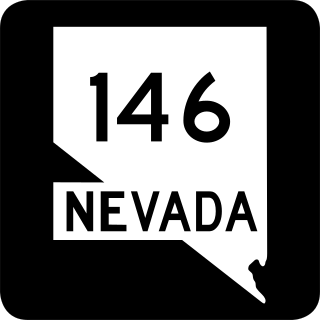
State Route 146 (SR 146) is a 6.673-mile-long (10.739 km) major east–west state highway in the southern part of the U.S. state of Nevada. It begins at the exit 27 interchange on Interstate 15 (I-15) south of the Las Vegas Strip and ends at the Pecos Road interchange on I-215 in Henderson. The highway is currently known as Saint Rose Parkway, but was known as Lake Mead Drive prior to 2001.

<span class="mw-page-title-main">Nevada State Route 604</span> Highway in Nevada

State Route 604 is the route number designation for parts of Las Vegas Boulevard, a major north–south road in the Las Vegas metropolitan area of Nevada in the United States best known for the Las Vegas Strip and its casinos. Formerly carrying U.S. Route 91, which had been the main highway between Los Angeles and Salt Lake City, it has been bypassed by Interstate 15 and serves mainly local traffic.

<span class="mw-page-title-main">Nevada State Route 168</span>

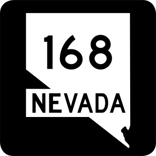
State Route 168 is a state highway in Clark County, Nevada, United States. Known as the Glendale–Moapa Road, the highway connects U.S. Route 93 to Interstate 15 (I-15) at Glendale about 25 miles (40 km) southeast. The route was designated as the southern end of State Route 7 in 1919, and served as part of US 93 from 1931 to 1967.

<span class="mw-page-title-main">Nevada State Route 582</span> Highway in Nevada

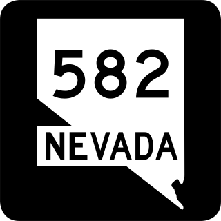
State Route 582 (SR 582) is a major 15.392-mile-long (24.771 km) highway in the Las Vegas Valley. The highway is the former route of U.S. Route 93 (US 93) and US 95 before they were moved to the current freeway alignment shared with Interstate 11 (I-11) and Interstate 515 (I-515). Known primarily as Boulder Highway, the route connects Downtown Las Vegas with Henderson and Boulder City to the southeast.

<span class="mw-page-title-main">Arizona State Route 93</span> Former state highway in Arizona, United States

Arizona State Route 93, abbreviated SR 93, was a state highway in Arizona that existed from 1946 to 1991. The route was co-signed with other highways along nearly all of its route from Kingman to the border at Nogales. SR 93 was the original designation for the highway from Kingman to Wickenburg, which was built in 1946. In 1965, the northern terminus of the state route was moved south to an unnamed desert junction with U.S. Route 89 just north of Wickenburg, and the southern terminus of U.S. Route 93 was moved south to the US 89 junction. The Arizona Highway Department sought U.S. Highway status for SR 93 across the rest of the state, but the proposal was never granted by AASHTO. On December 17, 1984, the SR 93 designation was removed south of the Grand Avenue/Van Buren Street/7th Avenue intersection in Phoenix. The route was completely decommissioned in 1991.

<span class="mw-page-title-main">U.S. Route 93 in Arizona</span> Highway in Arizona

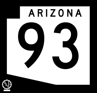
U.S. Route 93 (US 93) is a United States Numbered Highway in the state of Arizona that begins in Wickenburg and heads north to the Nevada state line at the Mike O'Callaghan–Pat Tillman Memorial Bridge. The total length of US 93 in Arizona is 199.38 miles. Between Wickenburg and Interstate 40 (I-40), part of US 93 is designated as the Joshua Forest Scenic Byway. While most of US 93 is a four-lane divided highway, sections of the highway between Wickenburg and I-40 are still narrow two-lane roads, gradually being upgraded to match the rest of the route. As part of a proposal by municipal leaders in Nevada and Arizona, the highway could be replaced by Interstate 11 (I-11).

<span class="mw-page-title-main">Interstate 15 in Nevada</span> Highway in Nevada, United States

Interstate 15 (I-15) is an Interstate Highway in the U.S. state of Nevada that begins in Primm, continues through Las Vegas and it crosses the border with Arizona in Mesquite. Within the state, the freeway runs entirely in Clark County. The highway was built along the corridor of the older U.S. Route 91 (US 91) and Arrowhead Trail, eventually replacing both of these roads.

<span class="mw-page-title-main">U.S. Route 95 in Nevada</span> Section of U.S. Highway in Nevada, United States

U.S. Route 95 is a major U.S. highway traversing the U.S. state of Nevada from north to south directly through Las Vegas and providing connections to both Carson City and Reno. US 95 is cosigned with Interstate 80 for 95 miles (153 km) between a junction in Trinity and Winnemucca before heading north into Oregon at McDermitt. At 646.71 miles (1,040.78 km), it is the longest highway in Nevada.

<span class="mw-page-title-main">Nevada State Route 172</span> Highway in Nevada

State Route 172 is a state highway in Clark County, Nevada. The route provides access to Hoover Dam from Interstate 11 (I-11)/U.S. Route 93 /U.S. Route 93 Business.

<span class="mw-page-title-main">U.S. Route 93 Business (Boulder City, Nevada)</span> Road in Nevada

U.S. Route 93 Business is a business route of U.S. Route 93 (US 93) in Clark County, Nevada. The route provides access to Lake Mead and downtown Boulder City from Interstate 11 (I-11). The route was originally part of mainline US 93 before it was realigned around Boulder City along I-11.

References

  1. Google (February 2, 2020). "Overview of US 93 in Nevada" (Map). Google Maps . Google. Retrieved February 2, 2020.
  2. Nevada Department of Transportation (January 2020). "State Maintained Highways of Nevada: Descriptions and Maps" . Retrieved February 2, 2020.
  3. Nevada Department of Transportation (2018). Named Highways of Nevada (Map). Retrieved February 19, 2022.
  4. 1 2 3 4 "U.S. 93 Reaching For The Border". Highway History. Federal Highway Administration. January 9, 2009. Retrieved July 21, 2009.
  5. Highway Map of the State of Nevada (Map). 1 in. = 25 mi. Nevada Department of Highways. 1927. Archived from the original on March 4, 2016. Retrieved June 7, 2009.
  6. Highway Map State of Nevada (Map). 1 in. = 25 mi. Nevada Department of Highways. 1929. Archived from the original on August 27, 2016. Retrieved June 3, 2009.
  7. Road Map (Map). 1 in. = 20 mi. Nevada Department of Highways. 1932. Archived from the original on March 4, 2016. Retrieved June 7, 2009.
  8. 1 2 Official Road Map of the State of Nevada (Map) (1936 ed.). Nevada Department of Highways. Archived from the original on April 24, 2016. Retrieved July 21, 2009.
  9. 1 2 3 Official Road Map of the State of Nevada (Map) (1939 ed.). Nevada Department of Highways. Archived from the original on December 26, 2014. Retrieved October 19, 2009.
  10. Official Road Map of the State of Nevada (Map) (1940 ed.). Nevada Department of Highways. Archived from the original on December 26, 2014. Retrieved October 19, 2009.
  11. Official Highway Map of Nevada (Map) (1967 ed.). Nevada State Highway Department. Archived from the original on July 10, 2015. Retrieved October 19, 2009.
  12. Nevada Department of Transportation (January 2012). "2012 Nevada State Maintained Highways, Descriptions, Index and Maps" (PDF). Archived from the original (PDF) on May 10, 2012. Retrieved January 28, 2012.
  13. Nevada Department of Transportation. "The Boulder City Bypass". Archived from the original on March 24, 2011. Retrieved January 29, 2012.
  14. Nevada Department of Transportation (May 2008). Maps of Milepost Location on Nevada's Federal and State Highway System by County.
Template:Attached KML/U.S. Route 93 in Nevada
KML is not from Wikidata


US 93.svg U.S. Route 93
Previous state:
Arizona
Nevada Next state:
Idaho