Uffington, Lincolnshire

Last updated

Uffington
St. Michael and All Angels, Uffington - geograph.org.uk - 120674.jpg
St Michael and All Angels' Church, Uffington
Lincolnshire UK location map.svg
Red pog.svg
Uffington
Location within Lincolnshire
Population686 (2011)
OS grid reference TF062076
  London 85 mi (137 km)  S
District
Shire county
Region
Country England
Sovereign state United Kingdom
Post town STAMFORD
Postcode district PE9
Police Lincolnshire
Fire Lincolnshire
Ambulance East Midlands
UK Parliament
List of places
UK
England
Lincolnshire
52°39′22″N0°25′49″W / 52.656138°N 0.430162°W / 52.656138; -0.430162 Coordinates: 52°39′22″N0°25′49″W / 52.656138°N 0.430162°W / 52.656138; -0.430162

Uffington is a village and civil parish in the South Kesteven district of Lincolnshire, England. The population of the civil parish at the 2011 census was 686. [1] It is in the valley of the River Welland, between Stamford and The Deepings.

Contents

Geography

Newstead Mill Newstead Mill near Stamford (geograph 3397330).jpg
Newstead Mill

The village lies 2 miles (3.2 km) east of Stamford on the A1175 (previously the A16) where the low Jurassic clay and cornbrash ridge on which it stands lies 100 feet (30 m) or so above the level of The Fens.

Uffington Park, the grounds of a country house built in 1681 by the Bertie family and demolished by fire in 1904, lies between the village and the River Welland. [2] Subsidiary buildings of Uffington House remain. [3]

To the north-east is Casewick House, a Grade I listed building. It was a medieval house remodelled in the 17th century by the Trollope family and divided into three units and sold in the 1980s. [4]

Towards Stamford lay Newstead Priory. Newstead Mill is a Grade II listed watermill on the River Gwash; it is now converted to flats.

Community

The Grade I listed parish church, St Michael and All Angels, dates back to the 12th century and was majorly restored in 1864 by Edward Browning. [5] It is part of the Uffington Group of churches that also includes Tallington, Barholm, West Deeping Wilsthorpe, Braceborough and Greatford. On the west side of the village is a nursery, and on the Market Deeping side, The Bertie Arms public house is on Bertie Lane.

The village holds an annual Scarecrow Adventure trail where visitors participate in early May Bank Holiday festivities and search for scarecrows around the village.

Until 1961 the village was served by Uffington and Barnack railway station. Today the village is served by Delaine Buses on the Stamford to Market Deeping route.

Lost village

Casewick House is the location of a Deserted Medieval Village mentioned as "Casuic" in the Domesday survey, and as "Casewick" in a tax list of 1334. By 1816 only Casewick House and one other house had survived. [6]

Governance

Signpost in Uffington UK Uffington (Lincolnshire).jpg
Signpost in Uffington

Uffington is served by a parish council, two district councillors who represent Casewick Ward on South Kesteven District Council and a county councillor representing Deepings West & Rural Division on Lincolnshire County Council. The district councillors re-elected in 2015 are Kelham Cooke (Con) and Rosemary Trollope-Bellew (Con). The county councillor elected in 2017 is Rosemary Trollope-Bellew (Con).

Related Research Articles

<span class="mw-page-title-main">Kesteven</span> Traditional division of Lincolnshire, England

The Parts of Kesteven are a traditional division of Lincolnshire, England. This division had long had a separate county administration, along with the two other Parts of Lincolnshire, Lindsey and Holland.

<span class="mw-page-title-main">Bourne, Lincolnshire</span> Market town in Lincolnshire, England

Bourne is a market town and civil parish in the South Kesteven district of Lincolnshire, England. It lies on the eastern slopes of the limestone Kesteven Uplands and the western edge of the Fens, 11 miles (18 km) north-east of Stamford, 12 miles (19 km) west of Spalding and 17 miles (27 km) north of Peterborough. The population at the 2011 census was 14,456. A 2019 estimate put it at 16,780.

<span class="mw-page-title-main">Stamford, Lincolnshire</span> Town in Lincolnshire, England

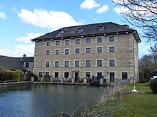
Stamford is a town and civil parish in the South Kesteven District of Lincolnshire, England. The population at the 2011 census was 19,701 and estimated at 20,645 in 2019. The town has 17th- and 18th-century stone buildings, older timber-framed buildings and five medieval parish churches. It is a frequent film location. In 2013 it was rated a top place to live in a survey by The Sunday Times. Its name has been passed on to Stamford, Connecticut, founded in 1641.

<span class="mw-page-title-main">South Kesteven</span> Local government district in Lincolnshire, England

South Kesteven is a local government district in Lincolnshire, England, forming part of the traditional Kesteven division of the county. It covers Bourne, Grantham, Market Deeping and Stamford. The 2011 census reports 133,788 people at 1.4 per hectare in 57,344 households. The district borders the counties of Cambridgeshire, Leicestershire, Northamptonshire, Nottinghamshire and Rutland. It is also bounded by the Lincolnshire districts of North Kesteven and South Holland.

<span class="mw-page-title-main">Market Deeping</span> Town in Lincolnshire, England

Market Deeping is a market town and civil parish in the South Kesteven district of Lincolnshire, England, on the north bank of the River Welland and the A15 road. The population of the town at the 2011 census was 6,008.

<span class="mw-page-title-main">Deeping St James</span> Village in Lincolnshire, England

Deeping St James is a large village in the South Kesteven district of Lincolnshire, England. The population of the civil parish was reported as 7,051 at the 2011 census.

<span class="mw-page-title-main">River Gwash</span> River in the East Midlands of England

The River Gwash, occasionally Guash, a tributary of the River Welland, flows through the English counties of Leicestershire, Rutland and Lincolnshire. It rises just outside the village of Knossington in Leicestershire, near the western edge of Rutland. It is about 39 kilometres (24 mi) long.

<span class="mw-page-title-main">Baston</span> Village and civil parish in Lincolnshire, England

Baston is a village and parish on the edge of The Fens and in the administrative district of South Kesteven, Lincolnshire, England. The 2011 census reported the parish had 1,469 people in 555 households.

<span class="mw-page-title-main">Thurlby, South Kesteven</span> Village and civil parish in the South Kesteven district of Lincolnshire, England

Thurlby is a village and civil parish in the South Kesteven district of Lincolnshire, England. It is situated just west of the A15 road, 2 miles (3 km) south from the town of Bourne, and on the edge of the Lincolnshire Fens. It is sometimes referred to as Thurlby by Bourne to distinguish it from other villages in Lincolnshire with the same name. Thurlby and the hamlet of Northorpe to its north are conjoined. The parish had a population of 2,136 at the 2001 census and 2,153 at the 2011 census.

<span class="mw-page-title-main">Barholm and Stowe</span>

Barholm and Stowe is a civil parish in the South Kesteven district of Lincolnshire, England. According to the 2001 census it had a population of 87 in 34 households, increasing to a population of 139 in 60 households at the 2011 census. The parish covers the village of Barholm and the Stowe hamlet.

<span class="mw-page-title-main">Barnack</span> Human settlement in England

Barnack is a village and civil parish in the Peterborough unitary authority of the ceremonial county of Cambridgeshire, England and the historic county of Northamptonshire. Barnack is in the north-west of the unitary authority, 3.5 miles (5.6 km) south-east of Stamford, Lincolnshire. The parish includes the hamlet of Pilsgate about 1 mile (1.6 km) northwest of Barnack. Both Barnack and Pilsgate are on the B1443 road. The 2011 Census recorded a parish population of 931.

<span class="mw-page-title-main">Braceborough</span> Village in the South Kesteven district of Lincolnshire, England

Braceborough is a village in the South Kesteven district of Lincolnshire, England. It is situated off the Stamford to Bourne A6121 road, just west of the A15 as it runs between Market Deeping and Bourne. It forms part of the Civil Parish of Braceborough and Wilsthorpe.

<span class="mw-page-title-main">Greatford</span> Village and civil parish in the South Kesteven district of Lincolnshire, England

Greatford is a village and civil parish in the South Kesteven district of Lincolnshire, England. It is situated 2 miles (3 km) west from the A15, 4.5 miles (7 km) north-east from Stamford, and 5 miles (8 km) south from Bourne. Greatford is noted for Greatford Hall, once the home of Francis Willis.

<span class="mw-page-title-main">West Deeping</span> Village and civil parish in Lincolnshire, England

West Deeping is a village and civil parish in the South Kesteven district of Lincolnshire, England. The population of the civil parish at the 2011 census was 255. It is situated on the A1175 road, 5 miles (8 km) east from Stamford and 2 miles (3.2 km) west from Market Deeping. It is the smallest of The Deepings group of villages situated around the A1175 road. Village population is 277.

<span class="mw-page-title-main">Langtoft, Lincolnshire</span> Village and civil parish in the South Kesteven district of Lincolnshire, England

Langtoft is a village and civil parish in the South Kesteven district of Lincolnshire, England. The population of the civil parish at the 2011 census was 2,045. It lies on the A15 road, about 10 miles (16 km) north from Peterborough and about 8 miles (13 km) east from Stamford, and on the edge of The Fens.

<span class="mw-page-title-main">Barholm</span> Village in the South Kesteven district of Lincolnshire, England

Barholm is a village in the South Kesteven district of Lincolnshire, England. It is 2 miles (3 km) west from the A15 road, and 6 miles (10 km) south from Bourne.

<span class="mw-page-title-main">Tallington</span> Village and civil parish in the South Kesteven district of Lincolnshire, England

Tallington is a village and civil parish in the South Kesteven district of Lincolnshire, England. The population of the civil parish at the 2011 census was 497. It is situated 4 miles (6 km) east from Stamford and 8 miles (13 km) north-east from the centre of Peterborough. The village has around 200 houses.

<span class="mw-page-title-main">Careby Aunby and Holywell</span> Civil parish in South Kesteven, England

Careby Aunby and Holywell is a civil parish in the district of South Kesteven, south-west Lincolnshire, in England. It stretches from the county border with Rutland in the west to the River West Glen in the east. The B1176 road from Corby Glen passes through Careby and on past Aunby toward Stamford. The main London to Scotland railway line passes through the parish, the line upon which Mallard took the speed record for the LNER.

<span class="mw-page-title-main">A1175 road</span> Road in south-west Lincolnshire, England

The A1175 road is a road in south-west Lincolnshire, England. It runs between Stamford and Spalding, along the old A16 route.

References

  1. "Civil Parish population 2011". Neighbourhood Statistics. Office for National Statistics. Retrieved 2 June 2016.
  2. "Uffington House". Lostheritage.org.uk. Retrieved 31 October 2018.
  3. "Uffington House and Park, Uffington". Lincs to the Past. Retrieved 15 January 2018.
  4. Historic England. "CASEWICK HALL (1165624)". National Heritage List for England . Retrieved 15 January 2018.
  5. "Church of St Michael and All Angels: A Grade I Listed Building in Uffington, Lincolnshire". British Listed Buildings. Retrieved 15 January 2018.
  6. Historic England. "DMV at Casewick (347796)". Research records (formerly PastScape). Retrieved 11 April 2010.
Gate lodges to the former Uffington House Gate lodges to former Uffington House (geograph 3397224).jpg
Gate lodges to the former Uffington House