
Sussex County is the northernmost county in the U.S. state of New Jersey. Its county seat is Newton. It is part of the New York metropolitan area and is part of New Jersey's Skylands Region. As of the 2020 census, the county was the state's 17th-most-populous county, with a population of 144,221, a decrease of 5,044 (−3.4%) from the 2010 census count of 149,265, which in turn reflected an increase of 5,099 (+3.5%) over the 144,166 persons at the 2000 census. Based on 2020 census data, Vernon Township was the county's largest in both population and area, with a population of 22,358 and covering an area of 70.59 square miles (182.8 km2).
West Milford is a township in Passaic County, in the U.S. state of New Jersey. As of the 2020 United States census, the township's population was 24,862, a decrease of 988 (−3.8%) from the 2010 census count of 25,850, which in turn reflected a decline of 560 (−2.1%) from the 26,410 counted in the 2000 census. It is the largest in the county by total area, covering 80.32 square miles (208.0 km2) and more than 40% of the county.

Hardyston Township is a township in Sussex County, in the U.S. state of New Jersey. As of the 2020 United States census, the township's population was 8,125, a decrease of 88 (−1.1%) from the 2010 census count of 8,213, which in turn reflected an increase of 2,042 (+33.1%) from the 6,171 counted in the 2000 census.

Vernon Township is a township in Sussex County, in the U.S. state of New Jersey. It is located about one hour's drive from New York City and is part of the New York Metropolitan Area. As of the 2020 United States census, the township's population was 22,358, a decrease of 1,585 (−6.6%) from the 2010 census count of 23,943, which in turn reflected a decline of 743 (−3.0%) from the 24,686 counted in the 2000 census. It is both the most populous municipality and the largest in area in the county.

Jefferson Township is the northernmost township in Morris County, in the U.S. state of New Jersey. As of the 2020 United States census, the township's population was 20,538, a decrease of 776 (−3.6%) from the 2010 census count of 21,314, which in turn reflected an increase of 1,597 (+8.1%) from the 19,717 counted in the 2000 census.

Newfoundland is an unincorporated community and census-designated place (CDP) covering portions of both West Milford in Passaic County, and Jefferson Township in Morris County, in the U.S. state of New Jersey. It is located along Route 23 and is the mailing address of Green Pond, a private lake in Rockaway Township. As of the 2020 United States census, the CDP's population was 1,145.

Highland Lakes is an unincorporated community and census-designated place (CDP) located within Vernon Township, in Sussex County, in the U.S. state of New Jersey. As of the 2010 United States Census, the CDP's population was 4,933. Highland Lakes has its own Post Office with the ZIP Code 07422.

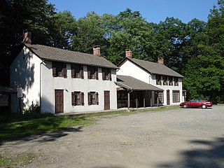
Wawayanda State Park is a 34,350 acres (139.0 km2) state park in Sussex County and Passaic County in northern New Jersey. The park is in Vernon Township on the Sussex side, and West Milford on the Passaic side. There are 60 miles (97 km) of hiking trails in the park, including a 20 miles (32 km) stretch of the Appalachian Trail. The park is operated and maintained by the New Jersey Division of Parks and Forestry. The hiking trails are maintained and updated by the New York - New Jersey Trail Conference.

Pompton Plains is a census-designated place (CDP) and unincorporated community constituting the majority of Pequannock Township, Morris County, in the U.S. state of New Jersey. As of the 2020 United States census, the CDP's population was 11,144. The community was first listed as a CDP in advance of the 2020 census.
New Jersey's 5th congressional district is represented by Democrat Josh Gottheimer, who has served in Congress since 2017. The district stretches across the entire northern border of the state and contains most of Bergen County, as well as parts of Passaic County and Sussex County.

Pine Brook, sometimes spelled Pinebrook, is a census-designated place (CDP) and unincorporated community located within Montville in Morris County, in the U.S. state of New Jersey. As of the 2020 United States census, the CDP had a population of 5,675.

Lake Hopatcong is a census-designated place (CDP) located in Jefferson Township, Morris County, in the U.S. state of New Jersey. It includes communities on the northeast side of Lake Hopatcong, the largest freshwater body in the state.
Oak Ridge is an unincorporated community and census-designated place (CDP) located along the border of West Milford Township in Passaic County and Jefferson Township in Morris County, in the U.S. state of New Jersey. The area is served as United States Postal Service ZIP Code 07438.
Oval is a census-designated place (CDP) in Limestone Township, Lycoming County, Pennsylvania, United States. As of the 2010 census, it had a population of 361. Oval is not a separately incorporated community, but is a part of Limestone Township.
Witmer is an unincorporated community and census-designated place (CDP) in East Lampeter Township, Lancaster County, Pennsylvania, United States. As of the 2010 census, the population was 492.
Country Squire Lakes is an unincorporated community and census-designated place (CDP) in Geneva Township, Jennings County, Indiana, United States. As of the 2010 census it had a population of 3,571.
Sheppards Mill is an unincorporated community and census-designated place (CDP) in Cumberland County, in the U.S. state of New Jersey. It is located in the western part of the county in northeastern Greenwich Township and southwestern Hopewell Township. The community is centered on Mill Creek, which is dammed to form Sheppards Millpond in the northwestern part of the CDP. Mill Creek is a southwest-flowing tributary of Wheaton Run, part of the Cohansey River watershed leading to Delaware Bay.
South Mount Vernon is a census-designated place (CDP) in Knox County, Ohio, United States, adjacent to the city of Mount Vernon. It was first listed as a CDP prior to the 2020 census.


