Urban planning of Shanghai

Last updated

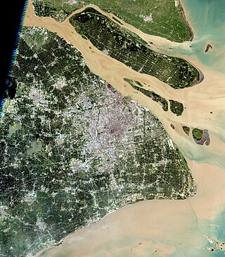
The urban planning of Shanghai refers to various phases of planning and development of Shanghai, presently the largest city in China and one of the largest in the world. The topic is the focus of the city's Urban Planning Museum, located in People's Square beside City Hall.

Contents

History

Medieval & Early Modern Shanghai

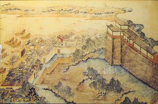
Chinese map of Shanghai c. 1553 (pub. 1813) 1553 map of Shanghai.jpg
Chinese map of Shanghai c.1553(pub. 1813)

Shanghai began as a fishing village at the confluence of the Wusong and Huangpu Rivers during the early medieval period. Under the Yuan, the Songjiang native Huang Daopo introduced new strains of cotton and improved techniques for working and dyeing it, improving the area's economic conditions just as the upper reaches of the Wusong River were thoroughly silting up, creating the modern Suzhou Creek and shifting commerce to the Huangpu. Under the Ming, Shanghai was raised in status from a town to a new county seat. A massive city wall was erected and the city's many canals were used to create a wide moat around it. [1]

Even after the city's promotion in status and the establishment of one of the country's few official international ports, however, it was allowed to develop fairly organically. Streets generally ran north to south and east to west, but the city's canals were far more important as means of transport. No effort was made to bring the town into compatibility with traditional Chinese urban planning as codified in the Rites of Zhou 's Kaogongji .

Colonial Shanghai

1935 map of Shanghai proper ("Nanshi"), the International Settlement, the French Concession, and surrounding suburbs Shanghai 1935 S1 AMS-WO.jpg
1935 map of Shanghai proper ("Nanshi"), the International Settlement, the French Concession, and surrounding suburbs

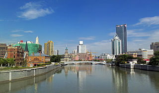
The United Kingdom took and plundered Shanghai in 1842 during the last phase of the First Opium War. Under the terms of the Treaty of Nanjing, the city was reopened to foreign trade as one of the first five treaty ports. An area of farmland around the city was yielded to foreign settlement in the form of a permanent lease. Consul Balfour laid out the initial plan of the British Concession along the west bank of the Huangpu from Yangjing Creek near the northern gate of the Chinese city to the south bank of Suzhou Creek. [2] The commercial establishments along the river bank were the beginning of the city's Bund. The French soon followed, taking the southern Bund, a strip of land between the British lease and the Chinese city, and a wider area northwest of the city.

Beginning in 1853, refugees from cities destroyed by the Taiping Rebellion and from the Chinese city after its conquest by the Small Sword Society quickly ballooned the population of the foreign territories from having no official Chinese residents to somewhere between 300,000 and 500,000. The territories expanded and developed, with the colonial administrators attempting to create a "model settlement" along the lines of 19th-century London and Paris with paved streets, a tram system, a pure and continuous water supply, and sewage treatment adequate to minimize outbreaks of cholera. [3] The British and French administrators had continual difficulty in coordinated planning but generally the British area around Nanjing Road developed into the city's dense commercial center while the French Concession was more open and residential. After the provision of an American concession, it merged with the British area as the Shanghai International Settlement while the French area remained separately administered.

Republican Shanghai

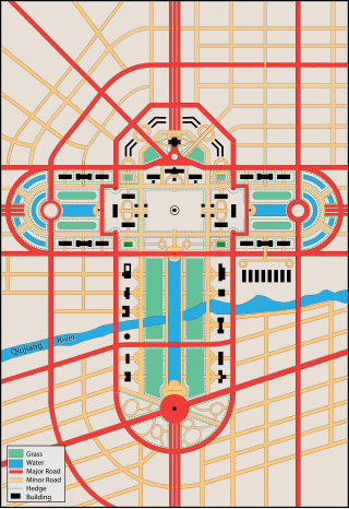
Having established a Greater Shanghai in 1927 that combined the administration of the old city (Nanshi) and the Chinese suburbs north of the international settlements (Zhabei), the Nationalist Government of the Republic of China in Nanjing formed an urban planning commission of both Chinese experts and foreign consultants. Their "Greater Shanghai Plan" ( t 民國 上海 計劃 , s 民国 上海 计划 ,Mínguó Dà Shànghǎi Jìhuà) published in July 1929 aimed to create greater autonomy for the Chinese by creating a new planned city at Jiangwan, shifting the Chinese government offices and center of population northeast between the international settlement and the expanding international port along the Yangtze River. The plan included rail and port expansions and a system of broad rectilinear streets to alleviate traffic congestion. The plan also designated around 15% of the area for parks and open spaces, with the most ambitious element being a civic center, occupying 333 acres (1,350,000 m2) and including a 50 m (160 ft) high pagoda and Washington-style reflecting pool. [4] The plan was rendered moot by the Japanese conquest and occupation of Shanghai between 1937 and 1945. The Japanese destroyed surviving public works created under the plan's guidance and eliminated the city's foreign enclaves. Upon their surrender, the Republic of China refused to restore the privileged foreign territories and the relocation of government offices and population was unneeded.

A second master plan was instead drafted by a city planning board established in 1946. This plan placed a great deal of emphasis on its relationship with broader regional planning. In particular, it proposed the development of Pudong on the east bank of the Huangpu and the establishment of bridge and tunnel connections between it and central Shanghai. [5] This plan was still in the process of enactment when the Nationalist defeat in the Chinese Civil War led to its annulment, the People's Liberation Army entering the city in 1949.

Maoist Shanghai

Following two decades of war, the first priority of the People's Republic of China with regards to Shanghai's urban planning was the restoration of all impaired utilities, communication, transportation, and other basic infrastructure. This was carried out from 1949 to 1956. From 1956, a massive urban renewal project was undertaken for Zhabei District. Further, forced relocation spread the population and industry through seven satellite towns within Shanghai Municipality but outside the urban core itself. [6] Hundreds of thousands of students or recent graduates also became sent-down youth, removed to Anhui or other provinces.

A series of political movements including the Great Leap Forward and the Cultural Revolution further impacted the city's economic development in the name of various social goals. This ended with the death of Mao Zedong, the fall of the Gang of Four that initially succeeded him, and the establishment of the Opening Up Policy under Deng Xiaoping in the late 1970s and early 1980s.

Modern Shanghai

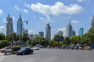
Pudong New Area and several neighborhoods in Shanghai currently operate under special administration to facilitate business, particularly with regard to finance, high technology, exports, and entertainment. The city has also refurbished its religious and historical sites with an eye to promoting tourism. The current urban plan, however, aims to commit all levels of the city government to restricting the municipality's population to 25,000,000 permanent residents and 3,200 km2 (1,200 sq mi) of developed land. This is partially intended to improve provision of public services to city residents until nearly all basic needs can be addressed within a 15 minute radius and partially to encourage more widespread development in other areas of China.

See also

Related Research Articles

<span class="mw-page-title-main">Shanghai</span> Most populous city in China

Shanghai is one of the four direct-administered municipalities of China. The city is located on the southern estuary of the Yangtze River, with the Huangpu River flowing through it. The population of the city proper is the third largest in the world, with around 29.2 million inhabitants in 2023, while the urban area is the most populous in China, with 39.3 million residents. As of 2022, the Greater Shanghai metropolitan area was estimated to produce a gross metropolitan product (nominal) of nearly 13 trillion RMB. Shanghai is one of the world's major centers for finance, business and economics, research, science and technology, manufacturing, transportation, tourism, and culture. The Port of Shanghai is the world's busiest container port.

<span class="mw-page-title-main">Pudong</span> District in Shanghai, Peoples Republic of China

Pudong is a district of Shanghai located east of the Huangpu, the river which flows through central Shanghai. The name Pudong was originally applied to the Huangpu's east bank, directly across from the west bank or Puxi, the historic city center. It now refers to the broader Pudong New Area, a state-level new area which extends all the way to the East China Sea.

<span class="mw-page-title-main">Huangpu, Shanghai</span> District in Shanghai, Peoples Republic of China

Huangpu District, makes up the eastern part of Shanghai's traditional urban core and is today the most central of Shanghai's 16 districts. Huangpu district is the seat of municipal government, includes key attractions such as The Bund and the Old City God Temple, as well as popular shopping districts such as Nanjing Road, Huaihai Road, and Xintiandi. The Huangpu District is one of the most densely populated urban districts in the world.

<span class="mw-page-title-main">The Bund</span> Historical district in central Shanghai, China

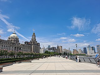
The Bund is a waterfront area and a protected historical district in central Shanghai. The area centers on a section of Zhongshan Road within the former Shanghai International Settlement, which runs along the western bank of the Huangpu River in the eastern part of Huangpu. The area along the river faces the modern skyscrapers of Lujiazui in Pudong. The Bund usually refers to the buildings and wharves on this section of the road, as well as some adjacent areas. This region has a significant European influence, with the style of many structures most comparable to that of European cities, particularly Gothic, Baroque, Neoclassical, Romanesque, Art Deco, and Renaissance architecture. Additionally, some of the city's top eateries are located there. From the 1860s to the 1930s, it was the rich and powerful center of the foreign establishment in Shanghai, operating as a legally protected treaty port.

<span class="mw-page-title-main">Jing'an, Shanghai</span> District in Shanghai, China

Jing'an District (静安区) is one of the central districts of Shanghai. In 2020, it had 975,707 inhabitants in an area of 37 km2 (14 sq mi).

<span class="mw-page-title-main">Battle of Shanghai</span> 1937 battle of the Second Sino-Japanese War

The Battle of Shanghai was a large urban battle between the Empire of Japan and the Republic of China in the Chinese city of Shanghai during the Second Sino-Japanese War. It lasted from August 13, 1937, to November 26, 1937, and was arguably the single largest and longest battle of the entire war, with it even regarded by some historians as the first battle of World War II. It resulted in the Japanese capturing the city and heavy destruction to the city.

<span class="mw-page-title-main">Yangpu, Shanghai</span> District in Shanghai, Peoples Republic of China

Yangpu (杨浦区) is one of the 16 districts of Shanghai. It is located in the northeastern part of downtown Shanghai, bordering the Huangpu River on the east and south, Hongkou on the west, and Baoshan on the north. The southern part of Yangpu District is 4 km (2.5 mi) away from The Bund, a major tourist attraction. It is predominantly composed of residential communities, with a total area of 60.61 km2 (23.40 sq mi) and a population of 1,242,548 as of 2020. The district administers 12 subdistricts.

<span class="mw-page-title-main">January 28 incident</span> 1932 China–Japan conflict in Shanghai

The January 28 incident or Shanghai incident was a conflict between the Republic of China and the Empire of Japan. It took place in the Shanghai International Settlement which was under international control. Japanese army officers, defying higher authorities, had provoked anti-Japanese demonstrations in the International Settlement following the Japanese invasion of Manchuria. The Japanese government sent militant ultranationalist Japanese Buddhist priests belonging to the Nichiren sect to Shanghai. The monks shouted anti-Chinese, pro-Japanese nationalist slogans in Shanghai, promoting Japanese rule over East Asia. In response, a Chinese mob formed killing one monk and injuring two. In response, the Japanese in Shanghai rioted and burned down a factory, killing two Chinese. Heavy fighting broke out, and China appealed with no success to the League of Nations. A truce was finally reached on May 5, calling for Japanese military withdrawal, and an end to Chinese boycotts of Japanese products. It is seen as the first example of a modern war waged in a large city between two heavily equipped armies and as a preview of what was to come during the Second World War.

<span class="mw-page-title-main">Lujiazui</span> Locality in Shanghai, China

Lujiazui is a locality in Shanghai, a peninsula formed by a bend in the Huangpu River. Since the early 1990s, Lujiazui has been developed specifically as a new financial district of Shanghai. The decision to earmark Lujiazui for this purpose reflects its location: it is located on the east side of the Huangpu River in Pudong, and sits directly across the river from the old financial and business district of the Bund.

<span class="mw-page-title-main">History of Shanghai</span>

The history of Shanghai spans over a thousand years and closely parallels the development of modern China. Originally a small agricultural village, Shanghai developed during the late Qing dynasty (1644–1912) as one of China's principal trading ports. Although nominally part of China, in practice foreign diplomats controlled the city under the policy of extraterritoriality. Since the economic reforms of the early 1990s the city has burgeoned to become one of Asia's major financial centers and the world's busiest container port.

<span class="mw-page-title-main">Waibaidu Bridge</span> Bridge in Shanghai, China

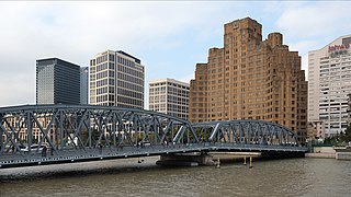
The Waibaidu Bridge, called the Garden Bridge in English, is the first all-steel bridge, and the only surviving example of a camelback truss bridge, in China. The present bridge is the fourth Western-designed bridge built at its location since 1856, in the downstream of the estuary of the Suzhou Creek, near its confluence with the Huangpu River, adjacent to the Bund in central Shanghai. It connects the Huangpu and Hongkou districts and was opened on 20 January 1908. With its rich history and unique design the Waibaidu Bridge is one of the symbols of Shanghai. Its modern and industrial image may be regarded as the city's landmark bridge. On 15 February 1994 the Shanghai Municipal Government declared the bridge an example of Heritage Architecture, and one of the outstanding structures in Shanghai. In an ever-changing metropolis, the Waibaidu Bridge still remains a popular attraction, and one of the few constants in the city skyline.

<span class="mw-page-title-main">Shanghai Campaign</span> 1949 Chinese military campaign

The Shanghai Campaign was a series of battles fought between the nationalists and the Chinese Communist Party (CCP) for the control of Shanghai, the largest city in China in the latter stage of the Chinese Civil War, and resulted in the city being taken over by the communists, who enjoyed numerical superiority.

<span class="mw-page-title-main">Wusong</span> Subdistrict of Baoshan, Shanghai, China

Wusong, formerly romanized as Woosung, is a subdistrict of Baoshan in northern Shanghai. Prior to the city's expansion, it was a separate port town located 14 miles (23 km) down the Huangpu River from Shanghai's urban core.

<span class="mw-page-title-main">Geography of Shanghai</span>

The geography of Shanghai is characterised by its location on the Yangtze River Delta on China's east coast and its proximity to the Pacific Ocean via the East China Sea. The city is centred on the Huangpu River, a tributary of the Yangtze River, and extends outwards in all directions, with the suburbs and satellite towns reaching east to the East China Sea, north and west to Jiangsu province, and south to Zhejiang province over Hangzhou Bay.

<span class="mw-page-title-main">Suzhou Creek</span> River in Shanghai, China

Suzhou Creek, also called the Wusong (Woosung) River, is a river that passes through the Shanghai city center. It is named after the neighboring city of Suzhou (Soochow), Jiangsu, the predominant settlement in this area prior to the rise of Shanghai as a metropolis.

<span class="mw-page-title-main">Shanghai French Concession</span> French concession in China

The Shanghai French Concession was a foreign concession in Shanghai, China from 1849 until 1943, which progressively expanded in the late 19th and early 20th centuries. The concession came to an end in 1943, when Vichy France under German pressure signed it over to the pro-Japanese Reorganized National Government of China in Nanjing. For much of the 20th century, the area covered by the former French Concession remained the premier residential and retail district of Shanghai, and was also one of the centers of Catholicism in China. Despite re-development over the last few decades, the area retains a distinct character and is a popular tourist destination.

<span class="mw-page-title-main">Old City (Shanghai)</span> Traditional urban core of Shanghai

The Old City of Shanghai, also formerly known as the Chinese city, is the traditional urban core of Shanghai. Its boundary was formerly defined by a defensive wall. The Old City was the county seat for the old county of Shanghai. With the advent of foreign concessions in Shanghai, the Old City became just one part of Shanghai's urban core, but continued for decades to be the seat of the Chinese authority in Shanghai. Notable features include the City God Temple, which is located in the center of the Old City and is connected to the Yuyuan Garden. With the exception of two short sections, the walls were demolished in 1912, and a broad circular avenue built over the former wall and moat: the southern half was named the "Zhonghua Road" and the northern half the "Minguo Road".

<span class="mw-page-title-main">Shanghai County</span> Historical county of China

Shanghai County was a Chinese county in modern-day Shanghai Municipality. Shanghai County was first established in 1292 and finally abolished in 1992. Shanghai County was for most of its existence a part of Songjiang Prefecture, in Jiangsu Province, but later became a county under Shanghai Municipality. Shanghai County was historically the governing authority of the Shanghai's urban area and neighbouring areas. Its extent reduced with the establishment of the Shanghai Special Municipality and, later, Shanghai Municipality. Immediately before abolition, the county extended over a crescent-shaped area adjacent to, and surrounding, the southwest of Shanghai's city centre.

<span class="mw-page-title-main">Yan'an Road</span> Road in Shanghai, China

Yan'an Road is a road in Shanghai, a major east–west thoroughfare through the centre of the city. The modern Yan'an Road is in three sections, reflecting three connected streets which existed pre-1945: Avenue Edward VII, Avenue Foch, and the Great Western Road. The streets were joined together under a common name by the Republic of China government in 1945, then renamed in the early 1950s after the Chinese Communist Party took over Shanghai. The road is named after Yan'an, the Communist base during the Chinese Civil War.

<span class="mw-page-title-main">Greater Shanghai Plan</span> 1927 Plan for Shanghai developed by the Republic of China

The Greater Shanghai Plan was a 1927 plan for the city of Shanghai, China, drawn up by the Nationalist Government of the Republic of China in Nanjing. It was presented at the 123rd meeting of the Shanghai City Government in July 1929 and as one of its provisions allocated 7,000 mu in the modern day Jiangwan Subdistrict of Shanghai's Yangpu District for the construction of a government headquarters and administration centre. Had it been completed, the government headquarters building would have stood close to the junction of today's Hengren Road (恒仁路) and the Qingyuan Ring Road (清源环路).

References

Citations

Bibliography

  • Balfour, Alan; et al. (2002), World Cities: Shanghai, London: Wiley Academy.
  • Yeung Yue-man; et al. (1996), Shanghai: Transformation and Modernization under China’s Open Policy, Hong Kong: Chinese University Press.