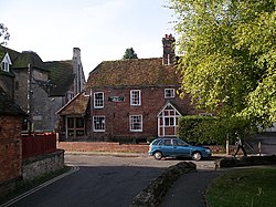
The Vale of Glamorgan, often referred to as The Vale, is a county borough in the south-east of Wales. It borders Bridgend County Borough to the west, Cardiff to the east, Rhondda Cynon Taf to the north, and the Bristol Channel to the south. With an economy based largely on agriculture and chemicals, it is the southernmost unitary authority in Wales. Attractions include Barry Island Pleasure Park, the Barry Tourist Railway, Medieval wall paintings in St Cadoc's Church, Llancarfan, Porthkerry Park, St Donat's Castle, Cosmeston Lakes Country Park and Cosmeston Medieval Village. The largest town is Barry. Other towns include Penarth, Llantwit Major, and Cowbridge. There are many villages in the county borough.

Oxfordshire is a ceremonial and non-metropolitan county in South East England, governed by Oxfordshire County Council and the non-metropolitan districts of City of Oxford, Cherwell, South Oxfordshire, Vale of White Horse and West Oxfordshire. The county is landlocked and bordered by Northamptonshire to the north-east, Warwickshire to the north-west, Buckinghamshire to the east, Berkshire to the south, Wiltshire to the south-west, and Gloucestershire to the west. The area of Oxfordshire south of the River Thames was part of the historic county of Berkshire, including the county's highest point, the 261-metre (856 ft) White Horse Hill. The largest settlement in the county is Oxford, its only city, with an estimated population of 151,584.

Wantage is a historic market town and civil parish in Oxfordshire, England. Although within the boundaries of the historic county of Berkshire, it has been administered as part of the Vale of White Horse district of Oxfordshire since 1974. The town is on Letcombe Brook, 8 miles (13 km) south-west of Abingdon, 24 miles (39 km) north-west of Reading, 15 miles (24 km) south-west of Oxford and 14 miles (23 km) north-west of Newbury.
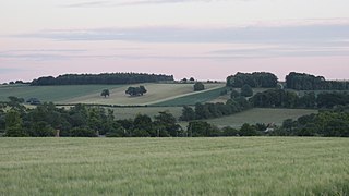
The Vale of White Horse is a local government district of Oxfordshire in England. It was historically a north-west projection of Berkshire. The area is commonly referred to as the 'Vale of the White Horse'. It is crossed by the Ridgeway National Trail in its far south, across the North Wessex Downs AONB at the junction of four counties. The northern boundary is defined by the River Thames. The name refers to Uffington White Horse, a prehistoric hill figure.

Llantwit Major is a town and community in Wales on the Bristol Channel coast. It is one of four towns in the Vale of Glamorgan, with the third largest population after Barry and Penarth, and ahead of Cowbridge. It is 4+1⁄2 miles (7.2 km) from Cowbridge, 9 miles (14 km) from Bridgend, 10 miles (16 km) from Barry, and 15 miles (24

Grove is a village and civil parish in the ceremonial county of Oxfordshire, England. Historically, part of Berkshire, it has been administered as part of the Vale of White Horse district of Oxfordshire since 1974. The village is on Letcombe Brook, about 1+1⁄2 miles (2.4 km) north of Wantage and 14 miles (23 km) south-west of Oxford. The 2011 Census recorded the parish's population as 7,178. It is also home to Formula One constructor Williams Racing.
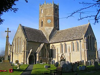
Uffington is a village and civil parish in Oxfordshire, about 4 miles (6.4 km) south of Faringdon and 6 miles (10 km) west of Wantage. The 2011 Census recorded the parish's population as 783. It was originally in the county of Berkshire, but under the Local Government Act 1972 it was transferred for local government purposes to Oxfordshire. The Uffington White Horse hill figure is on the Berkshire Downs on the south side of the parish. The village has been twinned with Le Chevain in France since 1991.

Wantage is a constituency in Oxfordshire represented in the House of Commons of the Parliament of the United Kingdom by Conservative MP David Johnston.
St Mary's School was a private day and boarding girls' school located in Wantage, Oxfordshire, England. In 2007 it merged with Heathfield School to become Heathfield St Mary's School and the Wantage site was closed.
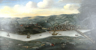
The ancient and historic village of Pilton is today a suburb within the town of Barnstaple, one of the oldest boroughs in England. It is located about quarter of a mile north of the town centre in the English county of Devon, in the district of North Devon. In 2009, the Pilton (Barnstaple) ward had a population of 4,239 living in some 1,959 dwellings. It has its own infants and junior school, houses one of Barnstaple's larger secondary schools, and one of Barnstaple's SEN specialist schools. North Devon Hospital is also within West Pilton parish. It has a Church Hall, two public houses, two hotels, and residential homes. It has residential estates of both private and public housing including flats. It also has a historic Church that dates back to at least the 11th Century.
Hanney was an ancient ecclesiastical parish about 3 miles (5 km) north of Wantage in the Vale of White Horse. It included the villages of East Hanney and West Hanney and Lyford. Hanney was part of Berkshire until the 1974 boundary changes transferred the Vale of White Horse to Oxfordshire.

Wantage was a rural district of Berkshire, England from 1894 to 1974.

Southmoor is a village in the civil parish of Kingston Bagpuize with Southmoor, about 6 miles (9.7 km) west of Abingdon, Oxfordshire. Historically part of Berkshire, the 1974 boundary changes transferred local government to Oxfordshire. Southmoor village is just south of the A420 between Oxford and Swindon.

Chain Hill is one of the hills of the North Wessex Downs, located in the civil parish of Wantage in the English county of Oxfordshire. In 1974 it was transferred from Berkshire. It is designated part of the Area of Outstanding Natural Beauty by the Countryside Agency and forms part of the Vale of White Horse.

Wantage Road railway station was a railway station on the Great Western Main Line in the Vale of White Horse district in Oxfordshire. The station was actually at the village of Grove, Oxfordshire, more than two miles north of Wantage. The station closed in December 1964 as part of the Beeching cuts.
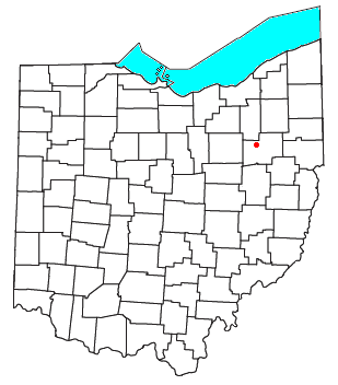
Marchand is an unincorporated community in northeastern Jackson Township, Stark County, Ohio, United States, a short distance west of North Canton. Marchand is a historical locality that contains very few businesses, surrounded by the B.& O. Railroad tracks.
McCord is a hamlet in the Canadian province of Saskatchewan.

The Lockinge Estate is a 3,035-hectare (7,500-acre) agricultural and housing estate near Wantage that today includes most of the land and property encompassing the villages of West Lockinge, East Lockinge and Ardington. The current manager of the Lockinge Estate is Thomas Loyd. Almost the entire estate is included within the North Wessex Downs Area of Outstanding Natural Beauty (AONB).

Ash Cemetery, also known as Emery Gates Cemetery on Church Road is the burial ground for the village of Ash in Surrey, England.
