
The River Dearne South Yorkshire, England flows roughly east for more than 30 kilometres (19 mi), from its source just inside West Yorkshire. It flows through Denby Dale, Clayton West, Darton, Barnsley, Darfield, Wath upon Dearne, Bolton on Dearne, Adwick upon Dearne and Mexborough to its confluence with the River Don at Denaby Main. Its main tributary is the River Dove, which joins it at Darfield. The river was one of those affected by the 2007 United Kingdom floods.

The River Maun is a river in Nottinghamshire, England. Its source lies in Kirkby-in-Ashfield, and from there it flows north east through Mansfield, Edwinstowe and Ollerton, these being the heart of the Sherwood Forest area. It becomes known as Whitewater near the village of Walesby and connects to the River Meden temporarily where the Robin Hood Way crosses them. They diverge, and near Markham Moor it merges again with the River Meden this time becoming the River Idle. Its main tributaries are Rainworth Water, Vicar Water and Cauldwell Water.

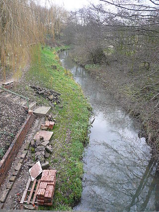
The River Meden is a river in Nottinghamshire, England. Its source lies just north of Huthwaite, near the Derbyshire border, and from there it flows north east through Pleasley and Warsop before merging temporarily with the River Maun near Bothamsall. The rivers divide after a short distance and go on separately to a point near Markham Moor where they once more combine to form the River Idle.

The River Rother, a waterway in the northern midlands of England, gives its name to the town of Rotherham and to the Rother Valley parliamentary constituency. It rises in Pilsley in Derbyshire and flows in a generally northwards direction through the centre of Chesterfield, where it feeds the Chesterfield Canal, and on through the Rother Valley Country Park and several districts of Sheffield before joining the River Don at Rotherham in Yorkshire. Historically, it powered mills, mainly corn or flour mills, but most had ceased to operate by the early 20th century, and few of the mill buildings survive.

The River Ryton is a tributary of the River Idle. It rises close to the Chesterfield Canal near Kiveton Park, and is joined by a series of tributaries near Lindrick Common in the Metropolitan Borough of Rotherham, South Yorkshire, England. Most of its course is in Nottinghamshire, flowing through the town of Worksop. It meanders northwards to join the River Idle near the town of Bawtry on the South Yorkshire-Nottinghamshire border.

The River Poulter which rises near Scarcliffe in Derbyshire, England is a tributary river of the River Idle in Nottinghamshire. It supplied power to mills along its route, most of which are now gone, although their mill ponds remain. Cuckney mill building is used as a primary school. The river has been dammed to create several lakes in the Dukeries estates of Welbeck Abbey and Clumber House now the National Trust property of Clumber Park. The ornamental Gouldsmeadow Lake, Shrubbery Lake and Great Lake on the Welbeck estate are supplied by a tributary of the Poulter, while Carburton Forge Dam and Carburton Dam were built to power a forge and a mill. Clumber Lake, consisting of an upper and lower lake, which is spanned by a Grade II* listed ornamental bridge, is part of the Clumber estate, and has suffered from subsidence.

The River Devon is a tributary of the River Trent, which rises in Leicestershire and joins the Trent at Newark in Nottinghamshire, England. In its upper reaches, it supplies Knipton Reservoir, which was built to supply water to the Grantham Canal, and Belvoir Lakes, designed by Capability Brown. It passes under the Grantham Canal, and then through Bottesford, where it is spanned by five railway bridges, only one of which is still used for its original purpose. On the outskirts of Newark, it passes by two Civil War structures, and just before it joins the Trent it becomes navigable, with a marina located on the west bank. Its name is pronounced "Deevon", not as spelt.

Clipstone is a former mining village in the Newark and Sherwood district of Nottinghamshire, England. The population of the civil parish was 3,469 at the 2001 census, increasing to 4,665 at the 2011 census, and substantially more so to 6,185 at the 2021 census.

The Longford River is an artificial waterway, a distributary designed to embellish a park, that diverts water 12 miles (19 km) from the River Colne at Longford near Colnbrook in England, to Bushy Park and Hampton Court Palace. Its main outlet is to the reach above Molesey Lock with lesser pond outlet channels to that above Teddington Lock. The waterway was built for King Charles I in 1638/39 as a water supply for Hampton Court. Water features in Bushy Park were added in 1710. North of the A30, its course has been diverted more than once as London Heathrow Airport has grown. Its cascades, grassed banks and fountains in Bushy Park were restored and reopened to the public in 2009 to close to their original state.

The River Went is a river in Yorkshire, England. It rises close to Featherstone and flows eastward, joining the River Don at Reedholme Common.

The River Freshney is a river in the English county of North East Lincolnshire. The town of Grimsby stands on its banks. It rises from at least four springs on the edge of the Lincolnshire Wolds, although local folklore and oral tradition has it springing from Welbeck Hill. Originally it entered the tidal Humber estuary at Pyewipe, north west of Grimsby, but has been re-routed and now supplies Grimsby Docks. There was an existing haven within the borough of Grimsby but this suffered greatly with silting problems so in 1669 landowners agreed to the diversion of the Freshney through the town to the haven to provide fresh water and improve the flow. It is believed the work was completed in the very early 18th century.

Rainworth Water is a watercourse that is a tributary of the River Maun near Rainworth, Nottinghamshire, England. It is characterised by a number of lakes, including that which forms part of the country park at Rufford Abbey. L Lake at Rainworth forms part of the Rainworth Lakes Site of Special Scientific Interest. There are two designated Local Nature Reserves along its length, one of which is also known by the name Rainworth Water. The Rainworth Water LNR is owned and managed by Nottinghamshire County Council.
The River Doe Lea is a river which flows near Glapwell and Doe Lea in Derbyshire, England. The river eventually joins the River Rother near Renishaw. The river contained 1,000 times the safe level of dioxins in 1991, according to a statement made by Dennis Skinner, (MP) in the House of Commons in 1992. The river flows through the site of the former Coalite plant near Bolsover, where coke, tar and industrial chemicals were manufactured until the plant closed in 2004.

The River Dove is a river that extends through the Low Valley in Barnsley, England. It flows from Worsbrough Reservoir to its confluence with the River Dearne.

King John's Palace is the remains of a former medieval royal residence in Clipstone, north-west Nottinghamshire. The name "King John's Palace" has been used since the 18th century; prior to that the site was known as the "King's Houses". It is not known how or when the building became associated with King John as he only spent a total of nine days here.

The River Torne is a river in the north of England, which flows through the counties of South Yorkshire and North Lincolnshire. It rises at the Upper Lake at Sandbeck Hall, in Maltby in South Yorkshire, and empties into the River Trent at Keadby pumping station. Much of the channel is engineered, as it plays a significant role in the drainage of Hatfield Chase, which it crosses.

The Roman River is a river that flows entirely through the English county of Essex. It is a tributary of the River Colne, flowing into its tidal estuary below Colchester. The lower end of the Roman River is also tidal, with tidal water flowing upstream to just above Fingringhoe.

Oldcotes Dyke is the name of the final section of a river system that drains parts of north Nottinghamshire and the Metropolitan Borough of Rotherham in South Yorkshire, England. Historically, it has supported milling, with seven water mills drawing their power from its water, and ran through the grounds of the Cistercian Roche Abbey. It is a tributary of the River Ryton.

Kings Clipstone is a settlement and civil parish, in the Newark and Sherwood district, in the county of Nottinghamshire, England. The parish lies in the west of the county, and north west within the district. It is 122 miles north of London, 15 miles north of the city of Nottingham, and 5 miles north east of the market town of Mansfield. In the 2021 census, the parish had a population of 312. The parish touches Clipstone village, Edwinstowe, Rufford and Warsop. The parish was formerly part of the wider Clipstone parish, on 1 April 2011 it became a separate parish. The area is within Sherwood Forest, well known for the Robin Hood legend.

