Victoria Street, Auckland

Last updated

Victoria Street
Auckland (870363180).jpg
Victoria Street in 2007, looking west towards the Sky Tower
Victoria Street, Auckland
Length1.42 km (0.88 mi)
Location Auckland City Centre, New Zealand
Postal code1010
Coordinates 36°50′53″S174°45′43″E / 36.84806°S 174.76197°E / -36.84806; 174.76197
West endCollege Hill
Beaumont Street
Major
junctions
Queen Street
East endKitchener Street

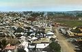
Victoria Street is a street in the Auckland City Centre, New Zealand, located between the base of College Hill and Albert Park. The street is split into two sections at the junction of Queen Street, Victoria Street West and Victoria Street East.

Contents

History

Victoria Street East in the 1870s, looking towards Albert Park Victoria Street East looking towards Barrack Hill or Albert Park. (AM PH-NEG-C18611) (cropped).jpg
Victoria Street East in the 1870s, looking towards Albert Park

Victoria Street West was formerly part of the foreshore of the Auckland waterfront. Victoria Park was the site of Freemans Bay, which was in-filled during the 19th century. The vent of the Albert Park Volcano was located at the modern location of the Victoria Street Carpark, which was quarried during the 1860s. [1] [2]

Victoria Street was the location of the first jail and courthouse in Auckland. [3] The large block to the south-west of the Queen Street intersection included the courthouse, labour yards and gallows. [2] Development of Victoria Street came later than early Auckland streets, which were focused on the waterfront to the north. [2]

By the 1880s, the Victoria and Queen Street intersection had become one of the busiest locations in Auckland. [3]

In 2024, Te Waihorotiu railway station is planned to open on Victoria Street. [4] Currently Te Hā Noa, a linear park for pedestrians and cyclists is under construction between Federal Street and Kitchener Street. [5] [6]

Notable locations

Related Research Articles

<span class="mw-page-title-main">Central, Hong Kong</span> Central business district in Hong Kong

Central is the central business district of Hong Kong. It is located in the northeastern corner of the Central and Western District, on the north shore of Hong Kong Island, across Victoria Harbour from Tsim Sha Tsui, the southernmost point of Kowloon Peninsula. The area was the heart of Victoria City, although that name is rarely used today.

<span class="mw-page-title-main">Queen Street, Auckland</span> Street in Auckland, New Zealand

Queen Street is the major commercial thoroughfare in the Auckland CBD, Auckland, New Zealand's main population centre. The northern end is at Queens Wharf on the Auckland waterfront, adjacent to the Britomart Transport Centre and the Downtown Ferry Terminal. The road is close to straight, the southern end being almost three kilometres away in a south-southwesterly direction on the Karangahape Road ridge, close to the residential suburbs in the interior of the Auckland isthmus.

<span class="mw-page-title-main">Waitematā Harbour</span> Harbour in Auckland, New Zealand

Waitematā Harbour is the main access by sea to Auckland, New Zealand. For this reason it is often referred to as Auckland Harbour, despite the fact that it is one of two harbours adjoining the city. The harbour forms the northern and eastern coasts of the Auckland isthmus and is crossed by the Auckland Harbour Bridge. It is matched on the southern side of the city by the shallower waters of the Manukau Harbour.

<span class="mw-page-title-main">Freemans Bay</span> Suburb in Auckland, New Zealand

Freemans Bay is the name of a former bay and now inner city suburb of Auckland, in the North Island of New Zealand. The bay has been filled in to a considerable extent, with the reclamation area now totally concealing the ancient shoreline. Historically a poor and often disreputable quarter, it is now a comparatively wealthy and desirable neighbourhood known for its mix of heritage homes and more recent single-dwelling houses, as well as for its two large parks.

<span class="mw-page-title-main">Ponsonby, New Zealand</span> Suburb in Auckland, New Zealand

Ponsonby is an inner-city suburb of Auckland located 2 km west of the Auckland CBD. The suburb is oriented along a ridge running north–south, which is followed by the main street of the suburb, Ponsonby Road.

<span class="mw-page-title-main">Albert Park, Auckland</span>

Albert Park is a public park in central Auckland, bounded by Wellesley Street East, Princes Street, Bowen Avenue and Kitchener Street. From the entrance at the corner of Bowen Ave and Kitchener St, sealed footpaths climb steeply through native trees to the large flat area at the summit, where a formal layout of paths and flower gardens encircle a fountain.

<span class="mw-page-title-main">Newton, New Zealand</span> Suburb in Auckland Council, New Zealand

Newton is a small suburb of Auckland, New Zealand, under the local governance of the Auckland Council. It had a population of 1,641 in the 2013 census.

<span class="mw-page-title-main">Central Motorway Junction</span> Road junction in New Zealand

The Central Motorway Junction or CMJ, is the intersection of State Highways 1 and 16, just south of the central business district of Auckland. A multilevel structure, it has been described as a "fiendishly complicated, multi-layered puzzle of concrete, steel and asphalt". Carrying around 200,000 vehicles a day, it is one of the busiest stretches of road in New Zealand.

<span class="mw-page-title-main">Auckland isthmus</span> Narrow landstrip in Auckland, New Zealand

The Auckland isthmus, also known as the Tāmaki isthmus, is a narrow stretch of land on the North Island of New Zealand in the Auckland Region, and the location of the central suburbs of the city of Auckland, including the CBD. The isthmus is located between two rias : the Waitematā Harbour to the north, which opens to the Hauraki Gulf / Tīkapa Moana and Pacific Ocean, and the Manukau Harbour to the south, which opens to the Tasman Sea. The isthmus is the most southern section of the Northland Peninsula.

<span class="mw-page-title-main">Waihorotiu Stream</span> Historic Auckland stream

Waihorotiu, sometimes called the Waihorotiu Stream and the 'Queen Street River', is a stream that ran down the Queen Street gully in the Auckland CBD, New Zealand, into the Waitemata Harbour. It has long since been covered over and put underground by the urbanisation of the area.

<span class="mw-page-title-main">Victoria Park, Auckland</span>

Victoria Park is a park and sports ground in the Auckland city centre, New Zealand. It was opened in 1905 and named after the queen who had died four years earlier. It lies on reclaimed bay land in Freemans Bay, a suburb directly west of the Auckland CBD. However, it does not have direct connection to the foreshore anymore, as the Western Reclamation and the Viaduct Basin quarter lie between it and the Waitematā Harbour. The bay started to be filled in as early as the 1870s although the bulk of the reclamation appears to have happened after 1901. The Park was 'finished' around 1912, the area to the north dates from after that.

<span class="mw-page-title-main">Victoria Park Market</span> Retail complex in Auckland, New Zealand

Victoria Park Market is a cluster of galleries, workshops, studios, offices, restaurants and retail shops as well as a gym and Pilates Studio in Auckland, New Zealand. The precinct is housed in a former waste depot and incinerator complex. It is located in Freemans Bay and its name derives from the adjacent Victoria Park which was created in 1905 and named after the late Queen who had died four years earlier.

<span class="mw-page-title-main">Auckland CBD</span> Central business district in Auckland Council, New Zealand

The Auckland Central Business District (CBD), or Auckland city centre, is the geographical and economic heart of the Auckland metropolitan area. It is the area in which Auckland was established in 1840, by William Hobson. It is New Zealand's leading financial hub, and the centre of the country's economy; the GDP of the Auckland Region was $126.917 billion in the year ending March 2022.

<span class="mw-page-title-main">Auckland</span> Metropolitan city in North Island, New Zealand

Auckland is a large metropolitan city in the North Island of New Zealand. The most populous urban area in the country and the fifth largest city in Oceania, Auckland has an urban population of about 1,440,300. It is located in the greater Auckland Region—the area governed by Auckland Council—which includes outlying rural areas and the islands of the Hauraki Gulf, and which has a total population of 1,695,200. While Europeans continue to make up the plurality of Auckland's population, the city became multicultural and cosmopolitan in the late-20th century, with Asians accounting for 31% of the city's population in 2018. Auckland is revealed as having the fourth largest foreign-born population in the world, with 39% of its residents born overseas. With its large population of Pasifika New Zealanders, the city is also home to the biggest ethnic Polynesian population in the world. The Māori-language name for Auckland is Tāmaki Makaurau, meaning "Tāmaki desired by many", in reference to the desirability of its natural resources and geography.

This is a timeline of the history of the city of Auckland in New Zealand.

<span class="mw-page-title-main">The Esplanade (Toronto)</span> East-west street in Toronto, Canada

The Esplanade is an east-west street along the central waterfront of Toronto, Ontario, Canada. Originally conceived as a city beautification project to clean up the city's waterfront in the 1850s, the street was taken over by the coming of the railways to Toronto in 1850. The railway eventually moved to an elevated viaduct, leaving only the eastern section of the street today. The area, east of Yonge Street, was dominated by industrial uses until the second half of the 20th century. As the harbour declined as a transfer point, the railway and industrial uses left the area. The Esplanade was redeveloped into a residential area, known as the "St. Lawrence Neighbourhood" in the late 1970s and early 1980s. This neighbourhood consists of generally low-rise and mid-rise housing - condominiums, public housing, cooperatives and some town homes between Jarvis and Parliament Streets south of Front Street. In the blocks between Jarvis and Parliament, the southern part of the street were converted to a long strip of park and recreation space for the residents - David Crombie Park. The stretch between Scott Street and Market Street is a popular restaurant area.

<span class="mw-page-title-main">Albert Park Volcano</span> Former volcano in New Zealand

The Albert Park Volcano was one of the volcanoes in the Auckland volcanic field in New Zealand. A small volcano that erupted approximately 145,000 years ago, the volcanic remnants were quarried during the early colonial history of Auckland between 1840 and 1869. The volcano was dwarfed by the pre-volcanic sandstone ridge of Albert Park directly to the south-east, and only recognised as volcanic by Ferdinand von Hochstetter when he visited Auckland in 1859.

<span class="mw-page-title-main">West Auckland, New Zealand</span> Region of Auckland, New Zealand

West Auckland is one of the major geographical areas of Auckland, the largest city in New Zealand. Much of the area is dominated by the Waitākere Ranges, the eastern slopes of the Miocene era Waitākere volcano which was upraised from the ocean floor, and now one of the largest regional parks in New Zealand. The metropolitan area of West Auckland developed between the Waitākere Ranges to the west and the upper reaches of the Waitematā Harbour to the east. It covers areas such as Glen Eden, Henderson, Massey and New Lynn.

References

  1. Hayward, Bruce W. (2019). "Volcanoes of central Auckland". Volcanoes of Auckland: a Field Guide. Auckland University Press. pp. 212–327. ISBN   978-0-582-71784-8.
  2. 1 2 3 "Auckland City Heritage Walks" (PDF). Auckland City Council . Retrieved 23 February 2023.
  3. 1 2 Haworth, Jenny (2016). Auckland Then and Now. United Kingdom: Pavilion Books. p. 26-27. ISBN   978-1-910904-79-4. Wikidata   Q116870435.
  4. Sadler, Rachel (19 June 2022). "The sorry state of Auckland CBD - and the plan to bounce back as international tourists return". Newshub. Retrieved 23 February 2023.
  5. Lowrie, Matt (22 September 2022). "Midtown Streets Regeneration starting soon". Greater Auckland . Retrieved 23 February 2023.
  6. "Te Hā Noa Victoria Street Project". Progress Auckland. Auckland Council . Retrieved 23 February 2023.
  7. "Auckland's giant Santa". Ministry for Culture and Heritage. 19 November 2020. Retrieved 23 February 2023.