Vista West, Wyoming

Last updated
Vista West, Wyoming
CDP
USA Wyoming location map.svg
Red pog.svg
Vista West, Wyoming
Location within the state of Wyoming
Coordinates: 42°52′13″N106°26′16″W / 42.87028°N 106.43778°W / 42.87028; -106.43778 Coordinates: 42°52′13″N106°26′16″W / 42.87028°N 106.43778°W / 42.87028; -106.43778
Country United States
State Wyoming
County Natrona
Area
  Total4.8 sq mi (12 km2)
  Land4.8 sq mi (12 km2)
  Water0.0 sq mi (0 km2)
Population
 (2010) [1]
  Total951
  Density200/sq mi (76/km2)
Time zone UTC-7 (Mountain (MST))
  Summer (DST) UTC-6 (MDT)
Area code(s) 307
FIPS code 56-80575 [2]

Vista West is a census-designated place (CDP) in Natrona County, Wyoming, United States. It is part of the Casper, Wyoming Metropolitan Statistical Area. The population was 951 at the 2010 census.

Contents

Geography

Vista West is located at 42°52′13″N106°26′16″W / 42.87028°N 106.43778°W / 42.87028; -106.43778 (42.870265, -106.437911). [3]

According to the United States Census Bureau, the CDP has a total area of 4.8 square miles (12.5 km2), all land. [4]

Demographics

As of the census [2] of 2000, there were 1,008 people, 364 households, and 306 families residing in the CDP. The population density was 206.4 people per square mile (79.8/km2). There were 376 housing units at an average density of 77.0/sq mi (29.7/km2). The racial makeup of the CDP was 96.63% White, 0.40% Native American, 0.60% from other races, and 2.38% from two or more races. Hispanic or Latino of any race were 0.79% of the population.

There were 364 households, out of which 38.5% had children under the age of 18 living with them, 75.3% were married couples living together, 6.0% had a female householder with no husband present, and 15.9% were non-families. 12.1% of all households were made up of individuals, and 3.3% had someone living alone who was 65 years of age or older. The average household size was 2.77 and the average family size was 2.99.

In the CDP, the population was spread out, with 27.1% under the age of 18, 6.3% from 18 to 24, 26.5% from 25 to 44, 32.6% from 45 to 64, and 7.5% who were 65 years of age or older. The median age was 41 years. For every 100 females, there were 107.4 males. For every 100 females age 18 and over, there were 103.0 males.

The median income for a household in the CDP was $45,865, and the median income for a family was $65,865. Males had a median income of $40,074 versus $21,607 for females. The per capita income for the CDP was $25,846. About 1.7% of families and 5.4% of the population were below the poverty line, including 6.2% of those under age 18 and none of those age 65 or over.

Related Research Articles

Mohawk Vista, California census-designated place in California, United States

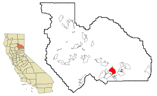
Mohawk Vista is a census-designated place in Plumas County, California, United States. The population was 159 at the 2010 census, up from 121 at the 2000 census.

South Lancaster, Massachusetts CDP in Massachusetts, United States

South Lancaster is a census-designated place (CDP) in the town of Lancaster and close to the Town of Clinton in Worcester County, Massachusetts, United States. Also known as ‘North Clinton’ The population was 1,894 at the 2010 census.

Cedar Crest, New Mexico Census-designated place in New Mexico, United States

Cedar Crest is a census-designated place (CDP) in Bernalillo County, New Mexico, United States. The population was 958 at the 2010 census. It is part of the Albuquerque Metropolitan Statistical Area.

Saugerties South, New York CDP in New York, United States

Saugerties South is a hamlet in Ulster County, New York, United States. The population was 2,218 at the 2010 census.

Chamberlayne, Virginia Census-designated place in Virginia

Chamberlayne is a census-designated place (CDP) in Henrico County, Virginia, United States. The population was 5,456 at the 2010 census.

Marblemount, Washington CDP in Washington, United States

Marblemount is a census-designated place in Skagit County, Washington, United States. The population was 203 at the 2010 census. It is included in the Mount Vernon–Anacortes, Washington Metropolitan Statistical Area.

Woods Landing-Jelm, Wyoming CDP in Wyoming, United States

Woods Landing-Jelm is a census-designated place (CDP) in Albany County, Wyoming, United States. The population was 97 at the 2010 census.

Smoot, Wyoming CDP in Wyoming, United States

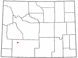
Smoot is a census-designated place (CDP) in Lincoln County, Wyoming, United States. The population was 195 at the 2010 census.

Antelope Hills, Wyoming CDP in Wyoming, United States

Antelope Hills is a census-designated place in Natrona County, Wyoming, United States. It is part of the Casper, Wyoming Metropolitan Statistical Area. The population was 97 at the 2010 census.

Bessemer Bend, Wyoming CDP in Wyoming, United States

Bessemer Bend is a census-designated place (CDP) in Natrona County, Wyoming, United States. It is part of the Casper, Wyoming Metropolitan Statistical Area. The population was 199 at the 2010 census.

Brookhurst, Wyoming CDP in Wyoming, United States

Brookhurst is a census-designated place (CDP) in Natrona County, Wyoming, United States. It is part of the Casper, Wyoming Metropolitan Statistical Area. The population was 185 at the 2010 census.

Casper Mountain, Wyoming CDP in Wyoming, United States

Casper Mountain is a census-designated place (CDP) on Casper Mountain in Natrona County, Wyoming, United States. It is part of the Casper, Wyoming Metropolitan Statistical Area. The population was 401 at the 2010 census.

Hartrandt, Wyoming CDP in Wyoming, United States

Hartrandt is a census-designated place (CDP) in Natrona County, Wyoming, United States. It is part of the Casper, Wyoming Metropolitan Statistical Area and the population was 693 at the 2010 census.

Homa Hills, Wyoming CDP in Wyoming, United States

Homa Hills is a census-designated place (CDP) in Natrona County, Wyoming, United States. It is part of the Casper, Wyoming Metropolitan Statistical Area. The population was 278 at the 2010 census.

Meadow Acres, Wyoming CDP in Wyoming, United States

Meadow Acres is a census-designated place (CDP) in Natrona County, Wyoming, United States. It is part of the Casper, Wyoming Metropolitan Statistical Area. The population was 198 at the 2010 census.

Mountain View, Natrona County, Wyoming CDP in Wyoming, United States

Mountain View is a census-designated place in Natrona County, Wyoming, United States. It is part of the Casper, Wyoming Metropolitan Statistical Area. The population was 96 at the 2010 census.

Red Butte, Wyoming CDP in Wyoming, United States

Red Butte is a census-designated place (CDP) in Natrona County, Wyoming, United States. It is part of the Casper, Wyoming Metropolitan Statistical Area. The population was 449 at the 2010 census.

Chugcreek, Wyoming CDP in Wyoming, United States

Chugcreek is a census-designated place (CDP) in Platte County, Wyoming, United States. The population was 156 at the 2010 census.

Clearview Acres, Wyoming CDP in Wyoming, United States

Clearview Acres is a census-designated place (CDP) in Sweetwater County, Wyoming, United States. The population was 795 at the 2010 census.

Farson, Wyoming CDP in Wyoming, United States

Farson is a census-designated place (CDP) in Sweetwater County, Wyoming, United States. The population was 313 at the 2010 census.

References

  1. "2010 City Population and Housing Occupancy Status". U.S. Census Bureau. Retrieved July 13, 2012.[ dead link ]
  2. 1 2 "U.S. Census website". United States Census Bureau . Retrieved 2008-01-31.
  3. "US Gazetteer files: 2010, 2000, and 1990". United States Census Bureau. 2011-02-12. Retrieved 2011-04-23.
  4. "2010 Wyoming Place Names". U.S. Census Bureau. Archived from the original on April 11, 2011. Retrieved July 13, 2012.