Midwest, Wyoming

Last updated

Midwest, Wyoming
WaterTowerMidwestWY.jpg
Midwest, Wyoming water tower
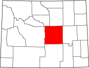
Natrona County Wyoming Incorporated and Unincorporated areas Midwest Highlighted 5652445.svg
Location of Midwest in Natrona County, Wyoming.
Usa edcp location map.svg
Red pog.svg
Midwest, Wyoming
Location in the United States
Coordinates: 43°24′48″N106°16′38″W / 43.41333°N 106.27722°W / 43.41333; -106.27722
Country United States
State Wyoming
County Natrona
Area
[1]
  Total0.49 sq mi (1.27 km2)
  Land0.49 sq mi (1.27 km2)
  Water0.00 sq mi (0.00 km2)
Elevation
4,849 ft (1,478 m)
Population
 (2010) [2]
  Total404
  Estimate 
(2019) [3]
394
  Density802.44/sq mi (309.99/km2)
Time zone UTC-7 (Mountain (MST))
  Summer (DST) UTC-6 (MDT)
ZIP code
82643
Area code 307
FIPS code 56-52445 [4]
GNIS feature ID1609125 [5]

Midwest is a town in Natrona County, Wyoming, United States. It is part of the Casper, Wyoming Metropolitan Statistical Area. The population was 404 at the 2010 census.

Contents

Geography

Salt Creek Museum in Midwest, Wyoming SaltCreekMuseumMidwestWY.jpg
Salt Creek Museum in Midwest, Wyoming

Midwest is located at 43°24′30″N106°16′41″W / 43.40833°N 106.27806°W / 43.40833; -106.27806 (43.408203, -106.278114). [6]

According to the United States Census Bureau, the town has a total area of 0.43 square miles (1.11 km2), all land. [7]

Climate

According to the Köppen Climate Classification system, Midwest has a warm-summer humid continental climate, abbreviated "Dfb" on climate maps. The hottest temperature recorded in Midwest was 106 °F (41 °C) on July 12, 1973, and August 5, 1979, while the coldest temperature recorded was −42 °F (−41 °C) on December 22, 2022. [8]

Climate data for Midwest, Wyoming, 1991–2020 normals, extremes 1939–present
MonthJanFebMarAprMayJunJulAugSepOctNovDecYear
Record high °F (°C)64
(18)
70
(21)
78
(26)
89
(32)
94
(34)
104
(40)
106
(41)
106
(41)
100
(38)
89
(32)
76
(24)
66
(19)
106
(41)
Mean maximum °F (°C)51.2
(10.7)
55.1
(12.8)
68.0
(20.0)
77.6
(25.3)
85.7
(29.8)
93.9
(34.4)
99.1
(37.3)
96.8
(36.0)
92.2
(33.4)
80.8
(27.1)
66.2
(19.0)
53.7
(12.1)
97.7
(36.5)
Mean daily maximum °F (°C)35.6
(2.0)
37.5
(3.1)
48.9
(9.4)
56.4
(13.6)
66.2
(19.0)
78.6
(25.9)
88.1
(31.2)
86.4
(30.2)
76.0
(24.4)
60.8
(16.0)
46.1
(7.8)
35.4
(1.9)
59.7
(15.4)
Daily mean °F (°C)23.6
(−4.7)
25.4
(−3.7)
35.2
(1.8)
42.1
(5.6)
51.9
(11.1)
62.2
(16.8)
70.3
(21.3)
68.3
(20.2)
58.6
(14.8)
45.5
(7.5)
33.3
(0.7)
23.7
(−4.6)
45.0
(7.2)
Mean daily minimum °F (°C)11.6
(−11.3)
13.3
(−10.4)
21.4
(−5.9)
27.7
(−2.4)
37.6
(3.1)
45.8
(7.7)
52.6
(11.4)
50.2
(10.1)
41.2
(5.1)
30.3
(−0.9)
20.4
(−6.4)
12.0
(−11.1)
30.3
(−0.9)
Mean minimum °F (°C)−11.1
(−23.9)
−9.2
(−22.9)
5.0
(−15.0)
15.8
(−9.0)
25.0
(−3.9)
36.2
(2.3)
44.6
(7.0)
41.6
(5.3)
30.6
(−0.8)
14.4
(−9.8)
−0.9
(−18.3)
−7.8
(−22.1)
−18.6
(−28.1)
Record low °F (°C)−39
(−39)
−31
(−35)
−20
(−29)
−4
(−20)
15
(−9)
26
(−3)
33
(1)
30
(−1)
14
(−10)
−8
(−22)
−29
(−34)
−42
(−41)
−42
(−41)
Average precipitation inches (mm)0.32
(8.1)
0.53
(13)
0.96
(24)
1.39
(35)
2.52
(64)
1.59
(40)
1.07
(27)
0.66
(17)
0.88
(22)
1.29
(33)
0.57
(14)
0.61
(15)
12.39
(312.1)
Average snowfall inches (cm)5.0
(13)
8.3
(21)
7.7
(20)
5.7
(14)
0.7
(1.8)
0.0
(0.0)
0.0
(0.0)
0.0
(0.0)
0.3
(0.76)
4.1
(10)
6.6
(17)
7.5
(19)
45.9
(116.56)
Average precipitation days (≥ 0.01 in)3.74.44.86.48.16.14.43.64.44.93.54.158.4
Average snowy days (≥ 0.1 in)3.54.13.32.50.40.00.00.00.21.52.94.122.5
Source 1: NOAA [9]
Source 2: National Weather Service [8]

Demographics

Historical population
CensusPop.Note
1980 638
1990 495−22.4%
2000 408−17.6%
2010 404−1.0%
2019 (est.)394 [3] −2.5%
U.S. Decennial Census [10]

2010 census

As of the census [2] of 2010, there were 404 people, 148 households, and 104 families living in the town. The population density was 939.5 inhabitants per square mile (362.7/km2). There were 200 housing units at an average density of 465.1 per square mile (179.6/km2). The racial makeup of the town was 95.5% White, 0.2% African American, 1.2% Native American, 0.2% Asian, 0.2% from other races, and 2.5% from two or more races. Hispanic or Latino of any race were 3.2% of the population.

There were 148 households, of which 39.9% had children under the age of 18 living with them, 44.6% were married couples living together, 16.2% had a female householder with no husband present, 9.5% had a male householder with no wife present, and 29.7% were non-families. 20.3% of all households were made up of individuals, and 4.7% had someone living alone who was 65 years of age or older. The average household size was 2.73 and the average family size was 3.09.

The median age in the town was 30.9 years. 29.7% of residents were under the age of 18; 8.4% were between the ages of 18 and 24; 26.8% were from 25 to 44; 29.2% were from 45 to 64; and 5.9% were 65 years of age or older. The gender makeup of the town was 50.0% male and 50.0% female.

2000 census

As of the census [4] of 2000, there were 408 people, 149 households, and 101 families living in the town. The population density was 922.0 people per square mile (358.0/km2). There were 228 housing units at an average density of 515.2 per square mile (200.1/km2). The racial makeup of the town was 95.34% White, 0.25% African American, 1.23% Native American, 1.96% from other races, and 1.23% from two or more races. Hispanic or Latino of any race were 2.70% of the population.

There were 149 households, out of which 38.9% had children under the age of 18 living with them, 53.0% were married couples living together, 11.4% had a female householder with no husband present, and 32.2% were non-families. 26.2% of all households were made up of individuals, and 13.4% had someone living alone who was 65 years of age or older. The average household size was 2.74 and the average family size was 3.33.

In the town, the population was spread out, with 33.6% under the age of 18, 5.4% from 18 to 24, 29.9% from 25 to 44, 22.1% from 45 to 64, and 9.1% who were 65 years of age or older. The median age was 33 years. For every 100 females, there were 105.0 males. For every 100 females age 18 and over, there were 99.3 males.

The median income for a household in the town was $30,000, and the median income for a family was $33,125. Males had a median income of $28,000 versus $20,625 for females. The per capita income for the town was $12,891. About 25.0% of families and 29.1% of the population were below the poverty line, including 45.0% of those under age 18 and 23.7% of those age 65 or over.

Education

Public education in the town of Midwest is provided by Natrona County School District #1.

Notable people

Related Research Articles

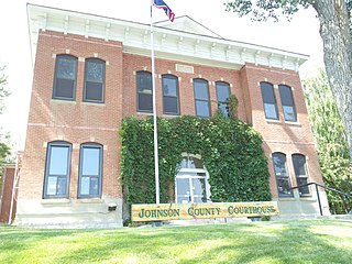
<span class="mw-page-title-main">Johnson County, Wyoming</span> County in Wyoming, United States

Johnson County is a county in the north central part of the U.S. state of Wyoming. At the 2020 United States Census, the population was 8,447. The county seat is Buffalo. Kaycee is the only other incorporated town in the county.

<span class="mw-page-title-main">Natrona County, Wyoming</span> County in Wyoming, United States

Natrona County is a county in the U.S. state of Wyoming. As of the 2020 United States Census, the population was 79,955, making it the second-most populous county in Wyoming. Its county seat is Casper.

<span class="mw-page-title-main">Saratoga, Wyoming</span> Town in Wyoming, United States

Saratoga is a town in Carbon County, Wyoming, United States. The population was 1,690 at the 2010 census.
<span class="mw-page-title-main">Town Creek, Alabama</span> Town in Alabama, United States

Town Creek is a town in Lawrence County, Alabama, United States, and is included in the Decatur Metropolitan Area, as well as the Huntsville-Decatur Combined Statistical Area. It incorporated in March 1875. As of the 2010 census, the population of the town is 1100, down from 1216 in 2000. Since 1920, it has been the second largest town in Lawrence County after Moulton.

<span class="mw-page-title-main">Hilmar-Irwin, California</span> Census-designated place in California, United States

Hilmar-Irwin is a census-designated place (CDP) in Merced County, California, United States. As of the 2020 census, the population was 5,164.

<span class="mw-page-title-main">Advance, Indiana</span> Town in Indiana, United States

Advance is a town in Jackson Township, Boone County, Indiana, United States. The population was 503 at the 2020 census.

<span class="mw-page-title-main">St. Olaf, Iowa</span> City in Iowa, United States

St. Olaf is a large village in Clayton County, Iowa, United States. The population was 106 at the time of the 2020 census, down from 136 in 2000. Swiss Valley has a large cheese packaging plant in St. Olaf. There is also a large feed granary, a post office, and a tavern.

<span class="mw-page-title-main">Willimantic, Maine</span> Town in the state of Maine, United States

Willimantic is a town in Piscataquis County, Maine, United States. The population was 134 according to the 2020 census.

<span class="mw-page-title-main">Sand Ridge, New York</span> CDP in New York, United States

Sand Ridge is a hamlet in Oswego County, New York, United States. The population was 849 at the 2010 census.

<span class="mw-page-title-main">Imbler, Oregon</span> City in Oregon, United States

Imbler is a city in Union County, Oregon, United States. The population was 306 at the 2010 census.

<span class="mw-page-title-main">Iron River, Wisconsin</span> Town in Wisconsin, United States

Iron River is a town in Bayfield County, Wisconsin, United States. The population was 1,123 at the 2010 census. The census-designated place of Iron River is located in the town. The unincorporated community of Topside is also located in the town.

<span class="mw-page-title-main">Avoca, Wisconsin</span> Village in Wisconsin, United States

Avoca is a village in Iowa County, Wisconsin, United States. The population was 637 at the 2010 census. It is part of the Madison Metropolitan Statistical Area. It is named after Avoca in Ireland.

Antelope Hills is a census-designated place in Natrona County, Wyoming, United States. It is part of the Casper, Wyoming Metropolitan Statistical Area. The population was 97 at the 2010 census.

<span class="mw-page-title-main">Bar Nunn, Wyoming</span> Town in Wyoming, United States

Bar Nunn is a town in Natrona County, Wyoming, United States. It is a part of the Casper, Wyoming Metropolitan Statistical Area. The population was 2,213 at the 2010 census. It was incorporated in 1980.
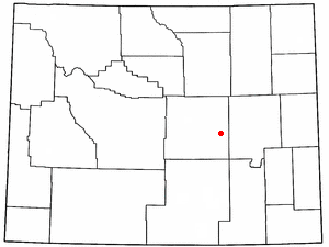
<span class="mw-page-title-main">Brookhurst, Wyoming</span> CDP in Wyoming, United States

Brookhurst is a census-designated place (CDP) in Natrona County, Wyoming, United States. It is part of the Casper, Wyoming Metropolitan Statistical Area. The population was 185 at the 2010 census.

<span class="mw-page-title-main">Edgerton, Wyoming</span> Town in Wyoming, United States

Edgerton is a town in Natrona County, Wyoming, United States. It is part of the Casper, Wyoming Metropolitan Statistical Area. The population was 195 at the 2010 census.

<span class="mw-page-title-main">Mills, Wyoming</span> Town in Wyoming, United States

Mills is a town in Natrona County, Wyoming, United States. It is part of the Casper, Wyoming Metropolitan Statistical Area. The population was 3,461 at the 2010 census.

Mountain View is a census-designated place in Natrona County, Wyoming, United States. It is part of the Casper, Wyoming Metropolitan Statistical Area. The population was 96 at the 2010 census.

Red Butte is a census-designated place (CDP) in Natrona County, Wyoming, United States. It is part of the Casper, Wyoming Metropolitan Statistical Area. The population was 1,430 at the 2020 census.

<span class="mw-page-title-main">Niagara (town), Wisconsin</span> Town in Wisconsin, United States

Niagara is a town in Marinette County, Wisconsin, United States. The population was 924 at the 2000 census. The city of Niagara is located to the north of and adjacent to the town.

References

  1. "2019 U.S. Gazetteer Files". United States Census Bureau. Retrieved August 7, 2020.
  2. 1 2 "U.S. Census website". United States Census Bureau . Retrieved December 14, 2012.
  3. 1 2 "Population and Housing Unit Estimates". United States Census Bureau. May 24, 2020. Retrieved May 27, 2020.
  4. 1 2 "U.S. Census website". United States Census Bureau . Retrieved January 31, 2008.
  5. "US Board on Geographic Names". United States Geological Survey. October 25, 2007. Retrieved January 31, 2008.
  6. "US Gazetteer files: 2010, 2000, and 1990". United States Census Bureau. February 12, 2011. Retrieved April 23, 2011.
  7. "US Gazetteer files 2010". United States Census Bureau . Retrieved December 14, 2012.
  8. 1 2 "NOAA Online Weather Data". National Weather Service. Retrieved August 19, 2022.
  9. "U.S. Climate Normals Quick Access". National Oceanic and Atmospheric Administration. Retrieved August 19, 2022.
  10. "Census of Population and Housing". Census.gov. Retrieved June 4, 2015.