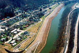
Cumberland is a home rule-class city in Harlan County, Kentucky, in the United States. The population according to the 2010 Census was 2,237, down from 2,611 at the 2000 census. The city sits at the confluence of Looney Creek and the Poor Fork Cumberland River.

Grundy is a town in Buchanan County, Virginia, United States, an area located within the Appalachian Mountains region. It is the county seat of Buchanan County. The town is home to the Appalachian School of Law. The population was 875 as of the 2020 census.

Williamson is a city in Mingo County, West Virginia, United States, situated along the Tug Fork River. The population was 3,042 at the 2020 census. It is the county seat of Mingo County, and is the county's largest and most populous city. Williamson is home to Southern West Virginia Community and Technical College. The Tug Fork River separates Williamson from South Williamson, Kentucky.

Appalachia is a geographic region located in the central and southern sections of the Appalachian Mountains of the eastern United States. It stretches from the western Catskill Mountains of New York state into Pennsylvania, continuing on through the Blue Ridge Mountains and Great Smoky Mountains into northern Georgia, Alabama, and Mississippi. In 2021, the region was home to an estimated 26.3 million people, of whom roughly 80% were white.

U.S. Route 119 (US 119) is a spur of US 19. It is a north–south route that was an original United States highway of 1926. It is Corridor G of the Appalachian Development Highway System (ADHS) east of US 23 and KY 80 in Kentucky to Interstate 64 at Charleston, West Virginia.
The Buffalo Creek flood was a disaster that occurred in Logan County, West Virginia, on February 26, 1972, when a coal slurry impoundment dam burst, causing significant loss of life and property damage.

Donald Leon Blankenship is an American business executive, political candidate, and convicted criminal. He was chairman and CEO of the Massey Energy Company—the sixth-largest coal company in the United States—from 2000 until 2010 when an explosion at Massey's Upper Big Branch Mine resulted in the death of 29 workers. He was imprisoned for 1 year for conspiring to violate federal mine safety standards.

The Eastern Kentucky Coalfield is part of the Central Appalachian bituminous coalfield, including all or parts of 30 Kentucky counties and adjoining areas in Ohio, West Virginia, Virginia, and Tennessee. It covers an area from the Allegheny Mountains in the east across the Cumberland Plateau to the Pottsville Escarpment in the west. The region is known for its coal mining; most family farms in the region have disappeared since the introduction of surface mining in the 1940s and 1950s.

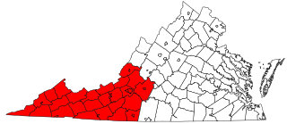
Southwest Virginia, often abbreviated as SWVA, is a mountainous region of Virginia in the westernmost part of the commonwealth. Located within the broader region of western Virginia, Southwest Virginia has been defined alternatively as all Virginia counties on the Appalachian Plateau, all Virginia counties west of the Eastern Continental Divide, or at its greatest expanse, as far east as Blacksburg and Roanoke. Another geographic categorization of the region places it as those counties within the Tennessee River watershed. Regardless of how borders are drawn, Southwest Virginia differs from the rest of the commonwealth in that its culture is more closely associated with Appalachia than the other regions of Virginia. Historically, the region has been and remains a rural area, but in the 20th century, coal mining became an important part of its economy. With the decline in the number of coal jobs and the decline of tobacco as a cash crop, Southwest Virginia is increasingly turning to tourism as a source of economic development. Collectively, Southwest Virginia's craft, music, agritourism and outdoor recreation are referred to as the region's "creative economy."

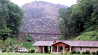
The Martin County coal slurry spill was a mining accident that occurred after midnight on October 11, 2000, when the bottom of a coal slurry impoundment owned by Massey Energy in Martin County, Kentucky, broke into an abandoned underground mine below. The slurry came out of the mine openings, sending an estimated 306 million US gallons of slurry down two tributaries of the Tug Fork River. By morning, Wolf Creek was oozing with the black waste; on Coldwater Fork, a 10-foot-wide (3.0 m) stream became a 100-yard (91 m) expanse of thick slurry.

South Williamson is a census-designated place (CDP) in the Appalachian Mountains of northeastern Pike County, Kentucky, United States, on the border with West Virginia. It is separated from Williamson, West Virginia by the Tug Fork River. The community is located near U.S. Route 119 about 23 miles (37 km) east of Pikeville, Kentucky and 28 miles (45 km) southwest of Logan, West Virginia.
Ashford is an unincorporated community and once-active coal town in Boone County, West Virginia, United States. Ashford was established as a coal camp and grew into a thriving mining community.
Stone is an unincorporated community and coal town in Pike County, Kentucky, United States. It was established in 1912. Stone was a mining community named for Galen Stone, head of the Pond Creek Coal Company which was based in Stone. In 1922 the Pond Creek Coal Company was sold to Fordson Coal Company, which was a subsidiary of Ford Motor Company. In 1936 Fordson sold the mine at Stone to Eastern Coal Company.
Beards Fork is a census-designated place (CDP) and coal town in Fayette County, West Virginia, United States that was founded as a coal town. As of the 2010 census, its population was 199.

Beauty is an unincorporated community in Martin County, Kentucky, United States. During the early 1920s the community was the home of the Himler Coal Company, a cooperative mining venture conducted by a group of Hungarian immigrants.

The Appalachian region and its people have historically been stereotyped by observers, with the basic perceptions of Appalachians painting them as backwards, rural, and anti-progressive. These widespread, limiting views of Appalachia and its people began to develop in the post-Civil War; Those who "discovered" Appalachia found it to be a very strange environment, and depicted its "otherness" in their writing. These depictions have persisted and are still present in common understandings of Appalachia today, with a particular increase of stereotypical imagery during the late 1950s and early 1960s in sitcoms. Common Appalachian stereotypes include those concerning economics, appearance, and the caricature of the "hillbilly."

Environmental justice and coal mining in Appalachia is the study of environmental justice – the interdisciplinary body of social science literature studying theories of the environment and justice; environmental laws, policies, and their implementations and enforcement; development and sustainability; and political ecology – in relation to coal mining in Appalachia.

Environmental issues in Appalachia, a cultural region in the Eastern United States, include long term and ongoing environmental impact from human activity, and specific incidents of environmental harm such as environmental disasters related to mining. A mountainous area with significant coal deposits, many environmental issues in the region are related to coal and gas extraction. Some extraction practices, particularly surface mining, have met significant resistance locally and at times have received international attention.

The Appalachian Land Ownership Survey was launched by the Appalachian Land Ownership Task Force in 1978. The survey was created in order to understand the demographics of land ownership within the Appalachian mountain region. This survey spanned the area across 420 different counties from Georgia to Maine. The main focus of the survey was to identify patterns within land ownership, specifically absentee owners and the effects on regional development in the areas. It is mandatory for agricultural land owners in the United States to participate in these surveys to account for their production, financing and inputs within each state.
The Vulcan Bridge is a one-lane bridge located in Vulcan, West Virginia. It spans the Tug Fork and the Kentucky–West Virginia border. In 1977, after several failed attempts in contacting the West Virginia government to build a new bridge, the mayor of Vulcan requested aid from the Soviet Union to build the bridge, since the previous one had collapsed. This event placed international attention on the small community, and the state legislature subsequently granted $1.3 million to build the bridge. It was completed in 1980.


