
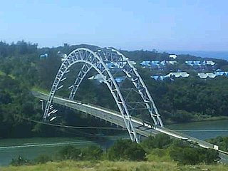
Durban is the third-most populous city in South Africa, after Johannesburg and Cape Town, and the largest city in the province of KwaZulu-Natal. Situated on the east coast of South Africa, on the Natal Bay of the Indian Ocean, Durban is South Africa's busiest port and was formerly named Port Natal. North of the harbour and city centre lies the mouth of the Umgeni River; the flat city centre rises to the hills of the Berea on the west; and to the south, running along the coast, is the Bluff. Durban is the seat of the larger eThekwini Metropolitan Municipality, which spans an area of 2,556 km2 (987 sq mi) and had a population of 4.2 million in 2022, making the metropolitan population one of Africa's largest on the Indian Ocean. Within the city limits, Durban's population was 595,061 in 2011. The city has a humid subtropical climate, with hot, wet summers and mild, dry winters.
Hillcrest is a town in the KwaZulu-Natal province of South Africa that forms part of the eThekwini Metropolitan Municipality and is situated approximately 32 km north-west of Durban and 53 km south-east of Pietermaritzburg.

Port Shepstone is a large town situated on the mouth of the Mzimkhulu River, the largest river on the KwaZulu-Natal South Coast of South Africa. It is located halfway between Hibberdene and Margate and is positioned 120 km south of Durban. It serves as the administrative, educational, industrial and commercial centre for southern Natal.
Port Edward is a small resort town situated on the south coast of KwaZulu-Natal in South Africa and lies on the border between KwaZulu-Natal and the Eastern Cape. It is situated on the R61 road between Port Shepstone and Lusikisiki.
Hibberdene is a small coastal town on the KwaZulu-Natal South Coast in South Africa, approximately 23 km north-east of Port Shepstone and 90 km south-west of Durban and halfway between coastal towns of Scottburgh and Margate.
Kingsburgh is a coastal resort town along the South Coast of KwaZulu-Natal, South Africa, approximately 32 kilometres south-west of Durban.

Uvongo is a seaside resort town situated along the KwaZulu-Natal South Coast at the mouth of the Vungu River in KwaZulu-Natal, South Africa. Situated 4 kilometres north of Margate, Uvongo is the largest upmarket residential area on the Lower South Coast.
Hilton is a small town that lies between Howick and Pietemaritzburg in the province of KwaZulu-Natal, South Africa. In 1872 the Reverend William Orde Newnham opened Hilton College on a large estate 7.8km north of the town, which is now one of South Africa's leading private schools.

Kloof is a town that includes a smaller area called Everton, located approximately 26 km north-west of Durban in KwaZulu-Natal, South Africa. Once an independent municipality, it now forms part of greater Durban area of the eThekwini Metropolitan Municipality.
Pinetown is a city that forms part of the eThekwini Metropolitan Municipality, based just inland from Durban in KwaZulu-Natal, South Africa. The town is situated 16 km north-west of Durban and 64 km south-east of Pietermaritzburg.

Mount Edgecombe or Mt Edgecombe is a town in KwaZulu-Natal, South Africa, situated just north of Durban, which forms part of eThekwini, the Greater Durban Metropolitan area. Much of the suburb is cordoned off as a gated settlement comprising resorts, golf courses and a retirement home. It was previously a sugar growing area. The population increased by 89% between 2001 and 2011 from 3,874 to 7,323. Its name is derived from the Earl of Mount Edgecombe in Cornwall, United Kingdom.

Verulam is a town 24 kilometres north of Durban in KwaZulu-Natal, South Africa and forms part of the eThekwini Metropolitan Municipality, governing the Greater Durban metropolitan area.
The Valley of a Thousand Hills is a valley between Pietermaritzburg and Durban, South Africa. The Umgeni River meets the Msunduzi River in the valley, and the Dusi Canoe Marathon is run through the area every year.
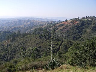
The Upper Highway Area is a region west of the city of Durban in KwaZulu-Natal, South Africa. It is the suburban western part of the Greater Durban metropolitan area and extends from Kloof in the east to Botha’s Hill in the west. It includes the main towns of Hillcrest, Gillitts and Kloof and the smaller areas of Assagay, Botha’s Hill, Everton and Waterfall.

uMhlanga, alternatively rendered Umhlanga, is a residential, commercial and resort town north of Durban on the coast of KwaZulu-Natal, South Africa. It is part of the eThekwini Metropolitan Municipality, which was created in 2000 and includes the greater Durban area. The name means "place of reeds" in the Zulu language, and the correct pronunciation of "hl" in uMhlanga is similar to the Welsh "ll".
The M13 is a metropolitan route in the Ethekwini Metropolitan Municipality in the KwaZulu-Natal province of South Africa. For most of its route, it is a highway named King Cetshwayo Highway and it acts as an alternative route to the N3 highway for travel between the suburbs closer to the Durban CBD and the Outer West Suburbs (Assagay).
Forest Hills is a suburb in the Outer West suburbs of Durban, Kwa-Zulu Natal, South Africa. The area borders on the Kloof Gorge which forms part of the Krantzkloof Nature Reserve, and is situated in between Kloof and Waterfall which is also about 7 km from Hillcrest. Forest Hills is referred to as being part of the Kloof area as they are both situated on opposite sides of the Kloof Gorge, as a result the areas are joined by one road which runs through the Kloof Gorge.
iBhayi is a large township near Port Elizabeth, South Africa. It is the second largest township in the Eastern Cape province and the ninth largest in South Africa after Mitchells Plain near Cape Town in the Western Cape.
Umhlali is a village on the North Coast of the KwaZulu-Natal province of South Africa, just inland from Salt Rock and approximately 50 km north-west of Durban. The name of the village, "Umhlali" derives from the Zulu name of the Monkey Orange tree - a small semi-deciduous tree that is predominant along the banks of the uMhlali River, north of the village.

