Wayville, South Australia

Last updated

Wayville
Adelaide,  South Australia
St. Nicholas Church, Wayville.jpg
St. Nicholas Russian Orthodox Church on Greenhill Road
Wayville, South Australia
Coordinates 34°56′42″S138°35′28″E / 34.945°S 138.591°E / -34.945; 138.591 Coordinates: 34°56′42″S138°35′28″E / 34.945°S 138.591°E / -34.945; 138.591
Population1,922 (SAL 2021) [1]
Established1899
Postcode(s) 5034
Time zone ACST (UTC+9:30)
 • Summer (DST) ACDT (UTC+10:30)
LGA(s) City of Unley [2]
State electorate(s) Unley
Federal division(s) Adelaide
Mean max tempMean min tempAnnual rainfall
22.1 °C
72 °F
12.1 °C
54 °F
545.3 mm
21.5 in
Suburbs around Wayville:
Adelaide Parklands Terminal Adelaide

Park Lands
Adelaide

Park Lands
Keswick Wayville Unley
Forestville Goodwood Unley

Wayville is an inner-southern suburb of Adelaide in the City of Unley. It is most notable for hosting of the Royal Adelaide Show at the Adelaide Showgrounds.

Contents

The suburb is bordered to the north by Adelaide's South Parklands, [3] to the west by Adelaide-Goodwood railway line, to the east by King William Road, and to the south by Leader Street, Parsons Street and Simpson Parade. Keswick Creek, a tributary of the Brown Hill Creek and Patawalonga River, flows through the southern side of the suburb.

History

In the 1860s, the place where Wayville now stands was a milk run rented from the South Australian Company. In the 1870s, King William Street was extended south through the Park Lands and Unley; this continues to form the eastern boundary of the suburb.

Wayville was first subdivided in 1881, but it was named Goodwood at that time. In 1899 the area was named Wayville after Reverend James Way.

Wayville Post Office opened around 1909. Wayville Military Post Office was open from 16 July 1940 until 19 October 1946 while the Showgrounds were used as an army camp. [4]

Points of interest

The Latvian Hall [5] or Talava (old mountain castle), located at 4 Clark Street in Wayville, was established in 1966. The hall is rented out to the community, and is supported by the Latvian Chamber of Commerce and Industry in Australia Inc. (LCCIA).

The Anglican Church of Emmanuel [6] was located on the corner of Young and Clark Streets, and formed part of the Anglican Parish of Parkside, along with St. Oswald's Church in Parkside. The cornerstone was laid by His Excellency the Governor Sir Thomas Bridges on 28 April 1923. This church was closed in 2014, and the building is now occupied by the evangelical Healing Life Church.

The St Michael the Archangel Church is part of the Roman Catholic (Latin Rite) Society of St. Pius X. [7] The church was first built in 1894, the cornerstone laid on 15 September 1894. The Church and hall were rebuilt in 1948. The new cornerstone was laid by Mrs Playford, the wife of then Premier Thomas Playford IV, on 20 November 1948.

There is a Ukrainian Catholic Church, [8] Protection of Mother of God Parish, on Davenport Terrace. On the Church grounds is a memorial bearing the insignia of the 14th Waffen Grenadier Division of the SS (1st Galician) reading "In memory of soldiers who died for liberation of Ukraine". [9] Next to this is a smaller memorial: "In memory of Michael Sukmanowsky Ukrainian boy scout killed in Vietnam". The St Peter's Latvian EV-Lutheran Memorial Church was erected in the memory of those who served in the World Wars. The Church is part of the Evangelical Lutheran Church of Latvia of Adelaide. The church was built in 1971.

The St. Nicholas Russian Orthodox Church is located on 41 Greenhill Road.

The Adelaide Showground Farmers Market [10] is open every Sunday, 9am to 1pm. The purpose of the market is to sell food and food related products by farmers and producers of South Australia. Entrance to the market is from the Leader Street (south) side of the Adelaide Showground.

The "Amphi Cosma" house in Young Street [11] [12] was built in 1914 by the noted Adelaide master builder Walter C. Torode for his own use. The architecture is of particular interest because of its unique octagonal design and its reinforced concrete structure. A noteworthy feature was a central reinforced concrete pillar and a series of radiating beams.

Education

Annesley Junior School is located on Greenhill Road on the northern edge of the suburb. It is an independent day school for girls and boys aged from two years old to year 6. The school was established in 1902 as Methodist Ladies' College.

The Alliance Française d’Adelaide at 319 Young Street is an Australian not-for-profit association set up to promotion French language and culture. It offers a range of French language courses, sponsors a number of French culture events for music and sponsors the Alliance Française French Film Festival. [13]

Fusion Business College is a provider of training to retail businesses. It is accredited by the Australian Government as a registered training organisation. Fusion Business Solutions was founded by Marc Brien and his wife Karen in July 1999. [14]

Central Queensland University Appleton Institute is a multidisciplinary research hub located at 44 Greenhill Road. The institute was founded in 2012 and has a teaching program in Safety Science.

The SACE Board of South Australia is located at 60 Greenhill Road. [15] It is an independent statutory authority established under the SACE Board of South Australia Act 1983, with responsibility for the accreditation, assessment, recognition and certification of learning in the South Australian Certificate of Education (the SACE).

Transportation

There are two Glenelg tram line stops in Wayville: Greenhill Rd - Tram Stop 1 and Wayville - Tram Stop 2. [16] Just west of Wayville in Goodwood there is a third tram stop, Goodwood Rd - Tram Stop 3.

There are numerous bus stops: three on Goodwood Road, stops 1, 2, and 3; five on Greenhill Road, stops 1B, 1C, 2, 2A, and 2B; and two on King William Road, stops 1 and 2.

On the northern side of the suburb, Greenhill Road is part of A21 the City Ring Route.

The numerous bike trails serving Wayville may be found at "BikeMap". [17] Part of the Mike Turtur Bikeway runs along the edge of Wayville. [18] [19] Running from the Adelaide city centre to Glenelg, the Mike Turtur Bikeway is the busiest cycling commuter route connected to the city.

Accommodation

Rosemary's Place at 7 Rose Terrace is designed to be country friendly accommodation. It consists of two fully furnished comfortable and inexpensive 1 bedroom maisonettes, and provides easy access to medical, government, and education services. [20]

Rectory Cottage is a B&B located at 15 Rose Terrace. The cottage was built in 1900 as a pastor's residence. The cottage has two bedrooms and is self-contained. [21]

Rose Terrace Lodge is located at 102 Rose Terrace. This is a Supported Residential Facility.

Notable people

Fauna

Related Research Articles

Goodwood railway station Railway station in Adelaide, South Australia

Goodwood railway station is the junction station for the Belair, Seaford and Flinders lines. The Belair line diverges south-east towards Millswood, while the Seaford and Flinders lines diverge south-west towards Clarence Park. The Glenelg tram line crosses over the railway lines at the south end of Goodwood station. The station services the Adelaide inner-southern suburb of Goodwood, and is 5.0 km from Adelaide station.

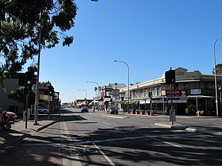
Goodwood is an inner southern suburb of the city of Adelaide. It neighbours the Royal Adelaide Showgrounds and features several churches in its commercial district. Its major precinct is Goodwood Road, which is home to many shops and businesses, as well as the local state school.

King William Street, Adelaide Street in Adelaide, South Australia

King William Street is the part of a major arterial road that traverses the CBD and centre of Adelaide, continuing as King William Road to the north of North Terrace and south of Greenhill Road; between South Terrace and Greenhill Road it is called Peacock Road. At approximately 40 metres (130 ft) wide, King William Street is the widest main street of all the Australian State capital cities. Named after King William IV in 1837, it is historically considered one of Adelaide's high streets, for its focal point of businesses, shops and other prominent establishments. The Glenelg tram line runs along the middle of the street through the city centre.

Unley, South Australia Suburb of Adelaide, South Australia

Unley is an inner-southern suburb of Adelaide, South Australia, within the City of Unley. The suburb is the home of the Sturt Football Club in the South Australian National Football League (SANFL). Unley neighbours Adelaide Park Lands, Fullarton, Hyde Park, Malvern, Parkside and Wayville.

Westbourne Park is an inner southern suburb of Adelaide, the State capital of South Australia. The suburb was named after Westbourne, a village in Sussex, England, and was laid out in 1881.

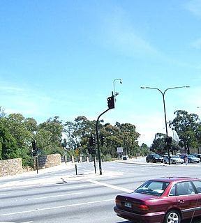
Greenhill Road is a major road in Adelaide, South Australia, that provides a connection to the eastern and hills suburbs. Its western section, running along the south side of Adelaide Parklands, forms part of Adelaide's City Ring Route.

Parkside, South Australia Suburb of Adelaide, South Australia

Parkside is an inner southern suburb of Adelaide, South Australia. It is located in the City of Unley.

Clarence Park, South Australia Suburb of Adelaide, South Australia

Clarence Park is an inner southern suburb of Adelaide, South Australia in the City of Unley. Its borders are Mills Street (north), Goodwood Road (east), Cross Road (south) and the Seaford railway line (north-west).

Everard Park, South Australia Suburb of Adelaide, South Australia

Everard Park is a small inner south-western suburb of Adelaide in the City of Unley, once part of the extensive land holdings of the prominent colonist Dr. Charles George Everard, and the location of "Marshfield", the home of part of his family.

Black Forest, South Australia Suburb of Adelaide, South Australia

Black Forest is an inner southern suburb of Adelaide, South Australia. It is located in the City of Unley, bounded by the Glenelg tram line (north-west), the Seaford railway line (south-east), South Road (west) and East Avenue (east).

Goodwood Road, Adelaide

Goodwood Road is a major north–south arterial road, approximately 10 kilometres long, in Adelaide, South Australia. It runs between the Adelaide city centre and Adelaide's southern suburbs of Pasadena and Panorama

Adelaide Showground

The Adelaide Showground holds many of Adelaide's most popular events, including the Royal Adelaide Show.

Cross Road, Adelaide

Cross Road is a major arterial road that travels east–west through the inner southern suburbs of the Australian city of Adelaide. It is designated route A3.

Anzac Highway Highway in Adelaide

Anzac Highway is an 8.7-kilometre-long (5.4 mi) main arterial road heading southwest from the city of Adelaide, the capital of South Australia, to the beachside suburb of Glenelg.

Glenelg East, South Australia Suburb of Adelaide, South Australia

Glenelg East is a residential suburb 9 kilometres (5.6 mi) south west of the centre of Adelaide, South Australia. It is characterised by quarter-acre blocks with heritage homes and parks intermingled with contemporary modern homes and low-rise multi-dwelling units.

Frome Street Street in Adelaide, South Australia

Frome Street is a street in the East End of the city centre of Adelaide, the capital of South Australia. It runs from North Terrace in the north to Angas Street, and then as Regent Street North to Carrington Street in the south. North of North Terrace, Frome Street continues towards North Adelaide as Frome Road.

The Mike Turtur Bikeway is a cycling route adjacent to the Glenelg tram line route connecting Glenelg to the Adelaide city centre. It is a popular commuter route for people who live in the inner suburbs southwest of the city and work in or near the city centre.

Unley Road Road in Unley, South Australia

Unley Road is a road in the City of Unley, located south of the City of Adelaide, the capital of South Australia. It runs from South Terrace to Cross Road, where it becomes Belair Road. The road was named after the family name of the wife of Thomas Whistler, owner of land in Unley which was laid out around 1857.

References

  1. Australian Bureau of Statistics (28 June 2022). "Wayville (Suburb and Locality)". Australian Census 2021 QuickStats. Retrieved 28 June 2022.  OOjs UI icon edit-ltr-progressive.svg
  2. When and Where In Unley: A Chronology 1906 - 2006. Retrieved 11 May 2013.
  3. The particular sections of the South Park Lands are: Kurrangga, Walyo Yerta, Minno Wirra, and Wikaparndo Wirra
  4. Premier Postal History. "Post Office List". Premier Postal Auctions. Retrieved 26 May 2011.
  5. Latvian Hall, www.communitywebs.org
  6. Church of Emmanuel, www.parksideparish.com.au
  7. Society of St. Pius X. Retrieved 25 May 2013.
  8. Ukrainian Catholic Church. Retrieved 1 June 2013
  9. "Ukrainian War Memorial | Monument Australia". monumentaustralia.org.au. Retrieved 30 March 2022.
  10. Adelaide Showground Farmers Market, www.aeec.com.au
  11. Dwelling (former 'Amphi Cosma') built and designed by WC Torode. Retrieved 30 June 2013
  12. Architectural works in South Australia: Torode. Retrieved 30 June 2013
  13. Alliance Française d’Adelaide. Retrieved 10 June 2013
  14. Fusion Business College. Retrieved 10 June 2013
  15. The SACE Board of South Australia 19 January 2014
  16. Adelaide Metro Tram Timetables. Retrieved 25 May 2013
  17. Wayville, www.bikemap.net
  18. Mike Turtur Bikeway. Retrieved 19 January 2014
  19. Mike Turtur route map. Retrieved 19 January 2014
  20. Rosemary's Place, www.rosemarysplace.org.au
  21. Rectory Cottage, www.rectory-cottage.com.au