
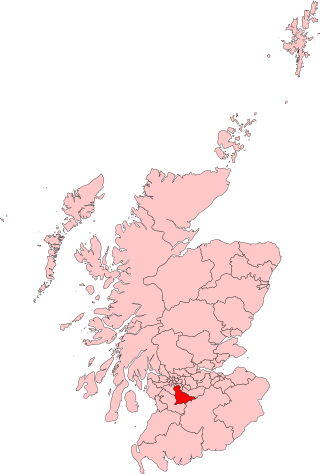
Lanarkshire, also called the County of Lanark, is a historic county, lieutenancy area and registration county in the Central Lowlands of Scotland. The county is no longer used for local government purposes, but gives its name to the two modern council areas of North Lanarkshire and South Lanarkshire.

East Kilbride is the largest town in South Lanarkshire in Scotland, and the country's sixth-largest locality by population. It was also designated Scotland's first new town on 6 May 1947. The area lies on a raised plateau to the south of the Cathkin Braes, about eight miles southeast of Glasgow and close to the boundary with East Renfrewshire.

Hillhouse is a council-built housing estate on the western side of the town of Hamilton in South Lanarkshire, Scotland.

Hairmyres is an area of East Kilbride in South Lanarkshire, Scotland, situated on the west side of the town, close to the main road to Eaglesham and Kilmarnock, and is 2+1⁄4 miles from the Glasgow City Council boundary at the Carmunnock Bypass and nine miles south of the city centre of Glasgow.
East Kilbride, Strathaven and Lesmahagow is a county constituency of the House of Commons of the Parliament of the United Kingdom, which was first used in the general election of 2005. It replaced East Kilbride and some of Clydesdale, and it elects one Member of Parliament (MP) by the first past the post system of election.

Fernhill is a residential neighbourhood in the Scottish town of Rutherglen in South Lanarkshire; it is situated south of the River Clyde and borders the Rutherglen neighbourhoods of High Burnside to the north and Cathkin to the east, the Glasgow district of Castlemilk to the west, and the open lands of Fernbrae Meadows to the south. Its location on a steep incline which is part of the Cathkin Braes range of hills offers panoramic views over the south and eastern parts of Greater Glasgow.
The Village is the oldest part of East Kilbride in South Lanarkshire, Scotland, dating back to well before its designation as a new town in the mid-20th century.
East Mains is an area of the Scottish new town East Kilbride, in South Lanarkshire.
Mossneuk is a predominantly residential area in the South-West of the Scottish new town East Kilbride, in South Lanarkshire.

Stewartfield is an area of the Scottish new town East Kilbride, in South Lanarkshire.
The Murray is a residential area in the new town of East Kilbride, in South Lanarkshire, Scotland; it lies immediately to the south-west of the town centre, and adjacent to the Westwood, Greenhills and Whitehills neighbourhoods to the west, south-west and south-east respectively.

The A725 road in Scotland is a major route which is a trunk road dual carriageway for almost its whole length, connecting several of the large towns of North Lanarkshire and South Lanarkshire, linking the M8 and M74 motorways; it has been upgraded frequently since its construction, with the most recent major work completed in 2017. In combination with the A726 road which meets the M77 motorway, it forms a southern and eastern bypass for the city of Glasgow.

The A726 road in Scotland is a major route with several distinct sections with different characteristics and names; owing to its stages of construction, since 2005 it has two separate parts, the first running between Strathaven in South Lanarkshire and Junction 5 of the M77 motorway south of Newton Mearns in East Renfrewshire via East Kilbride, and the other running between Junction 3 of the M77 and the M898 motorway near the Erskine Bridge, via Paisley and Junction 29 of the M8 motorway near Glasgow International Airport.

The A730 road in Scotland runs between the centre of Glasgow and the south-eastern edge of the city's urban area at Cathkin.

The A727 road in Scotland runs from East Kilbride in South Lanarkshire, through East Renfrewshire, to Junction 3 of the M77 motorway in Glasgow.

Hunter House Museum was a museum in Calderwood, East Kilbride, South Lanarkshire, Scotland.

Calderwood is a neighbourhood of the Scottish new town of East Kilbride, in South Lanarkshire. It lies on its north-east edge and is one of the largest areas of the town.

East Kilbride Central North is one of the 20 electoral wards of South Lanarkshire Council. Created in 2007, the ward initially elected four councillors using the single transferable vote electoral system and covers an area with a population of 16,547 people. Following a boundary review, the ward has elected three councillors since 2017.

East Kilbride West is one of the 20 electoral wards of South Lanarkshire Council. Created in 2007, the ward elects three councillors using the single transferable vote electoral system and covers an area with a population of 13,737 people.

The A724 road in Scotland runs within South Lanarkshire between Rutherglen and Hamilton. It follows an ancient route which is marked on William Roy's Lowland Map of Scotland (1755) with only minor deviations from its modern course.